Bondi to Manly - Part 5 - Taronga Zoo to Spit 07-06-2020
This map was created using
GPS Visualizer's do-it-yourself geographic utilities.
Please wait while the map data loads...
Route: Taronga Zoo, Bradleys Head Walking Track, Bradleys Head, Taylors Bay Track, Taylors Bay, Chowder Bay, Clifton Gardens, Georges Heights, Georges Head, Middle Head Road, Middle Head, Middle Head Road, Balmoral Park, Balmoral Beach, Edwards Beach, Wyargine Point, Parriwi Lighthouse, The Spit
Date: 07/06/2020
From: Taronga Zoo
Parking: N/A
Start Point: Taronga Zoo ferry wharf
Finish Point: Spit Bridge
Region: Sydney
Route length: 7.9 miles (12.7km)
Time taken: 03:15
Average speed: 2.5mph
Ascent: 328m
Descent: 315m
Points of Interest: Bradley's Head, Chowder Bay, Georges Heights, Middle Head, Balmoral Beach
Bondi and Manly are arguably Sydney's two most famous beaches. While they are only 10km apart, they sit on either side of the vast entrance to Sydney Harbour. When I arrived in Australia, I had the desire to hike the length of the Sydney Harbour foreshore and the introduction of the Bondi to Manly walking track has facilitated just that.
|
|
The Bondi to Manly logo features the Aboriginal depiction of a whale
|
The overall length of the Bondi to Manly track is 80km and while it has always been possible to walk the route, it has now become more formalised with signage and a supporting app. Thanks to the extensive public transport network in Sydney it is possible to break up the route into manageable one-way sections. The first leg took us from Bondi to Watson's Bay along the Federation Cliff Walk, culminating at South Head and the beaches of Watson's Bay.
From Watson's Bay, the second leg stretches to Rose Bay along the Hermitage Foreshore before entering the city along the third leg, finishing in the CBD at the bustling Circular Quay. The fourth leg, the first on the north shore, is a real highlight, crossing Sydney Harbour Bridge and passing round the deeply incised north shore bays to reach Taronga Zoo.
The fifth leg picks up at Taronga Zoo where the fourth ends, at the ferry wharf. I hopped off the ferry at the wharf, walking the short distance uphill to the main entrance of the zoo to find the Bradley's Head Track. Taronga is the largest zoo in Australia and is over 100 years old having opened its doors in 1916. It has succeeded in breeding critically endangered animals such as the Sumatran tiger, with 21 cubs having been born at the zoo since 1980.
 |
| The ferry wharf at Taronga Zoo |
 |
| Taronga Zoo |
The Bondi to Manly route continues along the Bradley's Head track, which starts opposite the zoo entrance and follows the west side of the peninsula in a southerly direction, passing Athol Beach and heading through some well-preserved bush. Bradley's Head forms part of the Sydney Harbour National Park which helps to protect several islands and large stretches of the foreshore around Sydney.
 |
| Bradley's Head track |
 |
| Bradley's Head track |
 |
| Sydney Red Gums along the track |
The track leads to the end of the peninsula and the Bradley's Head Amphitheatre, a stepped bowl built in 2000 for the filming of a Hollywood movie. The area's history goes back much further, however. Its present name is after Lieutenant William Bradley of HMS Sirius, the First Fleet flagship. Prior to this, the original Aboriginal inhabitants called it Borogegy, Booraghee, Booragy or Burrogy. The prominent headland has a sweeping view of the Sydney city skyline, among the best of any locations in the harbour.
 |
| Bradley's Head amphitheatre |
 |
| Sydney |
 |
| Bradley's Head |
At the tip of headland resides the tripod foremast and fire control tower of HMAS Sydney, an Australian warship that sank a German warship, Emden, in 1914. The Emden was tasked with a raid on the Cocos Islands, in an attempt to destroy British facilities. Emden was attacked by HMAS Sydney with the more powerful Australian ship quickly inflicting serious damage. The whole area around the mast now serves as a memorial to all RNAS sailors.
 |
| HMAS Sydney's foremast |
Standing out from the waters in front of the tower is a curious stone column. The column originated from the first Sydney General Post Office façade, which was demolished in 1863. It was erected near the Bradley's Head jetty to mark a nautical mile from Fort Denison to provide accurate sea trial measurements, allowing the speed of newly constructed ships to be checked.
 |
| Naval memorial |
 |
| Bradleys Head Lighthouse |
 |
| Bradleys Head Lighthouse |
 |
| Down at the waterside |
The sun was starting to poke through the clouds as I left Bradley's Head, following another trail through the bush around Taylors Bay. Views were limited by the trees until we reached the opposite side of the bay where some clearings allowed a few glimpses of the idyllic turquoise waters.
 |
| Bradley's Head |
 |
| Looking north towards Taylor's Bay |
 |
| Taylors Bay Track |
 |
| Taylor's Bay |
 |
| Sydney Harbour |
 |
| Taylors Bay Track |
 |
| There are some beautiful wooded sections prior to Chowder Bay |
The path took me to Chowder Bay which, like many of the bays around Sydney, has a historic military connection. After the withdrawal of British troops in the 1870s, Sydney had to devise its own defensive strategy to protect itself from attack. In order to achieve this, a base was built at Chowder Bay for the newly-devised Submarine Mining Corps. The defence strategy involved attaching mine to underwater cables that stretched across the harbour from Chowder Bay and were designed to detonate if an enemy ship entered the harbour.
 |
| Chowder Bay |
 |
| Chowder Bay |
Eventually, technology rendered the underwater mines and cables obsolete, and the Submarine Mining Corps closed in 1922. After that, Chowder Bay became a depot and barracks for Army engineers, and in the 1980s, it was the site of the Army Maritime until 1997. It wasn't until 2000 that the area was opened up to the public, looked after by the Harbour Trust.
 |
| Chowder Bay |
 |
| Naval signal mast |
From Chowder Bay, a short, steep set of steps climb up the hillside behind the beach. The shortcut, known as Bungaree Walkway (dedicated to historic indigenous leader Bungaree, who was the first person to be recorded in print as an Australian, and the first Australian to circumnavigate the continent) leads up to Georges Head Lookout.
 |
| Bungaree Walkway |
Georges Heights is home to some historic fortifications. The current lookout is the former site of the A84 Battery, which was set up to protect Sydney Harbour from naval threats. It originally housed six guns in open circular pits connected by zig-zag passages and tunnels that lead to an underground magazine. The lookout offers 180-degree views over the harbour and across to Manly, Vaucluse and the city.
 |
| Georges Heights |
 |
| Chowder Bay with Sydney beyond |
 |
| Sydney seen over the suburb of Clifton Gardens |
 |
| Georges Heights |
 |
| Rose Bay on the opposite side of the harbour |
Between 1916 and 1921, a large military hospital operated at Georges Heights, providing care to soldiers injured on the Western Front during the Great War. Known as the Hospital on the Hill, this important heritage building today serves as the headquarters of the Sydney Harbour Trust.
Beyond Georges Heights, a path follows the edge of the escarpment, overlooking the entrance to Sydney Harbour. It follows Middle Head Road to HMAS Penguin and onto the old forts at Middle Head.
 |
| Sydney Heads |
 |
| Headland park |
 |
| A Rainbow Lorikeet |
 |
| Approaching Middle Head |
Along with Georges Heights, Middle Head is one of the seven Sydney headlands which surround the bay and is an outstanding vantage point, looking directly between the north and south heads to the Pacific Ocean. It's no wonder there is a significant number of historic gun emplacements located here.
 |
| Middle Head |
 |
| Preserved officer building at Middle Head fort |
 |
| Middle Head |
 |
| Outer Middle Head |
The first fort at Middle Head was built in 1801 and the last batteries were constructed in 1942 though the majority of the fortifications were built between 1870 and 1911. The site contains the works of several periods and technologies, which remain in place today. Historically, it dates from the time when the defence was first moved away from Sydney Cove and towards The Heads.
 |
| Middle Harbour |
 |
| Looking out towards the Pacific |
 |
| Middle Head |
 |
| The Tiger Cages |
 |
| Inner Middle Head Battery |
 |
| Inner Middle Head Battery |
 |
| Sergeant Major's Quarters |
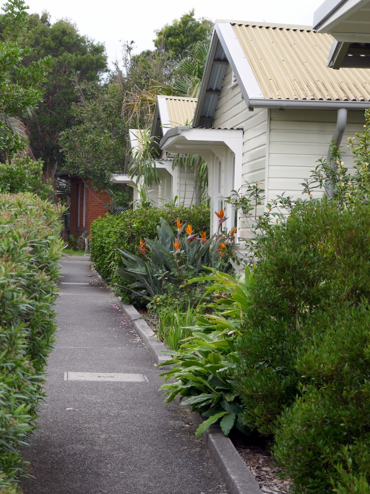
After a circuit of the old fort, I retraced my steps to the gated entrance and climbed the hill alongside the navy base HMAS Penguin which is home to the Balmoral Naval Hospital. Shortly after passing the hospital, a set of steps lead down a lush gully to Balmoral Park and the fine Balmoral Beach.
 |
| The Headland Park walking track |
 |
| Headland Park |
 |
| Headland Park |
Balmoral is named after the castle in Scotland. In the early 1920s, a ferry started to bring daytrippers to the area and shortly after a tram line opened and the beauty of the area was discovered by the masses.
 |
| Balmoral Park |
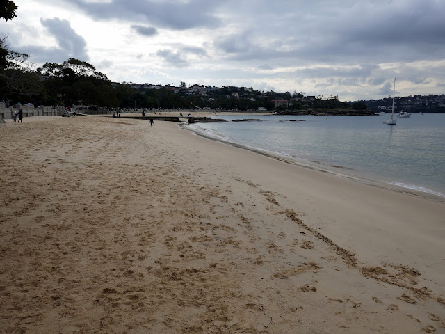 |
| Balmoral Beach |
 |
| Balmoral Beach |
A tree-lined promenade runs the length of the beach and continues to neighbouring Edwards Beach. The two beaches are separated by Rocky Point Island, a tiny outcrop accessed by an arched concrete bridge that has been conserved as a small, lawned recreational area. This is a favourite spot for picnickers and seats are placed at scenic vantage points around the small island.
 |
| Grotto Point Lighthouse |
 |
| The link to Rocky Point Island |
 |
| Balmoral Beach |
 |
| Edwards Beach |
 |
| Hunters Bay |
On the north side of the island is Edwards Beach, backed by the impressive Balmoral Bathers Pavilion. Built in 1929, the pavilion was the product of a surge of interest in swimming that had begun in the 1890s. To cater for the crowds flocking to their beaches, councils endowed with good beaches had to provide the desired facilities to keep up with the competition of neighbouring councils.
A set of steps lead away from the beach, cutting across Wyagine Point and up to Burran Avenue. I followed the street around the small headland to Rosherville Reserve and Chinaman's Beach. A steep climb follows, up Cyprian Street to Parriwi Road, which reveals expansive views across Middle Harbour. A short distance along Parriwi Road is the Parriwi Head Light, the rear range light for Grotto Point Light, almost exactly 1 mile away.
 |
| The north end of Edwards Beach |
 |
| Wyargine Point |
 |
| Grotto Point Lighthouse |
 |
| Rosherville Reserve |
 |
| Chinaman's Beach |
 |
| Parriwi Lighthouse |
From the lighthouse, the route follows Parriwi Road down to Parriwi Head which nestles below some imposing cliffs at The Spit. Here, the track comes to a natural conclusion ay Spit Bridge, the starting point of the famed Spit to Manly hike which is one of the highlights of all the hikes in and around Sydney Harbour. I hopped on a bus back to the city from Spit Bridge but, you can continue the Bondi to Manly journey here.
 |
| Cobblers Bay |
 |
| Looking out to the Sydney Heads |
 |
| The Spit |


No comments :
Post a Comment