This map was created using GPS Visualizer's do-it-yourself geographic utilities.
Please wait while the map data loads...
Please wait while the map data loads...
Route: Walls Ledge Loop Track, The Grotto, Centennial Glen, Colliers Causeway, Porters Pass, Lamberts Lookout, Fort Rock, Centennial Glen, Centennial Pass, Wall Ledge
Date: 06/06/2020
From: Centennial Glen Road
Parking: Centennial Glen Road
Start Point: Walls Loop Track
Finish Point: Walls Loop Track
Region: Blue Mountains National Park
Route length: 4.2 miles (6.7km)
Time taken: 03:00
Average speed: 1.4 mph
Ascent: 324m
Descent: 306m
Points of Interest: Walls Ledge, The Grotto, Colliers Causeway, Porters Pass, Lamberts Lookout, Fort Rock, Centennial Glen
With travel restrictions now lifting, we're able to get a bit further afield - out of Sydney and back up to the Blue Mountains. While it may be 'old news' now in the wake of COVID and the BLM protests, much of the Blue Mountains area is still closed due to the devastating bushfires during the 19/20 summer. The Grose Valley, east of the town of Blackheath and home to the beautiful Grand Canyon Track, is probably the worst affected with most popular tracks and lookouts off-limits.
West of Blackheath however, was spared from the flames thanks to the efforts of the Rural Fire Service, so we plotted a route around one of the Blue Mountains' hidden gems, Centennial Glen, which includes the spectacular Walls Ledge track and Colliers Causeway. Being the first long weekend after lockdown, the main road to the mountains was very busy, much like any typical bank holiday in the UK. We arrived at the parking area an hour later than expected.
A small parking area and toilets stand at the top of Centennial Glen with a few paths shooting off in different directions. Rather than begin with a direct descent into the valley, we opted to take a more circuitous route to make an approach along the Walls Ledge Track.
 |
| The view from the car park |
 |
| Beginning our journey along the Walls Ledge Loop |
 |
| Looking along the Kanimbla Valley towards Mount Piddington |
 |
| The Kanimbla Valley |
 |
| Starting along the Walls Ledge Track |
 |
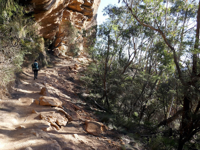
| Walls Ledge Track |
 |
| Walls Ledge |
 |
| Climbers enjoying the sandstone cliffs along the Walls Ledge Track |
 |
| Walls Ledge |
 |
| The Walls Ledge Track |
 |
| The sandstone which dominates the Blue Mountains |
 |
| Looking back along the track |
 |
| A narrow section of the Walls Ledge |
 |
| Kanimbla Valley |
 |
| Walls Ledge panorama |
 |
| Passing beneath a large overhang |
 |
| Looking back along Walls Ledge |
 |
| Kanimbla Valley |
 |
| Descending into Centennial Glen |
 |
| Entering The Grotto |
 |
| The waterfall at the end of The Grotto |
 |
| The Grotto |
 |
| The Grotto |
 |
| At the top of Slippery Dip falls |
 |
| Steps descend alongside the waterfall |
 |
| Another set of winding stone steps |
 |
| Colliers Causeway |
 |
| A glimpse of the views between the trees |
 |
| Colliers Causeway |
 |
| Colliers Causeway |
 |
| Eucalyptus trees |
 |
| Cliffs along Colliers Causeway |
 |
| Colliers Causeway |
 |
| Colliers Causeway |
 |
| Kanimbla Valley |
 |
| The gap in the cliffs at Porters Pass |
 |
| Waterfalls at the foot of Porters Pass |
 |
| Waterfalls |
 |
| Porters Pass |
 |
| Climbing Porters Pass |
 |
| Porters Pass |
 |
| Porters Pass |
 |
| Emerging at the top of Porters Pass |
 |
| Lamberts Lookout |
 |
| The top of Porters Pass from Lamberts Lookout |
 |
| Lamberts Lookout |
 |
| Wattle in bloom |
 |
| Open hillside below the Mountains Christian School |
 |
| Looking out over Kanimbla |
 |
| Cliffs below Mount Victoria |
 |
| Kanimbla |
 |
| The Shipley Plateau |
 |
| Fort Rock |
 |
| Above Centennial Glen |
 |
| Waterfall in Centennial Glen |
 |
| Centennial Glen |
 |
| Leaving Centennial Glen |

No comments :
Post a Comment