Showing posts with label walking route. Show all posts

Friday, 17 March 2023

Milford Sound / Piopiotahi Foreshore Walk

Milford Sound 17-03-2023

This map was created using GPS Visualizer's do-it-yourself geographic utilities.

Please wait while the map data loads...

Route: Milford Sound Lodge, Milford Foreshore Walk, Freshwater Basin, Milford Sound Harbour, Milford Sound Highway, Milford Sound Lodge

Date: 17/03/2023
From: Milford Lodge


ParkingMilford Sound Lodge
Start Point: Milford Sound Lodge
Finish Point: Milford Sound Lodge
Region: Fiordland National Park

Route length: 7.3km
Time taken: 02:30
Average speed: 4.7km/h
Ascent: 77m
Descent: 85m

Points of Interest: Milford Sound / Piopiotahi

Milford Sound / Piopiotahi is a breath taking fiord located in the southwestern part of New Zealand's South Island (Te Waipounamu). Renowned for its awe-inspiring natural beauty and pristine wilderness, Milford Sound is often regarded as one of the most stunning destinations in the world. Milford Sound is part of the larger Fiordland National Park, a UNESCO World Heritage site that encompasses over 1.2 million hectares of untouched wilderness.
The Earl Mountains from State Highway 94 - the only sealed road into Fiordland National Park
We spent a couple of days camping at the Milford Sound Lodge, located a short distance from the fiord itself. The reason we spent a few days in the area was to give ourselves the best chance of actually seeing the fiord given its reputation for wetness, which we got to experience first-hand.
One of the accommodation blocks at Milford Sound Lodge
The Cleddau River
Fiordland National Park is renowned for its wetness, earning it the title of one of the wettest places on Earth. The park's unique geography, characterized by towering mountains and deep fjords, creates an environment where moisture-laden clouds from the Tasman Sea collide with the steep slopes, resulting in abundant rainfall. The park receives an average of 200 days of rain per year, with rainfall measurements often exceeding several meters. That said, Milford Sound / Piopiotahi is worth visiting when it is raining as thousands of ephemeral waterfalls form on the steep cliffs, some for only a few hours at a time.
Ephemeral waterfalls on the cliffs of Fiordland
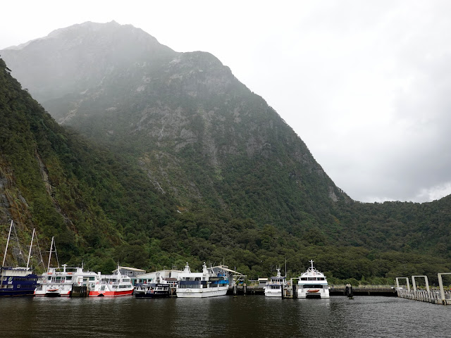
Many people will experience Milford Sound looking a little like this
Despite the beauty of its location, there is precious little hiking in the area, unless you set off on one of the multi-day hikes into the wilderness. This includes the most popular of all of New Zealand's Great Walks, the Milford Track which makes a four-day journey from Te Anau to Milford Sound / Piopiotahi. The most accessible and most popular walk in the local area is around the foreshore.

Once it had finally stopped raining, we ventured out of our campervan to the village. The foreshore walk, though short, gives some of the best views of the fiord, even on a grey day like today.
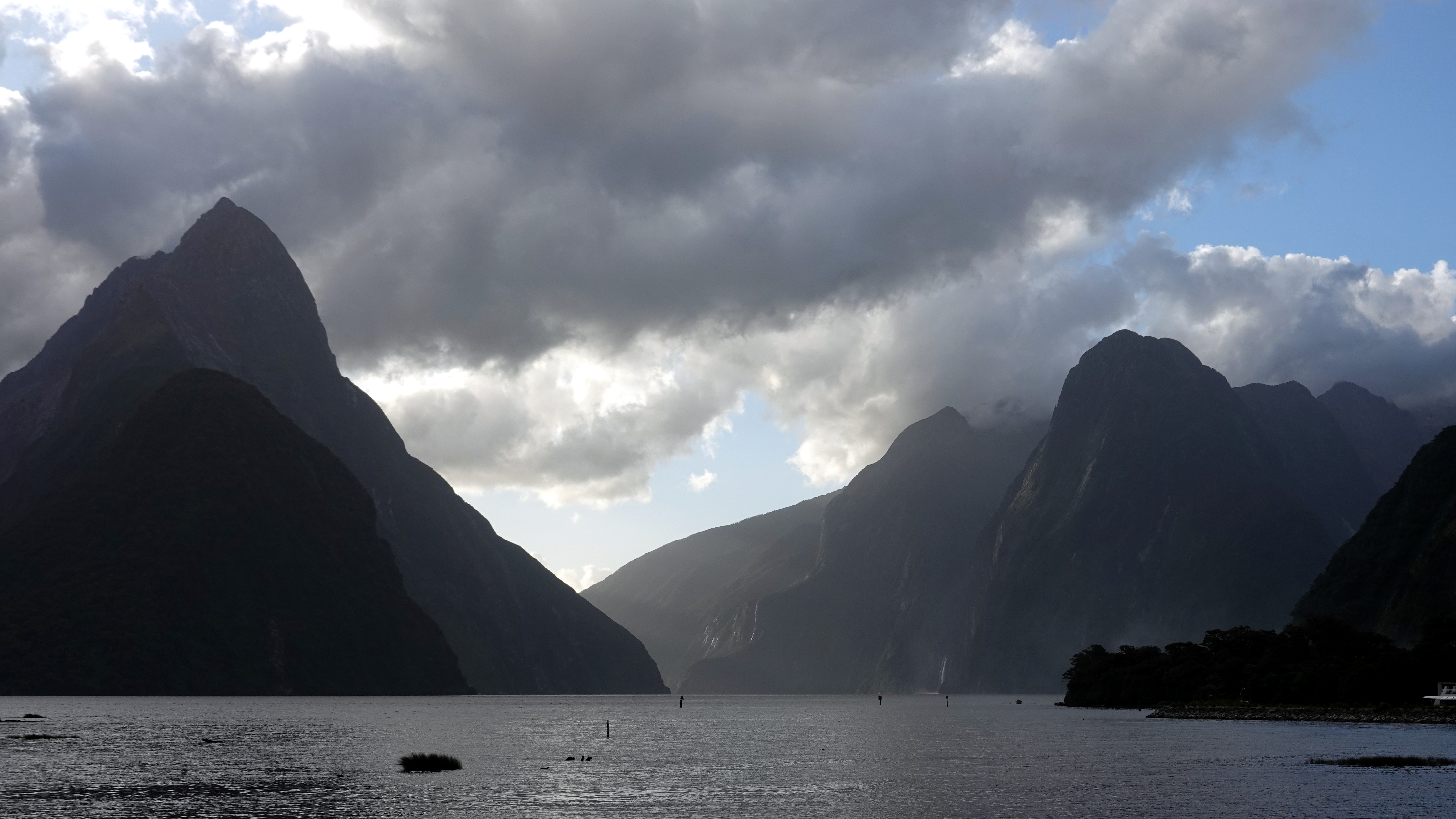
Milford Sound / Piopiotahi
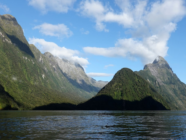
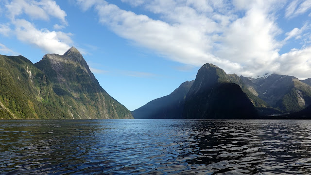
The views of the fiord are dominated by the mountains and Mitre Peak in particular - it is an iconic landmark that rises dramatically from the water to a height of 1,692m. The distinctive shape of Mitre Peak resembles a bishop's mitre, hence the name.
Mitre Peak
Mitre Peak
Speaking of names, you'll notice that I have been using the dual name for Milford Sound / Piopiotahi. This is thanks to the Ngāi Tahu Claims Settlement Act 1998, which included the alternation of significant place names to receive an official dual English and Māori name. Other areas included in the settlement are Aoraki / Mount Cook, Franz Josef Glacier / Kā Roimata o Hine Hukatere and Lake Rotorua / Te Rotorua nui ā Kahumatamomoe.

The English or European name, Milford Sound, is largely incorrect and fairly meaningless. Milford Sound / Piopiotahi is actually a fiord, not a sound. Sounds are formed when a river valley is flooded by the sea, whereas Milford Sound was formed by the erosion of ancient glaciers. The Milford part was described by sealer John Grono in 1823, who named it Milford after Milford Haven, his place of birth.

The Māori name, Piopiotahi, relates to the legend of Maui and his quest to win immortality for mankind. The quest required Maui to kill the goddess of death, Hine-nui-te-po, but Maui failed and was killed instead (I'll let you find out yourself how that came about). His partner, a piopio (a native thrush), flew to Milford Sound to mourn the death of Maui. Piopiotahi translates to 'a single piopio'.
A South Island Piopio specimen from Te Papa, the National Museum of New Zealand
If the tide is out you'll be able to get out a short distance onto the sandy bay which gives the best views of Bowen Falls (Hineteawa), the tallest permanent waterfall in Milford Sound / Piopiotahi. Given the amount of rain that had fallen the previous day, the waterfall was looking at its best when we visited. The river that feeds the waterfall also drives a hydroelectric turbine that provides all of the power to the small collection of buildings at Milford Sound / Piopiotahi.
Heading out at low tide
Bowen Falls (Hineteawa)
Following the sweep of Freshwater Basin took us to the cruise terminal that forms the hub of tourism in Milford Sound / Piopiotahi. Several cruises depart from the wharf and will take you to the mouth of the fiord and for a close encounter with Stirling Falls.
Freshwater Basin
The Lion and The Elephant guard Stirling Falls
Milford Sound / Piopiotahi Harbour below Barren Peak
Mitre Peak
The two-story vessels give a sense of scale to the mountains
The clouds continued to clear throughout the afternoon and, by the evening, we were treated to a cloud-free sunset over the fiord. For the first time in a couple of days, we could see Mount Pembroke, one of the tallest mountains that surround Milford Sound / Piopiotahi.
Freshwater Basin below the steep slopes of Cascade Peak
Milford Sound / Piopiotahi
The terraces show successive glaciations
Milford Sound / Piopiotahi
The Lion and The Elephant
Mitre Peak
Mitre Peak
Milford Sound / Piopiotahi
The Elephant, The Lion and Mount Pembroke
Mount Pembroke
Milford Sound / Piopiotahi
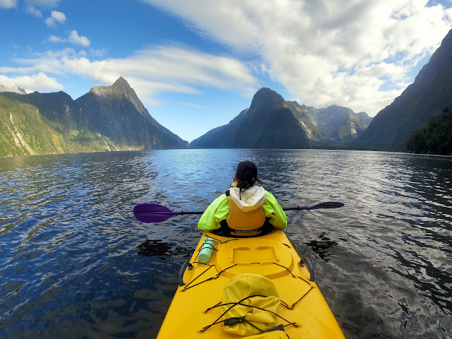
We returned the following day to spend a morning kayaking on the fiord, which is an incredible experience. What was more amazing was that we had managed to pick the only dry, sunny period of the entire time we were in the area. Getting out on the water is the best way to experience Milford Sound / Piopiotahi and this was an experience that will live long in the memory.
It was a beautiful day for a kayak on the fiord
Miter Peak, The Elephant and The Lion
We were sharing the early morning some a larger visitor, who swiftly departed
Milford Sound / Piopiotahi
Approaching Stirling Falls
Mitre Peak
The immense Sinbad Gully separates Mitre Peak from Llawrenny Peaks
Milford Sound / Piopiotahi
Sheerdown Peak
One of the locals
Front row seats

Wednesday, 15 March 2023

The Roys Peak Track - Wānaka

Roys Peak 15-03-2023

This map was created using GPS Visualizer's do-it-yourself geographic utilities.

Please wait while the map data loads...

Route: Wānaka Mount Aspiring Road, Roys Peak Track, Roys Peak

Date: 15/03/2023
From: Mount Aspiring Road


Parking: Roys Peak Car Park - Wānaka Mount Aspiring Road
Start Point: Roys Peak Car Park
Finish Point: Roys Peak summit
Region: Wānaka

Route length: 15.9km
Time taken: 04:31
Average speed: 4.4km/h
Ascent: 1,280m
Descent: 1,280m

Points of Interest: Roys Peak

Thanks to the popularity of Instagram, Roys Peak has gained a somewhat celebrity status thanks to its astounding views over Wānaka and the surrounding Mount Aspiring National Park - views that epitomize the dramatic, mountainous landscape of the South Island (Te Waipounamu) of New Zealand (Aotearoa). On paper, the hike to the summit looks fairly easy, but hikers face a 16km round trip with over 1,200m of elevation gain - no mean feat.

The Roys Peak Track is one of the most popular hikes in New Zealand but has some of the best views anywhere on the South Island so be prepared to share your hike with scores of other people aiming for the summit. My advice - hit the trail early and get hiking before dawn. That way you'll have a quieter experience and (if you are lucky) avoid climbing the mountain with the sun beating down on you. You may also be able to grab a car parking space before it fills up.

Following my own advice, I was up and at it early, thanks to a generous drop-off from my significant other. With my headtorch on I began the climb at 7am, just before the sun started to peek over the horizon.
The start of the Roys Peak Track
The path begins by crossing a ladder still and starts to climb straight away. It stays climbing for over 1,200m, all the way to the summit. If that sounds like too much of a challenge, then consider just hiking to the first viewpoint - more on that later. The first section of the trail crosses private farmland and closes between the 1st of October and the 10th of November for lambing season. During this time, you cannot climb Roys Peak.
Dawn light over Buchanan Peaks
Lake Wānaka
The Roys Peak Track - Roys Peak is the low pyramid on the horizon
The first part of the trail has some of the steepest sections of the hike before you cross a second ladder stile and reach a long, steady incline along the slopes of Roys Peak. Enjoy this as things get a bit steeper later on.
Early morning mists in Hāwea Flat
Lake Wānaka
After the long incline is another series of steep switchbacks that climb from 800m to the first viewpoint at 1,300m. The bonus of climbing at dawn is the constantly shifting light so the view (which remains much the same) never really gets uninteresting.
Lake Wānaka
Roys Peak - the summit is marked by the tall mast and looks deceptively close
Roys Peak north ridge catches the morning light
Roys Peak
The northern summit of Roys Peak sports a series of antenna
Looking north along Lake Wānaka towards the Southern Alps
Roys Peak
The view down the winding track towards the car park and Lake Wānaka
The first views of Mount Aspiring / Tititea
The 'first viewpoint' is sometimes mistaken by some to be the summit of Roys Peak. This is incorrect as the true summit is a further 200m higher. Because the track is located on the mountain's eastern slopes, any views of Mount Aspiring / Tititea and its surrounding national park to the west are hidden until you reach the ridge. This is where most of the hikers will congregate to capture 'that view' for their Instagram page. On busy days, large queues can form as people wait for that perfect shot - there was even a small gathering present in the early morning.
A lone hiker heads out for their turn on the ridge
The view is incredible but take my advice and don't bother waiting in line for a photo, the views get even better as you climb further and you'll get several opportunities to get a far better shot with fewer people and no waiting.

One thing you'll notice is that Lake Wānaka is present in views on either side of Roys Peak - the enormous glacial lake wraps around the northern half of the mountain with Glenhdu Bay to the west and Roys Bay to the east. At 45km long and 300m deep, it is New Zealand's fourth-largest lake - the largest being Lake Taupō on the North Island.

The highlight of the view fro Roys Peak is arguably along the Matukituki River towards Mount Aspiring / Tititea. The river drains parts of the enormous Bonar Glacier, the Maud Francis Glacier, and the Rob Roy Glacier that all form on the slopes of Mount Aspiring / Tititea.
The commanding Mount Aspiring / Tititea and its neighbouring peaks
Lake Wānaka and Mount Aspiring National Park
The view along the Matukituki River valley
Roys Peak summit
The path between the lookout ridge and the summit hugs the west side of the mountain, following the route of the narrow north ridge. As I mentioned, it climbs a further 200m to the summit allowing plenty of time to soak up those incredible views, mostly of Glendhu Bay and the mountains adjacent to Roys Peak.
The final push to the summit
Lake Wānaka panorama
Lake Wānaka (Glendhu Bay) and Mount Aspiring / Tititea
End Peak and the Motatapu Valley can only be seen if you climb to the summit
Summit panorama
The summit of Roys Peak is capped by a tall mast and has an astounding, near 360-degree view. To the west are the Harris Mountains, the Matukituki River and the crown of the 3,033m high Mount Aspiring / Tititea. To the north is the length of Lake Wānaka, framed by the Buchanan Peaks, Minaret Peaks, and the Southern Alps in the far distance while to the east is the town of Wānaka and the plains of the Clutha River (Mata-Au). To the south are Roys Peaks' closest neighbours, Mount Alpha, and several unnamed peaks, all taller than 1,500m.

The peak was named in honour of the Scottish hero Rob Roy MacGregor by early settlers, but it is not clear what links him to the peak (if anything). The whole area features many Scottish references including the Harris Mountains, Highland Creek, Macdonalds Peak and Clutha River so it is likely the early settlers were simply making new colony more homely.
The summit of Roys Peak
The Dunstan Range to the east
Lake Wānaka to the north
Roys Peak summit looking south into the Harris Mountains
The incredible summit panorama featuring Mount Aspiring / Tititea (left) to Wānaka (right)
Looking down the north ridge
Mount Aspiring / Tititea
After spending some time watching the shifting clouds, it was time to retreat from Roys Paek and start to long descent back to the car park where I had arranged to meet my lift. Descending the north ridge is a joy as the expansive views are directly in front of you, rather than behind and there are several points along the ridge to get some good photos.
Harris Mountains
Roys Peak
Buchanan Peaks
Mount Aspiring / Tititea
Niger Peak, Mount Avalanche, and Mount Aspiring / Tititea
North ridge panorama looking towards Wānaka
Before long I had made it back to the popular viewing area where a larger knot of people were milling around, waiting for a photo. Soon after, views of Mount Aspiring / Tititea disappear as you head back down the east side of the mountain. As I had set off at dawn, the views of Lake Wanaka and the town were totally different now that the sun had risen.
The track winds down the east side of Roys Peak
The north ridge and Mount Alba
Roys Peak Track
Mount Iron in Wānaka
Wānaka
Lake Wānaka
Roys Peak Track
The Clutha River (Mata-Au) valley
A final photo before reaching the car park
Before long I had made it back to the car park. I spent a total of 4.5 hours on Roys Peak, including about half an hour loitering around the summit. The views from Roys Peak are sensational and justify its popularity, but the views are hard-won, especially if you are not a seasoned mountain climber.

As a side note, no trip to Wānaka is complete without visiting the enigmatic tree that grows out of the lake at Roys Bay. It's easy to find and makes a fine subject for a few photographs.
Lake Wānaka
The famous tree in Roys Bay
Lake Wānaka