Despite being tucked away on the quieter eastern side of Snowdonia (Eryri), this high-level circuit of Cwm Eigiau ranks as one of the true classic mountain rounds in North Wales. Sharp ridges, airy arêtes, lofty summits, and brooding glacial crags were all on the agenda today—with a superb forecast to boot.
🗺️ Interactive Route MapPinch or use wheel to zoom
Despite being tucked away on the quieter eastern side of Snowdonia (Eryri), this high-level circuit of Cwm Eigiau ranks as one of the true classic mountain rounds in North Wales. Sharp ridges, airy arêtes, lofty summits, and brooding glacial crags were all on the agenda today—with a cracking forecast to boot.
The walk kicks off from a secluded car park perched right at the end of a fantastically winding, gated single-track lane leading up from the village of Tal-y-bont. With space for only about 15 cars, arriving early usually means bagging a spot and having the quiet hills virtually to yourself. The route works brilliantly in either direction, but I opted for an anti-clockwise loop—saving the absolute best of the ridge walking and sweeping views across the Carneddau for later in the day.
Cwm Eigiau on a fine morning
From the car park, a straight track leads towards Clogwynyreyr—the sharp termination of the Craig Eigiau ridge and our first summit of the day. The track follows the historic bed of the old quarry tramway towards the disused Melynllyn Hone Quarry, skirting around the base of Clogwynyreyr into the secluded, wild basin of Pant y Graifolen. Here, the valley opens up dramatically, bringing the towering summits of Foel Grach, Carnedd Gwenllian, and Foel-fras all into view.
The track leading away from the car park
Craig Eigiau
The track climbs gently to a wooden gate, where I left the main path and struck out uphill to gain the open ridge of Craig Eigiau. With every step, the sweeping views across the Carneddau grew ever more impressive. Nestled beneath the crags below, the dark waters of Dulyn Reservoir (Llyn Dulyn) came into view.
Despite its compact surface area, this small tarn is remarkably deep—plunging to almost 60 metres, making it nearly as deep as Lake Windermere in the Lake District. Its Welsh name translates directly to "Black Lake", a fitting moniker given by the looming, shadowed precipices of Craig y Dulyn above that keep its waters in perpetual shade. Llyn Dulyn’s dark, moody waters have spawned plenty of local folklore over the centuries. Local legend once claimed that the tarn was bottomless, that no bird would ever fly over its waters, and that anyone who stood on the cliffs on May Eve could peer into the lake to see the faces of those destined to die in the parish that year.
Craig Ffynnon and Pen Llithrig Wrach
Cerrig Cochion
Drum and Pen y Castell
Carnedd Gwenllian
The Melynllyn quarry road at Clogwyn Maldy
Foel-fras
The Cefn-Tal-llyn-Eigiau ridge reaches its climax at Craig Eigiau, towering over a dramatic wall of cliffs that shelter Llyn Eigiau far below. The summit itself is a fascinating landscape of fractured rock sheets, with a distinctive tilted slab marking the highest point at 735 metres. Standing on this exposed vantage point, I could see rain bands and passing showers starting to stack up to the west—unmistakably heading right my way.
Looking into Pant y Graifolen towards Pen y Castell
Cefn Tal-llyn-Eigiau
Afon Porth-llwyd
Carnedd Llewelyn, Foel Grach, Carnedd Gwenllian and Foel-fras
Craig Eigiau
Craig Eigiau's summit looking to Carnedd Llewelyn
The view to Pen Llithrig y Wrach
A broad, grassy ridge known as Gledrffordd forms a high-level bridge joining Craig Eigiau to its parent peak, Foel Grach, with a clear path threading its way towards the top. It makes for effortless walking as you weave along the crest. Looking north, the jewel-like Llyn Melynllyn sits neatly tucked below, while across the cwm, the towering, dark precipice of Craig yr Ysfa commands the skyline along Carnedd Llewelyn’s south-eastern flank.
Craig Eigiau
Looking across Gledrffordd to Carnedd Llewelyn
Foel Grach and Melynllyn
The Gledrfford ridge
Carnedd Llewelyn
Skies begin to darken
As I plodded up the final pull to the summit of Foel Grach, the rain finally caught up with me, falling quite heavily by the time I reached the high cairn at 976 metres. Luckily, the cloud base stayed high, preserving the vast, atmospheric views right across the Carneddau.
Tucked just below the summit lies a famous stone emergency refuge—a welcome sight in a downpour. Given the weather, I ducked inside for a quick look and a brief pause to shelter while the worst of the rain band swept through.
Looking through Bwlch Eryl Farchog
Showers stream into the Conwy Valley
Approaching Foel Grach
Foel Grach's summit just as the rain arrived
The shelter below the summit
With full waterproofs zipped up, I began the climb towards Carnedd Llewelyn along the Gwaun y Garnedd ridge, stepping off the main path now and then to peer over the drop into Cwm Eigiau and down to the tiny tarn of Ffynnon Llyffant. At 815 metres above sea level, Ffynnon Llyffant ("Frog Well") holds the distinction of being the highest named lake in Wales and England.
The rain had eased to a drizzle by the time I reached the high shoulder, but rather than heading straight for the main summit cairn, I veered west, intent on visiting the impressive outlying peak of Yr Elen.
Carnedd Gwenllian
A damp Carnedd Llewelyn and Yr Elen
Ffynnon Llyffant with an added rain spot for effect
The north ridge of Carnedd Llewelyn
Clouds draped across the lower slopes of Carnedd Gwenllian
Looking back to Foel Grash as the weather clears
A side trip out to Yr Elen is well worth the extra effort—the narrow, high arête linking it back to Carnedd Llewelyn is a spectacular place to tread, with the crag-rimmed amphitheatre of Cwm Caseg plunging dramatically below.
Yr Elen itself offers superb, wide-open views to the west towards the Menai Strait and Anglesey, along with a front-row seat looking back at the rugged, fortress-like western faces of the main Carneddau tops.
While exploring around the summit cairn, I spotted the Search and Rescue (SAR) helicopter banking sharply into the neighbouring Ogwen Valley—a sobering sight that, sadly, later proved to be a callout to a fatal fall on Tryfan rather than a routine training drill.
Yr Elen pokes up above the ridge of Carnedd Llewelyn
Yr Elen
Carnedd Dafydd
Elidir Fawr and the immense Atlantic Slab of Carnedd y Filiast
Yr Elen
Yr Elen's summit looking to Carnedd Gwenllian
Carnedd Llewelyn from Yr Elen
After returning to Carnedd Llewelyn, I sought shelter behind the massive summit cairn to escape the biting wind for a quick bite to eat before continuing my route east, descending the ridge of Penywaun Wen.
It makes for easy, open walking high above the towering wall of Craig yr Ysfa, right up until a final, steep rocky step needs to be negotiated at the very end of the ridge—a scramble that can be notoriously tricky in the wet or under a coating of ice. Craig yr Ysfa ("Crag of the Itch" or "Scabby Crag"), is legendary in British mountaineering history as the location of Great Gully, one of the classic multi-pitch rock climbs in Snowdonia first conquered back in 1900.
Carnedd Llewelyn
Yr Elen
Cwm Caseg
Foel Grach and Carnedd Gwenllian
Carnedd Llewelyn's summit
Penywaun-wen and Ffynnon Llugwy
Penywaun-wen
Moel Siabod and Ffynnon Llugwy
Tiny Ffynnon Llyffany in Cwm Eigiau
Pen yr Helgi Du and Pen Llithrig y Wrach
Cwm Eigiau
Ffynnon Llugwy
Pen yr Helgi Du and Fynnon Llugwy
The rock step on Penywaun-wen
The rocky step drops you straight onto the narrow spine of Bwlch Eryl Farchog—a superb, knife-edge arête that forms a dramatic watershed, separating Cwm Eigiau to the north from Cwm Llugwy to the south. Standing on this airy gash in the ridge, the immediate path ahead looks formidable, dominated by the steep, imposing north-west face of Pen yr Helgi Du rising sharply in front of you.
Bwlch Eryl Farchog and Pen yr Helgi Du
Carnedd Dafydd
Craig yr Ysfa
Despite first appearances, the short scramble up the ridge should pose no problems while affording fantastic views back across the bwlch, Craig yr Ysfa and Carnedd Llewelyn, as well as aerial views of Cwm Eigiau to the east and Cwm Llugwy to the west. The scramble ends at the summit of Pen yr Helgi Du.
The north-west ridge of Pen yr Helgi Du
Craig yr Ysfa and Cwm Eigiau
Carnedd Llewlyn and Craig yr Ysfa
Pen yr Helgi Du is a fine mountain featuring a broad, grassy summit shaped remarkably like a massive arrowhead—with its steep north-west ridge forming the sharp point. With quite a distance still left to cover, I didn't linger too long on the top, quickly beginning my descent down the east ridge into Bwlch y Tri Marchog—the evocative "Pass of the Three Horsemen". The pass has its own minor top, Clogwyn Llech Lefn, and it would have been rude to pass it by without a quick visit.
Pen yr Helgi Du's summit
Tryfan and the Glydrau
Capel Curig and Moel Siabod
The climb up Pen Llithrig y Wrach is admittedly fairly dull—a steady, grassy tramp at the end of a long day in the boots. Still, upon reaching the top, all that effort is rewarded as the narrow, dark waters of Llyn Cowlyd—Wales' deepest lake—are revealed stretching away far below.
Across the water rise two of Snowdonia's quieter, less-frequented Nuttalls: Creigiau Gleision and its North Top.
Pen Llithrig y Wrach
Cwm Eigiau
Pen Llithrig y Wrach
An interested onlooker
Looking back towards Pen yr Helgi Du and Carnedd Llewelyn
Pen Llithrig y Wrach's summit
With the final descent in sight, I spent some time checking in at HQ, enjoying the weather and the quiet solitude of Pen Llithrig y Wrach while contemplating its curious name. Translated from Welsh, it means "The Slippery Peak of the Witch"—perhaps a nod to the surrounding treacherous bogs and its uncanny resemblance to an archetypal witch's hat when viewed from the east.
A long but easy descent through the heather leads from Pen Llithrig y Wrach to Craig Ffynnon and, eventually, to one of the old mine roads that litter Wales. This one, in particular, formed the route of the Eigiau Tramway, a narrow gauge, horse-powered tramway which operated from in the late 1800s and served the Eigiau slate quarry. One of the remaining bridges is still visible today.
Creigiau Gleision
Craig yr Ysfa and Carnedd Llewelyn
Craig Eigiau
The ridge to Craig Ffynnon
Craig Eigiau
The valley of Afon Ddu
The quarry road
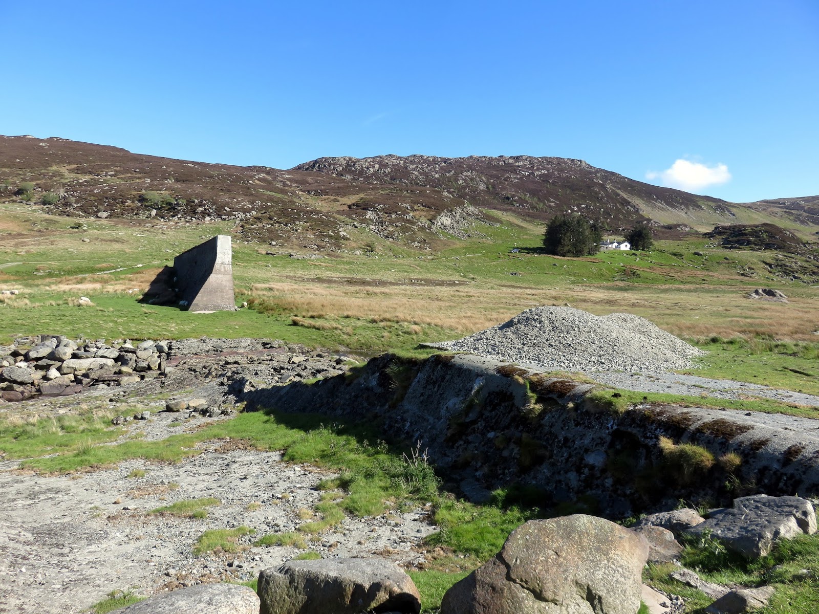
The track leads down to the broken remains of the breached Eigiau Dam wall. The structure catastrophically failed in November 1925 after more than 600 mm of torrential rain fell in just five days. Water overtopped the concrete embankment and washed out the shallow foundations, releasing three million tonnes of water that overtopped the lower Coedty Dam and sent a devastating wave into the village of Dolgarrog below, costing 17 lives.
The breached dam
The breached dam
Pen Llithrig y Wrach
Pen Llithrig y Wrach and the breached dam
Cwm Eigiau
From the breached dam, a straight, easy track leads back to the car park, where the car was duly awaiting my return. This is a spectacular walk from start to finish—a true mountain classic that delivered everything you could want from the Carneddau, and one I thoroughly enjoyed as I continue my ongoing exploration of North Wales.






Very well presented thanks
ReplyDeleteThanks!
DeleteFantastic detail and photos
ReplyDeleteThanks!
ReplyDelete