Castle Head 14-09-2024
This map was created using GPS Visualizer's do-it-yourself geographic utilities.
Please wait while the map data loads...
Route: Glenrapael Drive, Castle Head Track, Castle Head, Glenraphael Drive
Date: 14/09/2024
From: Glenraphael Drive
Parking: The locked gate - Narrowneck
Start Point: The locked gate - Narrowneck
Finish Point: The locked gate - Narrowneck
Region: Blue Mountains National Park
Route length: 4.3 km
Time taken: 02:29
Average speed: 4.5 km/h
Ascent: 171m
Descent: 150m
Points of Interest: Castle Head
After a recent trip to Castle Head, I vowed to return armed with my camera and tripod to catch a sunrise from one of the best vantage points in the southern Blue Mountains. While Castle Head appears to be a solid tableland, it is, in fact, a narrow ridge that protrudes into the valley. At its terminus, it is only a few metres across. Getting to Castle Head is very straightforward and requires only a modest effort - perfect for a pre-dawn excursion.
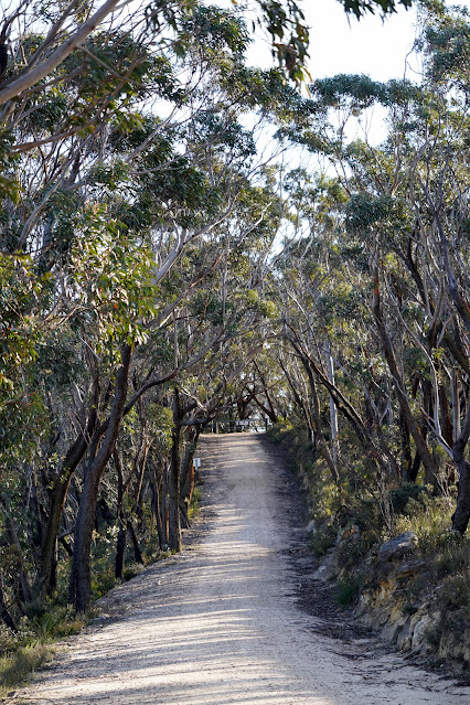
After camping close by in Katoomba, I arrived at the Narrowneck locked gate under the cover of darkness, ready to make the short hike to the lookout. To begin, the route is mostly along a fire trail before a sign marks the detour to Castle Head. This section is easy, even under the power of a head torch.
 |
| First light at the locked gate on Narrowneck Plateau |
 |
| The first part of the hike follows the Narrowneck fire trail |
 |
| The last of the stars before dawn |
The path makes a 1.2 km journey towards the end of the ridge, passing a couple of viewpoints along the way. Just before the track reaches the lookout at Castle Head, it passes an old trig station, marked by a metal post and a black disk. While the trig has a commanding view of its own, it pales in comparison to the views from the edge of the cliffs, only a short distance further.
 |
| Jamison Valley |
 |
| Approaching Castle Head |
 |
| Mount Solitary |
The lookout is located atop the cliff face at the end of the ridge, overlooking a vast sweep of the southern Blue Mountains. Ruined Castle and Mount Solitary dominate the view directly ahead, and it's possible to spot most of the area's famous attractions, including the Three Sisters, Sublime Point and Kings Tableland.
Castle Head, along with Ruined Castle and Mount Solitary, split the valleys of Cedar Creek to the west and Causeway Creek to the east. Both creeks eventually join Coxs River on the opposite side of Mount Solitary.
To the west, Cedar Creek is a wild valley framed by Mount Solitary and the continuation of the Narrowneck Plateau. There is also a rare glimpse of Lake Burragorang, the huge lake created by the Warragamba Dam that supplies water to Sydney though today, it was hidden under a layer of morning mists.
I spent a good hour at Castle Head watching the sunrise, casting a beautiful glow across the mountains. Here are a selection of some of my favourite images.
 |
| Ruined Castle and Mount Solitary |
 |
| Mists fill the Coxs River valley |
 |
| The Katoomba cliffs featuring Echo Point and Sublime Point |
 |
| Mount Solitary and Cedar Creek |
 |
| Ruined Castle and Mount Solitary |
 |
| Ruined Castle |
 |
| Mount Solitary |
 |
| The leading line from Castle Head |
I could have easily spent the whole day lounging at Castle Head, soaking up the sun and enjoying the view, but I had other plans on the other side of the national park. With the sun shining brightly overhead, I packed up my gear and retraced my steps toward the fire trail. After reaching the trail, it was a simple task to follow it back to the locked gate and the car park. |
| The Castle Head trig column |
 |
| There's a prominent gully leading off Narrowneck |
 |
| Jamison Valley |
 |
| Castle Head Track |
 |
| There were views of the Megalong Valley as I made my way back to the car park |
 |
| Narrowneck fire trail |
 |
| The locked gate and car park |


No comments :
Post a Comment