Ikara Head & Thor Head 27-11-2022
This map was created using GPS Visualizer's do-it-yourself geographic utilities.
Please wait while the map data loads...
Route: Victoria Falls Road, Ikara Head Track, Ikara Head, Ikara Head Trail, Asgard Plateau (off track), Asgard Swamp, Thor Head, Asgard Mine, Asgard Swamp Track, Victoria Falls Road
Date: 27/11/2022
From: Victoria Falls Road
Parking: Victoria Falls Road
Start Point: Ikara Head Track
Finish Point: Victoria Falls Road
Region: Blue Mountains
Route length: 13.1km
Time taken: 04:44
Average speed: 3.9km/h
Ascent: 530m
Descent: 535m
Points of Interest: Ikara Head, Thor Head, Asgard Mine
A recent visit to Victoria Falls gave me the taste for more exploration of the wilder areas of the western Grose Valley. This area is home to a handle of quiet hiking trails that link Victoria Falls Road to several prominent ridges; namely Ikara Head, Thor Head and Asgard Head.
The tracks are typically out-and-back affairs, but I concocted a more circuitous route thanks to some research. A word of warning - the off-track sections of this hike are remote and tough going thanks to the thick Australian bush and I would recommend this hike is not undertaken alone, or you have a locator beacon to hand.
The hike begins from Victoria Falls Road, an unsealed road that starts close to Mount Victoria. While unsealed, the road is in good condition and our 2WD car had no problems whatsoever. There are several areas where you can leave a car, particularly around the Ikara Head Track where I would be starting today.
 |
| Victoria Falls Road at the beginning of this hike |
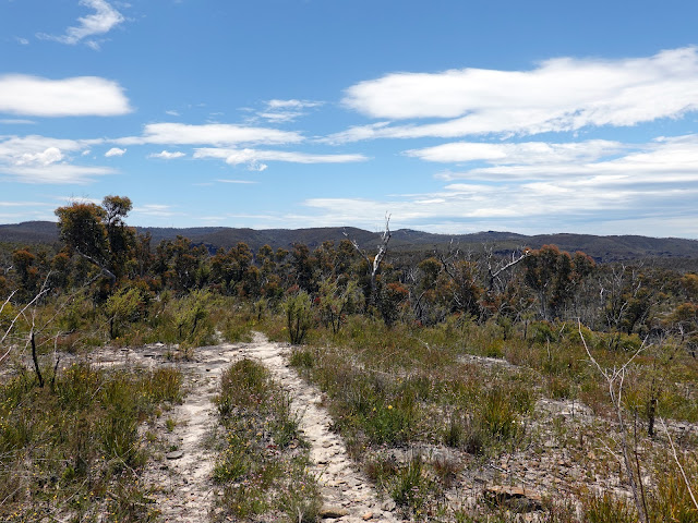
The Ikara Head Track is very well-defined and will take you all the way to the cliffs of Ikara Head, taking around 60 minutes or so. Spring is one of the best times to hike to Ikara Head when the wildflowers are in bloom - though the pink Flannel Flower puts on a particularly vibrant display in the late summer.
 |
| Ikara Head Track |
 |
| The Waratah - a hardy flower native to New South Wales |
 |
| Ikara Head Track |
 |
| Heading along the ridge towards Ikara Head |
 |
| Wildflowers along the track |
 |
| You'll find some interesting rock formations along the way |
 |
| Ikara Head |
 |
| Approaching Ikara Head |
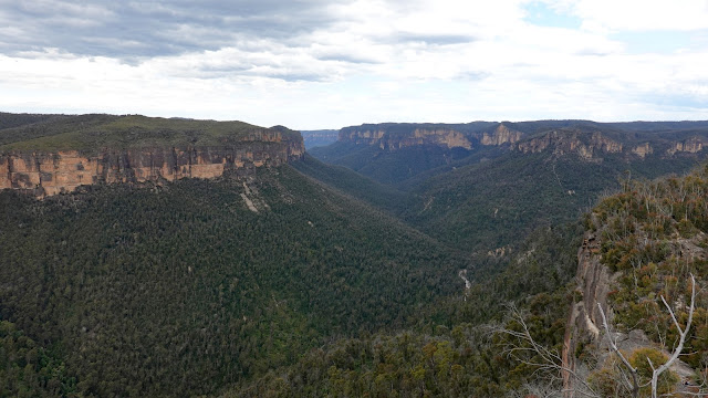
It was a superb morning for a hike and the views from Ikara Head are quite spectacular, including the Grose River, Surveyors Creek, Jungaburra Brook and Koombanda Brook.
 |
| Ikara Head |
 |
| Looking across Valhall Head towards Wilkinson Hill |
 |
| Looking along Jungaburra Brook and Kamarah Ridge |
 |
| Koombanda Brook escapes via a crack in the cliffs |
 |
| The Western panorama from Ikara Head |
 |
| The eastern panorama |
I backtracked along the path a short distance, following a GPS track I had loaded onto my phone. The aim was to cut across the neighbouring valley and pick up the nearby fire trail to save several kilometres of hiking. The route makes for a damp gully in the valley wall that picks its way down to the creek. You won't find this route marked on a map but, once you find the gully, the route to the creek is easy enough.
 |
| There are distant views along the Grose Valley |
 |
| Searching out the top of the gully |
 |
| Above the gully |
 |
| Looking back up the gully |
 |
| The unnamed creek at the bottom of the gully |
 |
| The creek once again |
After crossing the creek I picked up the bottom of the trail that climbs a spur, heading south through the bush for a short while before performing a 180 at the head of another small valley and following that track north. My plan was to try and find a way to Valhalla Head which does not have a marked track. Again, I was following the GPS track on my phone. This section is quite challenging and, despite my best efforts, I did not make it to Valhalla Head, mainly thanks to a swelling migraine that struck at the worst possible time.
 |
| The gully descends the hillside to the left of the tall rock |
 |
| The route through the cliffs in more detail |
 |
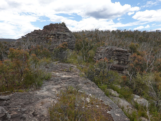
| Asgard Plateau |
 |
| Asgard Plateau |
 |
| Asgard Plateau |
 |
| Asgard Plateau |
 |
| Views across the Asgard Plateau |
 |
| Venturing off-track |
 |
| Above Asgard Swamp |
 |
| It's a wild no man's land atop the Asgard Plateau - the dome ahead is Asgard Head |
After abandoning thoughts of making it to Valhalla Head, I sought out Asgard Swamp by following a cliff line as it descends towards it. Basically, this meant the whole tramp through the bush was a waste of time as I could have reached this point along more formed paths and ended up with fewer scratches on my legs.
Asgard Swamp was a rich source of food and resources for the local Aboriginal people while, around the edges of the swamp, are the remains of huts used by the workers from nearby mines.
 |
| Following the cliffs towards Asgard Swamp |
 |
| Below Valhalla Head |
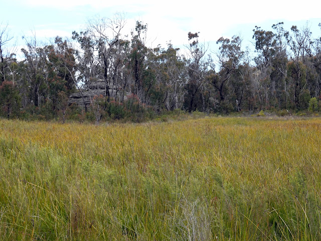 |
| Asgard Swamp |
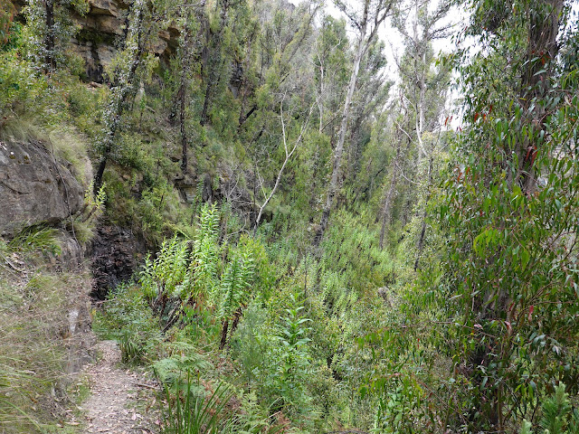
I skirted around Asgard Swamp and found a dry-ish route across. After traipsing through the bush, I was glad to make it back onto a formed trail again, this time the Asgard Swamp Track that forms part of the route to Thor Head. Thor Head can be reached by following a side that deviates from the main Asgard Swamp Track.
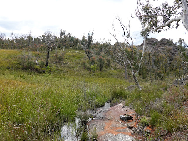 |
| Asgard Swamp |
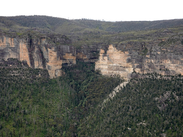
Reaching Thor Head involves a short climb through the trees to a flat rock platform on the cliff edge. From here, Thor Head rises above you while there is a spectacular panorama over the Grose Valley. The top of Thor Head is a short climb further, while the termination of the ridge can be reached by some awkward scrambling if you so desire.
 |
| The view of the Grose Valley from below Thor Head - Dalpura Head is directly opposite |
 |
| Thor Head |
 |
| Liversidge Hill and Docker Head |
 |
| The dramatic Burramoko Head |
 |
| The view from Thor Head |
 |
| The Grose Valley |
 |
| Dalpura Creek carves a path through the cliffs |
After soaking in the views and waiting for some painkillers to take hold, my migraine started to subside but that normally leaves me feeling nauseous for a number of hours. Despite this, I still planned on visiting Asgard Head, with a short detour to the Asgard Swamp mine - the best course of action to keep pressing and let the drugs do their thing. From Thor Head, I backtracked to the Asgard Swamp Track and made for the access path to the old mine which is signposted from the track.
 |
| Heading for the old mine |
The path zigzags down the hill a surprisingly long way until it ends at the old mine entrance, a small tunnel burrowed into the cliffside next to a waterfall. Apparently, the tunnel extends some 30m into the hillside - I ventured in a short distance but turned around shortly after - I had not brought a torch. Be warned - the integrity of the tunnel is unknown.
 |
| This narrow path leads down to the mine entrance |
 |
| The entrance to the mine |
 |
| Inside the mine tunnel |
By now I was feeling the after-effects of the migraine and decided that I was best making a sharp retreat back to the car - saving Asgard Head for another day. This was hastened by some developing thunderstorms nearby. Luckily for me, the Asgard Swamp Track carves a direct route back to Victoria Falls Road where I had left the car and, around an hour of hiking, I was unpacking my gear into the boot.
 |
| The Red-Bellied Black Snake - common across the Blue Mountains |
 |
| Asgard Swamp Track |
 |
| Asgard Swamp Track |
 |
| Back at Victoria Falls Road |
In hindsight, attempting to reach Valhalla Head was a waste of time, since I never managed to make it and gained nothing from wading through the bush. I'm not even sure whether there is a lookout up there that is worth it. I'll be back in the future, but the aim will be sticking to the formed tracks - the views from Ikara Head and Thor Head are spectacular and extremely easy to reach.


No comments :
Post a Comment