Lady Carrington Drive & the Uloola Track 27-12-2021
This map was created using GPS Visualizer's do-it-yourself geographic utilities.
Please wait while the map data loads...
Route: Audley Weir, Lady Carrington Drive, Jersey Spring, Forest Path, Couranga Track, Uloola Fire Trail, Uloola Falls, Uloola Track, Gurrumboola Ridge, Robertson's Roundabout, Robertson's Knoll, Engadine Track, Hacking River
Date: 27/12/2021
From: Audley Weir
Parking: Audley Dancehall
Start Point: Audley Weir
Finish Point: Audley Weir
Region: Royal National Park
Route length: 26.9 km
Time taken: 05:55
Average speed: 4.8 km/h
Ascent: 929m
Descent: 931m
Points of Interest: Jersey Spring, Forest Path, Uloola Falls, Robertson's Knoll
Royal National Park—affectionately known as ‘Nasho’ by some—is located just south of Sydney and holds the distinction of being Australia’s oldest national park, founded in 1879. Internationally, only Yellowstone in the US predates it by a few years. Its proximity to the city makes the park easily accessible by public transport. While the coastal cliffs are spectacular and offer some excellent hiking, much of Royal National Park is dominated by vast stretches of Australian bush, crisscrossed by numerous tracks. Among the longest of these are Lady Carrington Drive and the adjacent Gurrumboola Ridge.
Starting out from Audley Weir, the hike along Lady Carrington Drive is long but relatively easy, while the return via Gurrumboola Ridge adds a touch of wilderness to the outing—bringing the total distance to over 25 km. I parked at the national park visitor centre, located beside the Hacking River, and set off toward Lady Carrington Drive. |
| THe National Park visitor centre occupies the Audley Dance Hall |
 |
| The Engadine Track crosses the Hacking River |
 |
| Hacking River |
 |
| Hacking River |
Opened in 1886 by Lady Cecilia Carrington, wife of a former Governor of New South Wales, the 10 km trail was the first scenic route completed in Royal National Park, seven years after the park was officially declared. Originally built as a carriageway, it soon fell out of favour as visitors were drawn to the park’s more dramatic coastal cliffs. Today, the track serves as a haven for runners, walkers, and cyclists alike. |
| Lady Carrington Drive |
The first section of the trail passes through Fig Tree Flat before following a series of sandstone faces up to a formation known as Gibraltar Rock, which overhangs an old cobblestone section of the track. The formation is named after the Rock of Gibraltar, though I have to admit I don’t see much of a resemblance. From here, there’s a view of the Hacking River glimpsed through the trees. |
| Gibraltar Rock |
 |
| The Hacking River at Gibraltar Rock |
About 2.5 km along the road lies Jersey Spring. This natural spring feeds two sandstone watering troughs, built in 1892 to provide water for horses and travellers along Lady Carrington Drive. Remarkably, the spring still supplies the troughs today. It is named after Victor Child Villiers, 7th Earl of Jersey, who was the Governor of New South Wales at the time. |
| Tall Sydney Red Gum trees line Lady Carrington Drive |
 |
| The understory is a mix of many small trees and ferns |
 |
| The Red Gum bark sheds in large scales |
 |
| Jersey Spring |
 |
| The inscription on the trough |
The track then continues into some of the most accessible temperate rainforests in the park. This atmospheric woodland is filled with moss-covered logs, towering tree trunks, bird’s-nest ferns, and a spectacular understory of palm trees. It’s also one of the best places in the park to spot lyrebirds. |
| Lady Carrington Drive |
 |
| Lady Carrington Drive |
 |
| A female Lyrebird — the males have an ornate tail, much like a peacock |
 |
| Calala clearing |
 |
| The sign at Calala |
At the southern end of Lady Carrington Drive is the Forest Path, a connecting track that follows Bola Creek and another stretch of the Hacking River. In my opinion, it offers a more interesting route to the Couranga Track, which provides access to the Uloola Fire Trail. The Forest Path loops around the lower slopes of Forest Island, a hill isolated by the surrounding creeks and rivers, and passes through a variety of native vegetation, including tall eucalypts and casuarina trees.
 |
| Lady Carrington Drive |
 |
| Bola Creek from the Forest Path |
 |
| The Forest Path |
 |
| A hollowed-out Eucalyptus |
The Forest Path connects to the Couranga Track, which crosses the young Hacking River via a series of stepping stones. If the river is in flood, this section may be impassable. The rocky path then climbs alongside a small creek for a while before tackling a steeper ascent out of the valley onto the Uloola Fire Trail. (You could end the hike here by making your way to Waterfall station and returning to Sydney.)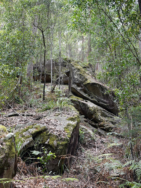 |
| Jumbled boulders along the Forest Path |
 |
| The Couranga Track junction |
 |
| Crossing the Hacking River |
 |
| The Couranga Track |
 |
| The Couranga Track climbs out of the valley |
 |
| At the top of the Couranga Track |
 |
| Uloola Fire Trail |
For me, this was the halfway point—an ideal spot to take a break. The next objective was Uloola Falls, about 6 km away along the fire trail. The track is easy to follow, meandering through the picturesque highlands of the national park, passing Uloola Swamp before eventually reaching the Uloola bush campsite—a little more than a cleared patch of ground among the trees. Uloola Falls lie just beside the campsite. |
| Uloola Fire Trail |
 |
| Bark if the Scribbly Gum — the tracks are made by moth larvae |
 |
| Uloola Fire Trail |
 |
| Uloola Fire Trail |
 |
| Approaching the Uloola campground |
The falls themselves are fairly impressive, though getting a clear view is difficult due to the surrounding trees. I suspect it’s possible to reach their base, but the route wasn’t obvious. The most obvious track leaving Uloola Falls heads toward Karloo Pool; however, I continued along a lesser-trodden section of the Uloola Track, climbing up onto Gurrumboola Ridge. |
| The camping area next to Uloola Falls |
 |
| Uloola Falls |
Once again, it’s a long hike to the next destination at Robertson Knoll, but the ridge remains interesting throughout, with a mix of dense bush and more open, rocky sections. Along the way, there are a few curious whaleback rocks to cross, as well as a fine lookout near Mount Ball offering sweeping views of the national park.  |
| Gurrumboola Ridge |
 |
| The whale back rocks found along the ridge |
 |
| A distant Sydney |
 |
| More whale-back rocks |
 |
| Panorama from Gurrumboola Ridge |
 |
| A view of Royal National Park |
From the lookout, the path continues along the ridge towards the Audley Weir using the oddly named Robertson's Roundabout track (you can use part of this to descend to Audley but you'd miss the view from Robertson's Knoll). The name comes from the fact that the circular track has several other tracks branching off, much like a roundabout. The knoll at the north end of the roundabout overlooks the Audley Weir and has a fine view of the Hacking River and a distant city of Sydney. |
| Robertson's Roundabout |
 |
| Robertson's Roundabout |
 |
| Audley Weir from Robertson's Knoll |
 |
| The view from Robertson's Knoll |
Afterwards, the track descends off to the right (it's a little hidden among the rocks and trees). It makes its way down to the Engadine Track junction where, if you turn left, you can hike to Engadine Station via the Bottle Forest. I turned right, following the final few hundred metres of the Robertson's Roundabout track back to the Hacking River and the visitor centre where the car was parked.
 |
| Some of the more constructed sections of the track |
 |
| The track descends towards the Hacking River |
 |
| Hacking River |
 |
| Hacking River |
 |
| Audley visitor centre |

No comments :
Post a Comment