Coogee to Bondi 28-12-2021
This map was created using GPS Visualizer's do-it-yourself geographic utilities.
Please wait while the map data loads...
Route: Beach Street, Coogee Beach, Dunningham Park, Dolphins Point, Gordon's Bay, Clovelly, Clovelly Beach, Bundock Park, Shark Point, Burrows Park, Waverley Cemetery, South Bronte Reserve, Bronte Beach, Tamarama Beach, Mackenzies Point, Bondi Icebergs, Bondi Beach
Date: 28/12/2021
From: Coogee
Parking: N/A
Start Point: Coogee Beach
Finish Point: Bondi Beach
Region: Sydney
Route length: 4.9 miles (7.9km)
Time taken: 02:45
Average speed: 1.8mph
Ascent: 190m
Descent: 177m
Points of Interest: Coogee Beach, Gordon's Bay, Clovelly Bay, Shark Point, Bronte Beach, Waverley Cemetery, Bondi Beach
At only 6km, the Bondi to Coogee walk amounts to little more than a morning or afternoon outing. It is, however, one of Sydney's most popular coastal walks and is often recommended as a 'must-do' for very good reason. The 6km path has plenty of ocean views, towering sandstone cliffs and crashing waves as far as you can see as well as several of Sydney's golden sand beaches, including Australia’s famous Bondi Beach.
Today, we were treated to some changeable weather. Towering shower clouds were dotted all around which, luckily for us, stayed mostly away from the Bondi coastline. We'd we hiking the famous route from Coogee to Bondi and back again. Here is the Coogee to Bondi section.
Having parked the car (and dodged the only rain shower of the day) we set off from the southern end of the great sweep of Coogee Beach. The name Coogee is said to be taken from a local Aboriginal word koojah which means "smelly place", likely a reference to the smell of drying seaweed that gets washed up on the beach rather than anything more sinister.
 |
| Coogee Beach |
 |
| The rainbow steps at Coogee Beach as the showers begin to clear |
From the beach the path climbs over Dolphin Point, heading through Dunningham Park and past the Bali Memorial while giving a fine view back over Coogee. It heads into the neighbouring Gordons Bay, named after Lewis Gordon, a government surveyor who was granted crown land in this area in the 19th century. The bay is protected by an offshore reef which is a popular dive spot and has a unique underwater trail consisting of small concrete drums linked by a chain.
 |
| The famed red and white swimming flags you'll find all along the Sydney coastline |
 |
| The Bali Memorial - in memory of those killed in the 2002 Bali bombing |
 |
| Looking north along the coast |
 |
| Gordons Bay |
 |
| Gordons Bay |
 |
| Gordons Bay |
The boardwalk leads around Gordons Bay to a sandstone headland and then to Clovelly Bay, home to a unique 'concrete beach' and one of the worlds first surf lifesaving clubs established in 1908. Once again, the path rounds the bay and makes its way out to a rocky headland, Shark Point.
 |
| Showers drift out to sea |
 |
| Clovelly |
 |
| Clovelly Beach |
 |
| The ocean pool at Clovelly |
 |
| Clovelly Beach |
 |
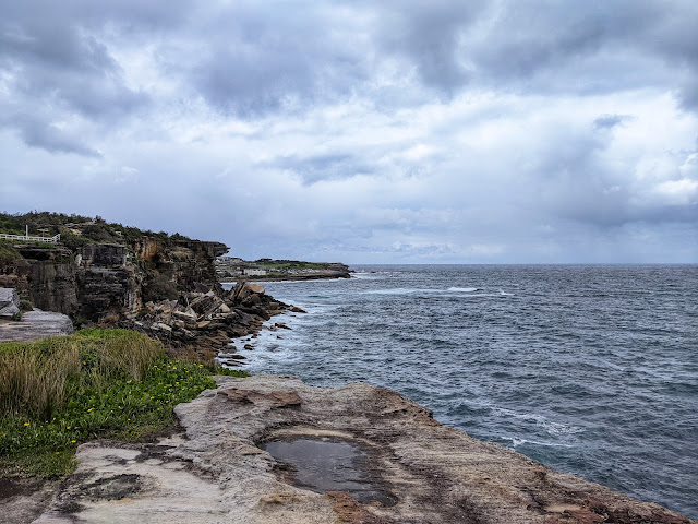
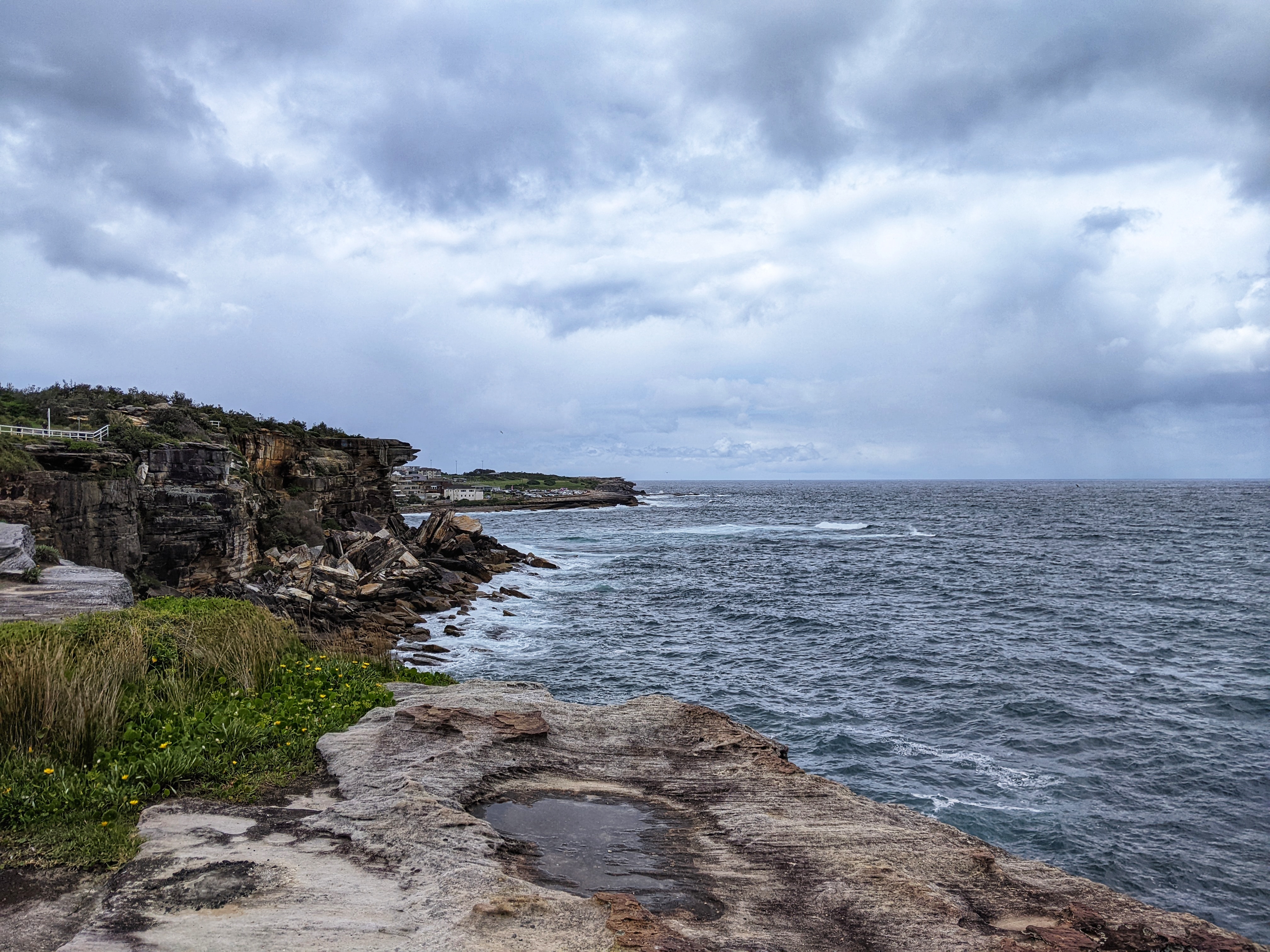
| Shark Point |
In the early 1870s, Shark Point was the site of a coastal defence facility that was excavated from the sandstone to include barracks, a powder magazine and a 9.2 inch "disappearing" gun. The subterranean barracks and gun emplacement were gradually demolished in the 1960s. This emplacement formed part of three gun emplacements originally designed to protect Sydney Harbour from a supposed Russian seaboard assault. Nothing remains today.
After leaving Shark Point and Burrows Park, the trail briefly leaves the coastline to pass the local lawn bowling club, which is a popular pastime in Australia. It emerges at the dramatic Waverley Cemetery which is contained in a large amphitheatre overlooking the sea cliffs. Here, the boardwalk hangs off the side of the cliff below the cemetery as it makes its way round to Bronte Beach.
 |
| Clovelly Bowls Club - bowls is surprisingly popular in Australia |
 |
| The Pacific Ocean at Waverley |
 |
| Waverley Cemetery |
 |
| The boardwalk at Waverley Cemetery |
 |
| Bronte Bay |
 |
| Overlooking Bronte Beach |
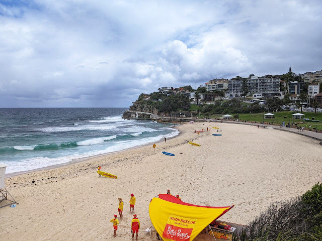
While Clovelly is home to one of the oldest surf lifesaving clubs, Bronte is home to the oldest, established in 1903. There is a particularly swift rip current on the south side of the beach - the Bronte Express. Adjacent to Bronte Beach is the smaller Tamarama Beach. Despite its size, Tamarama is considered the most dangerous patrolled beach in New South Wales, because of its deep water and omnipresent rip currents.
 |
| Bronte Beach |
 |
| Bronte Beach |
 |
| Bronte Beach |
 |
| Tamarama |
 |
| Tamarama Beach |
 |
| Shower clouds building |
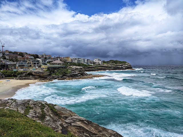
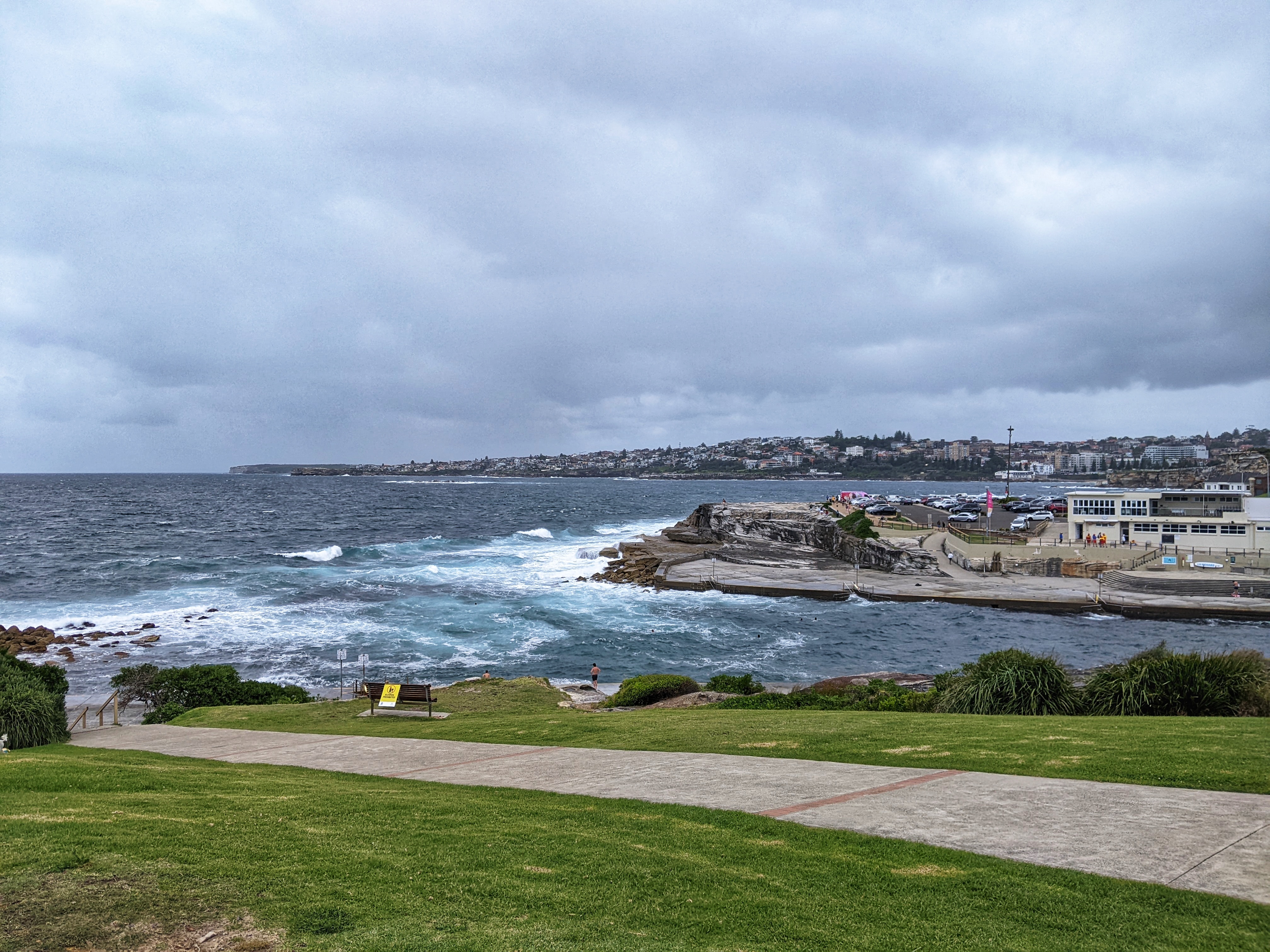
The northern headland is MacKenzies Point which juts out into the sea. Rounding the corner gives you your first view of the famous Bondi Beach thanks to a purpose-built lookout.
 |
| The paved path leading towards the lookout |
 |
| Bondi Bay |
 |
| Bondi Beach |
It's not clear exactly why Bondi has its world-famous reputation but it attracts visitors in their droves so it can get extremely busy. It's popular with surfers and many were out enjoying the waves today. From Mackenzies Point it's a 500m walk to the actual beach, passing the much-photographed Bondi Icebergs outdoor pool which marks the official end of the Coogee-Bondi walk. From here, you can make your way into Bondi itself where there are numerous cafes, pubs and bars vying for your attention. There's also that famous beach, of course.
 |
| Rounding the last headland into Bondi |
 |
| Bondi Beach |
 |
| Bondi Icebergs pool |
 |
| Bondi Beach as another heavy shower rolls in |


No comments :
Post a Comment