Bondi to Coogee 16-08-2020
This map was created using GPS Visualizer's do-it-yourself geographic utilities.
Please wait while the map data loads...
Route: North Bondi, Bondi Beach, Notts Avenue, Bondi Icebergs, MacKenzie Bay, MacKenzie Point, Marks Park, Tamarama Beach, Bronte Beach, Waverley Cemetary, Shark Point, Clovelly Beach, Cliffbrook Parade, Gordons Bay, Dolphins Point, Coogee Beach
Date: 16/08/2020
From: North Bondi
Parking: N/A
Start Point: Bondi Beach
Finish Point: Coogee Beach
Region: Sydney
Route length: 3.9 miles (6.2km)
Time taken: 02:45
Average speed: 1.8mph
Ascent: 190m
Descent: 177m
Points of Interest: Bondi Beach, Waverley Cemetery, Shark Point, Coogee Beach
At only 6km, the Bondi to Coogee walk amounts to little more than a morning or afternoon outing. It is, however, one of Sydney's most popular coastal walks and is often recommended as a 'must-do'. The 6km path has plenty of ocean views, towering sandstone cliffs and crashing waves as far as you can see as well as several of Sydney's golden sand beaches, including Australia’s famous Bondi Beach. We've been in Sydney for a little over a year now and this is the second time we've done this walk, this time in the opposite direction.
Bondi (from the Aboriginal 'Boondi' meaning 'the sound of waves crashing' or - surf) was made a public beach in 1882, and, by the 1920s, was attracting huge crowds during the summers days. It's not clear exactly why Bondi has its world-famous reputation but it attracts some 3 million visitors each. It's popular with surfers and many were out enjoying the waves today, despite the frigid water temperatures (it's the middle of winter here in Sydney). We parked on the streets of North Bondi and set off from the very north end of the beach, along the concrete promenade.
 |
Bondi Beach on a fine winter afternoon
|
 |
Looking over the bay to MacKenzies Point
|
 |
Bondi Beach
|
The promenade runs the length of the beach, from the North Bondi Lifesaving Club to the south end of Bondi Beach, passing the large pavilion building and the famed lifeguard tower.
At the south end of the beach is Notts Avenue where a set of steps climb away from the sands and up to the Bond Icebergs on Notts Avenue, passing a small memorial to Black Sunday.
On 6th February 1938, a series of freak waves washed hundreds of people off the beach into the sea. The sea off Bondi can be particularly dangerous, with powerful rip currents waiting for unsuspecting swimmers. Stunned lifesavers urgently sprung into action, sprinting to the water’s edge with seven surf rescue reels but many found themselves swamped by swimmers. Panic spread quickly as the severity of the situation became apparent.
 |
Volunteers re-enact carrying a rescue reel
|
The rescuers worked tirelessly to haul people from the sea and the colossal effort paid off. Of the 250 people swept into the sea, 60 required CPR and only five people lost their lives.
 |
Rescues assist people on the beach
|
At the inquest, Club Captain Jeppeson said the lifesavers merely fulfilled their duties, just as the police and ambulance men had done. However, the coroner, Mr Oram, highlighted one notable point of difference. While ambulance and police officers are paid to carry out their duties, the lifesavers were unpaid volunteers, which lent additional distinction to the exceptional work they had performed.
Returning to the walk, we passed the Bondi Icebergs swimming pool which origin dates back to 1929 and owes its origins to local lifesavers who wished to maintain their fitness during the winter months. They formed the Bondi Icebergs Winter Swimming Club and drew up a constitution and elected office bearers. Included in the constitution was a rule that to maintain membership it was mandatory that swimmers compete on three Sundays out of four for a period of five years.
 |
| The Black Sunday memorial |
 |
Bondi from the Black Sunday memorial
|
 |
Bondi Icebergs pool - a favourite with Instagrammers
|
 |
| The boardwalk at Mackenzies Bay |
From Notts Avenue the path leads to a walking track around the small Mackenzies Bay, passing beneath a series of sandstone overhangs before climbing to the headland at Mackenzies Point. The purpose-built lookout has a tremendous view of Bondi Bay.
 |
Mackenzies Bay
|
 |
Mackenzies Bay and Bondi
|
 |
Looking across the bay to Ben Buckler, North Bondi
|
From Mackenzies Point, the Bondi to Coogee walk continues to the distinct building of the Tamarama surf club headquarters which stands next to the semi-circular shape Tamarama Beach. The beach is enclosed by cliffs, and backed by Tamarama park. The route follows the promenade at the back of the beach, climbing along Tamarama Marine Drive towards Bronte Beach. Tamarama Beach and Bronte Beach are only a few hundred meters apart, the walk is level and offers great views of the Pacific Ocean.
 |
The path heads down from Mackenzies Point towards Tamarama
|
 |
| Tamarama |
 |
Tamarama
|
 |
Tamarama Beach
|
 |
| Tamarama Beach |
 |
A surfer out enjoying the waves
|
 |
Bronte Beach
|
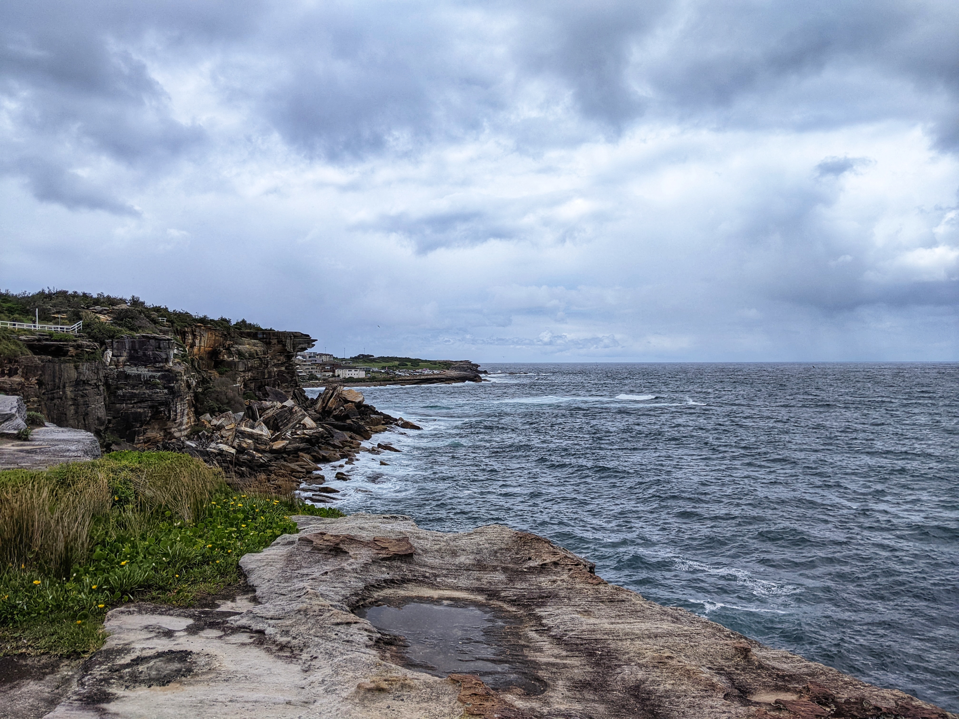
After climbing along the road at the south end of Bronte Beach, the path emerges at the dramatic Waverley Cemetery which is contained in a large amphitheatre overlooking the sea cliffs. The boardwalk hangs off the side of the cliff below the cemetery as it makes its way around towards Clovelly Beach. It is regularly cited as being one of the most beautiful cemeteries in the world and contains the graves of many significant Australians.
 |
| Approaching Waverley Cemetery |
 |
| Waverley Cemetery |
 |
| Waverley Cemetery |
After passing the cemetery, the track reaches Burrows Park and Shark Point, overlooking the expansive Coogee Bay. In the early 1870s, Shark Point was the site of a coastal defence facility which was excavated from the sandstone to include barracks, a powder magazine and eventually in 1893, a 9.2-inch gun. This emplacement formed part of three gun emplacements originally designed to protect Sydney Harbour from a supposed Russian seaboard assault. The subterranean barracks and gun emplacement were gradually demolished in the 1960s. |
Shark Point
|
 |
| Burrows Park and Clovelly |
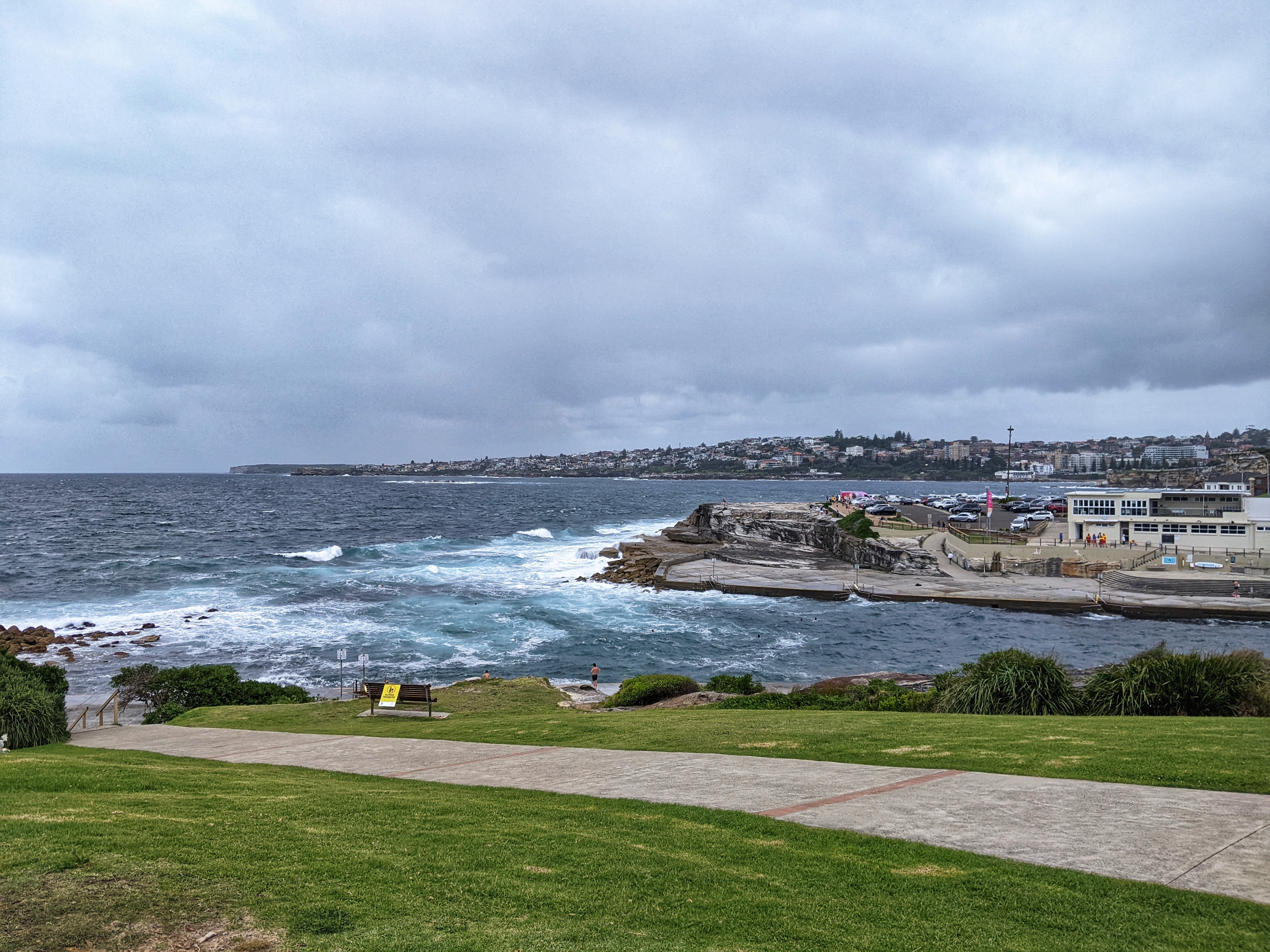
The Bondi to Coogee walk leads to Clovelly Beach, a tranquil beach at the mouth of a narrow bay between two rocky ridges.
 |
| Clovelly Beach |
 |
Clovelly Bay and Shark Point
|
After Clovelly, we made our way into the neighbouring Gordons Bay, named after Lewis Gordon, a government surveyor who was granted crown land in this area in the 19th century. The bay is protected by an offshore reef which is a popular dive spot and has a unique underwater trail consisting of small concrete drums linked by a chain. Racks of boats from the local fishing club cover most of it, which makes Gordons Bay feel like a quiet fisherman’s village in remote Greece.
 |
Thompsons Bay
|
 |
Looking across the bays to Dolphins Point
|
 |
The beautiful Gordons Bay
|
 |
| Gordons Bay |
After Gordons Bay, we crossed the large, grassy Dunningham Reserve at the north end of Coogee Beach before following a short series of steps down to the promenade.
The name Coogee is said to be taken from a local Aboriginal word 'koojah' which means "smelly place", likely a reference to the smell of drying seaweed that gets washed up on the beach rather than anything more sinister. Safe to say, not very smelly today. It's here where we finished our walk, catching a taxi back to Bondi before heading back home. As an introduction to Sydney's beaches, this is a superb walk and easy to complete.
 |
Crossing Dunningham Reserve as we head towards Coogee Beach
|
 |
The entrance to Gordons Bay
|
 |
| Looking over Thompsons Bay and Coogee Beach |
 |
Coogee Beach
|
 |
Coogee Beach and Dolphins Point
|