Furber Steps, Federal Pass & The Three Sisters 12-12-2020
This map was created using GPS Visualizer's do-it-yourself geographic utilities.
Please wait while the map data loads...
Route: Scenic World, Vanimans Lookout, Underfalls Walk, Juliets Balcony, Furber Steps, Federal Pass, Katoomba Falls View, Dardanelles Pass, Leura Forest, Federal Pass, Linda Falls, Fern Bower, Bridal Veil Falls, Prince Henry Cliff Walk, Honeymoon Point, Lady Carrington Lookout, Spooners Lookout, Echo Point, Skyway East Station, Katoomba Cascades, Reids Plateau, Orphan Rock Lookout, Scenic World
Date: 12/12/2020
From: Scenic World
Parking: Scenic World
Start Point: Scenic World
Finish Point: Scenic World
Region: Blue Mountains
Route length: 12.4km
Time taken: 04:59
Average speed: 3.8kph
Ascent: 609m
Descent: 590m
Points of Interest: Katoomba Falls, Furber Steps, Federal Pass, Leura Forest, Bridal Veil Falls, Echo Point
Having been exploring some new places of late I thought it time to revisit the Blue Mountains, home to some of the most stunning scenery in the Sydney area. Sadly, some areas are still closed after the 19/20 bushfires but not for much longer. For now, I'm content exploring the area around Katoomba and Leura as there are several tracks and passes I've yet to tackle.
Katoomba, in particular, is home to many of the area's iconic walks but also its busiest tourist spots. Katoomba sits atop a plateau above the Kedumba and Jamison valleys meaning many of the walks from the town are either along the cliff tops or involve a steep descent into the valley via elaborately constructed stairways - something I was going to experience today.
 |
| The sandstone steps of National Pass - one of several stone stairways in the Blue Mountains |
There are several sets of stairs linking the cliffs to various walking tracks and passes, from the Golden Stairs in the west to the Grand Staircase in the east at Wentworth Falls. Until now, Furber Steps is one I have yet to try.
I drove to Katoomba and parked (for free) at Scenic World, a curious outdoors theme park that is home to a cable car (the Scenic Skyway) and the world's steepest passenger railway - the 52-degree Scenic Railway (train enthusiasts may get excitable determining whether it is, in fact, a true railway or not). A path is tucked away behind the main Scenic World building, which leads off into the Blue Mountains playground.
Almost immediately the path stops at Vaniman's Lookout which has a prime view of Katoomba Falls, the westernmost of the tall waterfalls which fall from the plateau to the valley below. The path descends further with Juliet's Balcony having an equally good view of the falls.
 |
| A grey, overcast view of Katoomba Falls and the Three Sisters |
 |
| Katoomba Falls from Vanimans Lookout |
 |
| Descending to Juliet's Balcony |
 |
| Katoomba Falls from Juliet's Balcony lookout |
A switchback in the path leads further downhill to the Underfalls Walk track, a short out-and-back hike to the base of the first of Katoomba Falls' twin cascades. The 200m diversion is worth the modest amount of effort and time as it takes you perilously close to the lip of the waterfall.
 |
| The Underfalls Track crosses Witches Leap |
 |
| The upper cascade of Katoomba Falls |
 |
| The lip of the second waterfall - Mount Solitary dominates the background |
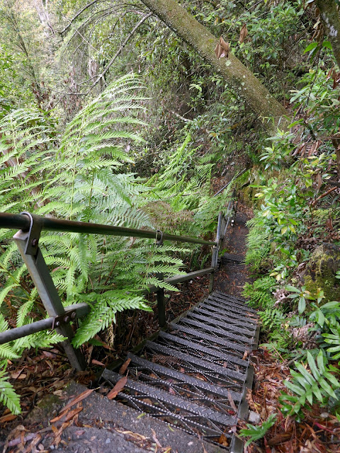
The Furber Steps begin from the junction with the Underfalls Walk. They begin with a steady descent to Lynes Point, which has the best view of Katoomba Falls, before descending very steeply into the valley below, hugging the cliffs and passing beneath vast overhangs of sandstone. They are sensational but quite short-lived.
 |
| The top of Vera Falls |
 |
| The Three Sisters and Mount Solitary from Queen Victoria Lookout |
 |
| Katoomba Falls - the Underfalls Track takes you to the top of the second fall |
 |
| Descending the Furber Steps |
 |
| Furber Steps (more of a path here) |
 |
| Furber Steps |
 |
| Another steeper section of Furber Steps |
 |
| Furber Steps |
 |
| The bottom of Furber Steps |
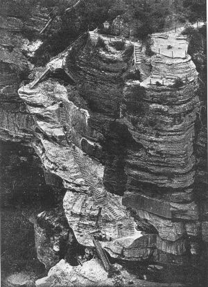
Furber Steps were constructed in 1908, to replace the bush pole steps of the original Federal Pass. The name 'bush poles' sounds precarious on its own, let alone down the side of a sandstone cliff. Thomas Furber, a Lands Department surveyor with an interest in conservation, was mainly responsible for obtaining a government grant of £140 for the work. The photo below was taken at the completion of the project. While the vegetation has grown back, the amazing feat of construction can be clearly seen.
 |
| 1908 photo of Furber Steps - I believe the lookout at the top of the photo is Juliet's Balcony |
Now, the Furber Steps join Federal Pass partway between the Scenic Station and Katoomba Falls View. If a climb out of the valley fills you with dread, I'd highly recommend using Furber Steps to descend and Scenic Railway to travel back up again (fees apply).
 |
| The Federal Pass junction at the base of Furber Steps |
The Federal Pass is one of the longer tracks in the Blue Mountains, joining the town of Leura in the east to Ruined Castle in the west via the base of the cliffs. It was originally built by the Katoomba community, from Leura Forest to Katoomba Falls, before being extended along an old horse-drawn coal tramway line. From the bottom of Furber Steps, I'd be hiking the original section, between Katoomba Falls and Leura Forest.
 |
| Federal Pass at Kedumba River |
 |
| Federal Pass |
Federal Pass is a very pleasant route, generally flat and out of the heat of the sun. It crosses the Kedumba River then extends through the bush to the tip of the Three Sisters ridge where it meets Dardanelles Pass, a path built to link the Giant Stairway to the Federal Pass. Federal Pass actually dips down into the rainforest from here while Dardanelles Pass cuts a level course, both meeting nearly 2km later. I chose the latter, which saves quite a bit of descent and reascent later.
 |
| Federal Pass high above Kedumba River |
 |
| On to Dardanelles Pass |
 |
| Dardanelles Pass at the foot of the Giant Stairway |
 |
| A marker stone on Dardanelles Pass |
 |
| A short section of Dardanelles Pass follows a metal walkway |
 |
| A landslide close to Leura Forest |
 |
| Landslides are common in the Blue Mountains, especially after bushfires when the soil becomes weakened |
The two tracks meet at Leura Rainforest, home to the Southern Sassafras and the Black Olive Berry, both relics from the age of Gondwana - the 550 million-year-old supercontinent and predecessor to Pangea. The area is remarkably open with a few picnic benches dotted around in addition to a wooden rotunda. It was home to a popular tea house from the late 1800s though only the foundations remain today.
 |
| Leura Forest picnic area |
From the clearing, Federal Pass crosses the Banksia Streamlet and begins to climb alongside Linda Creek heading towards the maze of tracks around Leura Cascades. The wooden steps give way to some narrow metal steps which snake their way up through the bush alongside the creek. This section of Federal Pass was originally constructed in 1894 and some of the original fabric remains, including earth benching and stone steps. Otherwise, the rest has been upgraded.
 |
| Banksia Stramlet in Leura Forest |
 |
| Linda Creek |
 |
| Signage at the Fern Bower Track - the continuation of Federal Pass |
 |
| Marguerite Cascades |
 |
| Federal Pass climbs through the bush |
 |
| Looking back down the snaking steps |
 |
| High alongside Linda Creek |
A final long narrow set of steps takes Federal Pass to the junction with the Amphitheatre Track (this will take you to the base of Bridal Veil Falls). The path climbs further along Linda Creek before it reaches Jamison Lookout overlooking the valley. A short distance further is the Prince Henry Cliff Walk and Solitary Restaurant.
 |
| Federal Pass |
 |
| Climbing out of the valley |
 |
| Looking back along Linda Creek from Jamison Lookout |
While in the vicinity, I took the opportunity to visit Bridal Veil Lookout, one of the viewpoints for Bridal Veil Falls. After a mostly cloudy morning in the bush, the sun had started to appear, illuminating the waterfall and surrounding valley. If you come at the right time, rainbows often form in the spray from the falls.
 |
| Bridal Veil Falls |
 |
| A wider view of the falls |
 |
| Bridal Veil Falls |
 |
| A close-up of the tumbling waters |
I returned to the Prince Henry Cliff Walk which is one of the highlights of the Katoomba area. The path links the clifftops lookouts between Scenic World and Gordon Falls. It's normally very busy but, given international travel into Australia is currently banned, it has never been quieter. The track passes Honeymoon Point and Tallawalla Lookout before it just out into the valley at the top of the Giant Stairway behind the famed Three Sisters.
 |
| A lush hanging swamp |
 |
| Prince Henry Clifftop |
 |
| Honeymoon Point |
 |
| Sublime Point and the Tablelands |
 |
| East Mount Solitary and the Jamison valley |
 |
| Prince Henry Clifftop |
 |
| The platform and arch at the top of the Giant Stairway |
 |
| Meehni - the tallest of the Three Sisters |
The track continues a short distance to Echo Point and the Queen Elizabeth Lookout - arguably the most popular of all the lookouts in the Blue Mountains.
 |
| Narrowneck - the pale line you can see in the distance is another landslide |
 |
| Looking along the Jamison Valley |
 |
| Echo Point |
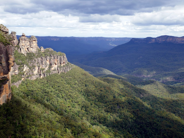
Echo Point is usually a busy place. Under normal circumstances, most (if not all) the tours from Sydney coincide at this location and disgorge hundreds of daily passengers though it was much quieter today. Obviously, Covid has had its effect, however, in the year we've been in Australia the lookout has been expanded and upgraded to create more room for visitors. The view of the Three Sisters from the lookout is the defining image of the Blue Mountains - one you'll no doubt find with a quick Google search.  |
| The Three Sisters - Meehni, Wimlah and Gunnedoo |
 |
| The sublime panorama from Echo Point |
 |
| The Three Sisters and Mount Solitary |
Heading west away from Echo Point, the Prince Henry Cliff Walk descends several flights of steps until it reaches the impressive Lady Darley's Lookout. A set of narrow metal steps descend an outcrop of rock with an imposing view of the valley. A handful of other lookouts are passed before reaching the Scenic Skyway East Station where the Scenic World cable car terminates.
 |
| Mount Solitary and Ruined Castle |
 |
| Descending the Prince Henry Clifftop |
 |
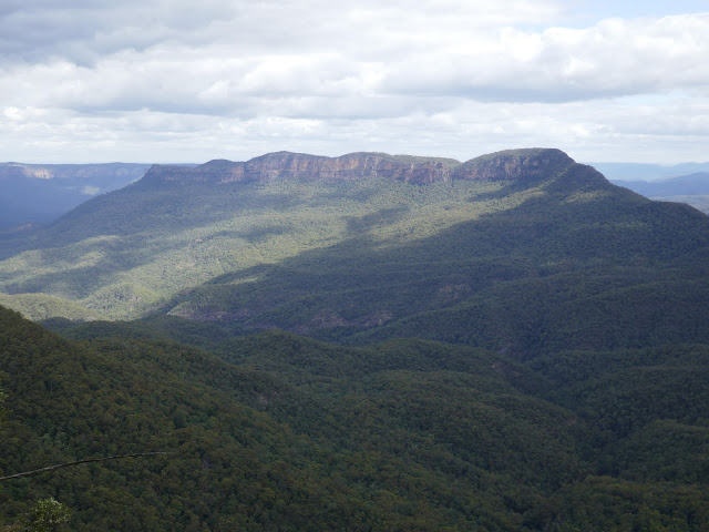
| Mount Solitary |
 |
| The Three Sisters |
 |
| The Three Sisters |
The Cliff Walk does a loop under the Katoomba Cascades, a picturesque set of waterfalls on the Kedumba River which sit just below a road and park. The river can be crossed by a set of stepping stones or a small footbridge (presumably for times when the flow is high). A last recommended port of call is Reids Plateau, a short circuit of a sandstone outcrop with several viewpoints of the valley, including Orphan Rock. From here, it's a short hike back to the car park at Scenic World.
 |
| Approaching the cable car station |
 |
| The cliffs at Scenic World |
 |
| Katoomba Cascades |
 |
| Kedumba River |
 |
| Katoomba Falls |
 |
| Orphan Rock |


No comments :
Post a Comment