Showing posts with label marilyn. Show all posts

Monday, 6 March 2017

Watch Hill & Setmurthy Common

Watch Hill 05-03-2017

This map was created using GPS Visualizer's do-it-yourself geographic utilities.

Please wait while the map data loads...


Route: Kirkhouse, Hill's Wood, Watch Hill, Setmurthy Common, Setmurthy Plantation, Kirkhouse

Date: 05/03/2017
From: Isel


Parking: Isel Road
Start Point: Isel Road
Region: North Western Fells

Route length:  2.9 miles (4.6 km)
Time taken : 01:02
Average speed: 2.8 mph
Ascent: 238m
Descent: 243m

Outlying Fells on this walk: Watch Hill (235m), Setmurthy Common (254m)

Additional summits: None

Other Points of Interest: None

Watch Hill and Clints Crags are two of the most northerly fells in the Lake District and a return to the Wainwright Outlying Fells (having climbed Orrest Head a couple of years ago. I had thought I'd make a start on the eastern fells around Shap or Bannisdale but, having completed a morning walk from Whinlatter quicker than planned, I had a free afternoon for some old-school peak bagging.

This comprises two very short walks to create one short report - in total, these two fells comprise of just three miles of walking and a couple of miles driving - you probably do both on foot if you out for the whole day.

Leaving Whinlatter, my first task was to drive to Cockermouth and beyond, into the quiet areas to the north of the main National Park. Watch Hill would be my first objective.

Watch Hill is a small hill lying on the fringe of the Lake District. The name Setmurthy Common is sometimes used (including by Alfred Wainwright in his book The Outlying Fells of Lakeland) to refer to the area including the highest point, with "Watch Hill" describing the area to the west of the summit.

To create a short circuit (I do love a good circuit), I parked at the end of a bridleway close to Kirkhouse on the northern side of the hill. The bridleway gradually climbs the slopes, heading directly for the Watch Hill summit. It's an easy stroll - this time in some very pleasant weather.
The long bridleway towards Watch Hill
Clints Crags
The bridleway at Hill's Wood
Hill's Wood
Hill's Wood
Reaching Watch Hill, the views over Cockermouth are revealed, and rather good they are too. Despite its low height, Watch Hill is a Marilyn because of the large height separation from its neighbours. This 'detachedness' means that it is an excellent viewpoint. Skiddaw, Blencathra, the Lord's Seat group and Grisedale Pike are all seen.
Clints Crags
The Derwent valley
Looking west towards the Solway Firth
The Solway Firth and the hills of Scotland
Approaching the top of Watch Hill
Cockermouth
The top of Watch Hill
Looking towards the Vale of Lorton
The Vale of Lorton and the high Buttermere fells
A green, undulating ridge heads east to the top of Setmurthy Common, another of Wainwright's diminutive Outlying Fells. The top (along with modest cairn) sits at the junction of a couple of walls, prior to entering Setmurthy Woods.
Setmurthy Common
Ling Fell backed by the Coledale fells
Setmurthy Common
Setmurthy Common
Forestry Commission tracks cut through the woodland, wending their way back towards the valley to the north. I eventually emerged on the edge of the woodland where a fence leads along a field edge directly back to the bridleway and the car. The next stop would be Clints Crags.
Setmurthy Plantation
Heading back to the car

Friday, 21 June 2013

Whin Rigg & Illgill Head

Open Space Web-Map builder Code

Route: Wasdale NT Campsite, Wasdale Head Hall Farm, The Screes Footpath, Greathall Gill, Whin Rigg, Illgill Head, Maiden Castle, Fence Wood

Date: 16/06/2013
From: Wasdale NT Campsite

Parking: Wasdale NT Campsite
Start Point: Wasdale NT Campsite
Region: Southern Fells

Route length: 9.3 miles (15km)
Time taken: 4:30
Average speed: 2.1mph
Ascent: 778m
Descent: 805m

Wainwrights on this walk:
Whin Rigg (535m), Illgill Head (609m)

Additional summits: None

Other points of interest: Screes Footpath, Wastwater Screes

On my final weekend in the Lake District for some weeks, we decided on a circular walk that involved crossing the famous Wastwater Screes (a Site of Special Scientific Interest) as well as taking in another two Wainwrights, Whin Rigg and Illgill Head; the two peaks that create the 2000 ft tumbling curtain of rock on Wastwater's eastern shores. Having seen The Screes (as labelled on the OS maps) a number of times before in passing, I hadn't realised there was a path that crossed them. It certainly didn't look possible looking at them from the opposite shore. Only one way to find out for sure....
The Wastwater Screes reflecting beautifully on a summer evening. Surely there is no way across?
Leaving the campsite at Wasdale Head, we made the short trip past Wasdale Head Hall Farm to join the start of the Screes Footpath. 'Rocky, uneven and slippery' was the warning on the sign on the gate. Perfect. The weather was almost playing fair again, after a miserable night, and blue skies were interspersed with drifting white clouds. Passing through the gate, we followed the path as it crosses the steep slopes of Illgill Head.
The Screes footpath as it crosses the lower slopes of Illgill Head
Knott Ends and Yewbarrow on the opposite side of the lake
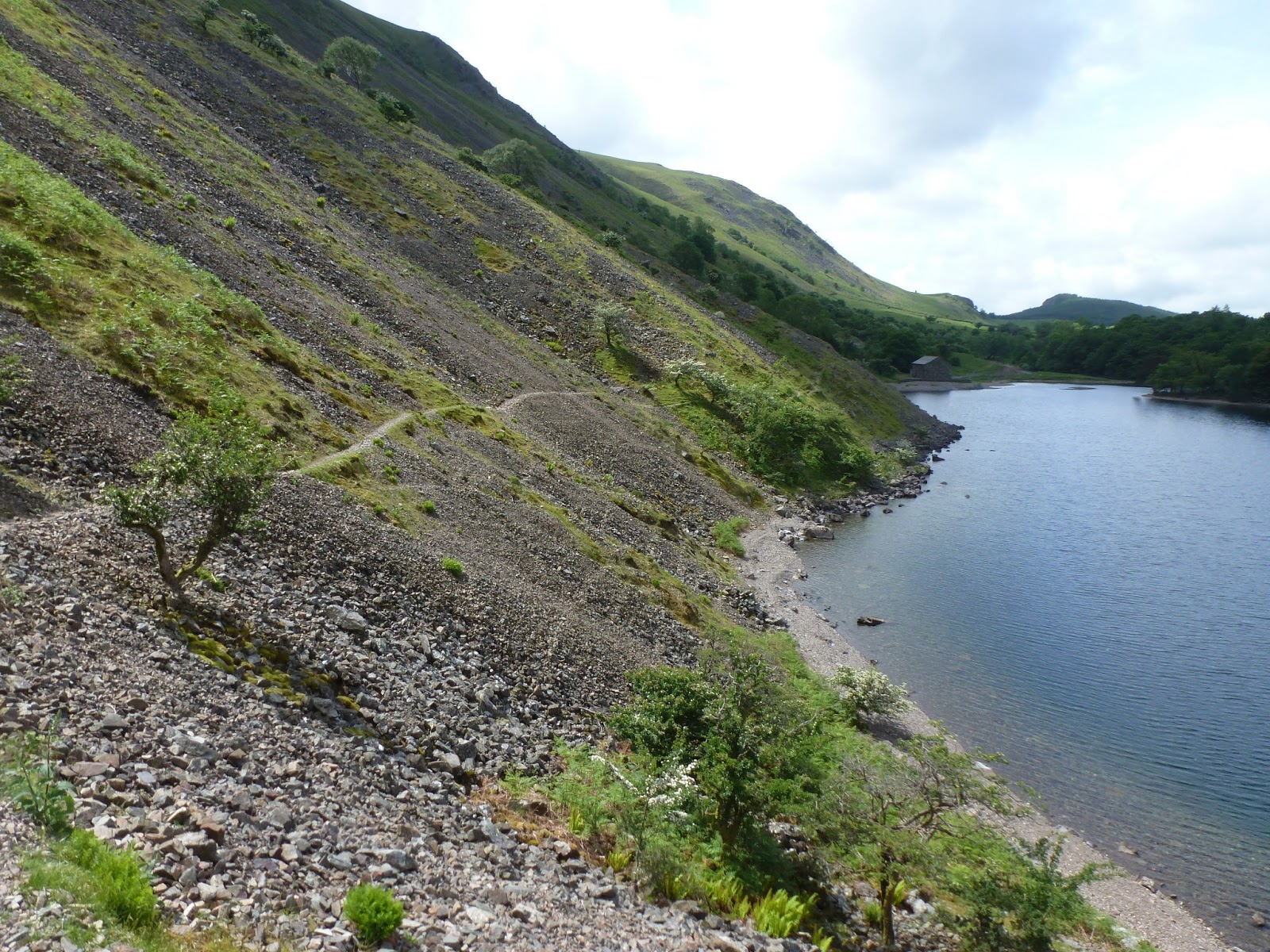
After an undulating section of narrow path, reminiscent of a low-level climbers traverse, the path crosses the first area of fallen stone. For the most part, the route is fairly distinct and the fact that the path is guarded on either side by the steep scree and a short tumble in the water prevents any travelling 'off piste'.
The path is easy to follow across the first section of The Screes
Low cloud mingles with the crags of Bell Rib and Vicker's How
A view straight up the steep sheet of rock
After crossing the area of smaller scree and gaining bit of altitude, the path regains its grassy nature and continues along to the real star of the day; the boulder field. From here it's a navigational free-for-all as the path disappears and is replaced by the jumbled pile of stones. I really enjoyed this part of the walk, hopping across the boulders while working up a decent sweat in the process. Before long, the path reappears and the boulders begin to subside as you reach the very end of Wastwater.
Ian leads the way across the boulders
The path eventually reappears and leads you to.....
..... the Southern end of Wastwater
Now, all that stood in the way of the first peak of the day was a 400m climb straight up alongside Greathall Gill to Whin Rigg. After climbing Scafell the day before, this steep half-hour climb really took it out of the legs and it was a welcome relief as the path becomes less steep and guides you to the summit.
Wastwater from the steep path up to Whin Rigg
The path becomes less steep as you reach the summit
Whin Rigg means 'gorse covered ridge' from the Norse "Hvin" (gorse) and "Hryggr" (ridge). At 535m, Whin Rigg is fairly modest in height but it has some very good views into Wastwater thanks to two vast gullies; Great Gully and C Gully, that cut into its slopes. The views down Great Gully are staggering but, unfortunately, it's a location reserved for climbers as it contains 17 vertical pitches as well as the remains of an aeroplane. Apparently.

The summit of Whin Rigg
Great Gully - no planes to be seen
The view down C Gully with Wastwater, Buckbarrow and Middle Fell in the background
From Whin Rigg, a 1 mile stretch of high ground links it to its parent peak, Illgill Head. Keeping to the left of the ridge offers further views down the vast slopes and crags that feed the scree below.
The Screes
A steady climb leads you to the summit of Illgill Head, the final Wainwright of the weekend (after Scafell and Whin Rigg). Illgill Head stands at 609m, just missing out on the 2000ft mark. 1998ft will have to do for this one.
A large summit shelter sits on top of Illgill Head
The view from Illgill Head into Wasdale Head with Yewbarrow, Kirk Fell, Great Gable and Lingmell
After a brief stop on the summit, it was time to drop back down to the campsite where the cars were parked. The path to the northeast takes you back down the grassy slopes to Maiden Castle and the old corpse road between Wasdale Head and Boot. From here, it's a case of following the numerous cairns past Straighthead Gill and a set of abandoned buildings down towards the campsite.
A dilapidated building looks across to Lingmell
While descending the path, the sun finally made an overdue appearance. Too little too late I'm afraid but it did brighten up the final few hundred metres of walking.
The path down to the campsite is lit by the afternoon sunshine
This is a very pleasant walk with a few surprises for the unexpected. Despite their relative lack of height, the views down the gullies of Whin Rigg and Illgill Head would easily rival those found on many of the higher, more famous peaks. I'd highly recommend a trip to these two rather overlooked fells next time you are in Wasdale especially to traverse the famous Wastwater screes and peer down the near endless crags of Great Gully and C Gully.

Leaving Wasdale behind, I crossed the infamous Hardknott Pass, one of (if not the) steepest road in England. It's an epic ribbon of tarmac draped on the sides of Eskdale and the Duddon Valley. A stern test for the car but a great end to a great weekend.
The Hardknott Pass. Probably my favourite road in the country

Sunday, 9 June 2013

Scafell Pike & Lingmell

Scafell Pike & Lingmell 08-06-2013

This map was created using GPS Visualizer's do-it-yourself geographic utilities.

Please wait while the map data loads...


Route: Wasdale NT Campsite, Wasdale Head, Bursting Knott, Sty Head, Spout Head, Corridor Route, Dropping Crag, Scafell Pike, Lingmell Col, Lingmell, Lingmell Gill, Brackenclose

Date: 08/06/2013
From: Wasdale NT Campsite


Parking: Wasdale NT Campsite
Start Point: Wasdale NT Campsite
Region: Southern Fells

Route length: 8.2 miles (13.2km)
Time taken: 4:29
Average speed: 1.8mph
Ascent: 1091m
Descent: 1106m

Wainwrights on this walk:
Scafell Pike (978m), Lingmell (807m)

Additional summits: None

Other points of interest: Sty Head, Corridor Route, Lingmell Crag

This was it, after a number of years walking it was time to take on the highest point in England, Scafell Pike. I walked this with a group of friends for the WaterAid200 Challenge, an annual mountain climbing event that raises money for water projects in Nepal. It's a great charity and gives me the excuse to climb a mountain in the name of a good cause. We were blessed with splendid hill walking weather, albeit it being a bit hazy. The forecast for the day was to stay clear and warm all day. Ideal.

Staying at the National Trust campsite at Wasdale meant we arrived the evening before to the glorious view of Yewbarrow, Great Gable and Lingmell just after the sun had set. Even though not part of the walk, I thought I'd add the picture anyway.
The legendary view down Wastwater that forms the image on the National Park's logo
The walk began with a stroll along to Wasdale Head and then beyond to Wasdale Fell and Moses' Trod, a path that leads into the valley of Lingmell Beck. Lingmell Beck is the result of a number of hillside streams joining at the head of the valley and feeds into Wast Water before flowing out the other side as a full-blown river, the River Irt. We'd be crossing many of the upland streams on the route that I'd chosen that takes you along the Corridor Route underneath Great End and Broad Crag. More about that later.
A warm, hazy Great Gable greets us at Wasdale Head
Moses' Trod leads you into the valley
As we entered the valley, the sheltering effect of the high valley sides led to a noticeable increase in temperature and exertion as we climbed up towards Bursting Knott. The path here is easy to follow and climbs steadily up the very lower flanks of Great Gable, underneath The Napes. There is an additional path along the valley floor that we avoided as it would mean a steeper climb at the end. Slow and steady wins the race, or so they say. Climbing past Bursting Knott, Scafell Pike appears for the first time, across the valley. It still looks an awfully long way up.
Sara leads the way up Bursting Knott, Wasdale Head and Yewbarrow can be seen in the distance
Scafell Pike can be seen poking its head up across the valley
Passing Bursting Knott, we continued the climb up past Toad How to Sty Head. The tarn here certainly looked appealing for a quick dip but we had to the small matter of the Corridor Route and Scafell Pike to tend to. Sty Head is a mountain pass that is a real crossroads of the Lakes. Paths from Wasdale, Eskdale, Borrowdale and Great Langdale all meet at Sty Head and there is a real variety of routes you can take from it. It is also a relative safety point between Great Gable and Scafell Pike, hence it being home to a Wasdale Mountain Rescue stretcher box. It's here we made a right turn to head towards Spout Head and the start of the Corridor Route.
The tarn at Sty Head
The point at Sty Head where the path splits right at the cairn to join the Corridor Route
The Corridor Route, similar in some ways to the Climbers Traverse on Bowfell, is a path cut into the side of the northern slopes of the range. Wainwright describes it as 'the easiest of all routes to the Pike' as well as being 'interesting throughout'. He was certainly not wrong. The path takes you from Sty Head to the foot of Broad Crag, while climbing some 250m along its length. It also includes a couple of gill crossings while keeping you entertained with stunning views of Lingmell, Lingmell Crags, Piers Gill and Wasdale. It is also noticeably quieter than many of the so-called tourist's routes, as we'd find out a bit later.
The Corridor Route can be seen snaking up through the centre of the picture
The path crosses one of a number of streams including Greta Gill and Piers Gill
The scramble down into Greta Gill
Crossing Greta Gill
The view of Lingmell and Great Gable from the Corridor Route
The scenery explodes into view as you climb out underneath Broad Crag
I had been a bit concerned about the Corridor Route and its suitability for non-walkers and, in my opinion, it offers no real challenge to any able-bodied person or anyone with a fear of exposure and steep drops. There are some scrambly parts but I think they enhance the excitement of the route. If you are reading this considering the Corridor Route, I urge you to do it.

The final part of the ascent involves the first really steep bit of climbing up the scree between Broad Crag and Scafell Pike. It's here that we start to encounter the large number of walkers ascending and descending from the summit.
The path leads to the head of Greta Gill. We took the path to the left, up the scree.
Climbing out to meet the path from Broad Crag
It becomes obvious how popular Scafell Pike is
Turning right at the top of the scree leads you to another brief climb that takes you onto the plateau of the summit of Scafell Pike. The summit is actually owned by the National Trust after it was donated to them in 1919 by Lord Leaconfield as a memorial to the men of the Lakes District "who fell for God and King, for freedom, peace and right in the Great War". After a few hours of climbing from Wasdale, we'd reached the top of England and what a great feeling that is. We took our turn to be photographed on the summit platform before finding a quieter spot for lunch.
Sara and I atop Scafell Pike, sporting matching WaterAid branding
The busy summit of Scafell Pike
The views from Scafell are extensive but do suffer a bit due to its relative lack of prominence. A quick excursion to the southeastern edge of the plateau reveals a panorama including Eskdale, Bowfell, Crinkle Crags and the Southern Fells. A trip to the north reveals LingmellGreat Gable and the high Northern Fells of Skiddaw and Blencathra in the distance. It was surprising to find no one venturing over the extremities of the summit and I'd recommend heading in these directions to leave the crowds and improve the views.
Bowfell, Crinkle Crags and the Southern Fells from Scafell Pike
The impressive lump that is Scafell including Broad Stand, Mickledore and Lord's Rake
After refreshing ourselves with a variety of sandwiches and snacks, we continued our route towards Lingmell by dropping down onto the very busy path adjacent to Dropping Crag that leads directly up from Wasdale. We passed several groups asking how far the summit was, it seemed that despite its popularity, this route was more taxing on the legs than ours from Sty Head. The warmth of the afternoon was also starting to creep up.
The view across Lingmell Col to Lingmell and Great Gable
I'd been recommended a visit to Lingmell on our way down and so we did. Crossing Lingmell Col and then climbing 60 or so metres gets you to the summit of Lingmell and I assure you, the additional effort was definitely worth it. The views are spectacular. Uninterrupted views of Great Gable to the north, the entire Scafell massif to the southeast and the sheers crags of Piers Gill to the northeast. The summit was also devoid of any other hikers as many are attracted instead to Scafell and Scafell Pike. It's a shame we didn't wait half an hour or so and stop for lunch here.
Posing with the view from Lingmell across Sty Head, all the way down Borrowdale
Lingmell Crag and Piers Gill
The Scafells from Lingmell
From Lingmell, the return route to the campsite is very straightforward, if not a little taxing on the knees. The path that leads to the summit continues west down the grassy sloping banks of Lingmell to arguably one of the finest views of Wasdale.
Wasdale including Illgill Head, Whin Rigg, Yewbarrow, the Mosedale valley and Kirk Fell
'I've been there'. Sara points out the Mosedale horseshoe
Despite the relative lack of height, the steep slopes create a feeling of standing right on top of everything that you can see in the valley below and also gives a great view of the classic Mosedale horseshoe, a walk I completed in 2012 with Sara and my folks (and dog). After a few minutes spent soaking in the views and making some running repairs, we marched down the rest of the hill to reach Lingmell Beck and return to the campsite. We could still see a number of people beginning their ascent up the path next to Lingmell Beck late into the afternoon, a testimony to the popularity of Scafell Pike (if that was to be their destination).
A line of walkers on the path up Lingmell Beck
Being my first trip up Scafell Pike, I got a great sense of achievement reaching the very top of our small country. Modest by most mountain standards, the climb still requires a great deal of effort which is easily outweighed by the satisfaction of knowing that, for one brief moment, you are the highest person in England (I made sure I stood on what looked like the highest part of the platform on the summit). It was also heartening to hear that the group I was climbing with (most of whom don't do a great deal of walking) enjoyed their day out while raising several hundred pounds for WaterAid.