Showing posts with label dewey. Show all posts

Sunday, 2 July 2000

Great Cockup

Great Cockup

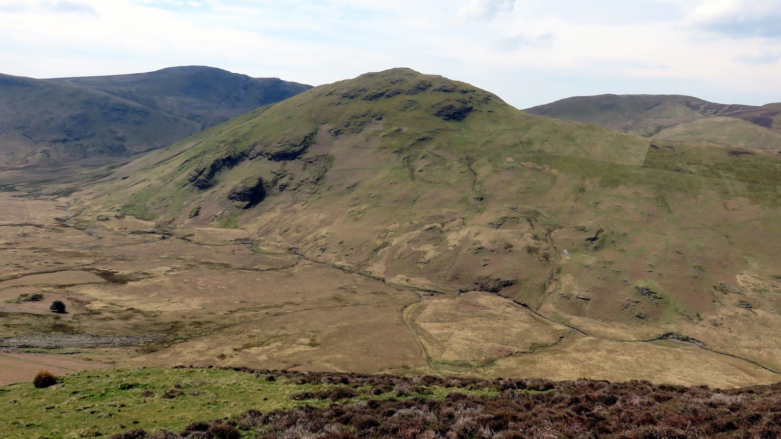
Great Cockup rising steadily beyond the sheep pass of Trusmadoor

Great Cockup

Height526m (1,726ft)
Prominence90m (295ft)
RegionNorthern Fells
Climbed1 Time

Great Cockup is an extensive, smooth-backed bulk that anchors the western edge of the Uldale Fells. Bearing an unforgettable name rooted in Old English, it translates historically to the "larger fell above the secluded valley frequented by woodcock or black grouse"—distinguishing it from its smaller sibling, Little Cockup, which rests on its northwestern shoulder. Lacking the jagged profiles of the central lakes, it offers an immense, rolling canvas of mountain grass that captures the true pastoral character of the Back o' Skiddaw.

"Viewed from a distance, Great Cockup appears as a modest but extensive eminence with no obvious summit and nothing calling for closer inspection. First impressions are confirmed by a tour of exploration, the fell underfoot providing no more interest than the fell at a distance." — Wainwright 1962, Book Five

Alfred Wainwright offered one of his famously dry, dismissive assessments of Great Cockup in his Pictorial Guides, claiming that a closer tour of exploration confirms there is absolutely nothing here calling for closer inspection. Yet for walkers who appreciate isolation, its massive, grassy ridges provide an incredibly tranquil mountain walk. For those with an eye out for ancient geology, the lower southern slopes host a massive, isolated boulder marked on large-scale ordnance maps—a prominent glacial erratic dropped here by a retreating ice sheet millennia ago.

The summit of Great Cockup

A small, humble pile of stones marks the highest turf on Great Cockup

The high point of the fell is a broad, unassuming plateau where the true summit marker is simply a humble, small pile of loose stones set out on the open grass. What the summit lacks in dramatic rock formations, however, it more than compensates for with its spectacular, contrasting views. Standing by the cairn rewards walkers with an exceptional, close-up perspective across the massive northern scree slopes of the Skiddaw range, beautifully counterbalanced by a wide-open, glorious northern outlook reaching out toward the Solway Firth and the distant Scottish Border hills.

Hay Stacks

Hay Stacks

Hay Stacks wearing its winter coat

Hay Stacks

Height597m (1,959ft)
Prominence78m (256ft)
RegionWestern Fells
Climbed3 Times

Hay Stacks stands as one of the most beloved and visually complex summits in the entire Lake District. Located at the southeastern head of the Buttermere Valley, it serves as the vital link between the massifs of the Western Fells and the high ground of the Great Gable group. Despite its modest height relative to its neighbours, it offers a dense, intricate landscape that feels like a micro-mountain range unto itself.

"Hay Stacks stands unabashed and unashamed in the midst of a circle of much loftier fells, but not one of them can show a greater variety and a more fascinating arrangement of interesting features. Here are sharp peaks, tarns with islands, crags, screes, rocks for climbing and rocks not for climbing, heather tracts, marshes, tarns with streams and tarns with no streams." — Wainwright 1962, Book Seven

The fell's name originates from the visual impression of its summit cliffs—though Alfred Wainwright famously argued that the name is a corruption of the Icelandic 'stack', meaning 'a columnar rock', implying the correct translation should be 'High Rocks'. Beyond the nomenclature, it is cemented in Lakeland lore as the final resting place of Alfred Wainwright himself, whose ashes were scattered at the serene, island-dotted Innominate Tarn on the fell's summit plateau.

Hay Stacks summit

The summit cairn looking toward Great Gable

The summit is a short, jagged rocky ridge topped with cairns at both ends, with the northern cairn marking the official high point. Exploring the top is a constant delight of discovery, featuring hidden marshlands, secret rock shelters, and a series of tarns. It provides an essential bridge between the Ennerdale and Buttermere valleys, framing the towering, austere presence of Great Gable to the southeast.

High Seat

High Seat from Armboth fell
Height: 608m (1,995ft)
Prominence: 136m (446ft)
Region: Central Fells
Classifications: HuMP, Dewey, Wainwright, Birkett
Summit feature: Large platform & trig pillar
Times climbed: 1
Related trip report:
High Seat's summit pillar
What Wainwright said:

"High Seat is the principal fell on the north section of the central ridge, overtopping all others within a radius of some miles, and is, therefore, an excellent viewpoint".

High Seat is the highest point for about 5 miles in any direction; a consequence of the fact that the centre of the district is lower than the surrounding parts.

Below Threefooted Brandreth on the eastern slope, sitting on a shallow saddle above Mere Ghyll is the Litt's Memorial. On March 9, 1880, John Litt was following the Blencathra Foxhounds when he inexplicably fell behind and failed to return. A search party found his body at that place the following day.

The summit is set on a small rock platform with an Ordnance Survey column. The views are extensive due to the central location and a lack of higher neighbours.

Return to Lake District – Central Fells

Ard Crags

Ard Crags from the slopes of Catbells

Ard Crags rising prominently as seen from the slopes of Catbells

Ard Crags

Height581m (1,906ft)
Prominence116m (381ft)
RegionNorth Western Fells
Climbed2 Times

Tucked beneath the shadows of giant neighbours like Causey Pike and Crag Hill, Ard Crags is a peak that can be easily overlooked by busy fellwalkers. However, when viewed from specific angles within the Rigg Beck pass or the Newlands Valley, it reveals a remarkably sharp, symmetrical pyramidal silhouette that instantly commands attention. Running parallel to the main Coledale ridge is a lower, beautifully quiet spine composed of Knott Rigg and Ard Crags, offering a delightfully narrow and airy walking experience. Ard Crags itself forms the eastern half of this scenic crest.

"There is one point on the path alongside Rigg Beck where the defile ahead is occupied by the shapely pyramid of Ard Crags, its appearance suggesting a complete isolation from other fells." — Wainwright 1957, Book Two

The narrow, heather-carpeted ridge line culminates at a rounded summit dome marked by a modest, compact stone cairn. While the soaring profiles of the higher Crag Hill to Causey Pike ridge sever much of the views looking north and west, the summit compensates by presenting an absolute masterpiece of an aerial perspective, looking directly down over the green patchwork fields of the Newlands Valley below.

The domed summit looking to Blencathra

The quiet, heather-clad summit of Ard Crags, looking across to the distant profile of Blencathra

Hen Comb

Hen Comb and marshy Mosedale
Height: 509m (1,670ft)
Prominence: 140m (2,992ft)
Region: Western Fells
Classifications: HuMP, Dewey, Wainwright, Birkett
Summit feature: Cairn
Times climbed: 1
Related trip report: 
The Loweswater Five - 08/05/2016
A surprisingly good view from the summit
What Wainwright said:

"Following the general pattern of the Loweswater Fells, Hen Comb rises as a long ridge from the valley to a round summit set well back. It is a grassy fell, almost entirely, with a rocky knuckle, Little Dodd, midway on the ridge".

Hen Comb is a linear ridge, beginning in the fields of the Loweswater valley and climbing away southwards. Although of only moderate height, its ascent can be difficult as it is largely surrounded by bogs.

Hen Comb has no direct topographical link with Mellbreak to the east, the two parallel ridges being separated by the wet valley of Mosedale. The head of Mosedale curves westward around the summit of Hen Comb, its source being at Floutern Tarn.

A cairn atop the grassy dome marks the summit, from which a respectable view can be seen. The Buttermere valley is a high point with the Grasmoor range beyond. Both arms of the Western Fells are also seen to good effect.

Meal Fell

Meal Fell

The distinctive profile of Meal Fell

Meal Fell

Height550m (1,804ft)
Prominence30m (98ft)
RegionNorthern Fells
Climbed1 Time

Meal Fell is an architectural standout within the rolling Uldale Fells, breaking the uniform pattern of the surrounding grassy ridges. Rising as a sharp, structural pyramid on a long ridge line reaching out from the declivity of Great Sca Fell, its steep flanks taper into a wonderfully defined summit. While most of its neighbours are characterized by sweeping hillsides of smooth pasture, Meal Fell introduces a harsher, more rugged terrain to the northern fringe of the national park.

"Thrusting out from the smooth declivity of Great Sca Fell is a long ridge that swells into two subsidiary fells before coming down sharply to Orthwaite. The first of these takes the form of a pyramid, the summit appearing from certain viewpoints as a shapely peak." — Wainwright 1962, Book Five

Reaching a height of 550 metres, the peak presents an uncommonly stony landscape for this part of Cumbria, featuring patches of loose slate scree alongside its traditional grass barrows. This unique rocky crown led legendary outdoor writer Bill Birkett to speculate that the summit plateau may have served as a small hill fort in ancient times. To the west, the mountain drops sharply down into Trusmadoor—a historic mountain pass whose name stems from the ancient Cumbric term for a door or corridor. This geological trench was famously dubbed by Alfred Wainwright as the bustling "Piccadilly of sheep in that locality."

The summit of Meal Fell

The stony summit of Meal Fell, featuring a substantial stone shelter

The high point is crowned by a modest stone cairn alongside an impressive, circular drystone wind shelter that incorporates the local scree. While the inland panorama is heavily restricted by the massive, looming shapes of higher parent fells, the view looking outward is spectacular. Standing by the summit stones rewards walkers with a brilliant, wide-open view stretching northwest toward the coast, where the rolling Cumbrian lowlands meet the shimmering expanse of the sea.

Bleaberry Fell

Bleaberry Fell over Low Moss
Height: 590m (1,936ft)
Prominence: 42m (2,992ft)
Region: Central Fells
Classifications: Dewey, Wainwright, Birkett
Summit feature: Cairn & windshelter
Times climbed: 1
Related trip report: 
Bleaberry Fell's impressive cairn and view
What Wainwright said:

"Bleaberry Fell terminates the central ridge to the north, appearing as a lofty dome overlooking the Keswick to Penrith gap. Bleaberry Fell is a superb viewpoint, ideally situated long and lazy contemplation of a beautiful panorama"

Bleaberry Fell stands on the main watershed between Borrowdale and Thirlmere. It is the northernmost top on the ridge that separates the valleys containing the lakes of Derwentwater and Thirlmere.

Bleaberry Fell's central position is rewarded by a fine all-round view, all of the major fell groups being visible.

Return to Lake District – Central Fells

Souther Fell

Souther Fell

The long, elegant ridge of Souther Fell curving into the valley

Souther Fell

Height522m (1,713ft)
Prominence87m (285ft)
RegionNorthern Fells
Climbed1 Time

Souther Fell rises directly to the south of Mungrisdale village, acting as a striking eastern wingman to the mighty Blencathra range. Stretching out as a long, continuous grassy crest, it falls away abruptly at its northeastern tip into a patchwork of valley fields. This geography creates Mousthwaite Comb—a fascinating hydrological quirk where the River Glenderamackin runs eastward along the north of the ridge, and westward along the south, wrapping around the fell on three sides like a six-mile-long natural moat.

"Souther Fell, taking the form of a long ridge, extends Blencathra to the east and curves northwards to its extremity, where there is an abrupt fall of altitude to the fields of Mungrisdale - and no more high ground." — Wainwright 1962, Book Five

Beyond its landscape, Souther Fell holds legendary status in Cumbrian folklore due to the bizarre phenomenon of the "Spectral Army" witnessed on Midsummer’s Day in 1745. For several hours, twenty-six sober, sworn local witnesses watched a phantasmagoria of marching infantry, cavalry, and carriages traverse the precipitous summit ridge—terrain known to be far too steep for actual wheels. When investigators climbed the ridge the following morning, not a single boot print or broken blade of grass could be found on the soft turf. While modern theories suggest it was a rare atmospheric mirage reflecting Bonnie Prince Charlie’s troops drilling across the Solway Firth, or perhaps smoke from traditional Germanic bonfire rituals distorted by the popular press, the mystery still haunts the valley.

The unmarked summit of Souther Fell

The completely unmarked, smooth grassy summit of Souther Fell

The spine of the ridge features several undulating bumps, with the true northeastern top rising some thirty feet higher than its southern partner. True to the minimalist character of the region, the summit area features no cairn or stone structure whatsoever, leaving the open turf completely unblemished. As the final high outpost of the Northern Fells in this direction, standing on its crest offers a magnificent, totally uninterrupted panoramic outlook eastward over the Eden Valley to the Pennines, balanced by a dramatic view of the Lakeland fells peeking around the massive, dark shoulders of Blencathra.

Dodd (Skiddaw)

Dodd

The sharp profile of Dodd picked out by a passing winter snow shower

Dodd

Height502m (1,647ft)
Prominence110m (361ft)
RegionNorthern Fells
Climbed2 Times

Dodd is a sharp, beautifully woodland-clad fell that stands proud beneath the massive western flanks of the Skiddaw range. Positioned entirely within Forestry Commission land known as Dodd Wood, the hill was heavily farmed with dense rows of commercial conifers right up to its crown for the better part of a century. However, a comprehensive clearance programme initiated in 2001 has successfully unburdened the summit, allowing the high ground to breath once more and slowly revert to its native heather moorland character.

"Dodd, like Latrigg, can be described as a whelp of Skiddaw, crouched at the feet of his parent. But Dodd has latterly shown nothing of the family characteristics and the old man must today regard his offspring with surprise and growing doubt..." — Wainwright 1962, Book Five

The lower slopes of Dodd Wood offer a pristine habitat for wildlife, famously hosting nesting pairs of Ospreys around the southern shoreline of Bassenthwaite Lake. An open-air viewing platform constructed on the mountain's flanks provides a superlative vantage point for bird spotters looking to observe these magnificent birds of prey. The fell also boasts a colourful local history; during the 1860s, it was home to George Smith, a Scottish hermit who lived in a wigwam-style tent constructed against a low stone wall on an exposed mountain ledge, earning a living painting portraits and reading characters at local Cumbrian fairs.

Dodd summit

The distinct stone memorial pillar marking the clear summit of Dodd

The highest point of the hill is marked by a distinctive stone memorial pillar bearing a brass plaque dedicated to the memory of John Lole and Ian Sandelands of the 1st Seaton Scout Group. Despite its modest height of 502 metres, Dodd features an exceptionally powerful position that commands views far superior to many of its taller neighbours. Standing at the pillar rewards walkers with an absolute panorama, capturing the full expanses of Bassenthwaite Lake and Derwent Water alongside a dramatic, long-range perspective out to the high southern crowns of Scafell Pike, Great Gable, and Bowfell.

Trip Reports

Dodd & Binsey13/06/2015
Binsey & Dodd31/01/2014

Mellbreak

The superb Mellbreak
Height: 512m (1,680ft)
Prominence: 260m (853ft)
Region: Western Fells
Classifications: Marilyn, Dewey, Wainwright, Birkett
Summit feature: Small cairn
Times climbed: 1
Related trip report:
The Loweswater Five - 08/05/2016
Mellbreak's summit and view towards the Buttermere ridge
What Wainwright said:

"From Kirkstile, at the northern foot, the gable of the fell assumes the arresting outline of a towering pyramid; suggesting a narrow crest, but the top widens into a considerable plateau having two summits of almost equal height separated by a broad saddle".

Mellbreak, despite being surrounded on all sides by higher fells, stands in isolation. It is surrounded on three sides by a "moat" of deep marshy land, and on the east side by the lake of Crummock Water.

Mellbreak's name is derived from differing sources: the Celtic "moel", meaning "bare hill", and the later Old Norse of the Vikings, "brekka", which means a hill slope.

A popular route up the fell is a path from the village of Loweswater, that threads its way between the crags and rocky outcrops on the north side. Although the south top is slightly higher, at 512m it is the north top that is the better summit, being rocky and situated on the top of the crags that make up the north face of the fell. Both carry cairns, that of the true summit being on grass.

The views are good from both summits, a consequence of Mellbreak's isolation and great relative height.

Middle Fell

The craggy Middle Fell
Height: 582m (1,909ft)
Prominence: 117m (384ft)
Region: Western Fells
Classifications: HuMP, Dewey, Wainwright, Birkett
Summit feature: Cairn
Times climbed: 1
Related trip report: 
Summit cairn on Middle Fell
What Wainwright said:

"Many of the lesser fells of Lakeland make up for their lack of height by an aggressive fierceness of expression that seems more appropriate to greater mountains and by an intimidating ruggedness and wildness of terrain. Middle Fell comes into this category".

Middle Fell is a satellite of Seatallan standing above the northern shore of Wastwater. It is steep on all sides. The western face is rough with areas of scree and boulders, but generally free of crags. The longer eastern slopes, by contrast, have tier upon tier of rocks. The ridge northward to Seatallan is broad, levelling out onto grass after an initial rough descent.

The summit cairn is sited on a small rock outcrop, close to the beginning of the ridge-end descent to the south. The view across Wastwater to the screes of Whin Rigg and Illgill Head is excellent.

Whinlatter

Whinlatter seen from Graystones

The rugged profiles of Whinlatter rolling away as captured from the slopes of Graystones

Whinlatter

Height525m (1,722ft)
Prominence58m (190ft)
RegionNorth Western Fells
Climbed1 Time

Whinlatter rises as a small but characterful fell situated immediately north of the Whinlatter Pass. The mountain's etymology traces back through a fascinating linguistic hybrid of Old Norse and Gaelic elements: combining the Old Norse word 'hvin' (meaning gorse or furze) with the Gaelic word 'lettir' (signifying a slope), the title translates directly as "The Gorse or furze-covered slope". Along the lower southern flanks of the fell lies the Whinlatter Visitor's Centre, a widely popular outdoor destination owned and maintained by the Forestry Commission, which provides a gateway into the extensive conifer forest trails below.

"Whinlatter the Fell, a lonely sheep pasture, is known to few. The abrupt heathery slopes, streaked with long tongues of scree, form an effective northern wall to the Whinlatter pass, and there is little in this rough and forbidding declivity to suggest the pleasant heights above". — Wainwright 1957, Book Two

The mountain preserves an intriguing spot in cartographic history. Throughout the mid-20th century, official Ordnance Survey maps consistently marked the neighbouring top of Brown How as the absolute summit. Alfred Wainwright discussed this anomaly at considerable length in his guides, utilising his own meticulous amateur surveying methods to argue that the mapmakers were incorrect. Modern iterations of the Ordnance Survey maps have ultimately conceded the argument, officially updating their registers to mark Whinlatter Top as the true, definitive high point of the fell, crowned by a simple stone cairn.

The summit - Whinlatter Top

The quiet, rocky high point cairn marking the true summit crest at Whinlatter Top

Trip Reports

Mountain Profile: Black Hill

Black Hill seen from Bleaklow
Height: 582m (1,909ft)
Prominence: 165m (541ft)
Region: Peak District Dark Peak
Classifications: Marilyn, County Top, Dewey
Summit feature: Platform & trig pillar
Times climbed: 1
Related trip report:
Black Hill - 02/10/2016
The summit of Black Hill
Black Hill is the highest point in the historic county of Cheshire, but now lies on the border between the boroughs of Kirklees in West Yorkshire and High Peak in Derbyshire.

The top is peaty and thus very boggy after rain. The area surrounding the summit itself had virtually no vegetation and was very dark, giving the hill an appropriate name. However, recent restoration work has eliminated much of the exposed peat. Black Hill is crossed by the Pennine Way whose now-paved surface allows walkers to reach the top dry-shod even in the wettest of weather.

Return to list

Sergeant's Crag

Sergeant's Crg and Langstrath
Height: 571m (1,873ft)
Prominence: 45m (148ft)
Region: Central Fells
Classifications: Dewey, Wainwright, Birkett
Summit feature: Cain on rock
Times climbed: 2
Related trip reports: 
A Langstrath Round - 13/08/2017
A cairn marks the summit
What Wainwright said:

"The northwestern slopes of High Raise descend gradually at first, with nothing of interest; and then, after some hesitation, rise sharply to the walled summit of Sergeant's Crag before plunging precipitously, without further delay, to Langstrath far below".

Sergeant's Crag is an intermediate height on the ridge between the Langstrath and Greenup valleys in the Central Fells.

As the spur falling north from High Raise gradually narrows, the ground becomes rockier, until a sudden turn toward the east throws up a knuckle of crag. From Sergeant's Crag, the ridge drops slightly before reaching its terminus at Eagle Crag.

A cairn resting on a rock platform marks the summit. Bowfell and Esk Pike can be seen along Langstrath, with other high Southern Fells visible over Glaramara.

Return to Lake District – Central Fells

Gavel Fell

The grassy slopes of Gavel Fell
Height: 526m (1,726ft)
Prominence: 73m (239ft)
Region: Western Fells
Classifications: Dewey, Wainwright, Birkett
Summit feature: Cairn
Times climbed: 1
Related trip report: 
The Loweswater Five - 08/05/2016
The summit has a fine view of the western fells
What Wainwright said:

"Gavel Fell is the central and second highest of the five Loweswater fell south of the lake. It rises as a well defined ridge between Highnook Beck and Whiteoak Beck but become sprawling towards the summit, which is a wide grassy tableland of no particular interest".

Gavel Fell the centremost of the five Loweswater Fells in the western part of the District, it stands between Hen Comb and Blake Fell.

Tarns are unusual in this part of the District, although Gavel Fell has a share in one its southern boundary. This is Floutern Tarn, lying beneath Floutern Cop. A long, brooding pool with a depth of about 12 ft, Floutern Tarn drains east and then north into the morass of Mosedale.

A walker's pass crosses beside Floutern, providing access from Buttermere to Ennerdale.

The highest point is marked by a large cairn on a grassy plateau. The view seawards is blocked in part by Blake Fell, but there is a fine array of fells eastward.

Crag Fell

Crag Fell from Bowness Knott
Height: 523m (1,716ft)
Prominence: 114m (374ft)
Region: Western Fells
Classifications: HuMP, Dewey, Wainwright, Birkett
Summit feature: Cairn
Times climbed: 2
Related trip reports:
Grike, Crag Fell & Lank Rigg - 24/03/2017
Grike, Crag Fell & Lank Rigg - 28/03/2015
Crag Fell's summit cairn
What Wainwright said:

"Crag Fell is a fine, abrupt height, prominently in view on the approach to Ennerdale from the west, its configuration being such that it may easily be, and often is, mistaken for pIllae by those who have not studied their maps sufficiently, the illusion being strengthened by the conspicuous excrescence of rock on its north side".

Crag Fell is part of the Lank Rigg group, standing above Ennerdale Water. The craggy northern face above the lake gives the fell its name, prominent in views from the car park at Bowness Knott.

The northern flanks of Crag Fell tumble roughly down to the shore of Ennerdale Water. One tier of crags is directly below the summit, Revelin Crag being a notable feature, whilst a second abuts the lake itself. This is Anglers Crag, also known as Robin Hood's Chair. By contrast, the southern slopes fall steadily to the headstream of the Calder, the lower section being planted with conifers.

There are two mounds on the top of the fell, that to the north-west being the summit. The whole area is undulating and grassy. There is a wide panorama to seaward.

Knott Rigg

Knott Rigg above Newlands Hause

The steep slopes of Knott Rigg rising above the pass at Newlands Hause

Knott Rigg

Height556m (1,824ft)
Prominence52m (171ft)
RegionNorth Western Fells
Climbed2 Times

Knott Rigg stands at the head of the Newlands Valley, deriving its name from Old English roots to mean "hill on a knobbly ridge". Due to its relatively moderate elevation, the fell misses out on many major British hill lists, but it deservedly claims an individual chapter in Alfred Wainwright’s Pictorial Guide to the Lakeland Fells. The mountain is best viewed from the road at Newlands Hause, where it presents the illusion of a sharp, conical peak, though its true high point is actually hidden from view. To see the complete, sweeping stature of the fell, one must look at it from the Buttermere valley to the southwest.

"Keskadale is the long arm of Newlands extending south-west and providing its only outlet for vehicles from the head of the valley. The road is accompanied by a steep-sided ridge of moderate height. The ridge has two distinct summits; the lower is Knott Rigg." — Wainwright 1957, Book Two

Standing on the summit, the immediate panorama is heavily enclosed by the towering walls of the Coledale and Buttermere giants. However, the vista opens up beautifully looking eastward, framing a fantastic window through the valley in the wide gap between Causey Pike and the high shoulder of High Spy.

A small pile of stones on the summit of Knott Rigg

The simple, small pile of stones marking the high point of Knott Rigg