This map was created using GPS Visualizer's do-it-yourself geographic utilities.
Please wait while the map data loads...
Route: James Paterson Street, Gan Gan Road, Blanch Street, Boat Harbour Road, Boat Harbour, Whale Lookout, Kingsley Drive, Kingsley Beach, Little Kingsley Beach, Tomaree National Park, Fishermans Bay, Birubi Point Cemetery, Robinson Reserve, Birubi Beach
Date: 29/06/2024
From: Worimi Conservation Lands Lookout
From: Worimi Conservation Lands Lookout
Parking: Worimi Conservation Lands Lookout
Start Point: Worimi Conservation Lands Lookout
Finish Point: Birubi Beach
Region: Tomaree National Park
Start Point: Worimi Conservation Lands Lookout
Finish Point: Birubi Beach
Region: Tomaree National Park
Route length: 11.0km
Time taken: 03:35
Average speed: 4.5km/h
Ascent: 203m
Descent: 203m
Time taken: 03:35
Average speed: 4.5km/h
Ascent: 203m
Descent: 203m
Points of Interest: Stockton Dunes, Boat Harbour, Whale Lookout, Birubi Beach
The Tomaree Coastal Walk is one of New South Wales' newest creations, joining several trails through Tomaree National Park to create a 27 km, two-day adventure. The track weaves along the beautiful coastline of Tomaree National Park before arriving at the Southern Hemisphere’s largest mobile sand dunes at Worimi Conservation Lands.
Like many long-distance hikes, the Coastal Walk can be broken into smaller segments, including our part from Boat Harbour to Anna Bay at the southern end of the massive dunes. There is a large, free car park at Worimi Lookout, where we began our hike. After grabbing a few photos of the dunes while the sun was shining, we set off towards the far end of the hike at Boat Harbour, 4.5 km away along Gan Gan Road. If you don't fancy the walk along the road, you can use the 130 bus service to shorten the length of the hike.
 |
| Stockton Beach and the largest coastal dunes in the southern hemisphere |
 |
| Stockton Beach runs 32km before reaching the edge of Newcastle |
Gan Gan Road took us to the sleepy village of Boat Harbour, with its picture-perfect semi-circular bay. The picnic facilities make it the perfect spot to stop for lunch, though you'll need to watch for the swooping Kookaburras, who will have no trouble grabbing something straight from your hand.
 |
| A small strip of national park provides access to Boat Harbour |
 |
| Boat Harbour Beach |
 |
| Boat Harbour |
 |
| Boat Harbour Beach |
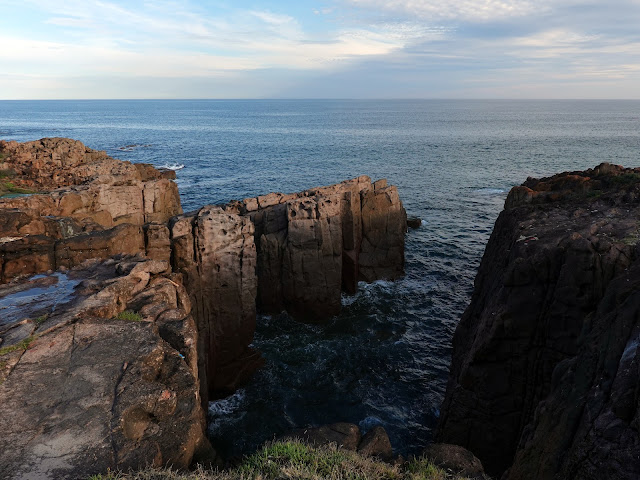
Adjacent to Boat Harbour is a headland and a rocky stretch of coastline, crowned by a finger of rock called Whale Lookout that commands an expansive view of the ocean. At the peak of the Humpback Whale migration season, we were treated to a few close passes, including a trio so close that we could hear them calling to one another as they enjoyed the waves.
 |
| Boat Harbour headland |
 |
| Whale Lookout |
 |
| Humpback Whales |
 |
| Humpback Whales |
 |
| The whales get close to shore due to the shape of the bay |
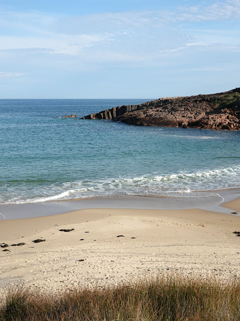
After watching the whales, we forged along Kingsley Drive to an entry to Tomaree National Park. The small national park is most famous for Tomaree Head, a rugged, 160m high peak with astounding views along the coastline and the entrance to Port Stephens. The southern part of the national park encloses Boat Harbour and Fishermans Bay.
 |
| Kingsley Beach in Tomaree National Park |
 |
| Kingsley Beach |
 |
| Boat Harbour and Whale Lookout |
 |
| Tomaree coastline |
A well-built path snakes its way to the bush, crossing Kinglsey Beach and making its way to the picture-perfect Little Kinglsey Beach, one of the most isolated beaches in the region. From the beach, some more bushwalking leads to the tiny village of Fishermans Bay — keep an eye out for the area's elusive Koalas.
A recent bushfire opened up the final section between Fishermans Bay and Birubi Beach, and the path follows the rocky shoreline. There are some interesting notches cut into the rocks by the waves, best seen from a small lookout platform at Iris Moore Reserve, named after a long-time Anna Bay resident. After the lookout, the path passes behind a few houses, emerging at Pacific Avenue and the Anna Bay Point Historic Cemetery, home to the graves of unknown sailors - Anna Bay Point was the scene of many shipwrecks.
Adjacent to the cemetery is the Birubi Point Aboriginal Placet at the very eastern end of Birubi Beach and Worimi National Park. The Worimi are the traditional owners of the Port Stephens area, which remains important for the Worimi people.
The Birubi Point Aboriginal place is important in the heart of the local Worimi country. The significant archaeological value of Birubi Point was first documented in 1920 when burial grounds were first found and excavated nearby. Today the Worimi Local Aboriginal Land Council works closely with Worimi descendants to provide opportunities that promote, foster and protect the culture and heritage.
After gazing upon the dunes, with the sun casting an interesting light across them, it was time to head for the car park a short distance away.


No comments :
Post a Comment