Bondi to Circular Quay 27-03-2021
This map was created using GPS Visualizer's do-it-yourself geographic utilities.
Please wait while the map data loads...
Route: Bondi Beach, Military Road, Rodney Reserve, Diamond Bay, Coastal Cliff Walk, The Gap, South Head, Watsons Bay, Vaucluse, Steele Point, Hermitage Foreshore, Rose Bay, Point Piper, Double Bay, Darling Point, Rushcutters Bay, Elizabeth Bay, Potts Point, Woolloomooloo, Botanic Garden, Mrs Macquaries Point, Farm Cove, Sydney Opera House, Circular Quay
Date: 27/03/2021
From: Bondi Beach
Parking: N/A
Start Point: Bondi Beach
Finish Point: Circular Quay
Region: Sydney
Route length: 17.1 miles (27.5km)
Time taken: 07:28
Average speed: 2.5mph
Ascent: 587m
Descent: 579m
Points of Interest: Bondi Beach, Diamond Bay, Federation Cliffs, South Head, Watsons Bay, Hermitage Foreshore, Rose Bay, Mrs Macquaries Point, Sydney Opera House, Circular Quay
After some pretty poor weather of late, I decided I wanted to do a long hike without needing a long drive or train ride. Sydney is the perfect city for such endeavours as its expansive coastline and timely public transport allow hikers to enjoy its highlights with ease.
I decided that I wanted to revisit some parts of the Bondi to Manly track - the 80km route that links two of Sydney's most famous beaches. Specifically, the first third between Bondi Beach and Sydney CBD which includes Federation Cliffs, Watsons Bays and the Hermitage Foreshore, ending at Sydney's beating heart in Circular Quay, home to the Harbour Bridge and Opera House.
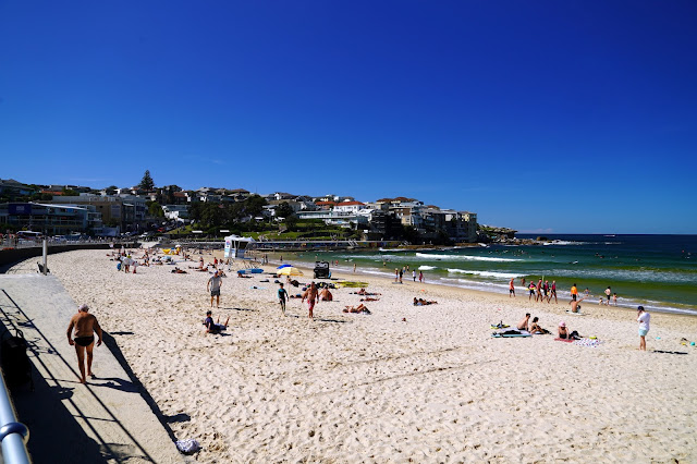
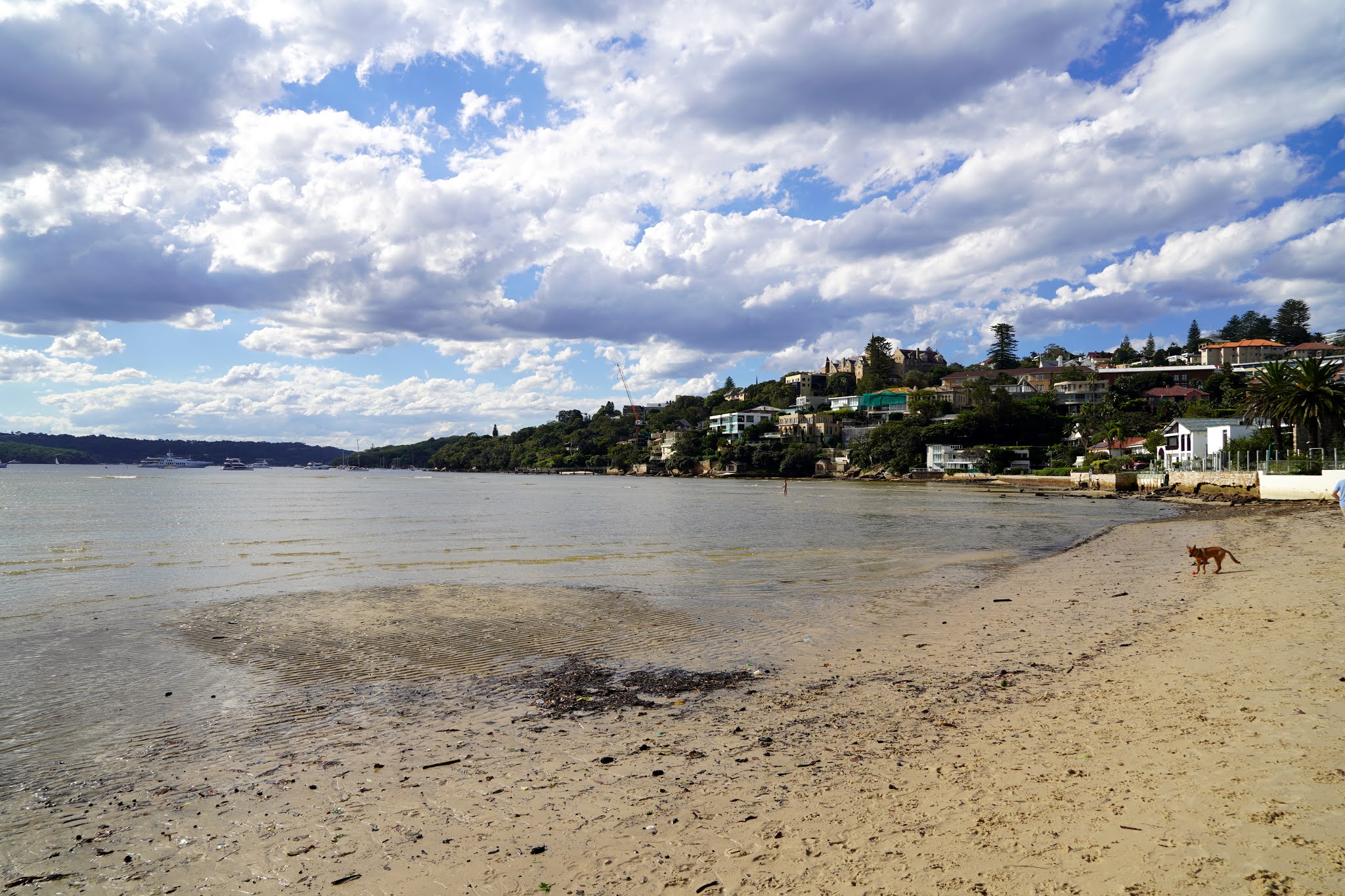
After climbing off the bus opposite the Bondi Lifeguard tower (the official starting point of the B2M walk), I set off east along the promenade above the beach, passing the Bondi Pavilion. The beach at Bondi is regarded as one of the best in the world though I don't see what elevates it above other beaches in the area. I wouldn't regard myself as a beach lover, so perhaps I'm not the best to offer an opinion on the matter.
Bondi is an Aboriginal word meaning water breaking over rock. It has been spelt several different ways over time; Boondi, Bundi, Bundye.
 |
| Bondi Beach |
 |
| Bondi Beach |
At the east end of the beach, the Bondi to Manly route climbs away from the shore along Campbell Parade, a winding road that leads to the residential area of North Bondi. You will pass a wide area along the road that was once a tram terminus and operated between the 1940s and 1960s.
I continued along the road, now Military Road, as it runs parallel to the Bondi golf course. The course is home to a tall, white column which, while impressive, is no more than a sewer vent shaft built in 1910. Despite this, the vent shaft is an important landmark for a great distance is likely to be unique in New South Wales for its use, design and construction. Additionally, aboriginal rock carvings can be found here if you know where to look (they were re-carved in the 1960s, so you may argue they are not genuine).
 |
| The old sewer vent shaft |
 |
| Aboriginal carvings |
 |
| Aboriginal carvings |
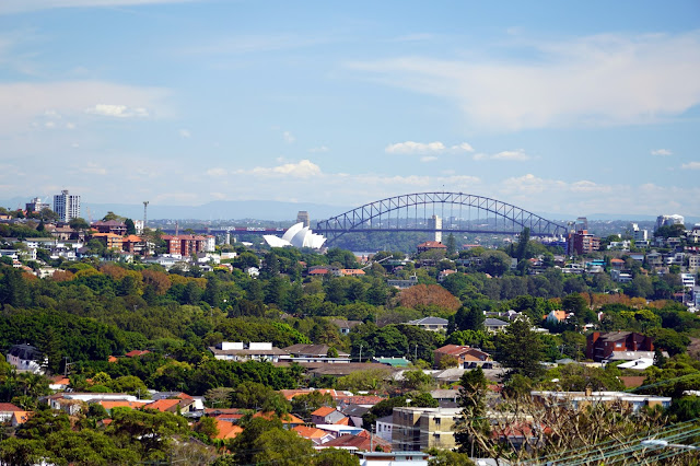
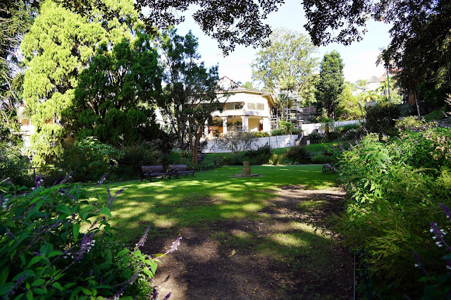
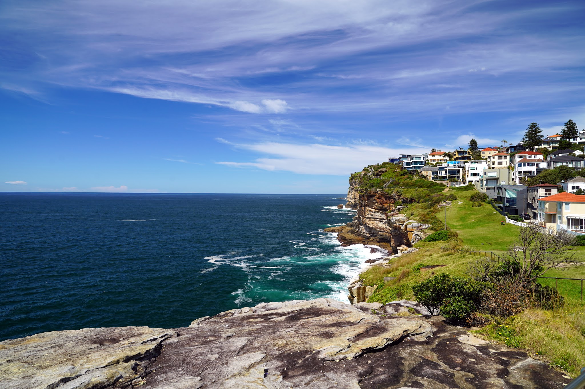
After visiting the carvings, I pressed on, leaving Military Road along a short, steep side road that climbs to a grassy area called the Hugh Bamford Reserve. More suburban walking led me along the streets of North Bondi to the Raleigh Reserve, the beginning of a long stretch of cliff-top walking - the Federation Cliff Walk (also the Waverley Cliff Walk). I also passed through Dudley Page Reserve, a grass park that has a superb view of the Sydney skyline.
 |
| The Federation Cliffs |
 |
| A view of Sydney Harbour from Dover Heights |
The cliff walk starts within a broad grassy park, Rodney Reserve, which leads to the former site a WWII radar station. After the war, the site was dedicated to the field of radio astronomy and led the way in determining the precise location of the centre of our galaxy - coordinates that are still used by astronomers today. Sadly nothing of the site remains though I believe there are (or have been) plans to mount a replica transmitter close to its original 1950s location.
 |
| Sydney viewed from Dudley Page Reserve |
Before long, I reached the suburb of Dover Heights where the cliff walk truly takes off. A wooden boardwalk clings to the rugged sandstone as it descends down a series of steps towards Diamond Bay. The craggy bay is surrounded by a reserve that shares the same name, home to Rosa Gully where you can find a small bushland remnant.
 |
| The Eastern Reserve boardwalk |
 |
| The cliffs at Diamond Bay |
 |
| Eastern Reserve |
 |
| Looking south back towards Bondi |
 |
| Diamond Bay |
 |
| Diamond Bay |
 |
| The Bondi vent shaft can be seen for miles |
The path skirts the top of Rosa Gully and then heads along a road back towards the cliff edge. I followed the streets until I reached Clarke Reserve and Christison Park, home to the Macquarie Lighthouse, the first in Australia, and the longest-serving. North of the lighthouse is the remaining foundations of the Signal Hill Battery - a gun emplacement intended to defend Sydney from bombardment by an enemy vessel standing off the coast.
 |
| Macquarie Lighthouse |
 |
| Macquarie Lighthouse |
 |
| South Head Signal Station |
 |
| The old Signal Hill Battery |
 |
| The entrance to Gap Park and views across to North Head |
Old South Head Road squeezes the path onto the pavement for a short distance from the battery site until you reach the entrance to Gap Park, an area of recreation ground that extends from The Gap to the tip of South Head. The park was dedicated as a public recreation reserve in 1887. Now, thanks to the nearby car park and superb views, the small lookout at The Gap attracts a multitude of phone-wielding tourists.
 |
| Gap Park |
 |
| More old gun batteries in Gap Park |
Aside from the view, the lookout is home to a memorial to the "Dunbar", a ship that was wrecked on the cliffs in 1857 with the loss of all but one of her 122 passengers and crew. The tragedy highlighted the need to more clearly define the entry to the harbour, showing deficiencies of the Macquarie Lighthouse, as it appeared that The Gap may have been mistaken for the harbour entry. As a consequence, the Hornby light was constructed at the extreme northerly end of South Head. This would be my next destination.
 |
| The anchor from the Dunbar |
 |
| The Gap |
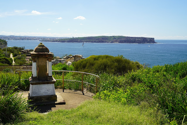
From The Gap, the route takes a slightly circuitous route along the Gap Bluff Walking Track, around the existing naval base at HMAS Watson and down to Camp Cove, one of Sydney's idyllic harbour bays. The South Head Heritage Trail leaves from the north end of the beach and makes a short, 2km circuit of the headland, visiting Hornby Lighthouse before returning back to the beach.
In the scheme of the Bondi to Manly trek, you may consider it an avoidable detour but it is worth it for the panoramic views of the harbour. It will also give you a sense of perspective for when you eventually reach North Head some 70km of hiking away.
 |
| The Gap from Gap Bluff |
 |
| Sydney |
 |
| Hornby Keepers cottage |
 |
| Hornby Battery at the entrance to the harbour |
 |
| Hornby Lighthouse and North Head |
At the southern end of Camp Cove is Green Point Reserve, a small open area that covers a peninsula, jutting out into the harbour. The Bondi - Manly route follows the exposed rocks along the shore. This passes a stone obelisk and concrete pad marking the remains of a winch house which. The building used to serve as a WW2 anti-torpedo net which was strung 1.5km across the harbour (the obelisk was a navigational aid built some 90 years earlier).
 |
| Camp Cove |
 |
| Camp Cove |
Once around Green Point, the B2M route heads east to Watson's Bay, before turning south through the fringe of Robertson Park until it reaches the Vaucluse Yacht Club in the suburb of Vaucluse, one of the most affluent areas in Sydney, along with Point Piper. The properties in these neighbourhoods exchange hands for millions of dollars.
The path follows the shore to Gibson Beach where it is forced onto one of the leafy residential streets, Hopetoun Avenue and The Crescent. While not unpleasant, suburban streets don't make for particularly impressive photos. After following The Crescent for some 700m, I reached the footbridge over Parsley Bay.
 |
| Sydney Harbour |
 |
| Boats at Watsons Bay |
 |
| Watsons Bay |
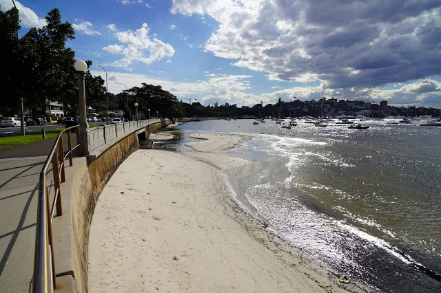
The 1910 suspension bridge is the focal point of the wider Parsley Bay reserve, a tiny but beautiful bay that has long been one of Sydney’s favourite harbour-side places, and since 1906 has been officially reserved for the enjoyment of the public.
 |
| Parsley Bay |
 |
| Parsley Bay Beach |
 |
| Parsley Bay Bridge |
From Parsley Bay, I made my way through more suburbs, towards the promontory of Steele Point which is comprised of Shark Bay and Vaucluse Bay. The route took me past Vaucluse House, one of Sydney's C19th mansions now home to the Living Museum. It is one of the few C19th houses on Sydney Harbour retaining a significant part of its original estate setting.  |
| Vaucluse House |
 |
| The grounds adjacent to Vaucluse House |
 |
| Vaucluse Bay and Steele Point |
Like many coastal areas around Sydney, Steele Point is home to a former gun battery tasked with defending the entrance to the harbour. Perhaps more interestingly, Steele Point was home to a naval degaussing station, which helped to protect ships from magnetic sea mines.
Just off Steele Point Road is the first access to the Hermitage Foreshore, one of Sydney's most popular tracks. The area was established as a reserve in 1912 as part of the Foreshore Resumption Scheme though the land wasn't declared public until the 1960s.
The area was largely left in its natural state so the 3km of rock and beach along the foreshore is mostly untouched by urban development and is fully accessible to the public. The tracks and facilities were upgraded in the 1990s and are now one of the best short walks in the city.
 |
| The sweeping Shark Beach |
 |
| The gun battery on Steele Point |
 |
| Sydney CBD |
 |
| Sydney Opera House |
Just after Milk Beach, the foreshore track skirts the grounds of Strickland House, a largely intact 1850s villa. Its location on a rise overlooking the harbour represents the picturesque aspirations of wealthy mid-nineteenth-century society. The grounds now form one of the best harbourside parks in Sydney.
 |
| Milk Beach |
 |
| Sydney Harbour |
 |
| Strickland House |
As it makes its way south along the shore, the path gets squeezed between the waters of Sydney Harbour and the high retaining walls of the various mansions which line Carrara Road above - one of the most expensive areas of property in the city. One of the properties offered short-term leases for A-listers such as Elton John and Brad Pitt before being sold.
 |
| The Hermitage Track at Hermit Bay |
The Hermitage Foreshore track leads to the small Hermit Bay with its beach and boat ramp before continuing along the shore to Queens Beach and finishing at Bayview Hill Road. A few more suburban streets lead to the beginning of the vast Rose Bay.
 |
| Hermit Bay |
 |
| Sydney Harbour |
 |
| A seaplane departs the busy Rose Bay |
 |
| Rose Bay Beach |
The wide expanse of Rose Bay was used to train Australian sailors, many for service in World War I. HMAS Tingira, named after an Aboriginal word for 'open sea', was moored in the bay between 1912 to 1927 for this purpose. After, from 1938, seaplane flights to and from London began and terminated in Sydney Harbour on Rose Bay, making it Sydney's first international airport, and what is now Rose Bay Water Airport.
 |
| A seaplane arrives at Rose Bay airport |
The 1930s were widely considered aviation’s golden age. The Empire flying boats could carry up to 14 passengers and with a flight time of only ten days from Rose Bay to Southampton compared to more than 40 days by sea, they began to rival ships as a popular form of transport. Flying boats provided a first-class only service – out of reach of most Australians as a ticket cost the equivalent of an annual salary.
From the Rose Bay wharf, the Bondi to Manly route continues west along a concrete promenade that runs along the wide sweep of Rose Bay to the beginning of Point Piper. The point is home to large properties which front the harbour, limiting access for hikers. It is regarded as Australia's most expensive suburb with houses being bought and sold in excess of $60million.
 |
| Rose Bay |
 |
| Rose Bay |
 |
| Rose Bay promenade |
Wolseley Road does a loop of Point Piper, with the shortest of diversions down a set of stairs leading to Duff Reserve, a small patch of grass sandwiched among the jetties and pools of the properties. Wolseley Road itself is among the most expensive streets in the entire world though isn't particularly photogenic thanks to the high walls and gates which surround everything.
Hidden down St Mervyns Avenue is an alleyway that leads between the houses to Seven Shillings Beach. There are two existing ideas regarding the name of the beach, the first being a Sydney resident giving an Aboriginal seven shillings compensation for his fishing rights to the bay. Another explanation states a nurse employed in the area lost a purse containing 'seven shillings' on the beach. The route passes along the 300m long beach to the western end, backed by the leafy Blackburn Gardens, a beautifully restored heritage garden.
 |
| Seven Shillings Beach |
 |
| Seven Shilling Beach |
 |
| Blackburn Gardens |
Sadly there is no harbourside route between the gardens and Double Bay wharf (an option to break up the walk if you wish). The beach at Double Bay leads to Steyne Park and a set of stairs that climb to Darling Point Road. Along the way, I passed one of Sydney's preserved 1930s electricity substations which can be found scattered across the city. Many of these are aesthetically distinctive and finely detailed.
 |
| Stafford Street |
 |
| Double Bay Beach |
 |
| Boats in the bay |
 |
| Steyne Park |
Darling Point Road is a very pleasant tree-lined street that leads north along Darling Point towards another ferry wharf. Darling Point (originally Mrs Darling's Point), honours the wife of Governor Ralph Darling. The west side of the point is lined by the long Yarranabbe Park (using its Aboriginal name) and forms part of Keltie Bay - the western bay of the Double Bay area (the other bay being Diendagulla).
 |
| Steps between Steyne Park and Marathon Road |
 |
| Marathon Road |
 |
| Yarranabbe Road |
 |
| Keltie Bay |
 |
| Boats in Keltie Bay |
Yarranabbe Park led me to Rushcutters Bay, which was once used by convicts to cut the 'rushes' used as roofing material in the early days of the Australian penal colony. Across the bay are a set of steps that climb up to Holdsworth Avenue to the district of Elizabeth Bay, home to Elizabeth Bay House, once one of the colony's finest houses, now, a living museum.
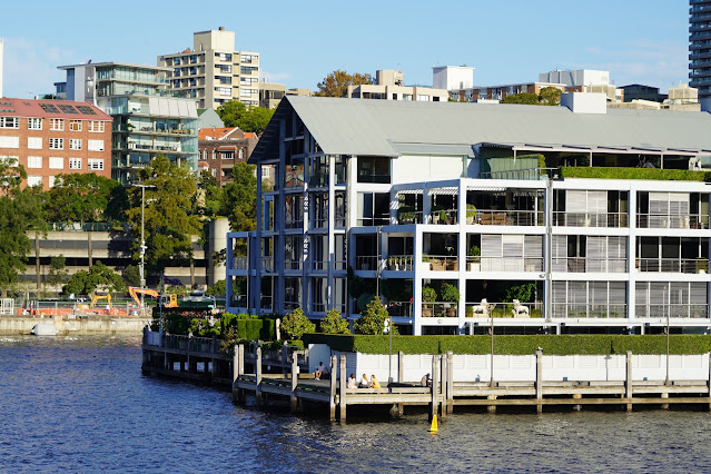
The route cuts across the bottom of the navy base at Potts Point (which blocks any access to the harbour) to McElhone Stairs, a set of steps that afford a fine view of the city as you descend. The stairs commemorate John McElhone, a merchant and politician who had lived in Potts Point. The steps descend into the district of Woolloomooloo, originally a working-class suburb but now largely gentrified with the redevelopment of the waterfront, particularly the development on the Finger Wharf, which has caused major change.
 |
| The Woolloomooloo Finger Wharf |
 |
| Woolloomooloo Finger Wharf |
 |
| Woolloomooloo |
 |
| Woolloomooloo Finger Wharf |
Adjacent to the Finger Wharf is Sydney's Royal Botanic Garden - the oldest scientific institution in Australia and one of the most important historic botanical institutions in the world. Its stunning position in Sydney Harbour ensures it is one of the most visited places in Australia. The path follows the eastern side of the park though you could cut through if you wish.
At the tip of the Botanic Gardens is Mrs Macquarie's Point which honours Governor Lachlan Macquarie's wife, Elizabeth, who had a chair carved out of rock in 1815. She often came to sit and watch ships enter and leave the harbour. Just around the corner is perhaps THE best view of the Sydney Opera House and Harbour Bridge (though I was not there at the best time as the afternoon sun shines directly towards the point).
 |
| Fort Denison in Sydney Harbour |
 |
| Sydney CBD |
 |
| Sydney Opera House and Harbour Bridge from Mrs Macquaries Point |
 |
| Sydney Opera House |
 |
| The northern pylons of Sydney Harbour Bridge |
The opera house occupies Bennelong Point, named after Bennelong, an aborigine whom Macquarie befriended and used as a guide and interpreter. During his tenure as Governor, Macquarie built a fort on the point as part of his harbour defence system. This was replaced by a tram depot, which was demolished in the 1950s to make way for the Sydney Opera House. A path follows the sweep of Farm Cove to reach the famed building.
 |
| Sydney Opera House |
 |
| A shady Royal Botanic Garden backed by the towers of the CBD |
 |
| Sydney Harbour Bridge peeps over the top of the gardens |
 |
| Sydney CBD |
 |
| Approaching the Opera House from Farm Cove |
 |
| Sydney Opera House |
The Sydney Opera House is one of the worlds most famous and distinctive buildings though its current design was close to never being realised. An international competition to design the opera house was announced in 1956, and when Jørn Utzon entered his proposal it was promptly relegated to the bin. When renowned American architect, Eero Saarinen was looking through the rejects he found Utzon’s entry and Utzon subsequently won the contract. The concept of the roof represented a ship’s billowed sails, a representation of Australia’s maritime history. At that point in time, no one knew exactly how challenging the construction of this roof would be.
 |
| Sydney Opera House |
 |
| The Monument Steps in front of the Sydney Opera House |
 |
| Sydney Opera House |
The shells of the roof were the most complex feature of the building. At the time, hand-written mathematical equations were required to make the roof construction possible; it took 30,000 separate equations just to work out how much stress could be applied. The margin of error could be no more than 13mm when putting the segments together; anything more would have thrown the whole thing out of alignment as everything is curved and there is not one flat plane in the entire roof.
 |
| It is possible to walk all the way around the Sydney Opera House |
 |
| The walkway alongside the Sydney Opera House |
 |
| Bennelong Point |
 |
| Sunlight reflects off the windows of the Sydney Opera House |
Eventually, it was discovered that the roof 'shells' could be derived from the planes of a sphere - a watershed moment in the design and construction of the building. Despite this achievement, Utzon became embroiled in the political controversies of the day, with his designs, schedules and cost estimates being questioned. It is said that the government at the time withheld money from Utzon. Utzon was stymied and subsequently resigned in 1966. Sadly Utzon and his family left Australia, never returning to see his concept completed.
 |
| The intricate tiles that clad the Opera House |
 |
| Sydney Opera House |
 |
| Circular Quay |
 |
| Sydney Harbour Bridge |
 |
| Monument Steps |
 |
| Sydney Opera House |
You can get up close to the tiles as you make your way around the opera house towards the bustling Circular Quay - the final stop along this stretch of the walk. Circular Quay is the birthplace of modern Australia for it was here, in 1788, the first British fleet landed and established the penal colony which grew into modern-day Sydney. Why the name Circular Quay when it is clearly a rectangle? It's simply a shortening of Semi-Circular Quay which was the working ports original name and shape.
 |
| Moonrise |
 |
| Sydney Harbour Bridge |
 |
| Sydney Opera House |
 |
| Sydney Opera House from the Circular Quay cruise terminal |
 |
| Crown Sydney - the newest tower on the Sydney skyline |
 |
| Sydney Harbour Bridge |
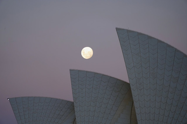 |
| The moon over sails of the Sydney Opera House |
Now, Circular Quay acts as a hub for Sydney thanks to the rail station and ferry wharves. Thousands of people visit daily, whether commuting into the city or arriving on one of the many cruise ships that dock during the summer months. It marks the end of this city-based leg of the Bondi to Manly hike and is the penultimate area of the south shore before it makes its way back towards Manly.
 |
| Sydney Harbour Bridge and the cruise ship terminal |
 |
| Circular Quay |


No comments :
Post a Comment