The Bullawarring Track 04-01-2021
This map was created using GPS Visualizer's do-it-yourself geographic utilities.
Please wait while the map data loads...
Route: Waterfall Station, Bundarra Street, Camp Coutts Track, Camp Road, Lake Toolooma Fire Trail, Lake Toolooma, Waterfall Gully, Bullawarring Track, Heathcote Creek, Kingfisher Pool, Karong Gully, Python Gully, Marks Lookout, Battery Causeway, Pipeline Trail, Mirang Pool, Friendly Trail, Freeman Road, Oliver Street, Heathcote Station
Date: 04/01/2021
From: Waterfall
Parking: N/A
Start Point: Waterfall Station
Finish Point: Heathcote Station
Region: Heathcote National Park
Route length: 7.7 miles (12.4km)
Time taken: 03:47
Average speed: 2.0mph
Ascent: 315m
Descent: 346m
Points of Interest: Lake Toolooma, Kingfisher Pool, Mirang Pool
Heathcote National Park stands next to Royal National Park, separated from the more famed Royal National by the M1 Princes Highway. The problem with Royal National Park is it can get very busy as Sydneysiders flock there on any given day. The way to avoid the crowds? Head to Heathcote, next door. While it lacks the coastal splendour of Royal National Park, Heathcote is home to an abundance of interesting scenery, centred around Heathcote Creek.
The Bullawarring Track is one of the highlights of the national park and, best of all, you need the train to complete it as it follows Heathcote Creek, linking the stations at Waterfall and Heathcote. For no specific reason, I decided to do this hike from south to north.
I departed the train at Waterall Station, crossing Princes Highway by way of Koorban Street before following a path down to Bundarra Street. Technically, the Bullawarring Track begins north of the station but, heading south, adds an extra kilometre or two by beginning on the Camp Coutts Track via Lake Toolooma. The Camp Coutts Track doe not have an obvious starting point as you have to hop over a crash barrier to find it.
 |
| Follow the signs for Camp Coutts |
Once on the track, it descends into the bush and it appears that it isn't hiked very much. I've come to learn that the less used the track is, the more spider webs you'll end up walking through. That said, there is an obvious track on the ground which makes its way to Camp Road.
 |
| Camp Coutts Track, close to Waterfall station |
 |
| Camp Coutts Track, close to Waterfall station |
 |
| Sydney Red Gum bark |
 |
| Descending the Camp Coutts Track |
 |
| Camp Road |
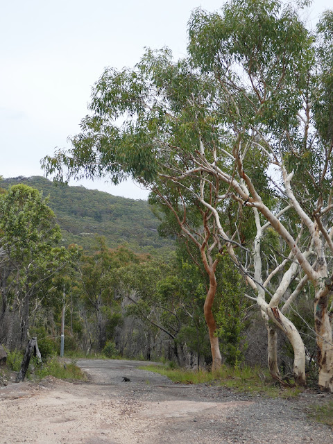
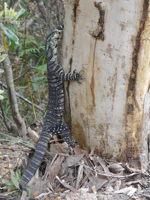
I was only on the cracked tarmac road for a short while before the Lake Toolooma Trail branches off to the north. There was, however, enough time to spot a few of the large Goanna lizards that live around these parts.
 |
| Camp Road |
 |
| A Goanna lizard |
 |
| A Goanna lizard hangs on to a Scribbly Gum tree |
 |
| Lake Toolooma Fire Trail |
The track past Lake Toolooma is actually a wide fire trail that hugs the eastern side of the lake. As I made my way along, views of the lake opened which include a curious rusty boiler - likely an apparatus for when the lake was dammed and used to supply water to Waterfall station in the 1900s. Water from the lake was pumped to a holding reservoir and fed to the water tank in the Waterfall yard.
 |
| The trail sits below an escarpment |
 |
| Lake Toolooma |
 |
| Lake Toolooma, the dam and the old boiler |
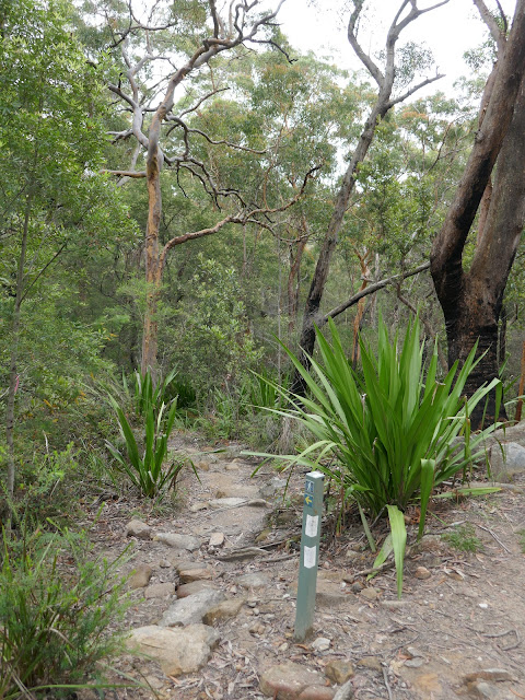
After passing the lake, the fire trail eventually meets the Bullawarring Track, make by an eponymous NSW national parks sign. Immediately, the trail becomes far narrower, winding through the beautiful Heathcote bush. Almost immediately, the shrill chirping of the Cicadas began to drown out nearly everything else.
 |
| Lake Toolooma Fire Trail at Waterfall Gully |
 |
| Australian Water Dragon |
 |
| The Bullawarring Track |
The track crosses Heathcote Creek and then Westmacott Rill before it reaches the beautiful Kingfisher Pool. It is fed by Heathcote Creek as it tumbles through some oddly eroded rocks, creating a natural stone bridge above the pool. You can camp nearby at the Kingfisher Pool camping area.
 |
| Heathcote Creek above Kingfisher Pool |
 |
| Heathcote Creek leading to Kingfisher Pool |
 |
| The natural bridge created by Heathcote Creek |
 |
| Kingfisher Pool |
A short distance beyond Kingfisher Pool is another, smaller waterfall that can be reached via the briefest diversions from the path. After this, the Bullawarring Track follows the course of Heathcote Creek for a few hundred metres before climbing the flank of Mount Mannell, crossing the dried-up creek at Python Gully. Now, some 100m above Heathcote Creek, there are the occasional openings with views of the valley.
 |
| Waterfalls beyond Kingfisher Pool |
 |
| Heathcote Creek valley deep within the bush |
 |
| Climbing the slopes of Mount Mannell |
 |
| Escarpment on Mount Mannell |
 |
| The Bullawarring Track negotiates some interesting rocky features |
 |
| Python Gully |
 |
| The Bullawarring Track |
 |
| Views of Mount Mooray from Mount Mannell |
The track continues, passing what I believe to be a shield tree. Shield trees have had bark removed by Aboriginal Australians for the creation of bark canoes, shelters, weapons such as shields, tools, or other artefacts. Also known as scarred trees, they are found among mature native trees, especially box gum and red gum trees, along rivers and lakes and at sacred sites. They are protected by legislation.
 |
| A shield tree, perhaps |
The Bullawarring Track continues to the junction with the Goanna Track and descends back to Heathcote Creek at Battery Causeway. The decrepit road forms part of the access to the Woronora dam, located a short distance away on the Woronora River. The dam, built in the early 1940s, supplements water supply to southern Sydney.
 |
| Battery Causeway |
 |
| Heathcote Creek |
 |
| Heathcote Creek |
 |
| Battery Causeway |
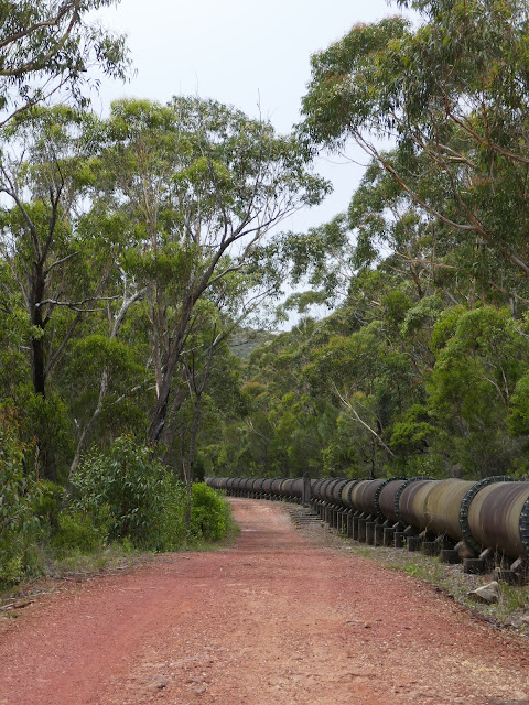
Crossing the causeway can be tricky if the creek is in full flow as it tends to wash over the top of the road. Once across, you will join the Pipeline Trail which is little more than a service road for the dam, following and immense pipe which is mildly interesting. The pipeline passes Mirang Pool, a deep bend on Heathcote Creek which is home to a rudimentary campground. There are no facilities here so you will have to arrive self-sufficient (but you are not far from Heathcote).
 |
| Pipeline Trail |
 |
| Pipeline Trail |
 |
| Crossing the water pipeline |
 |
| Mirang Pool on Heathcote Creek |
 |
| Another Australian Water Dragon |
Shortly after Mirang Pool, the pipeline road meets a junction with the Friendly Track, accessed by climbing up and over the large concrete pipeline via the metal platform and stairs. The track then continues up a long hill beside Scout Gully eventually finding its way out of the bush and into Heathcote at Freeman Road. From here, it's a short stroll to the train station and a ride back to Sydney.
 |
| The Friendly Trail |
 |
| Scout Gully |
 |
| The Friendly Trail |


Another fascinating look at the other side of the world. Love the wildlife shots.
ReplyDeleteThanks!
Delete