Sunday, 5 January 2020

Bondi to Manly - Part 7 - Manly Wharf to Manly Beach via North Head

Bondi to Manly - Part 7 - Manly Wharf to Manly Beach
This map was created using GPS Visualizer's do-it-yourself geographic utilities.

Please wait while the map data loads...

Route: Manly Wharf, East Manly Cove Beach, East Esplanade, Stuart Street, Little Manly Cove, Little Manly Point, Collins Flat Beach, Collins Beach Track, Collins Beach Road, Barracks Precinct, Memorial Walk, Fairfax Track, Avenue of Honour, Hanging Swamp, Bluefish Drive, Blue Fish Track, Shelly Head, Shelly Beach, Manly

Date: 04/01/2020
From: Manly Wharf


Parking: N/A
Start Point: Manly Wharf
Finish Point: Manly Beach
Region: Sydney

Route length: 6.5miles (10.5km)
Time taken: 04:36
Average speed: 1.3mph
Ascent: 197m
Descent: 184m

Points of Interest: Collins Beach, Barracks Precinct, Fairfax Point, Shelly Beach

Bondi and Manly are arguably Sydney's two most famous beaches. While they are only 10km apart, they sit on either side of the vast entrance to Sydney Harbour. When I arrived in Australia, I harboured an ambition to hike the length of the Sydney Harbour foreshore and the introduction of the Bondi to Manly walking track has facilitated just that.
The Bondi to Manly branding features the aboriginal depiction of a whale
The overall length of the Bondi to Manly track is 80km and while it has always been possible to walk the route, it has now become formalised with signage and a supporting app. Thanks to the extensive public transport network in Sydney it is possible to break up the route into manageable one-way sections. The final section completes the route by making a circuit of North Head which includes the commanding Fairfax lookout.

Though it was very hot and sunny, the current bushfires which have encircled Sydney are frequently casting a dull haze over the city. Fortunately, in recent weeks, I've managed to time my hikes when the air quality has been ok - there are occasional days when the smoke hangs over the city like an autumnal UK fog and it's best to stay indoors. Today, however, things were not too bad.

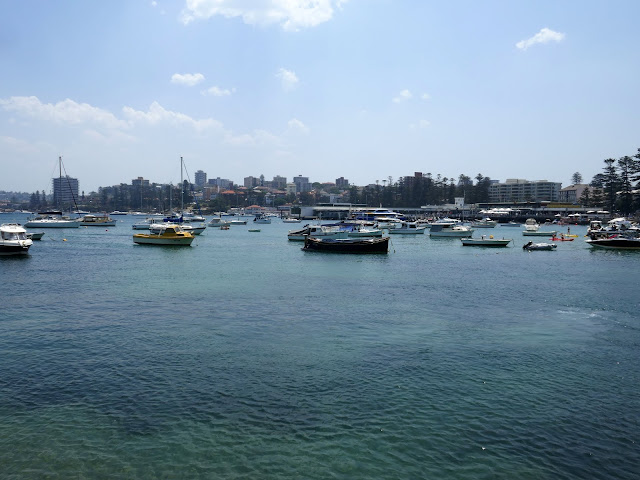
I picked up the walk where the Spit to Manly leg finishes, at the Manly ferry wharf overlooking Manly Cove. This is the final stretch and, while the main Manly Beach is a mere 400m away from the wharf, a direct route would miss out the views and bushland of North Head, particularly Fairfax Lookout, which we'll get to later.
Manly Cove and Manly Cove Beach
Cabbage Tree Bay
A path curves around Cabbage Tree Bay to the Manly Yacht Club, along Stuart Street to Little Manly Beach. The path continues to the promontory of Little Manly Point. Originally known as Manly Gasworks, Little Manly Point was cleaned up a few years ago and converted into a beautiful little park with a sweeping view of the nearby bays.
The harbour at Manly
Smedley's Point protrudes into the harbour
The scorched grass of Little Manly Point
Little Manly Point
Little Manly Cove
Just beyond Little Manly Point is Skinner's Reserve and Collins Flat Beach. I had to weave among the throngs of visitors who were soaking up the heat of the day. If you're lucky, a visit to Collins Flat Beach might even come with a sighting of the Little Penguins that live here, the only known colony of penguins on the NSW mainland.
Collins Bay
The route climbs away along the bush-lined Collins Beach Road, up to the Barracks Precinct on North Head. Formerly the School of Artillery, the area seems very off-limits but the roads are all public access. The entirety of North Head forms part of the North Head Sanctuary.
Collins Beach Road
Collins Beach Road
The entrance to North Head
North Head Sanctuary, sitting high at the northern entrance to Sydney Harbour, is one of Sydney’s most spectacular landmarks. The site was one of Sydney’s most heavily fortified military sites and played a significant role in the national chain of coastal defence, with a large network of underground tunnels and a series of military installations.
The Barracks Precinct
The isolation and prominence of North Head heavily influenced its use. In the1930s, events in Europe led the Federal Government to construct the North Fort and the associated Barracks. The Barracks complex contains a collection of art deco buildings, a parade ground, service areas and sheds, as well as a large area of remnant bushland. The Harbour Trust took over the management of North Head Sanctuary in 2001, remediated the site and opened it to the public in 2007.
The parade ground
The parade ground and mess hall
Having made my way through the parade ground, a side path snakes off into the Banksia bushland along a boardwalk. There are some superb viewpoints along this path, looking across Manly and Sydney Harbour. With the sun beating down, I emerged from the bush at the Quarantine Station cemetery, overlooking the harbour. North Head was chosen to house a quarantine station due to its proximity to the entrance of Sydney Harbour but also its relative isolation, being distant by land and even water from the early settlement of Sydney.
North Head sanctuary
The North Head boardwalk
Banksia bush
The view from the Northern Lookout
The cemetery was established in 1881 for victims of a smallpox epidemic. It is a significant example of the nation’s evolving quarantine practices of the time. By the time of the cemetery’s closure in 1925, more than 240 people had been buried here, succumbing to the effects of influenza, the bubonic plague, smallpox and all manner of trendy Victorian diseases.
Sydney
Sydney from the quarantine Cemetary
Third Quarantine Station Cemetary
Sydney Harbour
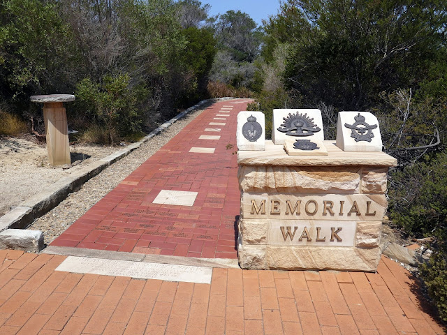
Upon reaching the North Fort car park, at the end of the track, I entered the Avenue of Honour, a cobblestone pathway created as a memorial to local soldiers killed in all theatres of war with grand, sandstone monuments inscribed with hundreds of names. Halfway along the memorial walk is the detour to Fairfax Lookout.
Memorial Walk
Memorial Walk
Memorial to the lives lost in WWI
A short circuit connects three lookouts along the coastal fringe of North Head which provide sensational views of the entrance to Sydney Harbour. From this vantage point, the bushfire smoke haze that has lingered over the city for weeks was clear to see. Opposite the Fairfax lookouts, across the harbour entrance, is South Head and Hornby Lighthouse - visited during the second leg of my Bondi to Manly trek.
Fairfax Walking Track
The cliffs of Blue Fish Point
Fairfax Lookout
Sydney in the bushfire smoke haze
A layer of haze blankets the city
The Fairfax loop returns to the Avenue of Honour and the walk continues on its way, passing some of the remains of the large gun emplacements which once defended Sydney's harbour from the sea and the air. The Avenue of Honour (as named) continues along the eastern side of North Head with a board-walked detour around a notable hanging swamp. Water does not easily seep into the sandstone rock of North Head and, after rain, water remains for a short time, creating shallow wetlands.
WWII gun pit
Avenue of Honour
The hanging swamp
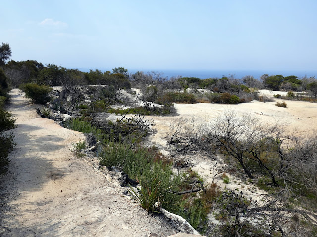
Blue Fish Track
After an easy walk along the rest of the Avenue of Honour, I reached the Blue Fish Track, a narrow path that would lead to the cliffs of Blue Fish Wall. The path leads to a wall with a hole cut through it (part of the old military bases outer wall'. Despite the warning signs, the path is public access and perfectly safe. Beyond the wall, the path descends to the lookouts along the Shelly Headland.
The Blue Fish Track
The Tasman Sea
The hole in the wall
Sydney's Northern Beaches
A glimpse of the Pacific Ocean
Shelly Headland
Views from the Shelly Beach walking track
Shelly Head Lookout
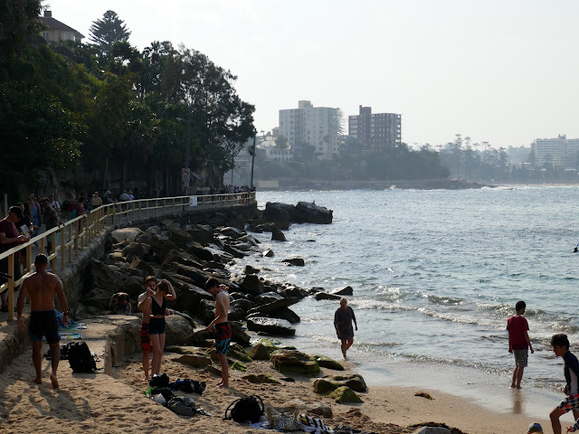
I reached Shelly Beach in the afternoon and the locals were still out in force. Shelly Beach forms part of Cabbage Tree Bay, a protected marine reserve that lies adjacent to North Head and Fairy Bower. With a maximum depth of approximately 12 metres, Shelly Beach has become popular with Scuba Divers and Snorkelers alike with a large variety of marine life that can be viewed in relatively shallow water.
Shelly Beach
Marine Parade heads towards Manly
Fairly Bower
Cabbage Tree Bay Aquatic Reserve
Marine Parade leads along the shore to the huge, sweeping beach at Manly. Manly was named by Captain Arthur Phillip for the indigenous people living there, stating that "their confidence and manly behaviour made me give the name of Manly Cove to this place". While scouting for fresh water in the area, Phillip encountered members of the clan, and after a misunderstanding, he was speared in the shoulder by one of the clan; to his lasting credit, the progressively-minded Phillip ordered his men not to retaliate.
Manly Beach
!!
Now, Manly is a popular tourist destination and is the location of the world's first surfing contest, held in 1964. This makes it one of Australia's most famous beaches, along with Bondi, 80km away. The iconic beach curves from South Steyne to North Steyne and Queenscliff, where a submerged reef, or bombora, creates the waves that inspire the world's best surfers to travel to Australia.

Reaching the beach at Manly brings the epic Bondi to Manly trek to a close. It's an amazing and not-too-difficult means of seeing some of the best that Sydney has to offer.

No comments :

Post a Comment