Saturday 4 May 2019

Cautley Spout & the Howgill Fells

Cautley Spout & the Howgills 04-05-2019

This map was created using GPS Visualizer's do-it-yourself geographic utilities.

Please wait while the map data loads...


Route: Cross Keys, Cautley Spout, Cautley Crag, Great Dummacks, Calders, Bram Rigg Top, The Calf, Dales High Way, Hazelgill Knott, Bowderdale, Leath Gill, Leathgill Bridge, Randygill Top, Kensgriff, Saddle, Yarlside, Ben End, Cross Keys

Date: 04/05/2019
From: Cross Keys


Parking: Small layby off A638 at Cross Keys
Start Point: Cross Keys
Region: Yorkshire Dales

Route length: 9.8 miles (15.7km)
Time taken: 04:54
Average speed: 2.3mph
Ascent: 1,125m
Descent: 1,125m

Summits: Calders (674m), Bram Rigg Top (672m), The Calf (676m), Randygill Top (624m), Yarlside (639m)

Other points of interest: Cautley Spout

Cautley Spout has the honour of being England's highest cascading waterfall (Hardraw Force has a greater unbroken fall, as does Gaping Gill though this resides underground). It tumbles some 200m down the only crag to the found in the Howgill Fells, the curious rolling hills that separate the Yorkshire Dales from the Lake District.

I've only visited the Howgills on one previous occasion a number of years ago which is a shame as it's a lovely area for walking. I devised a route that would take in the highlights of the Howgills; Cautley Spout and its crag, the high point at The Calf and two outlying Nuttalls that have long evaded my attention. These fells; Randygill Top and Yarlside, would add a sting in the tail of an otherwise straightforward day.

There's room for a few cars in a layby close to the historic Cross Keys Inn. which was thought to have been built in the late 16th Century and is now looked after by the National Trust. I've never known the Howgills to be particularly busy but there is certainly a chance that the parking spaces could fill up on a sunny summer day.
The River Rawthey and Great Dummacks
I immediately crossed the footbridge over the River Rawthay, where a gravelled path leads into the valley of Cautley Holme Beck. It was a fine day though a cold wind was blowing, at least until I reached the shelter of the valley. An information board explains the importance of the valley to the Iron Age settlers.
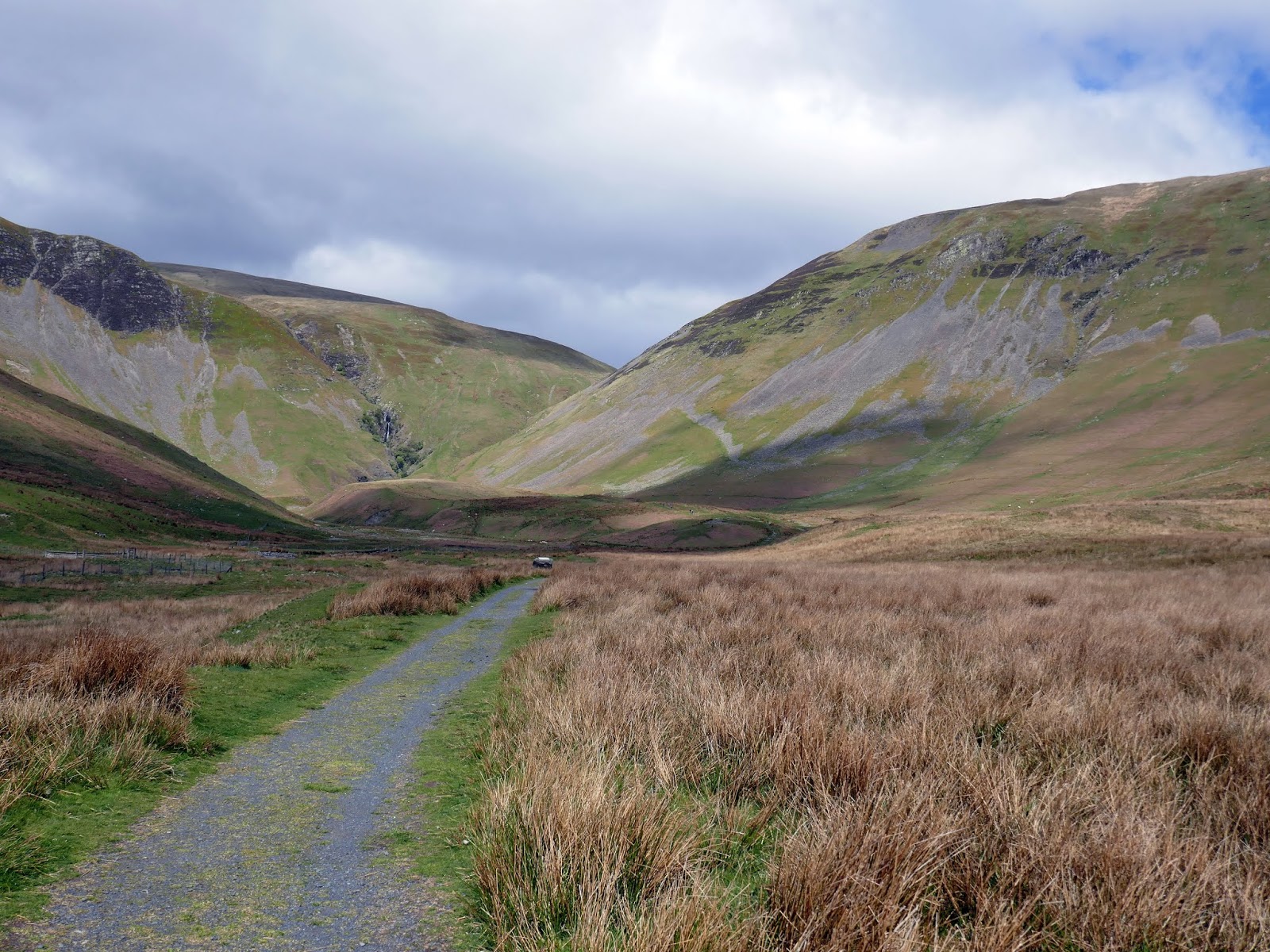
The path leading along Cautley Holme Beck
Cautley Spout
The north end of Cautley Crag
As the path continues, Cautley Crag begins to come into view. It is the only significant crag in the entire Howgills. It's not a suitable climbing crag but it adds a bit of drama to the otherwise grassy nature of this area. Cautley Spout also starts to make more of a meaningful appearance as the path reaches the base of the falls.
Cautley Crag
Cautley Spout
Looking up to Cautley Crag
The path climbs up alongside the full height of Cautley Spout and is very steep. Initially, the climb begins up grass but soon steps take over which makes the climbing that bit easier. The path skirts the side of the waterfall and gives a fine view of the numerous cascades. Cautley Spout was formed during the last Ice Age and is the backwall of a glacial corrie. The ice cut back into the mountain to form the rocky Cautley Crag.
Cautley Spout
Looking back along the valley below the waterfall
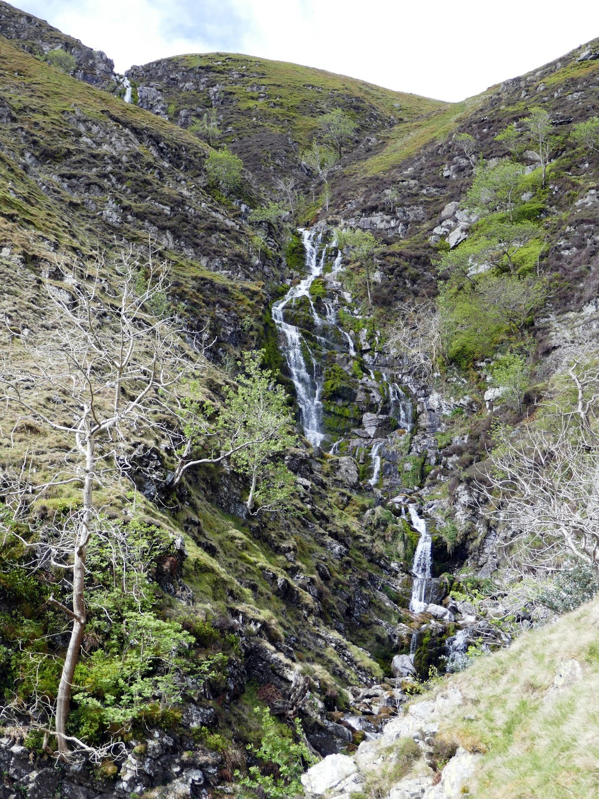
The cascading Cautley Spout
Cautley Spout
The steep slopes of Yarlside
The top of the waterfalls
Eventually, I reached the top of the falls and chose to take a lesser-used path which hugs the rim of the crags. This route is far better than heading for The Calf directly as the views across the valley and crags are superb and the climbing is far more gentle. It also gives a brief overview of the hills I'd be visiting later in the day The vague path reaches the main bulk of the Howgills at the ill-defined summit of Great Dummacks (sadly not prominent enough to count as a separate hill).
Swere Gill prior to falling over the cascade
Cautley Crag
Looking across towards Wild Boar Fell and Swarth Fell
Cautley Crag and Yarlside
Great Dummacks
Middle Tongue and Sickers Fell
The cairn on Calders
Arant Haws from Calders
I reached a fence at the top of Middle Tongue before meeting the main path at Calders. This path (the Dales High Way bridleway) runs right along the spine of the Howgills. After a short detour to the top of Bram Rigg Top, I found myself at The Calf, the Howgills highest point. The view from the trig point is superb, particularly as you can see the full length of the Lake District and many of the Yorkshire Dales' famed peaks.
Whinfell Common and the south eastern Lake District
The Scafells on the horizon
Bram Rigg Top
The summit?
The Calf looking northwest across Bush Howe
The Calf once again - this time looking south west
The bridleway bears northeast from The Calf along a high, thin ridge of ground which runs north for several kilometres. I had intended to head down into the valley of Bowderdale from here in preparation to climb Randygill Top but decided time would be better spent following the ridge a bit further.
The deep Langdale valley 
Bush Howe - one of the Howgill Nuttalls
A small tarn close to the Dales Way
East Grain and Langdale
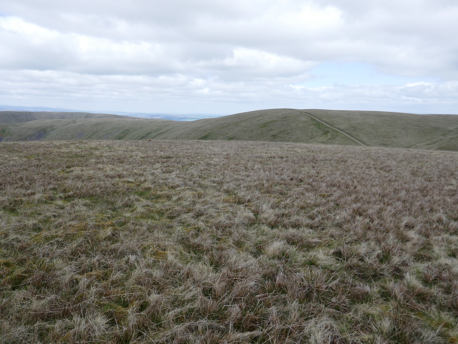
The Dales Way leading to Hazelgill Knott
Bush Howe
Langdale Knott
Hazelgill Knott
Once I had reached the next top along the ridge, Hazelgill Knott, I had a good view of Randygill Top across the valley. From my vantage point all the routes of ascent looked intimidatingly steep - Randygill Top rises some 300m from Bowderdale in a very short distance. I did, however, notice that Leath Gill provides a devious route around the rear of the fell and a gentler gradient. This would all be pathless - the joys of exploring access land.
The Calf forms the head of the valley
Randygill Top
Bowderdale
Randygill Top
Leath Gill is the small valley to the left of Randygill Top
Shortly after Hazelgill Knott, I followed a small stream down into the wilds of Bowderdale, pausing for a moment to eye up my route around the back of Randygill Top. A direct ascent from the valley is certainly possible but looks steep and imposing with no path to speak of. I worked my way around to Leath Gill and began following the small, cascading stream.
Yarlside
Bowderdale
Leath Gill
Leath Gill
Leath Gill
Leath Gill
I found this a straightforward route of ascent with no significant obstacles - surely a better way than tackling the slopes directly. Leath Gill ends at a narrow col - Leathgill Bridge. Another short climb is then required to reach the summit of Randygill Top.
Green Bell from Leathgill Bridge
By the time I left the summit, the weather was starting to look a little threatening, especially over the distance Pennines. An easy slope leads down to a gradual ridge which rises to the minor top of Kensgriff. Views over towards Wildboar Fell and Swarth Fell were interesting from this small top, especially with the constantly shifting clouds. Beyond Kensgriff rises Yarlside and one final steep climb.
Showers brewing in the distance
West Grain and Green Bell
Randygill Top
The steep slopes of Yarlside - a faint path can just be seen
The cairn on Kensgriff
The depression of Saddle separates the two hills with some worn 'steps' leading to the base of the Yarlside's slope. Viewed from Kensgriff the slopes look nearly vertical but the climb is manageable. Just.
Looking across the Saddle to Yarlside
Yarlside from the Saddle
Adamthwaite and Wandale Hill
A few more eroded steps begin the climb but peter out after a short distance. It appeared to me that a thin ribbon of scree offers a swift way down the slope but climbing it looked like an unnecessary challenge. Instead, I just weaved my way up alongside it, eventually reaching the broad slopes below the summit.
The interesting panorama from the slopes of Yarlside
A true reflection of the steepness of the slope
Adamthwaite and Wandale Hill
Randygill Top
Kensgriff and the Saddle
Wandale Hill once again
Showers shroud the Pennines
Rain briefly threatened as I made my way across the top of the fell to the summit which has an extensive view across Cautley Spout, Cautley Crag and the higher Howgills of Bram Rigg Top and The Calf. As luck would have it, none of the threatening showers seemed intent on heading in my direction.
The cairn atop Yarlside
Showers approaching
The Calf
Cautley Crag
The great grass ridge of Ben End leads in a southeasterly direction from the summit towards the Cross Keys and the car. After an initial steep section (this is the Howgills after all!) the gradient eases as the ridge meets the River Rawthey. Across the bridge once again and I was back at the car, having successfully negotiated the highest of the Howgill Fells.
A distant Whernside and Ingleborough
Cautley Crag
The Rawthey valley
Great Dummacks
The Rawthey valley

No comments :

Post a Comment