Showing posts with label tramp. Show all posts

Thursday, 23 March 2023

Mount John Summit Walkway

Mount John 23-03-2023

This map was created using GPS Visualizer's do-it-yourself geographic utilities.

Please wait while the map data loads...


Route: Tekapo, Tekapo Springs, Mount John, Tekapo Mt John Walkway, Tekapo

Date: 23/03/2023
From: Tekapo

Parking: Tekapo Springs
Start Point: Tekapo Springs
Finish Point: Tekapo Springs
Region: Lake Tekapo

Route length: 8.5 km
Time taken: 02:00
Average speed: 4.9 km/h 
Ascent: 376m
Descent: 385m

Points of Interest: Mount John, Lake Tekapo

Mount John can be found at Tekapo in the Mackenzie area on New Zealand's South Island. Tekapo village is probably most famous for the dazzling blue lake, but it is also home to some of the best star gazing in the world thanks to its relative remoteness to light pollution. It is located within the Aoraki Mackenzie International Dark Sky Reserve, which is the largest dark sky reserve in the world. There are plenty of accommodation options in Tekapo if you're looking to use it as a base for a few days.
The Church of the Good Shepherd is a popular spot in Tekapo village 
So good are the dark skies that Mount John is home to the University of Canterbury's astronomy site, home to six telescopes including the largest in the country — more on those later.

The hike to the summit of Mount John forms part of a pleasant 8 km circuit that starts and ends in the village, visiting the summit of the hill and then returning along the shore of the lake. It is a perfect hike for the morning or late afternoon, as was my case.

The track begins at Tekapo Springs, where it climbs around the back of the spa complex until it enters the wooded hillside of Mount John. Here it winds its way uphill through the trees on a well-defined track, emerging on the tussock-covered hillside below the summit. This is easily the most challenging part of the hike, simply because it gains 150m in a short space of time.
Mount Edward (1,916m)
Tekapo village
The path from Tekapo Springs climbs the steep side of Mount John
Mount John
The observatory occupies the summit and is closed after 5pm to allow the safe operation of the telescopes. This doesn't prevent you from seeing any of the views, however. If you can't manage the hike or don't have the time, you can drive to the observatory by paying a modest fee to use the road. The Astro Café awaits you at the summit, where you can enjoy a coffee while marvelling at the views.
Views over the Mackenzie Basin
Lake Tekapo
The Mount John Observatory
On the subject of the summit — the University of Canterbury owns the observatory atop Mount John, which is home to the 1.8m MOA telescope, the largest optical telescope in New Zealand. They operate tours through the Dark Sky Project, and we were lucky enough to spend some time at the observatory on a crystal-clear night that coincided with a strong Aurora Australis or, Southern Lights. The results were spectacular.
A strong Aurora Australis was on show when we visited the observatory
The Milky Way over Tekapo
The Astro Café atop Mount John
Geologically (or glacialogically), Mount John is a roche moutonnée on a vast scale. These rock formations are created by the passage of glacial ice over underlying bedrock resulting in asymmetrical erosion as the ice is slowed on the upstream face of the rock and then accelerates over the downstream side.

The entire landscape of the MacKenzie region was shaped by the most recent Ice Age with glacial flooding creating the flat terrain in the Mackenzie Basin. Situated at an altitude exceeding 600 meters and located in the rain shadow of the mountains, the dry, and cold region surrounding Lake Tekapo experiences a climate similar to that of Siberia. It has extremely hot summers and freezing winters, with little rainfall. These factors contribute to the arid nature of the area.

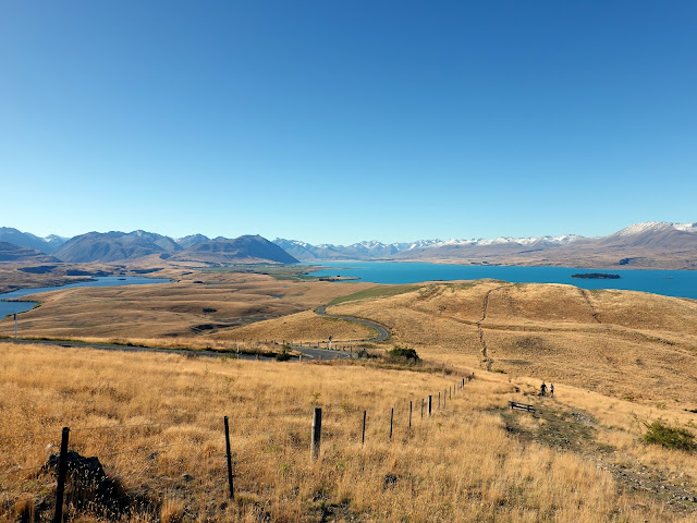
The best view of the Mackenzie Basin is from the top of the track after it emerges from the woodland.
The view from the trail over the Mackenzie Basin
The Mackenzie Basin
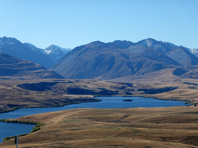
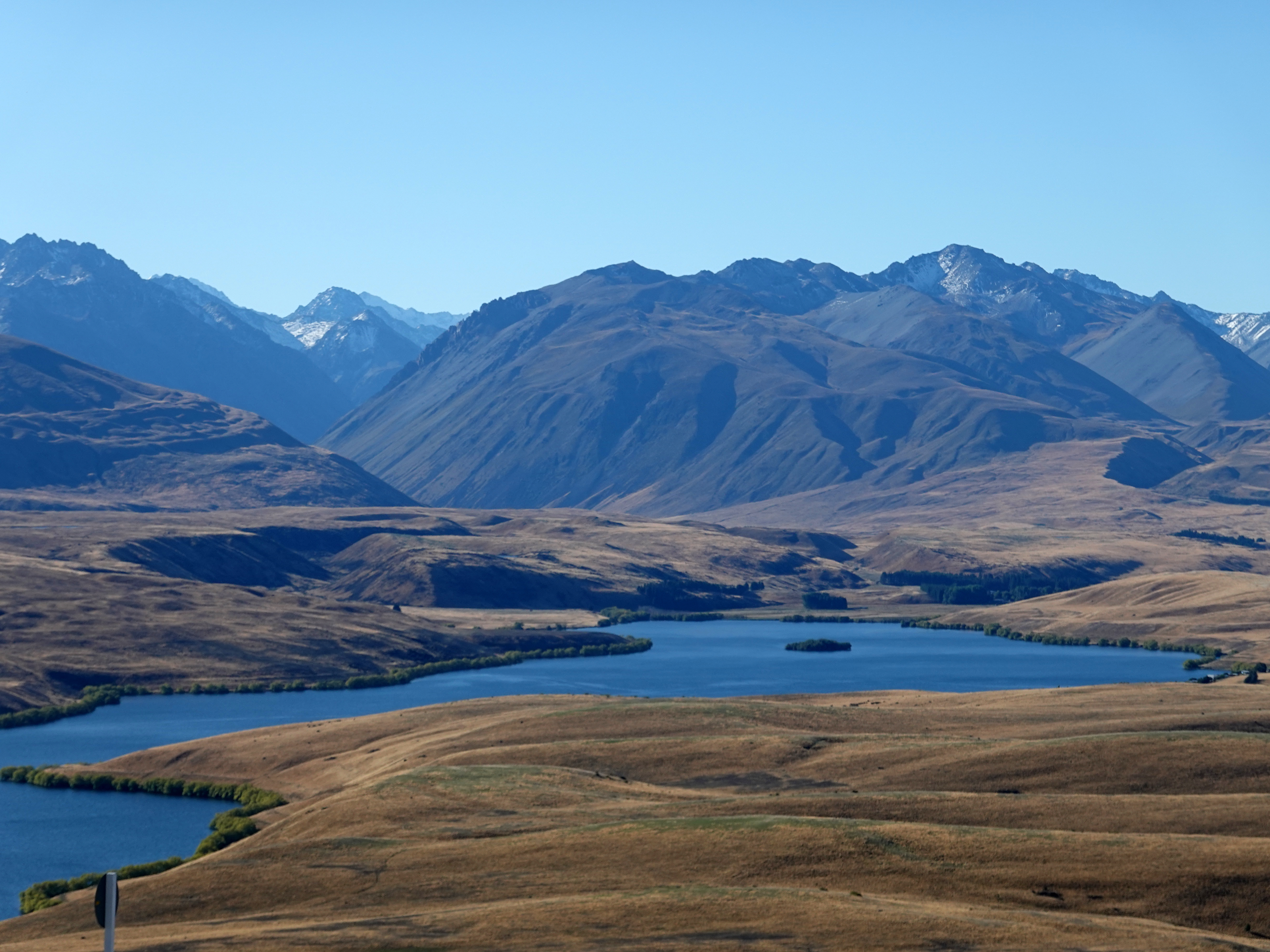
The trail continues along the spine of Mount John, heading north down a fairly gentle slope. The views to the north are spectacular, encompassing Lake Tekapo, Lake Alexandrina, the Gamack and Hall Ranges and part of the Southern Alps.
Clouds spill through Tekapo Saddle
Mount Ardmore (1,989m)
Lake Tekapo and the Southern Alps
Lake Alexandrina
Descending from Mount John
At the north end of Mount John, the path turns through 180 as it descends towards the lake and begins its route back towards Tekapo Springs. Here, you'll get the best of the views of Lake Tekapo.
Looking north across Lake Tekapo
Motuariki Island and the Two Thumb Range
The pleasing lines of the Sibbald Range, crowned by Mount Sibbald (2,811m)
Descend off the north side of Mount John
Motuariki Island and Mount Ardmore (1,989m)
Tekapo village
Lake Tekapo is one of three lakes that run roughly parallel along the northern edge of the Mackenzie Basin, the other two being Lake Pukaki and Lake Ohau. The lake is fed by water from the Southern Alps, specifically meltwater from the Grey Glacier, Classen Glacier and Godley Glacier (among other, smaller ones). The glacial silt carried in the water gives Lake Tekapo its distinctive colour.
Lake Tekapo
The route back to the village follows the shoreline of the lake along the eastern side of Mount John. This section is fairly flat, all the way back to Tekapo Springs.
Lake Tekapo
Clouds spill through Tekapo Saddle
Lake Tekapo
Tekapo village
Lake Tekapo in Tekapo village
The scenery around Mount John makes a climb to the summit well worth the effort. In addition, the summit of Mount John, with its observatory and state-of-the-art telescopes, offers a unique opportunity to explore the depths of the universe and witness the brilliance of the stars above. It seems Tekapo is fast trying to position itself as a main tourist destination on South Island, and I can see why. The scenery, both during the day and the night, is truly stunning.

Saturday, 4 March 2023

Wai-o-tapu - Rotorua Geothermal Reserve

Wai-o-tapu 04-03-2023

This map was created using GPS Visualizer's do-it-yourself geographic utilities.

Please wait while the map data loads...

Route: Waiotapu Loop Road, Weather Pool, Devil's Home, Rainbow Crater, Devil's Ink Pots, Artist's Palette, Champagne Pool, Primrose Terrace, Panoramic View, Bridal Veil Falls, Lake Ngakoro, Osyer Pool, Frying Pan Flat, Alum Cliffs, Sinter Terrace, Champagne Pool, Devil's Bath

Date: 02/03/2023
From: Waiotapu Loop Road


Parking: Wai-o-Tapu Car Park
Start Point: Geyser Cafe
Finish Point: Geyser Cafe
Region: Rotorua

Route length: 1.5km
Time taken: 00:40
Average speed: 4.9km/h
Ascent: 67m
Descent: 71m

Points of Interest: Artist's Palette, Champagne Pool, Lake Ngakoro, 
Roto Kārikitea

Wai-o-tapu is a must-visit if you find yourself in or around Rotorua on New Zealand's North Island (Te Ika-a-Māui). The small reserve is home to some dramatic geothermal features that truly defy belief. While it is a paid tourist attraction, the area can only be accessed on foot and makes for an interesting couple of hours.

The entire area is an extremely active geothermal area at the southern end of the Okataina Volcanic Centre, in New Zealand's Taupō Volcanic Zone. Hot springs and geysers are dotted across the North Island but none are as impressive as those found in Wai-o-tapu. 

The name Wai-o-tapu (or waiotapu) is Māori for sacred waters and has been a protected reserve since the 1930s. The site is currently owned by a local Māori tribal business and has been since 2012. As a result, all the features have dropped their European names in favour of the local Māori name. I've tried to represent both here.

There are three marked, intertwined trails and if you complete all three (visiting every feature) it should take you around 90 minutes - perfect if you are short on time. From the visitor centre, the first loop begins in a clockwise direction crossing Waiotapu Stream on a bridge, where you'll see your first steaming hot spring. 
Entrance to the reserve
Waiotapu Stream
Waiotapu Stream
The spring is followed by four craters (Māhanga Rua, Te Rua Uenuku, Te Rui Whaitiri and Ipu). In total, there are around twenty craters at Wai-o-tapu that are typically up to 20 metres deep. They are formed by acidic steam rising up from beneath the earth’s surface that erodes the rock causing it to collapse.
The first of the craters - Māhanga Rua (also the Devil's Home)
Inside Te Rua Uenuku - the Rainbow Crater
The craters are tinged a variety of colours by the minerals in the steam that oxidise as they come into contact with the earth’s atmosphere creating hues of brown, purple, red, orange and yellow. At the base some are dry, others contain boiling mud, water and even oil.
Mud pools in Te Rua Whaitiri - Thunder Crater
Te Rua Whatiri - Thunder Crater
Ipu or, the Devil's Inkpot
After the first set of craters is the Artist's Palette, the first of the brightly coloured features that make Wai-o-tapu so special. The huge cauldron is a mixture of colours from green and yellow to turquoise and black. These are all naturally formed by the mix of mineral deposits; namely sulphur (yellow), iron oxide (red/brown), silica (white) and black (carbon). You'll notice the waters of the Artist's Palette spill from the neighbouring Champagne Pool.
The Artist's Palette
The edge of the Champagne Pool
Foreground Pool within the Artist's Palette
There is a wooden boardwalk that links the Artist's Palette to the Champagne Pool, passing the top of the Sinter Terraces on the way (these are better seen later. At the end of the boardwalk is the Champagne Pool which gets its name from the carbon dioxide bubbles that form in the waters, not unlike a champagne glass. It is the largest spring in the geothermal Rotorua region, measuring 65m in diameter and 60m deep. Thanks to its sensational colours, it is the most photographed spot at Wai-o-tapu.
Crossing the boardwalk
The Champagne Pool
It was formed some 700 years ago during a hydrothermal eruption, leaving a crater full of water at 74°C. The dramatic colour in the outer ring comes from orpiment, an arsenic and sulphite mineral with a deep orange-yellow colour.
The Champagne Pool
Champagne Pool sits at the top of the first loop so you could head back to the car park from here if you were short of time. Otherwise, continue on and start the second loop. There is a brief climb that takes you along a ridge that passes a couple of viewpoints overlooking the Sinter Terrace and thermal lake Papa Wera.
The Sinter Terrace
Overlooking thermal lake Papa Wera
Papa Wera and Lake Ngakoro
Papa Wera and the Alum Cliffs crater
Some steps take you down to the boardwalk that marks the beginning of the third loop. This section has by far the most steps. First, the loops take you past some sulphur mounds to a junction that has two arms - one leads to Lake Ngakoro and back, the other into Papa Wera (Hot Flat). We opted for Lake Ngakoro first.
The bottom of Te Rere Ārai Mārena (Bridal Veil Falls)
Lake Ngakoro is at the far end of the trail. It’s a stunning jade green colour due to the elevated temperature that provides the perfect environment for an algal bloom. There is even a small, steaming waterfall flowing into it - Puna o Ngakoro.
Lake Ngakoro
Lake Ngakoro
Lake Ngakoro
Lake Ngakoro
Puna o Ngakoro
Lake Ngakoro
Puna o Ngakoro and Lake Ngakoro
We backtracked from the lake to Papa Wera then followed the other part of the third loop past Rua Whānāriki (the sulphur cave) and Te Puna Tio (Oyster Pool). The path leads to the Alum Cliffs and Papa Wera - the thermal lake we had viewed from the lookout. Part of the third loop track was closed during our visit (the link from Alum Cliffs to Te Rere Arai Marena) so we took the long way back to reach the same point.
Rua Whānāriki - the sulphur cave
Te Puna Tio - the Oyster Pool
The Alum Cliffs and crater lake
Papa Wera (Hot Flat or Frying Pan Flat)
No touching!
The closed section of the third loop
An erupting geyser
Te Rere Arai Marena is located at the bottom of the Sinter Terrace, where the rock ends and the stream begins. A sinter terrace is formed when water from hot springs overflows and cools, leaving fine sinter sediments behind. The sinter is made of very fine-grained silica and takes the form of flat, layered terraces. There were some famous Pink and White Terraces (Te Otukapuarangi) in the past but these were destroyed in 1886 when the nearby Mount Tarawera erupted. The path leads alongside the Sinter Terrace back to the Champagne Pool.
The fine layers of Sinter Terrace
Sinter Terrace
Champagne Pool
Champagne Pool
Champagne Pool
Champagne Pool panorama
We lingered at the Champagne Pool for a while as the sun emerged from behind the clouds before moving on, completing the circuit back to the visitor centre. The path passes the dark maw of Rua Pūmahu (Inferno Crater), home to a boiling mud pool that was recorded and used as a sound effect in the Lord of the Rings trilogy.
The Artist's Palette boardwalk
The Artist's Palette
Rua Pūmahu - the Inferno Cave
From Rua Pūmahu the path passes Rua Ōwhanga (Birds Nest Cave). The large crater has been put to good use by nature. Swallows, starlings and mynahs have built their nests on the crater wall and the heat that rises up helps to incubate the eggs. The large mountain you can see in the background of the image below is the volcano Maungakakaramea,  also known as Rainbow Mountain.
Rua Ōwhanga
Small nests dot the walls of Rua Ōwhanga
The final highlight is the spectacular Roto Kārikitea (the Devil's Bath or Green Light Lake). The bright green pond really has to be seen to be believed and, despite its appearance, it's entirely natural. The bright green water gets its colour from deposits of sulphur that rise to the surface and float on top.
Roto Kārikitea - the Devil's Bath
Roto Kārikitea - notice the change in colour as soon as the sun went behind a cloud
While there are many sites listed on the map, each loop is well worth doing. Despite the Champagne Pool, Artist's Palette and Roto Kārikitea being located close together, a trip to the far end to see Lake Ngakoro and its waterfall are highlights not to miss. If you have the time and are able to walk the distance, it is all well worth seeing.