Hunting for the ultimate gorge views and canyon lookouts in New South Wales? Tucked away just two hours from Sydney, Bungonia National Park is a geological goldmine, boasting dramatic limestone landforms you won't find anywhere else in the country. By stitching together the Yellow, Green, and White Tracks into a challenging 14.5 km circuit, this high-reward loop serves up a non-stop highlight reel along the rim of the spectacular Bungonia Gorge. From peering down the slot canyon at Jerrara Lookout and standing on the cantilevered platforms of Adams Lookout and Bungonia Lookdown, to venturing inside the historic Mass Cave and catching sweeping vistas over the Shoalhaven River at Mount Ayre, this trail is easily one of the best day hikes in NSW.
This adventure is centred within Bungonia National Park, a small area (only fifteen square kilometres) tagged onto the side of the much larger Morton National Park. Bungonia protects part of the Shoalhaven River and the area's unique geology. Thanks to this, you'll find some landforms that exist nowhere else but this small part of Australia.
Hiking around the national park is straightforward thanks to a series of colour-coded trails, including the Green Track, Yellow Track, White Track, Orange Track and the infamous Red Track. Today, I'd be exploring a combination of the Yellow Track, Green Track and White Track, which form a spectacular loop above the gorges that make the area so special.
Most of the trails begin or can be accessed from a large, well-appointed campground that lies in the corner of the national park. In fact, it's one of my favourite campgrounds in the wider Sydney area. Clocking in at around 10 km, the Green Track alone is a fine hike; however, I had decided to include the Yellow Track and White Tracks to make the 2-hour drive from Sydney more rewarding.
 |
| The Bungonia Campground access road |
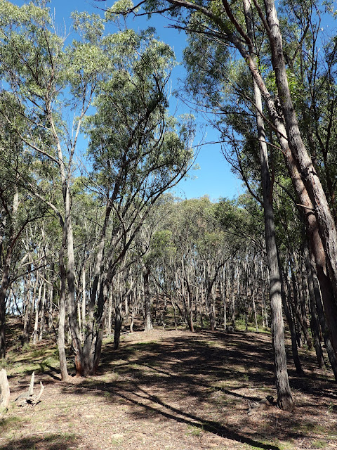
I made my way to Pump House Road, a small looped road on the edge of the campground. The Jerrara Creek Trail begins from the turning circle at the far end. The track is nice and wide as it heads down through the bush to Bungonia Creek, which you'll have to cross. The track turns back on itself and climbs to a broad ridge. At the high point of the ridge, the Jerrara Falls Trail leaves the Jerrara Creek Trail, heading north.
 |
| The beginning of the Jerrara Creek Trail |
 |
| Jerrara Creek Trail |
 |
| The languid Bungonia Creek |
 |
| The Jerrara Falls Trail, climbing away from Bungonia Creek |
There's another fork at the Paddys Castle Trail, where I continued along the Jerrara Falls Trail, heading towards the edge of the cliffs. While the hiking had been pleasant, there had not been any views of note up until this point. However, that all changes at the Jerrara Canyon Lookout.
 |
| Continuing the Jerrara Falls Trail |
 |
| Approaching the rim of the Bungonia Creek gorge |
 |
| A sneak peek of Bungonia Gorge |
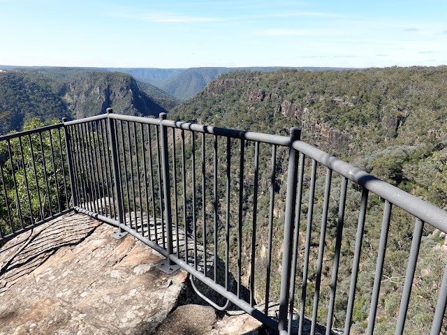
The fenced lookout can be found almost immediately after joining the Yellow Track from the Falls Trail. It peers down the slot canyon created by Jerrara Creek into the larger Bungonia Gorge and is quite spectacular, especially on a bright sunny day like today.
 |
| Jerrara Falls Lookout |
 |
| The top of Jerrara Falls |
 |
| The very top of Bungonia Gorge |
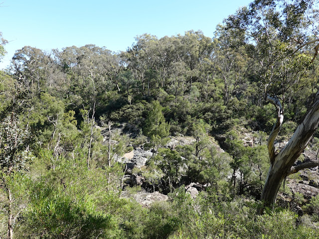
The Yellow Track leads back towards the Campground, following the rim of the deep valley containing Bungonia Creek. Along the route, there are several nice views into and along the valley, as the Yellow Track makes its way to Bungonia Creek a short distance downstream of the Jerrara Creek Trail. Again, it is necessary to cross the creek to continue the Yellow Track. |
| Views from the Yellow Track |
 |
| Looking along Bungonia Creek |
 |
| Bungonia Creek |
 |
| Bungonia Creek |
 |
| Crossing Bungonia Creek |
 |
| Looking across Bungonia Creek |
Climbing away from the creek, the Yellow Track meets the Green Track as it leaves the Campground (you can finish the hike here if you wish by turning right). The Green Track is full of highlights and is arguably the best way to see the national park. It's the only track that has a grandstand view of Bungonia Gorge.
The Green Track makes its way north, along the eastern side of Bungonia Creek (the opposite side of the valley to the Yellow Track). You'll pass a couple of informal lookouts on the edge of the cliffs before reaching Jerrara Lookout, which has a view directly towards Jerrara Falls.
 |
| The Green Track |
 |
| Paddys Castle (left) is a prominent feature above Bungonia Creek |
 |
| Jerrara Canyon |
 |
| Jerrara Falls |
 |
| Bungonia Creek |
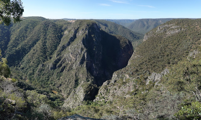
A short distance further along the Green Track, the parking area of Adams Lookout. You cannot miss this lookout, as it has the only view of Bungonia Gorge — the jewel in the national park's crown. An accessible path links the Green Track to the lookout, where a pair of large metal platforms jut out above the steep hillside. The view of the gorge is incredible.
 |
| The path to Adams Lookout |
 |
| Bungonia Gorge |
The 275m high Troy Walls are the result of Bungonia Creek forcing its way through a thick band of limestone, part of the area's unique geology. While the lookout has the best view of the gorge, the best way to experience it is to follow the Red Track, which descends into the gorge and offers a challenging but unforgettable day out. You can read more about it here.  |
| Bungonia Gorge |
 |
| The Troy Walls |
 |
| Adams Lookout |
Another feature of Bungonia National Park is its many caves — another result of the limestone geology. The majority can only be accessed with specialist skills and equipment, including Drum Cave, home to the biggest single-drop pitch on the Australian mainland. One cave that can be accessed by mere mortals is Mass Cave, located along the Green Track, halfway between Adams Lookout and Bungonia Lookdown.
 |
| Looking across to Paddys Castle |
 |
| The Green Track |
 |
| Mass Cave can be found by following this sign |
The small cave can be found following the signed path that leaves the Green Track. Once you find it, you can walk straight in through the metal gate, though you may need a torch to get to the main chamber. A metal chain is fixed to the wall to help you. As you may have guessed by the name, church services were held inside Mass Cave during the 1950s.
 |
| The entrance to Mass Cave |
 |
| A chain bolted to the wall will help you into Mass Cave |
 |
| Mass Cave |
After visiting the cave, the Green Track briefly meets the Red Track at the David Reid Car Park, where I recommend you visit Bungonia Lookdown. This is a spectacular cantilevered platform that juts out from the top of the Troy Walls, offering a view along the Shoalhaven River and down to the exit of Bungonia Gorge (unfortunately the gorge's famous boulders are not visible). It also has a clear view of the Marulan Limestone Mine located above the gorge, no doubt a blight on the landscape but one that has been important to many buildings in New South Wales.
 |
| The Red Track |
 |
| Mount Ayre |
 |
| Shoalhaven River Valley |
 |
| Marulan Limestone Mine |
 |
| Marulan Limestone Mine |
 |
| The mine sits prominently above the gorge but gives it some scale |
The Molly O'Neill Nature Walk provides a means to get back to the Green Track from the Lookdown. She was an amateur botanist who spent many hours exploring and researching what was Bungonia Reserve (now the National Park). The short track has interpretive signs that tell you about the plants native to the area.
Given the high quality of this hike so far, you'd be forgiven for thinking that was all there was to see, however, there is one final lookout that I had my sights set on (literally and figuratively). The Green Track leads to an intersection with the White Track, a short out-and-back beneath the summit of Mount Ayre to Mount Ayre Lookout.
 |
| Following the White Track |
 |
| The White Track runs beneath the top of Mount Ayre |
 |
| You can hike down to the Shoalhaven River from the lookout, but it's a steep route |
The quiet lookout has a fantastic view over the Shoalhaven River gorge below and the adjacent Morton National Park. There is a bench, but it has obviously seen better days, at least when I visited.
 |
| Mount Ayre Lookout |
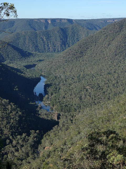 |
| Shoalhaven River |
After returning to the Green Track from the lookout, there is still a good stretch of hiking before reaching the campground again. While this last section is back in the bush, it passes several of Bungonia's larger caves, including Drum Cave, which I mentioned previously. Otherwise, it's an easy and pleasant route to follow.
 |
| Distant Morton National Park |
 |
| Returning from the Mount Ayre Lookout |
 |
| The Green Track |
 |
| Grass meadows in Bungonia National Park |
This is easily one of the best hikes I've done in a while and packs a lot into a relatively short length. If you have never heard of Bungonia National Park before, then I'd highly recommend checking it out. The Green Track is the perfect introduction to the area, while the Red Track explores the gorge more intimately. Combined, they may be two of the best hikes in NSW.


