Minnehaha Falls 06-11-2022
This map was created using GPS Visualizer's do-it-yourself geographic utilities.
Please wait while the map data loads...
Route: Minni Ha Ha Road, Minnehaha Track, Minnehaha Falls
Date: 06/11/2022
From: Minni Ha Ha Road
Parking: Minni Ha Ha Road
Start Point: Minni Ha Ha Road
Finish Point: Minni Ha Ha Road
Region: Blue Mountains - Minnehaha Falls Reserve
Route length: 2.6km
Time taken: 00:50
Average speed: 4.3km/h
Ascent: 108m
Descent: 102m
Points of Interest: Yosemite Creek, Minnehaha Falls
Minnehaha Falls is a little hidden gem, nestled away from prying eyes on the north side of Katoomba. If it had a convenient car park and lookout, it would be one of the most popular waterfalls in the national park, but access to the falls is strictly by foot. However, the hike to the falls is not far and, being located in a local reserve, is dog-friendly too.
The hike starts from a small parking area on the fringe of the Minnehaha Falls Reserve, located at the end of Minni Ha Ha Road - note the difference in spelling. Its name has evolved over the years, all being a variation on Minnehaha (Minnie-ha-ha for example). The translation is supposedly Native American, from the Dakota language, simply meaning 'waterfall'.
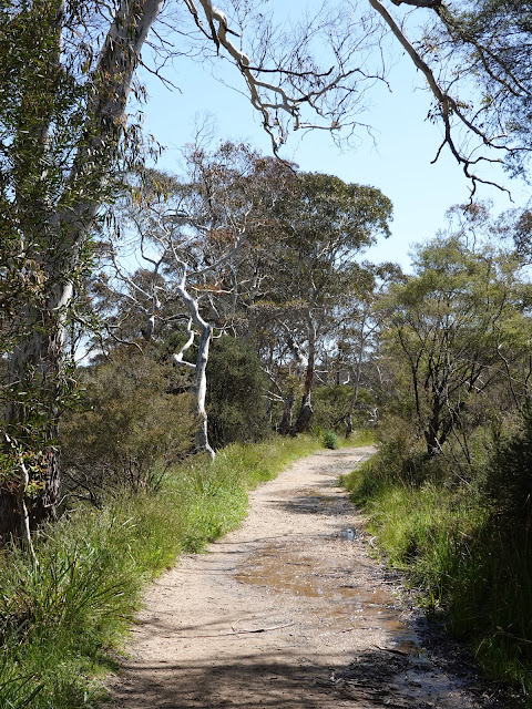 |
| The track as it leaves the parking area |
The reason behind the North American naming is likely because the area around the waterfall was owned by an American company in the 1890s when the track was built. It reminded them of Yosemite National Park, so the creek that feeds Minnehaha Falls was named Yosemite Creek.
 |
| Yosemite Creek |
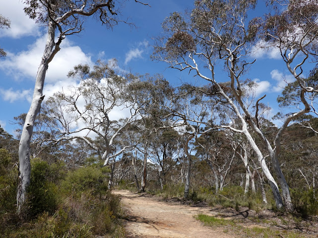
The first official track to the waterfall was established at the beginning of the 20th century. It was constructed by a contractor named John Cliff, who also constructed the historic Rodriguez Pass near Blackheath. The main waterfall track crosses Yosemite Creek and follows it for a few hundred metres while, along the way, a couple of side tracks will take you to the waters of Yosemite Creek itself
 |
| Yosemite Creek |
 |
| A small cascade on Yosemite Creek |
 |
| The Minnehaha Track |
The track is quite eroded at the moment and some areas remain quite wet so you may want to consider some waterproof shoes if you hike this route in the near future. Around halfway along the track, the creek starts to dive towards the waterfall with the track remaining high up on the valley slopes. This ultimately leads to a superb location where you'll see the full height of the Minnehaha waterfall and the surrounding valley.
 |
| Minnehaha Falls |
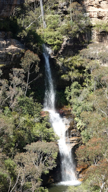 |
| Minnehaha Falls |
From the lookout the path descends very steeply to Yosemite Creek, using a set of metal steps in places. Once at the creek, the path backtracks a short distance to the plunge pool at the base of the waterfall. It is one of the best swimming spots in the Blue Mountains, being accessible and relatively safe.
 |
| The steep section down to the waterfall |
 |
| Heading back along the track to the base of the falls |
 |
| Minnehaha Falls |
 |
| Minnehaha Falls |
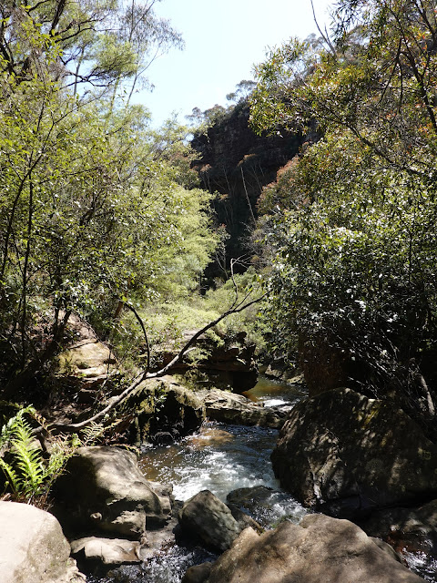 |
| Yosemite Creek |
After spending a few minutes clambering around the rocks at the base of the falls I decided it was time to make tracks back to the car and explore some more of the shorter, scenic hikes the Blue Mountains has to offer. The return route to the car park simply requires backtracking along the path via the metal steps.
 |
| Returning to the steps |
 |
| Minnehaha Falls |
 |
| The track back to the car park |


No comments :
Post a Comment