Wentworth Falls & Lincoln's Rock 17-10-2021
This map was created using GPS Visualizer's do-it-yourself geographic utilities.
Please wait while the map data loads...
Route: Wentworth Falls Picnic Area, Wentworth Falls Lookout, Wentworth Falls Track, Fletchers Lookout, Undercliff Track, Princes Rock Lookout, Undercliff Track, Den Fenella, Overcliff Track, Empress Lookout, Empress Falls, Sylvia Falls, Edith Falls, Wentworth Pass, Lower Wentworth Falls, Slacks Stairs, National Pass, Upper Wentworth Falls, Rocket Point, Kedumba Walls, Little Switzerland Drive, Lincolns Rock, Chester Trail, Rocket Point, Queens Cascades, Wentworth Falls Track
Date: 17/10/2021
From: Wentworth Falls
Parking: Wentworth Falls Picnic Area
Start Point: Jamisons Lookout
Finish Point: Wentworth Falls Picnic Area
Region: Blue Mountains
Route length: 11.8km
Time taken: 03:15
Average speed: 3.6km/h
Ascent: 636m
Descent: 635m
Points of Interest: Den Fenella, Valley of the Waters, National Pass, Lincoln's Rock
After 107 days of lockdown, residents of Sydney are finally allowed to travel further than 5km from home. For me, that meant I could get back to hiking in the Blue Mountains after a four-month hiatus.
I decided to visit an area I am very familiar with, Wentworth Falls, home to majestic waterfalls and the dramatic National Pass. Routes around these parts are typically short affairs, concentrating on the passes, so my intent was to make this a longer outing, worthy of being my first Blue Mountains trip outside of lockdown.
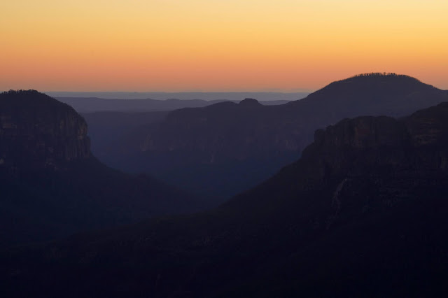
For me, the day started bright and early to catch the sunrise from the lookout at Govett's Leap, located close to the village of Blackheath, having been camped in Katoomba the night before. With sunrise at 6am, I was ready at the lookout, camera in hand around 5.30am. Below are a few photos of the dawn breaking over the Grose Valley.
 |
| First light |
 |
| Looking along the Grose Valley |
 |
| Lockley Pylon and Mount Hay |
 |
| The walls of Govetts Leap |
 |
| Sun shines into the Grose Valley |
 |
| The Grose Valley |
Having captured the sunrise, I drove back towards Wentworth Falls, making it to the parking area by 7am, after stopping to grab an early morning coffee from Leura. Being early, there were plenty of car parking spaces, but the car park does fill up when the park gets busy so you may find yourself parked on the road leading in.
My previous efforts in this area have all been clockwise routes, tackling National Pass first and in descent. Today, I'd save National Pass for later by first heading west, along the cliffs.
I say west, after saddling up, the track initially heads east, along the rim of the cliffs at the edge of the car park to Wentworth Falls Lookout where you'll get your first view of the top of Wentworth Falls. Being early in the morning meant it was nice and quiet along the usually busy tracks, I'm sure this would change as the day wore on, given that it was the first weekend out of lockdown and the weather was nothing short of perfect.
 |
| Early morning views towards Mount Solitary |
 |
| Mount Solitary |
 |
| Kings Tableland/Kedumba Walls and the Jamison Valley |
I descended the Wentworth Falls Track to Fletchers Lookout which has a view of the upper falls and the Jamison Valley before I joined the Undercliff Track to begin my journey west.
 |
| Descending the Wentworth Falls Track |
 |
| The top of Wentworth Falls from Fletchers Lookout |
 |
| Wentworth Falls (the very upper part at least) |
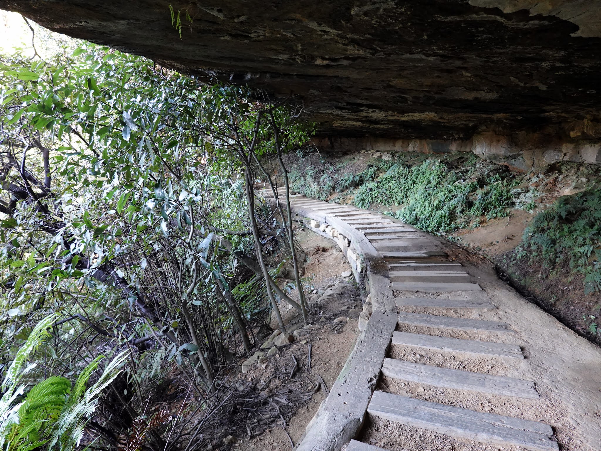
The Undercliff Track is exactly that, a track that has largely been built beneath a large overhang beneath the upper cliffs. It has benefitted from some recent maintenance that has replaced the rotting timber boards with larger sandstone blocks.
 |
| The Undercliff Track |
 |
| Undercliff Track |
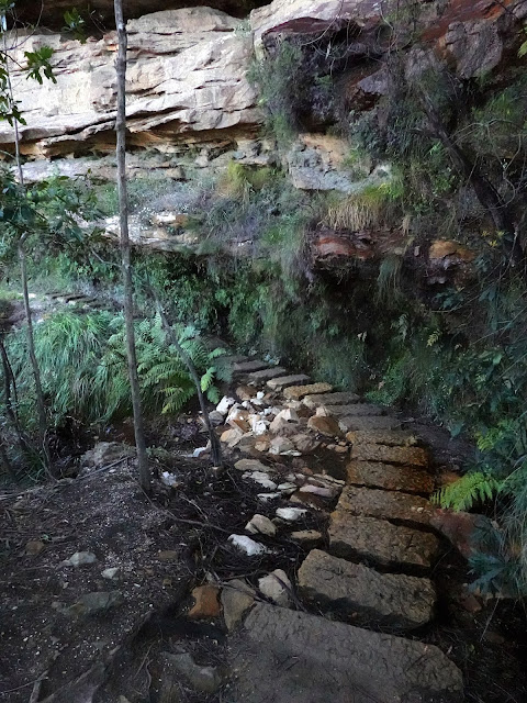 |
| One of the newly renovated sections of the Undercliff Track |
 |
| Undercliff Track |
Partway along the Undercliff Track is the opportunity to backtrack slightly to Princes Rock Lookout where there is one of the best, full-height views of Wentworth Falls. You'll find that the falls are in the shade during the morning, so this lookout is best saved for the afternoon.
 |
| Looking across to Wentworth Falls from Princes Rock |
 |
| The view from Princes Rock Lookout |
 |
| Wentworth Falls |
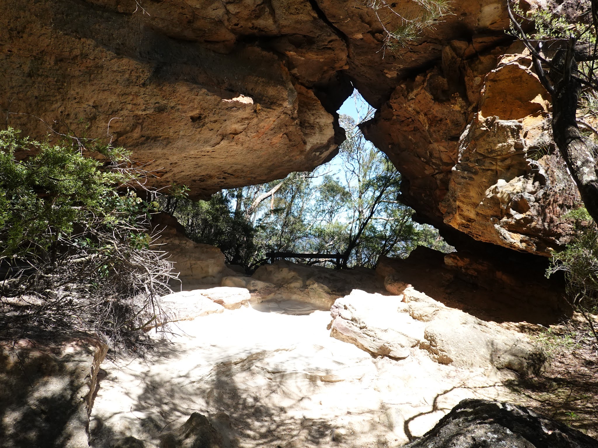
The Undercliff Track continues until it reaches Den Fenella, a narrow incision where Den Fenella Creek disappears into the cliffs. You can follow a track into the charming grotto which provides ample opportunity to test out your photographic skills on the tumbling waters. You can continue down the gorge to the lookout, however, the view is much the same as you get from the Overcliff Track which is where I was heading next.
 |
| Sublime Point |
 |
| Undercliff Track |
 |
| Den Fenella |
 |
| Den Fenella |
 |
| Den Fenella Creek |
 |
| Den Fenella |
Due to the geological quirk of the Den Fenella gorge, the Undercliff Track becomes the Overcliff Track (now perched atop the cliffs rather than below, but without any significant climbing). The Overcliff Track makes its way westwards along the cliffs to Empress Lookout and the start of the Valley of the Waters.
 |
| Breakfast Point Lookout |
 |
| Moya Point and Sublime Point |
 |
| Overcliff Track |
 |
| Overcliff Track |
 |
| The Overcliff Track |
 |
| Looking along the Valley of the Waters |
 |
| Empress Falls (in the shadows) from Empress Lookout |
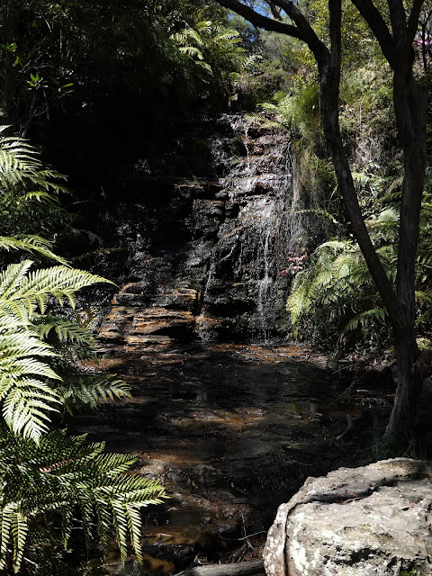
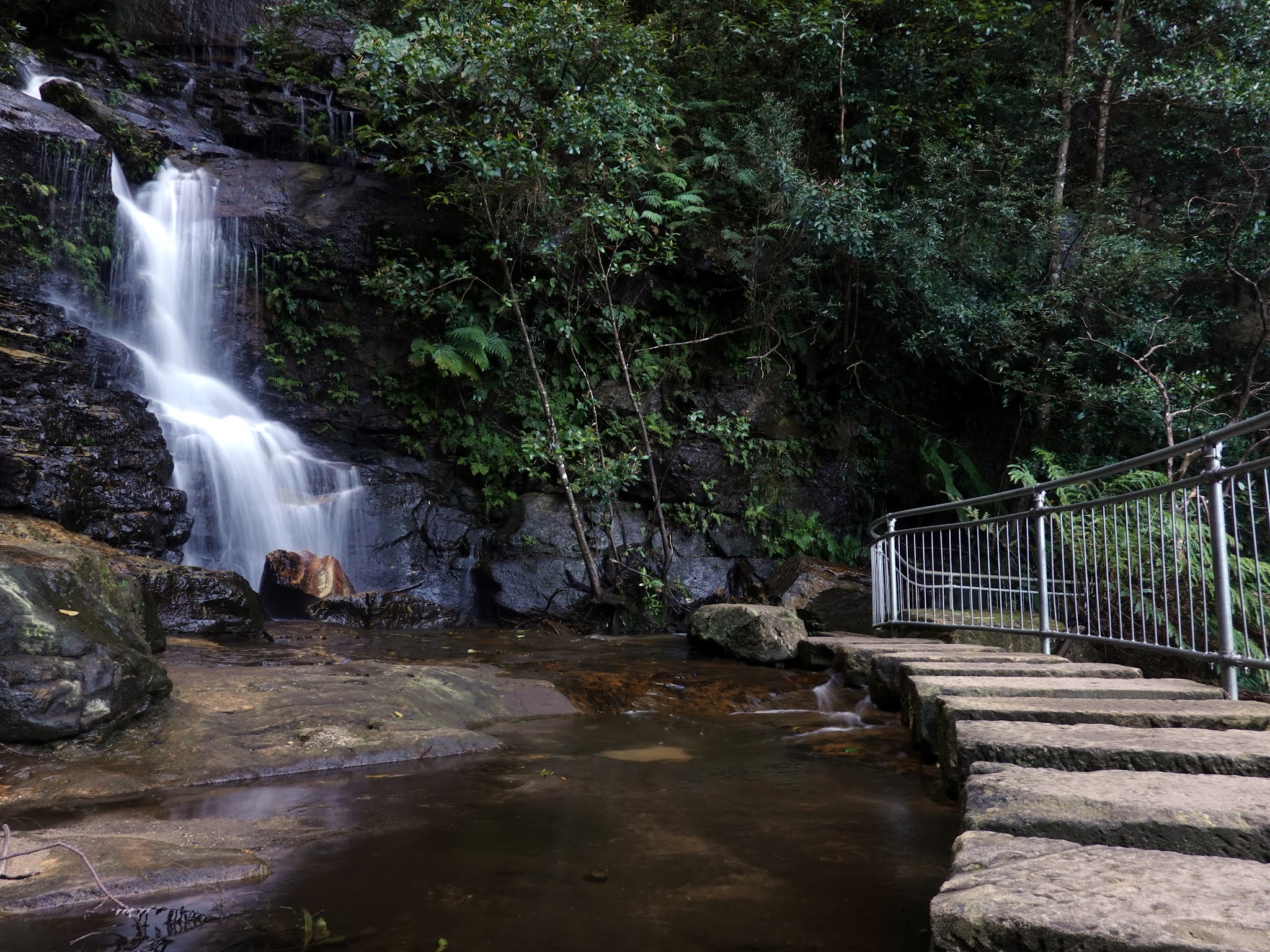
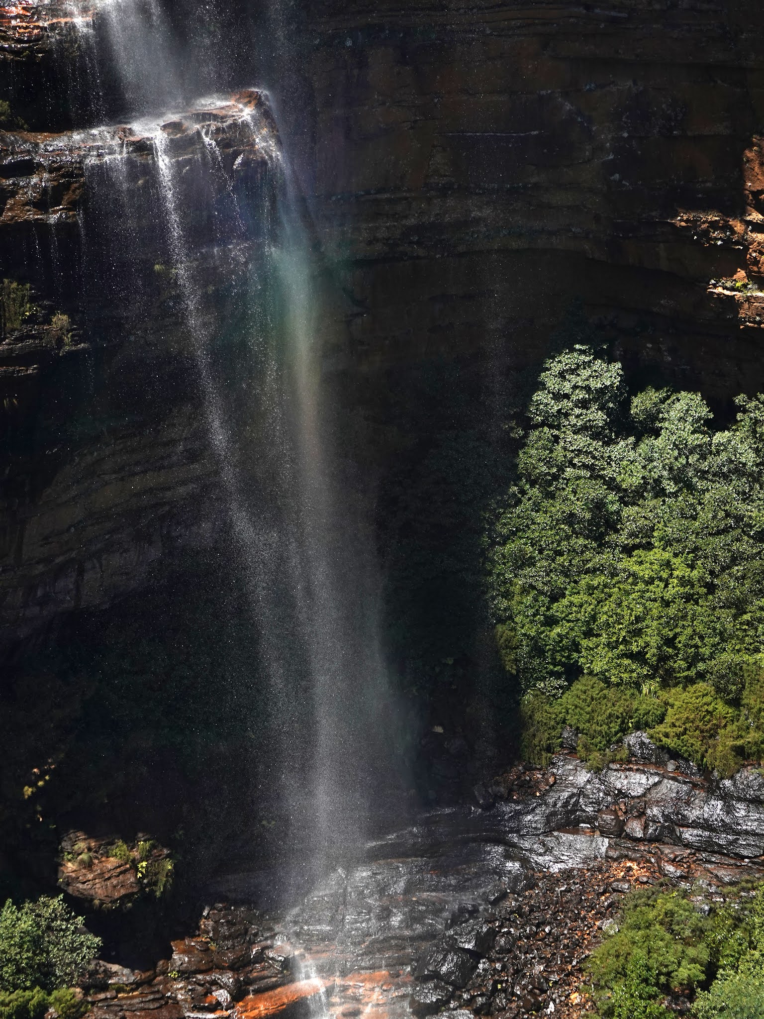
Valley of the Waters is one of the highlights of the Blue Mountains. The path follows Isobel Creek as it takes a tumbling route down several waterfalls on its way to Jamison Creek. The first section of the track descends a steep set of steps and ladders until it reaches the bottom of Empress Falls - the tallest waterfall along the valley. (Empress Falls is a popular place for abseiling, something we did a few years ago and would highly recommend).
 |
| Starting the climb down to the Valley of the Waters |
 |
| Valley of the Waters Track |
 |
| Isobel Creek |
 |
| Empress Falls plunge pool |
 |
| Below Empress Falls |
 |
| Empress Falls |
The track crosses beneath Empress Falls and then down a twisting set of steps to Sylvia Falls, one of the most spectacular in the Blue Mountains. The track passes the lower cascade of Sylvia Falls over a set of sandstone stepping stones before dropping down alongside Edith Falls and Lodore Falls to the junction with the National Pass. Sadly, the majority of the National Pass is currently closed, most likely indefinitely, after a national park worker was killed by a rockfall in 2017.
 |
| The creek below Empress Falls |
 |
| The twisting Valley of the Waters Track |
 |
| Sylvia Falls |
 |
| Sylvia Falls |
 |
| The Valley of the Waters |
 |
| Crossing below Sylvia Falls |
 |
| The lower cascade of Sylvia Falls |
 |
| Peering over the edge of another one of the waterfalls |
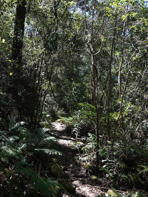
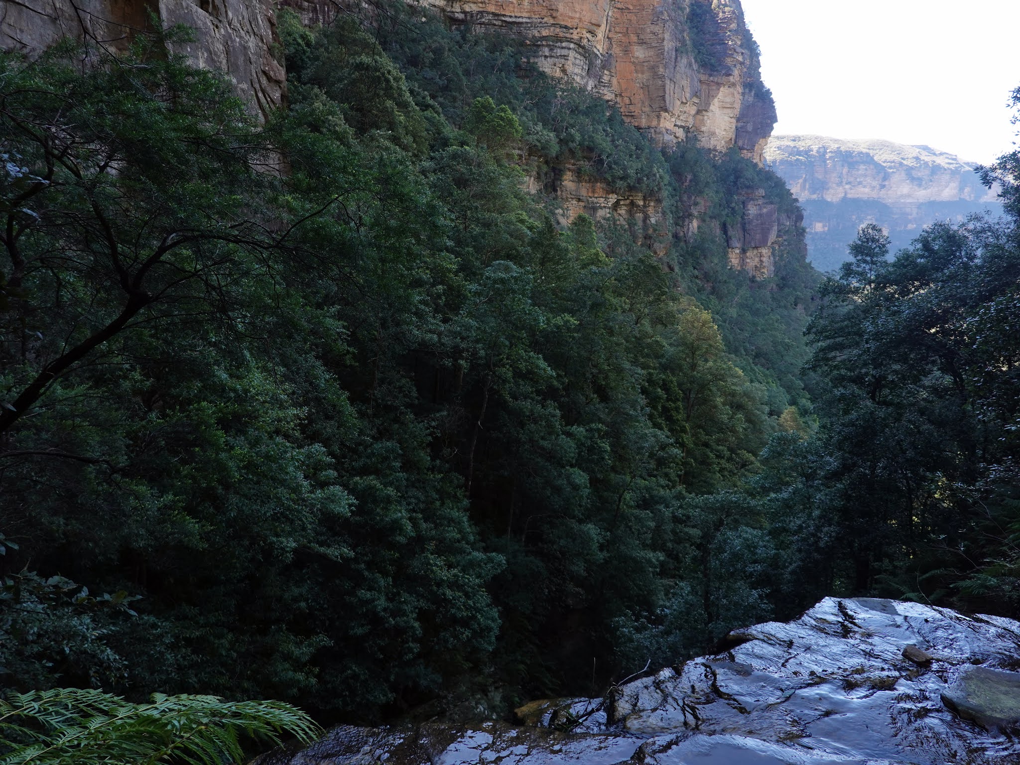
The Valley of the Waters track crosses the creek below Lodore Falls and descends further into the depths of the National Park. Eventually, I reached another track junction, this time with Wentworth Pass. The pass links Valley of the Waters to Wentworth Falls and follows the cliff line through the bush.
 |
| Flat Rock Falls |
 |
| Valley of the Waters Creek hidden among the boulders |
 |
| The Wentworth Pass track junction |
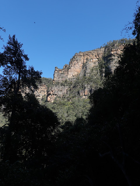 |
| A view of the cliffs through a gap in the trees |
 |
| Wentworth Pass |
 |
| Wentworth Pass |
The total length of Wentworth Pass is around 5km, so should take most people around an hour to traverse the full length. The only minor challenge to navigating the track, is located around halfway along. There is a large rock shelf on the track that seems to send you uphill whereas the track drops off the rock to the left. Eventually, Wentworth Pass reaches the base of Wentworth Falls. |
| Lower Wentworth Falls |
 |
| The lower falls and the plunge pool |
 |
| The Kedumba Walls |
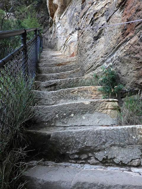
The path turns away from the falls and makes its way uphill to the foot of Slacks Stairs - a short, exciting route up the cliffs that utilises a series of metal ladders and steps.
They are named after Isaac Platt Slack, who was a trustee of the Wentworth Falls Group of Blue Mountains Sights Reserve. He pushed for the addition of the missing link between National Pass and Wentworth Pass in the early part of the Century. The original wooden stairs were constructed in 1932, however, they were substantially damaged in a bush fire in 1957 and were eventually replaced with metal ones in 1988.
 |
| Slacks Stairs |
 |
| Slacks Stairs |
 |
| The perilous location of Slacks Stairs |
 |
| Approaching the top of Slacks Stairs where it squeezes between a cleft in the rocks |
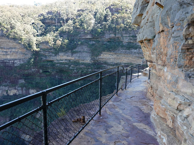
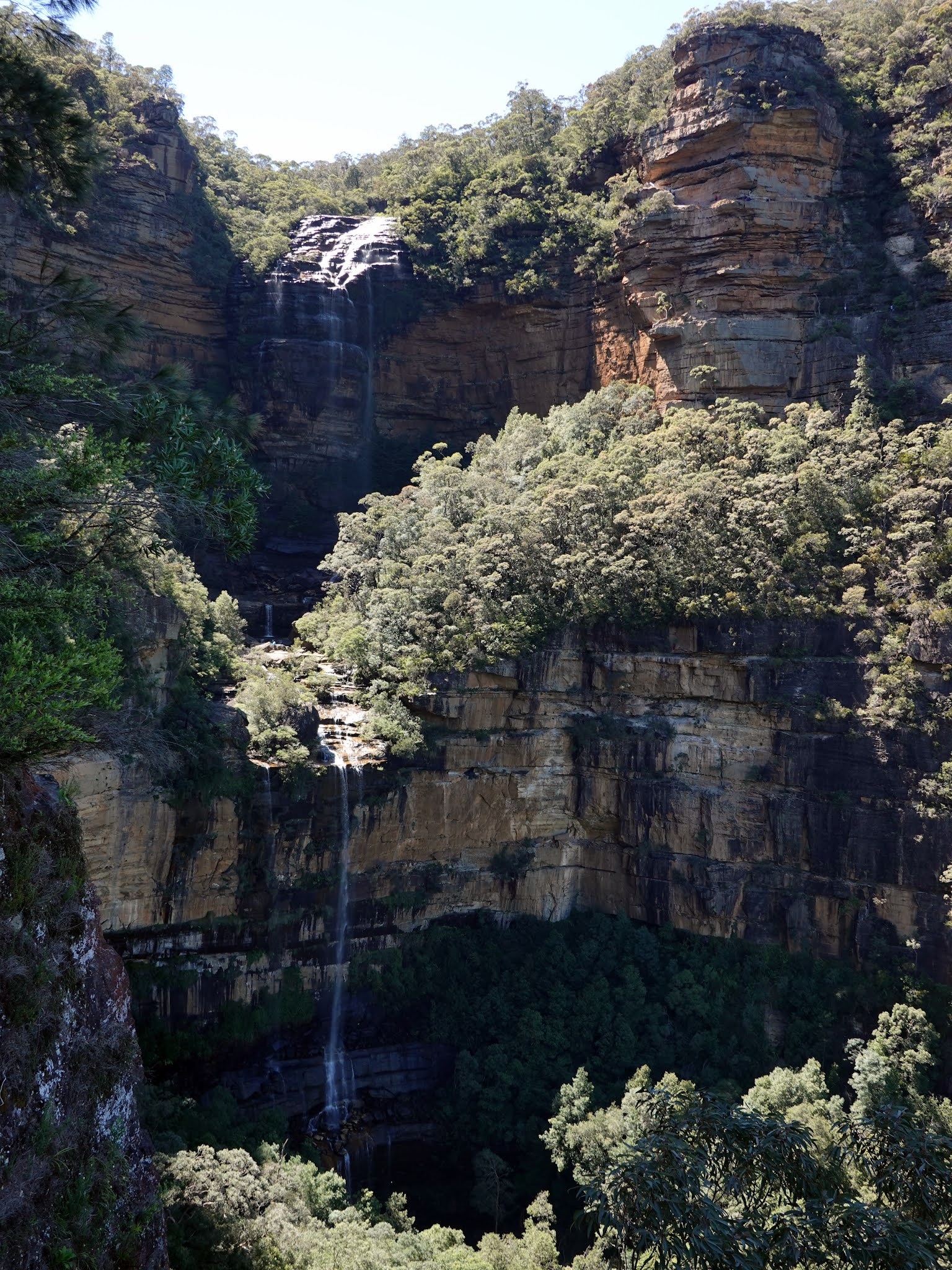
Slacks Stairs emerge at the National Pass, next to the gate that bars the entrance to the collapsed section to the west. National Pass continues east below an overhang of sandstone with a full-height view of the towering Wentworth Falls.  |
| Wentworth Falls |
 |
| Wentworth Falls |
 |
| The middle terraces of Wentworth Falls - the track crosses at the top where the people are stood |
 |
| The upper terraces of Wentworth Falls |
The National Pass crosses Wentworth Falls halfway down its long drop. Here, the fine, misty water descends into a large pool - perfect for a summer swim. At this crossing, NPWS have installed sandstone block bridges to make the creek easier to cross. There is also a great view of the valley beyond the falls. |
| Wentworth Falls |
 |
| Wentworth Falls |
 |
| Wentworth Falls |
From Wentworth Falls you can access the Grand Stairway - the route back up to the cliff tops. The stairway is reported to be ‘the tallest outdoor staircase in Australia’ and was built in the early 1900s by hand (and dynamite). This stairway, and the rest of the National Pass, was built by a team nicknamed ‘the Irish Brigade’ for the cost of £430. The most spectacular part is at the top of the steps where the track follows a ledge high above the valley.
 |
| National Pass |
 |
| National Pass |
 |
| National Pass |
 |
| National Pass |
 |
| Wentworth Falls |
 |
| National Pass |
National Pass ends at the top of Wentworth Falls. The obvious route is to cross the falls and return towards the car park, however, I had something else in mind. As I said before, I wanted to create a longer route and had a plan to continue the hike to Lincoln's Rock to the south, along a path that runs along the top of the Kedumba Walls. It can be reached via Rocket Point, an oft-overlooked viewpoint for Wentworth Falls.
 |
| The small creek above Wentworth Falls |
Rocket Point can be reached by turning right when you reach the small creek joining the top of Wentworth Falls - a vague path climbs up the hillside. If you find yourself on the stepping stones at the Queen's Cascade, you've gone too far.
 |
| Rocket Point |
After climbing up to Rocket Point, I paused for an early lunch, having been up since the dawn at 5.30am. A rock tunnel at Rocket Point makes the perfect spot to get out of the sun for a few minutes while the view down to Wentworth Falls is impressive to say the least. |
| Wentworth Falls from Rocket Point |
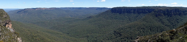
From Rocket Point a path heads southwards along the clifftop. It's unnamed until it reaches the Little Switzerland Firetrail. Much of the path is hemmed in by vegetation and you'll spend much of the time pushing it out of the way or ducking under it. However, interspersed along its length, are several openings to the cliff tops with spectacular views over the Jamison Valley and no railings or tourists to spoil things.
 |
| Continuing along the track from Rocket Point |
 |
| Looking across the Jamison Valley |
 |
| The view towards Lincoln's Rock |
 |
| Above the Kedumba Walls |
Sadly, the same cannot be said about Lincoln's Rock, located at the end of Little Switzerland Drive. While the views are superb, the Instagrammers have made it overcrowded with many people stopping to take the obligatory 'legs dangling over the edge' photo (which is just an illusion). The specific spot has now started to become very worn in only a few years. So popular is Lincoln's Rock that the national parks service has built a new car park and bus stop at the site. |
| Little Switzerland Drive |
 |
| Lincoln's Rock - crowds artfully excluded |
 |
| The Jamison Valley from Lincoln's Rock |
The Lincoln's Rock name is fairly recent, having been coined in 2013. It refers to Lincoln Hall, an Australian mountaineer, who 'died' on Mount Everest before being found alive the following day by rescuers. he lived around Wentworth Falls until his Asbestos-related death in 2012. |
| Lincoln's Rock |
Having had a wander around the rock it was time to head back towards Wentworth Falls and the car. This time I followed the Chester Trail, a larger track that leads back towards Rocket Point.  |
| Little Switzerland fire trail |
 |
| The Chester Trail |
After descending back to the top of the waterfall, I followed the path as it crosses below the Queen's Cascade above Wentworth Falls. It was early afternoon now and the area was starting to get very busy. I stopped off at Fletchers Lookout before starting the climb back towards the car park.
 |
| Above Wentworth Falls |
 |
| Fletchers Lookout |
 |
| Wentworth Falls with the Rocket Point lookout above |
Given that it was now the afternoon, I decided to make one last detour back to Princes Rock Lookout. I mentioned earlier that this viewpoint is best saved for the afternoon as the waterfall is in shadow during the morning, as you can see in the earlier photos. It's safe to say that the views do not disappoint - a fitting finale to an excellent hike.
 |
| Looking along the Jamison Valley |
 |
| Wentworth Falls from Princes Rock Lookout |
 |
| Wentworth Falls |
 |
| Wentworth Falls |


No comments :
Post a Comment