Cooks River & Wolli Creek 12-09-2021
This map was created using GPS Visualizer's do-it-yourself geographic utilities.
Please wait while the map data loads...
Route: Patygareng Place, Livingstone Road, Marrickville Golf Club, Cooks River Cycleway, Boat Harbour, Canterbury Sugar Works, Cup and Saucer Creek, Pat O'Connor Reserve, Hughes Park, William Street, Main Street, Woodlawn Avenue, Johnston Street, Illoura Reserve, Bray Wetlands Track, Garrahween Park, Girrahween Track, Turrella Reserve, Jackson Track, Jackson Place, Undercliff Track, Unwin Street, Gough Whitlam Park, Wanstead Reserve, Illawarra Road, Marrickville Road
Date: 12/09/2021
From: Marrickville
Parking: N/A
Start Point: Patygareng Place
Finish Point: Patygareng Place
Region: Sydney - Inner West
Route length: 15.5km
Time taken: 03:00
Average speed: 5.0km/h
Ascent: 242m
Descent: 219m
Points of Interest: Cooks River, Wolli Creek flying fox camp
Sydney is back in lockdown, thanks to a rising number of Covid cases. While Australia has done well in suppressing the disease, it has been slow to vaccinate the population meaning it lags well behind other developed nations such as the UK and the USA. This lockdown places limits on how far we can travel from home, so we're making the best of it to explore Sydney's Inner West.
Cooks River and Wolli Creek are two of the main waterways in the Inner West and both benefit from a network of modest walking and cycling tracks, enough to create some interesting loops. The Two Valley Trail is arguably the highlight of these. The last time I did this hike, I drove a short distance to Steel Park, down by Cooks River. This time, however, I decided to hike the circuit directly from our front door in Marrickville.
 |
| The new Marrickville library at Patygareng Place |
 |
| St Brigid's church |
We live close to the new Marrickville Library at Patygareng Place, named after Patygareng, an Aboriginal woman who is thought to have been the first to teach an Aboriginal language to the early colonists in New South Wales. The library stands opposite the Mediterranean-inspired St Brigid's church, one of the largest in Sydney.
I followed Livingstone Road south from the church to Cooks River and the Cooks River Cycleway. The entire length of Cooks River (a modest 23km) is heavily urbanised but is a rare area of open space among one of the most developed areas of Sydney. The Cycleway follows the curves of the river around the Marrickville Golf Club and through Beaman Park. At Suttons Reserve you will find the 'boat harbour', an old mooring that was built to train sea cadets however, it silted up not long after it was built.
 |
| Marrickville Oval |
 |
| The path skirts the edge of Marrickville Golf Club |
 |
| Cooks River |
 |
| The Boat Harbour on Cooks River |
 |
| The Boat Harbour |
 |
| A pelican at the Boat harbour |
Eventually, I reached Cup and Saucer Creek where it joins Cooks River opposite an old sugar works. The building here went on to form the nucleus of a small village until it closed in 1854 and was absorbed by the ever-growing Sydney. It has now been transformed into apartments.
 |
| The old sugar works on Cooks River |
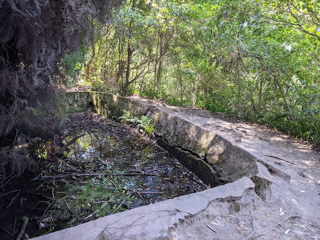
I crossed the river and started following Cup and Saucer Creek. I had thought the creek would be interesting but it is little more and a concrete stormwater channel, however, the open reserve is pleasant enough. Its unusual name came from the sandstone formations of the river bed - now long destroyed.
 |
| Cup and Saucer Creek - behind the fence and under the power lines |
After reaching Bexley Road, I was at the far end of the circuit I had in mind. The Two Valley Trail continues by following the suburban streets southwards towards Bexley and Wolli Creek Regional Park.
The National Parks Service looks after the Regional Park in much the same way as more illustrious areas like the Blue Mountains. The park was announced in 1998 after sustained community campaigning for the area to be preserved and for the M5 East Freeway to go underground. It's a rare example of bush in the heart of Sydney that is home to mangroves, freshwater wetlands, sandstone Eucalypt woodland and, a colony of flying foxes. The Wolli Creek Track passes through the heart of the park.
 |
| Entering Illoura Reserve |
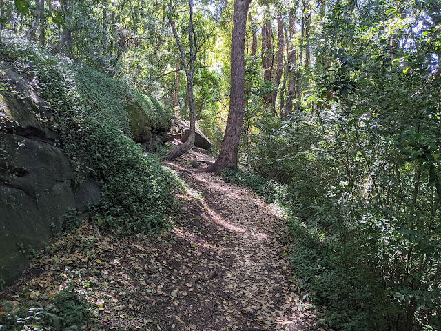
The hike along Wolli Creek can be broadly split into three sections. The first makes its way through Illoura Reserve along the Bray Wetlands Track to Bray Avenue and Girrahween Park. The second section, along the Girrahween Track, is arguably the highlight of the day and most reminiscent of wilder areas such as the Blue Mountains. At the start of the Girrahween Track you will find Russell's Pool, a small pool built below a sandstone overhang. It is drip-fed and was reputedly built but a local in the 1920s as a swimming pool. The identity of 'Russell' remains unknown.
 |
| Bray Wetlands Track |
 |
| Bray Wetlands Track |
 |
| Paperbark Creek |
 |
| Bray Wetlands |
 |
| Girrahween Park |
 |
| Girrahween Track |
 |
| Girrawheen Track |
 |
| Russells Pool |
As well as beautiful bushland, the Girrahween track passes a flying-fox camp. The camps are areas where flying foxes like to roost during the daytime and there are hundreds, if not thousands at Wolli Creek.
 |
| Flying Foxes |
 |
| Flying Fox |
 |
| Flying Fox camp |
 |
| Wolli Creek |
The track emerges at Turrella Reserve before heading back into the bush once again along the third part of the hike, the Jackson Track and Undercliffe Track. The Jackson Track follows Wolli Creek from Jackson Place to Waterworth Park. Jackson Place is home to six sandstone cottages, built by Yorkshireman William Jackson in the early 1900s.
 |
| Jackson Place |
After another short section through the bush, the path enters Waterworth Park, another large open recreational area. You can skirt the edge of the park, following Wolli Creek, but I decided to cut across to nearby Gough Whitlam Park instead. The park is centred around a large pond and formal gardens, crowned by a metal sculpture.
 |
| Gough Whitlam Park |
 |
| Gough Whitlam Park |
On the opposite side of the park is Cooks River and the cycleway one again. I followed it a short distance back to Steel Park and Illawarra Road which leads directly back into the heart of Marrickville, though is uphill nearly the entire way.
 |
| High tide along Cooks River |
 |
| Cooks River |


No comments :
Post a Comment