Sydney 07-08-2021
This map was created using GPS Visualizer's do-it-yourself geographic utilities.
Please wait while the map data loads...
Route: The Domain, Woolloomooloo Finger Wharf, Mrs Macquaries Road, Mrs Macquaries Chair, Mrs Macquaries Point, Farm Cove, Royal Botanic Garden, Government House, Sydney Opera House, Cahill Walk, Circular Quay, Campbells Cove, Hickson Road Reserve, Hickson Road, Walsh Bay, Wulugui Walk, Barangaroo, Watermans Cove, Darling Harbour, Pyrmont Bridge, Market Street, Hyde Park, Archibald Fountain, Art Gallery Road, The Domain
Date: 07/08/2021
From: The Domain
Parking: The Domain
Start Point: The Domain
Finish Point: The Domain
Region: Sydney
Route length: 12.2km
Time taken: 02:42
Average speed: 4.8km/h
Ascent: 191m
Descent: 201m
Points of Interest: Woolloomooloo, Mrs Macquaries Chair, Farm Cove, Sydney Opera House, Circular Quay, Sydney Harbour Bridge, Barangaroo, Darling Harbour
Despite Sydney's lockdown, this is a hike I have had in mind for a long while - essentially a Sydney highlights tour that includes the Botanic Gardens, Opera House, the Harbour Bridge and the neighbouring Darling Harbour. The absence of being able to travel outside of Sydney made this outing a no-brainer.
Using public transport is the most logical way of getting to Sydney, and there are numerous train stations dotted along the route. We, however, opted to drive into the city, parking at The Domain on the fringe of the Royal Botanic Gardens, to avoid any Covid cross-contamination. After leaving the car in the deserted car park, we crossed the Eastern Distributor to begin the hike from the Woolloomooloo wharf.
 |
| Woolloomooloo wharf |
The area of Woolloomooloo was originally a working-class suburb but now is largely gentrified thanks to the redevelopment of the waterfront, particularly the development on the Finger Wharf. Its interesting name is derived from the first homestead built in the area, however, it is not clear what Wooloomooloo actually referred to. The closest Aboriginal words are Wallamullah meaning place of plenty or Wallabahmullah meaning young black kangaroo.
 |
| A sculpture on the Woolloomooloo waterfront |
 |
| Woolloomooloo Bay |
We followed the wharf north to find the track that runs around the eastern edge of the Royal Botanic Garden, passing the Andrew Charlton Pool (named after one of Australia's Olympic medal-winning swimmers). Past the pool, at the tip of the Botanic Gardens, is Mrs Macquarie's Point which honours Governor Lachlan Macquarie's wife, Elizabeth, who had a chair carved out of rock in 1815. She often came to sit and watch ships enter and leave the harbour. Just around the corner from the chair is perhaps THE best view of the Sydney Opera House and Harbour Bridge. The view is at its best before midday when the sun is behind you.
 |
| The Woolloomooloo Finger Wharf |
 |
| Mrs Macquarie's Chair |
 |
| Mrs Macquaries Point (also known as Yurong) |
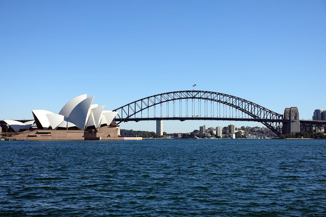 |
| Sydney Opera House and Sydney Harbour Bridge |
 |
| Sydney Opera House |
 |
| Farm Cove and Sydney City |
 |
| Sydney Opera House and Sydney Harbour Bridge |
A concrete path runs alongside the edge of Farm Cove, taking you into the heart of the Royal Botanic Garden. The garden is one of the oldest scientific institutions in Sydney, having been opened in 1816 and has played a major role in acclimatising plants from other regions. It is split into three areas; the Lower Garden around Farm Cove, the Middle Garden with its numerous beds and sculptures, the Palace Gardens and the Bennelong Precinct, home to Government House.
 |
| Farm Cove |
 |
| Sydney Opera House |
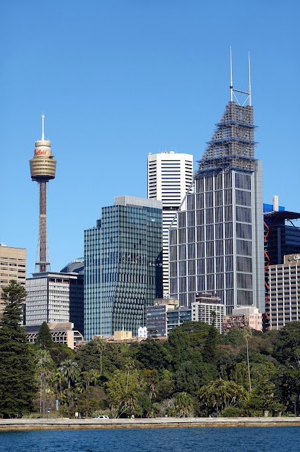 |
| Sydney Tower and Deutsche Bank Place rise over the Royal Botanic Gardens |
 |
| Sydney Harbour |
 |
| Entering the Royal Botanic Garden |
Given the glorious weather, we spent some time wandering around the various gardens, ultimately making our way to the imposing steps of the Sydney Opera House. Being the end of the winter meant it was a bit early for the displays of flowers.
 |
| Royal Botanic Gardens |
 |
| Royal Botanic Gardens |
 |
| Royal Botanic Gardens with some resident White Ibis |
 |
| Royal Botanic Gardens |
 |
| The Rose Garden |
 |
| Views from the Herb Garden |
 |
| Looking across Farm Cove to Mrs Macquarie's Point |
 |
| Government House |
 |
| Approaching the Sydney Opera House |
The Sydney Opera House is one of the world's most famous and distinctive buildings though its current design was close to never being realised. An international competition to design the opera house was announced in 1956, and when Jørn Utzon entered his proposal it was promptly relegated to the bin. When renowned American architect, Eero Saarinen was looking through the rejects he found Utzon’s entry and Utzon subsequently won the contract. The concept of the roof represented a ship’s billowed sails, a representation of Australia’s maritime history. Then, no one knew exactly how challenging the construction of this roof would be.
 |
| Sydney Opera House |
The shells of the roof were the most complex feature of the building. At the time, hand-written mathematical equations were required to make the roof construction possible; it took 30,000 separate equations just to work out how much stress could be applied. The margin of error could be no more than 13mm when putting the segments together; anything more would have thrown the whole thing out of alignment as everything is curved and there is not one flat plane in the entire roof.
 |
| Sydney Opera House |
Eventually, it was discovered that the roof 'shells' could be derived from the planes of a sphere - a watershed moment in the design and construction of the building. Despite this achievement, Utzon became embroiled in the political controversies of the day, with his designs, schedules and cost estimates being questioned. It is said that the government at the time withheld money from Utzon. Utzon was stymied and subsequently resigned in 1966. Sadly Utzon and his family left Australia, never returning to see his concept completed.
 |
| Sydney Opera House |
 |
| Sydney Opera House |
The colour of the opera house is as famous as its design. There are more than 1 million 12x12cm ceramic tiles covering the shells, made in Sweden. The subtle chevron pattern is a glossy white-matte and cream colour that catches the light but doesn't glare and took three years to develop.
 |
| The intricate tiled pattern on the sails of the Opera House |
You can get up close to the tiles as you make your way around the opera house towards the bustling Circular Quay. Circular Quay is the birthplace of modern Australia for it was here, in 1788, that the first British fleet landed and established the penal colony which grew into modern-day Sydney. Why the name Circular Quay when it is clearly a rectangle? It's simply a shortening of Semi-Circular Quay which was the working port's original name and shape. Metal markers on the floor note where previous iterations of the docks once stood.
 |
| Lower path to Sydney Opera House |
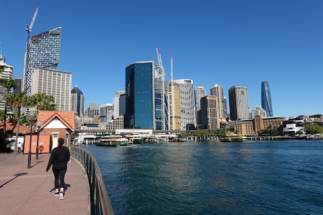 |
| Circular Quay and Sydney |
 |
| Sydney Harbour Bridge |
Now, Circular Quay acts as a hub for Sydney thanks to the rail station and ferry wharves. Thousands of people visit daily, whether commuting into the city or arriving on one of the many cruise ships that dock during the summer months. You can walk around the cove and, if cruise ships are not docked, walk in front of the terminal building to Campbells Cove.
 |
| Sydney Harbour Bridge |
 |
| Circular Quay |
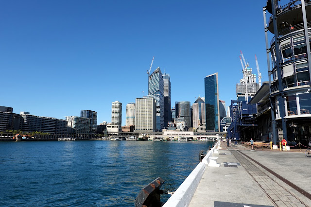 |
| Circular Quay |
The cove forms part of Sydney's famed Rocks district, one of the oldest and most historic areas of the city. The cove is backed by beautifully restored warehousing and factory buildings along with the uber-expensive Park Hyatt hotel (a single night costs anything between $1000 and $2000). For that price, you get the iconic view of the Sydney Opera House on the opposite side of the harbour.
 |
| Sydney Opera House |
 |
| Sydney Opera House |
 |
| Campbells Cove |
 |
| Factory and warehouse buildings in The Rocks |
 |
| A tall ship moored in Campbells Cove |
Beyond the hotel is the imposing southern pylon of the Sydney Harbour Bridge which has its footing in Dawes Point Reserve, a form harbour gun battery. There is a modest museum in the southern pylon which is well worth the $19 admission fee - mainly thanks to the superb views from the top.
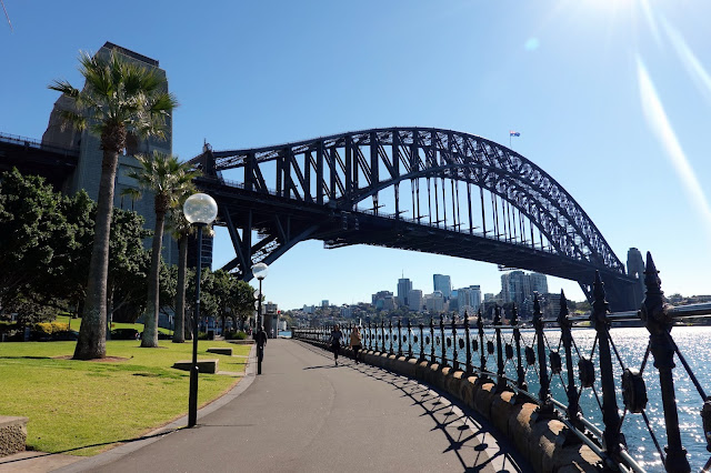 |
| Sydney Harbour Bridge at Dawes Point |
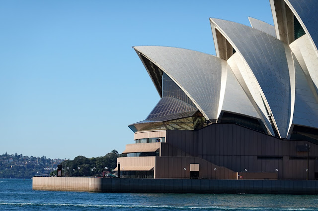 |
| Sydney Opera House |
 |
| Hickson Road Reserve |
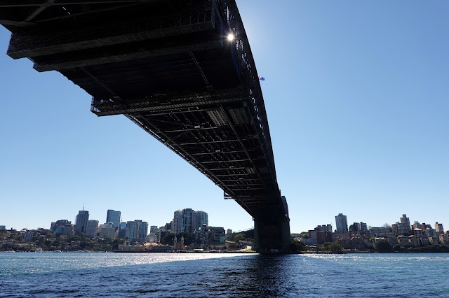 |
| Underneath the bridge |
The bridge was designed and built by British firm Dorman Long of Middlesbrough and opened in 1932 (they later went on to build the Tyne Bridge in Newcastle). It is currently the tenth-longest spanning-arch bridge in the world and the tallest steel arch bridge, measuring 134m from top to water level. It is a magnificent beast. In addition to the road, the Harbour Bridge carries a railway and a pedestrian footpath that gives a superb view of Sydney Harbour and the iconic Sydney Opera House as well as an intimate view of the steel structure of the bridge itself.
We passed beneath the bridge to the west side of Dawes Point, into Walsh Bay and the old Wharves Precinct. The wharf buildings here were mostly constructed in 1918 to modernise Sydney's docks to handle steamships before they were converted to apartments, restaurants and cafes. It is now a major arts precinct and a beautiful area to explore, particularly on a warm sunny day like today.
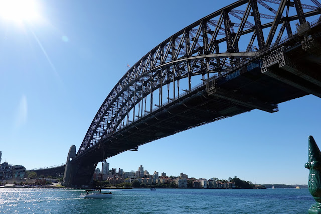 |
| Sydney Harbour Bridge |
 |
| Sydney Harbour Bridge |
 |
| The Wharves Precinct |
 |
| Walsh Bay |
 |
| Walsh Bay - Crown Tower rises in the background |
 |
| Walsh Bay |
Continuing on, we made our way to one of Sydney's newest open spaces, Barangaroo Reserve. The terraced lawns and cycle paths were opened in 2015 as part of the development of the old stevedoring docks at East Darling Harbour that includes the trio of International Towers and Crown Sydney - the tallest building in the city. Development at the site will be ongoing for the next few years to include a new metro station and several other tall buildings.
 |
| Barangaroo |
 |
| One of the inner coves of Sydney Harbour |
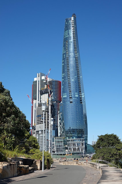 |
| Crown Tower - Sydney's newest tall building |
 |
| Johnston's Bay and ANZAC Bridge |
The waterfront at Barangaroo leads to Darling Harbour, arguably one of Sydney's most vibrant areas. The former rail marshalling yards have been transformed into restaurants, shopping centres, museums and tourist attractions. I know Darling Harbour well as it is just behind our office on Kent Street so you'll often find me there on a lunch break.
 |
| International Towers at Barangaroo |
The most notable feature of the harbour is Pyrmont Bridge, a 1902 swing bridge built to accommodate the first vehicles in Sydney until it was permanently closed to vehicles in the 1980s. For 25 years the bridge carried a section of Sydney's curious monorail until it too was removed in 2013.
 |
| Pyrmont Bridge |
 |
| Pyrmont Bridge |
We did a loop around Darling Harbour and crossed the bridge, heading into the city. Darling Harbour is normally bustling with tourists and locals alike, but these are not normal times and with no international tourism, and Sydney in lockdown, Darling Harbour and most of Sydney are all but deserted.
 |
| Darling Harbour |
 |
| Darling Harbour and Sydney's brand new IMAX theatre |
 |
| Darling Harbour |
 |
| A large flag flies over Darling Harbour |
 |
| Market Street |
 |
| Queen Victoria Building |
 |
| George Street |
We cut across the empty heart of the city along Market Street to the top of the expansive Hyde Park, the oldest park in Australia where we emerged at the Archibald Memorial Fountain that stands in the centre of Birubi Circle. The fountain commemorates the association between Australia and France in World War I.
 |
| Archibald Fountain |
 |
| Archibald Fountain |
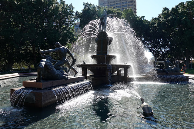 |
| Archibald Fountain |
 |
| St Mary's Cathedral |
Opposite the fountain is St Mary's Cathedral and the road leading back to the car park in The Domain where we concluded this hike. Sydney is a fantastic city for hiking and sightseeing and this route visits some of its most iconic locations. If you're only in Sydney for a few days, then I'd highly recommend this to see some of the best sights the city has to offer.


No comments :
Post a Comment