Belougery Split Rock 13-06-2021
This map was created using GPS Visualizer's do-it-yourself geographic utilities.
Please wait while the map data loads...
Route: Split Rock Car Park, Belougery Split Rock Track, Beloigery Split Rock, Burbie Canyon Track, Split Rock Car Park
Date: 13/06/2021
From: Split Rock Car Park
Parking: Split Rock Car Park
Start Point: Split Rock Car Park
Finish Point: Split Rock Car Park
Region: Warrumbungle National Park
Route length: 4.3km
Time taken: 02:01
Average speed: 2.3km/h
Ascent: 398m
Descent: 399m
Points of Interest: Belougery Split Rock
Located some 6-7 hours northwest of Sydney, getting to Warrumbungle National Park is no mean feat but it is well worth the effort. Not only is the scenery spectacular but it is Australia's only Dark Sky Park (for now), promising amazing views during both the day and the night (if you are lucky to get clear skies). We used a long weekend to make the trip up from Sydney, staying for three nights at the excellent Camp Blackman.
After exploring the Grand High Tops the previous day, I set off to find another one of Warrumbungle National Park's spectacular viewpoints, that of Belougery Split Rock. It's a short but energetic hike to the highest part of the immense lava dome which has a near 360-degree panorama of the national park. A word of warning - reaching the top of the dome in wet weather can be dangerous as the final climb to the top can become extremely slippery.
The Split Rock Track begins from the Split Rock car park, located off the John Renshaw Parkway at Camp Wambelong. For no particular reason, I chose the anti-clockwise direction which heads around the east side of the dome before approaching the summit.
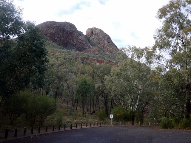 |
| Belougery Split Rock from the Split Rock car park |
The climb begins immediately from the car park, following an eroded path through the bush to the first of a series of rock steps. The route up the steps involves some very modest scrambling, following yellow reflective squares glued to the rocks. The climb reveals views across the west of the national park.
 |
| Starting the climb from the car park |
 |
| Some modest scrambling is required as you climb higher from the car park |
 |
| Western views of the Central Tablelands |
 |
| The northern Warrumbingle mountains |
As the path continues, it levels out and approaches the sheer rock walls of the dome, giving you an up-close look at the weird and wonderful shapes of the ancient lava. After another climb the path levels out once again as it approaches the south side of Belougery Split Rock, revealing the first views of the famous Grand High Tops.
 |
| Below the northern top of Belougery Split Rock |
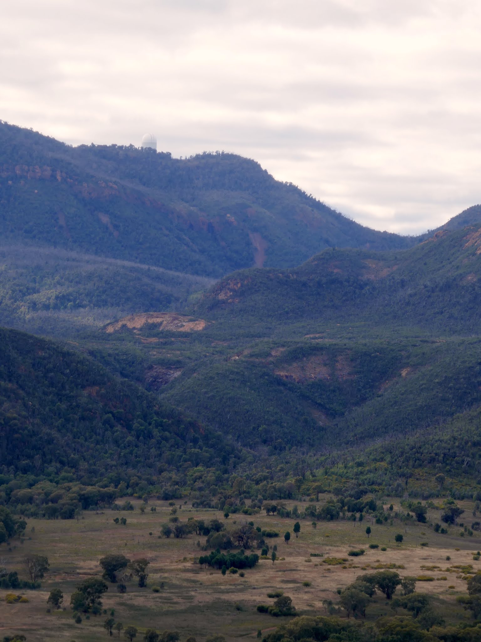
 |
| The Central Vallet, Mount Scabilon and Mount Woorut, home to the Siding Spring Observatory |
 |
| The Anglo-Australian Telescope sits atop Mount Woorut |
 |
| The steep walls of Belougery Split Rock |
 |
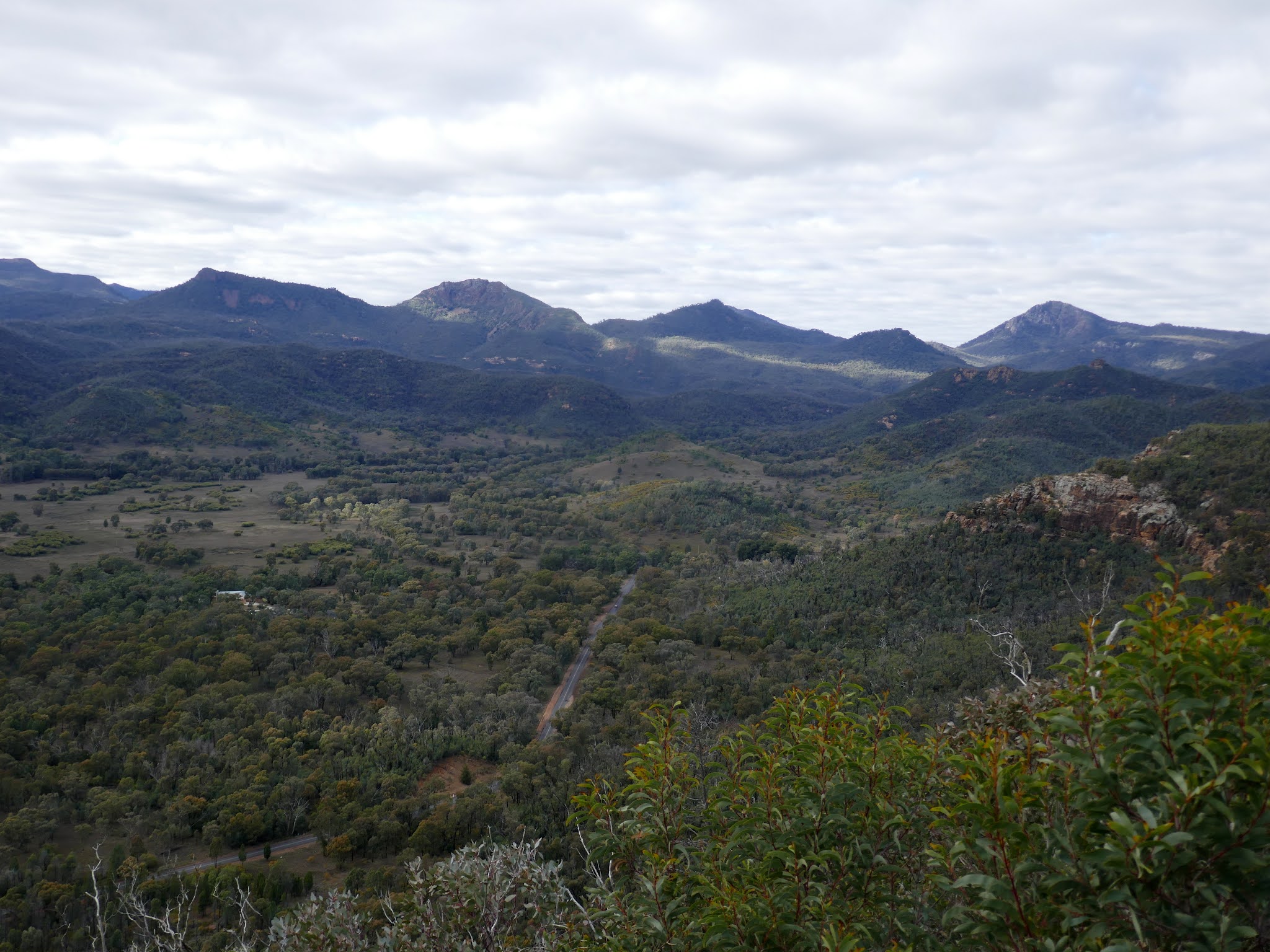
| The Central Valley |
 |
| The Grand High Tops from left to right - Belougery Spire, The Breadknife (below the horizon), Crater Bluff, Mata Rocks |
The Grand High Tops are a geological wonderland of rock domes, towers and spires. The entire area was once an enormous shield volcano, some 50km wide and 1km high. Millions of years of erosion have worn away the softer rocks, leaving behind the weird and wonderful dykes, plugs, and domes of trachyte. The features are clustered around the Grand High Tops and are all named - Belougery Spire, Belougery Split Rock, Crater Bluff, Bluff Mountain, Mount Exmouth and The Breadknife. The Breadknife, a straight wall of jagged rock nearly 100 metres high, is particularly rare and the poster child of the national park.
 |
| The Breadknife and Crater Bluff |
Eventually, the path reaches a metal gate and a short set of steps. This marks the beginning of the out-and-back route to the summit which initially involves a fair amount of steep scrambling. Steps have been cut into the rocks in places but they are old and eroded, more often a hindrance than a help. This is the section that will become more challenging in the wet as rocks are slippery even in the dry.
 |
| The path cuts across a scree slope |
 |
| Starting the scramble towards the summit |
 |
| The scramble heads left her, away from the steeper section |
 |
| An emerging view of the Grand High Tops |
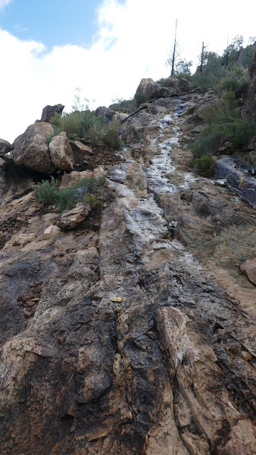 |
| Some parts of the climb are slippery, especially when they are wet |
 |
| The sun emerged as I reached the top |
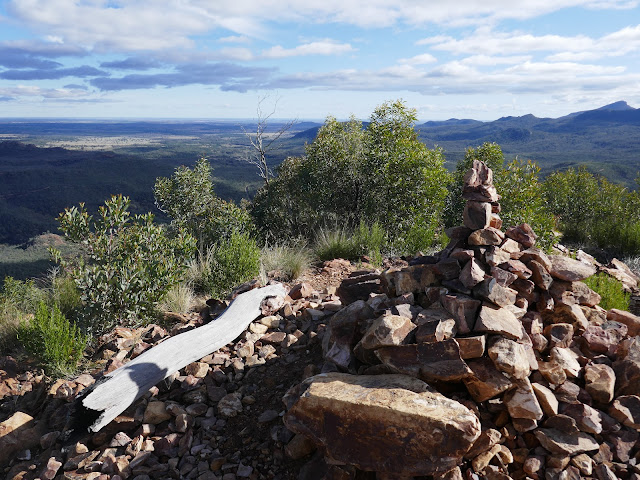 |
| Summit of Belougery Split Rock |
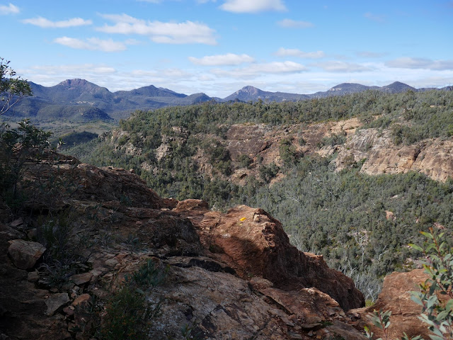
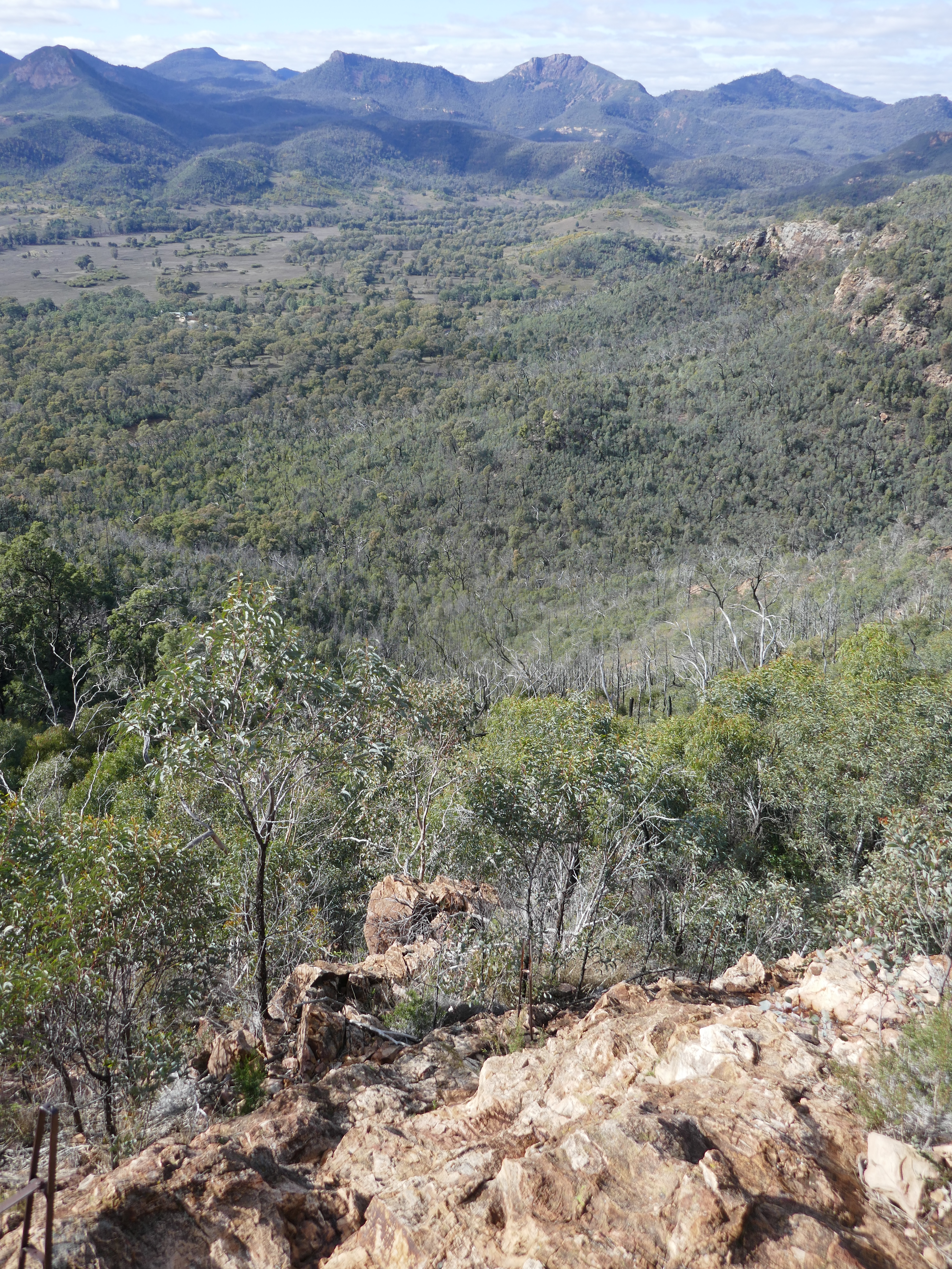
The track eventually flattens off at piles of rocks which marks the highest point of the rock. The sun was out by now and the view from Belougery Split Rock is impressive. The highlight is the panorama of the Grand High Tops. The view also displays the full height of Mount Exmouth, the highest point of the Warrumbungles.
 |
| The Grand High Tops - including Bluff Mountain |
 |
| The Warrumbungle Mountains |
 |
| Looking west over the Central Tablelands |
 |
| Mount Exmouth |
Having had my fill of the views, it was time to retrace the steep route back to the steps and the Split Rock Track. As ever, descending the steeper sections is more challenging than climbing them but they shouldn't pose many problems to experienced hikers.
 |
| The Central Valley |
 |
| Returning back towards the Split Rock Track |
 |
| This section was more slippery than it looks |
 |
| An example of the reflective markers which guide the way |
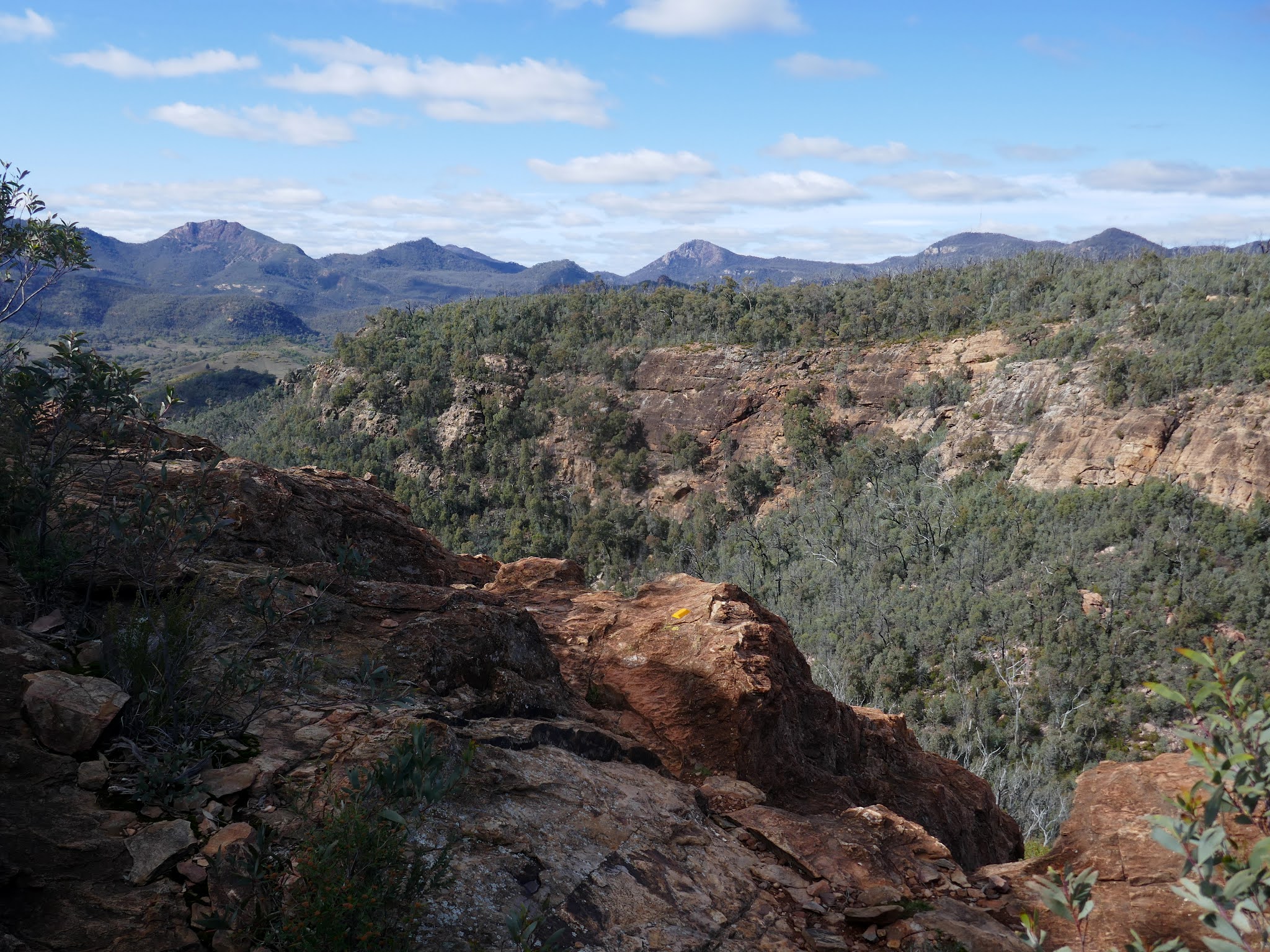
 |
| The Grand High Tops |
 |
| Looking down the final steep part of the scramble |
 |
| The steps at the Split Rock Track |
The track now makes its way back down towards the car park, zigzagging down the southern side of Belougery Split Rock until it reaches Belougery Creek. Here, the path turns north and descends to the Burbie Canyon Track, a wide fire trail that delves deep into the heart of the Warrumbungle Mountains. Heading north, the trail leads directly back to the car park.
 |
| Burbie Canyon |
 |
| Burbie Canyon |
 |
| Burbie Fire Trail |
This is a great half-day hike - one you could undertake before the long drive back to Sydney. Several other short hikes in the area, including Tara Cave and Fans Horizon, would turn these short outings into a day-long adventure.


No comments :
Post a Comment