This map was created using GPS Visualizer's do-it-yourself geographic utilities.
Please wait while the map data loads...
Please wait while the map data loads...
From: Leichardt Park
Parking: Leichardt Park
Start Point: Leichardt Park
Region: Sydney
Route length: 4.6 miles (7.4km)
Time taken: 01:38
Average speed: 2.9mph
Ascent: 52m
Descent: 43m
Other points of interest: Callan Park, Iron Cove Bridge, Rodd Park Memorial
With region-wide travel now restricted, we're forced to look closer to home for our outdoors fix. Sadly, Marrickville lies in the heart of the Sydney suburbs and extensive green space is limited. We've been visiting the nearby Cooks River but decided to branch out a bit on a warm, sunny weekend.
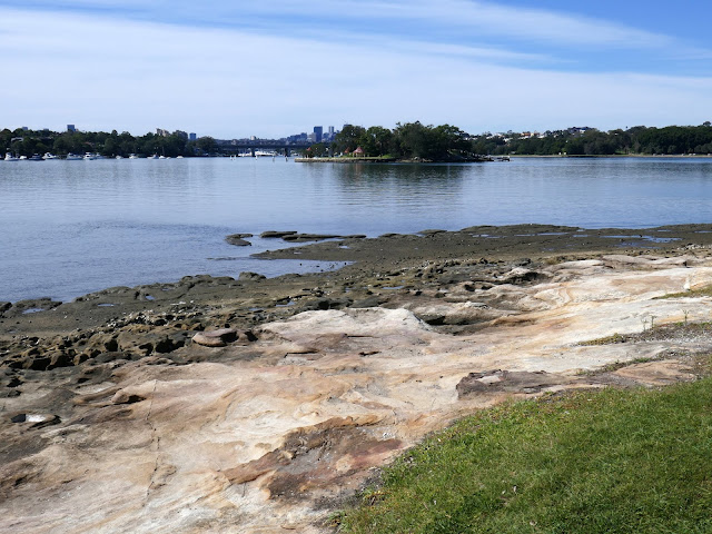
To the north of the Inner West is Iron Cove, a long bay that is now home to the 'Bay Run', a tidy seven-kilometre scenic circuit that skirts the waterfronts of inner western suburbs like Leichhardt, Drummoyne, Russell Lea and Rozelle. Because it's a jewel of the Canada Bay Council Area, it's well maintained but popular, especially now the beaches are closed.
In the early days of the colony of New South Wales, the area was sometimes known as Long Cove, presumably for its long narrow shape. However, the origin of the name 'Iron Cove' is unclear. It has been suggested that the name is derived from the iron shackles worn by convicts from Cockatoo Island, who were forced to work in the area around the bay from 1839. Another possible explanation for the name is that it was derived from the Ironbark trees that used to grow there.
There's a large parking area on the fringe of Leichhardt Park, Leichhardt being one of Sydney's inner suburbs. It is known as Sydney's 'Little Italy' due to the relatively large Italian population who have settled there.
 |
| Iron Cove |
 |
| Boats moored in Iron Cove |
 |
| Rodd Island |
 |
| Leichhardt Park |
 |
| Leichhardt Park |
 |
| Old hospital buildings in Callan Park |
 |
| A ship carved onto the rocks |
 |
| Iron Cove and Iron Cove Bridge |
 |
| Callan Park - now the Sydney College of the Arts |
 |
| Iron Cove from the bridge |
 |
| Drummoyne Olympic Pool |
 |
| Iron Cove |
 |
| Iron Cove Bridge backed by Sydney |
 |
| Sisters Bay |
 |
| Half Moon Bay |
 |
| Looking across to Rodd Island |
 |
| Iron Cove |
 |
| Rodd Park |
 |
| Rodd Park |
 |
| Rodd Point Memorial |
 |
| Rodd Island |
Marine Drive continues, rounding the head of the bay at Timbrell Park and crossing Iron Cove Creek via a footbridge (built in 2015 to protect pedestrians who otherwise had to cross the road). The path passes the local rowing club who seemed to be doing a roaring trade in take-out coffees. If there's one thing the Aussies love, it's a good coffee.
 |
| Iron Cove |
The final stretch of the walk follows the shore of the bay along back to Leichardt Park. It's fortunate that we are currently living in Sydney as areas like Iron Cove are plentiful meaning we can still get out and about despite the current Covid restrictions. I have a few more local walks up my sleeve so keep your eyes peeled for those.

No comments :
Post a Comment