
This map was created using GPS Visualizer's do-it-yourself geographic utilities.
Please wait while the map data loads...
Please wait while the map data loads...
Route: Minnamurra Rainforest Centre, Loop Walk, Falls Walk, Minnamurra Falls, Loop Walk
Date: 16/02/2019
From: Minnamurra Rainforest Centre
Parking: Minnamurra Rainforest Centre
Start Point: Minnamurra Rainforest Centre
Finish Point: Minnamurra Rainforest Centre
Region: Budderroo National Park
Route length:
Time taken:
Average speed:
Ascent:
Descent:
Points of Interest: Minnamurra Falls, Jamberoo Lookout, Carrington Falls
It was a colleague at work who mentioned Minnamurra as a place to visit after I made some enquiries on how to fill an empty Sunday. Minnamurra is part of the Budderoo National Park, some 100km south of Sydney. As nice as the city is, it’s also nice to leave the hustle and bustle behind occasionally.
Budderroo is a modestly sized national park in the Illawarra region of New South Wales, famed for its pristine rainforest and beautiful waterfalls. The Illawarra area is bounded to the west by the sandstone cliffs of the Illawarra escarpment which forms the eastern edge of the southern highlands plateau. In turn, the plateau causes the formation of some impressive waterfalls. With New South Wales has experienced its heaviest rain in 30 years, we were hoping the falls might be putting on a show.
It's a 2-hour drive south of Sydney to reach Minnamurra but we set off early and arrived under some sunny, mid-morning skies. There are two short tracks in the rainforest, the 2km rainforest loop and the additional 4km Falls Track, an out-and-back to Minnamurra Falls. We were intent on linking both to see the best of the valley.
We set off from the Rainforest Centre (which was closed for refurbishment) picking up the clockwise loops track through the rainforest. The loop track heads along a network of elevated boardwalks, crossing theMinnamurra River via a collection of suspension bridges.
 |
| The first suspension bridge over the Minnamurra River |
 |
| Minnamurra River |
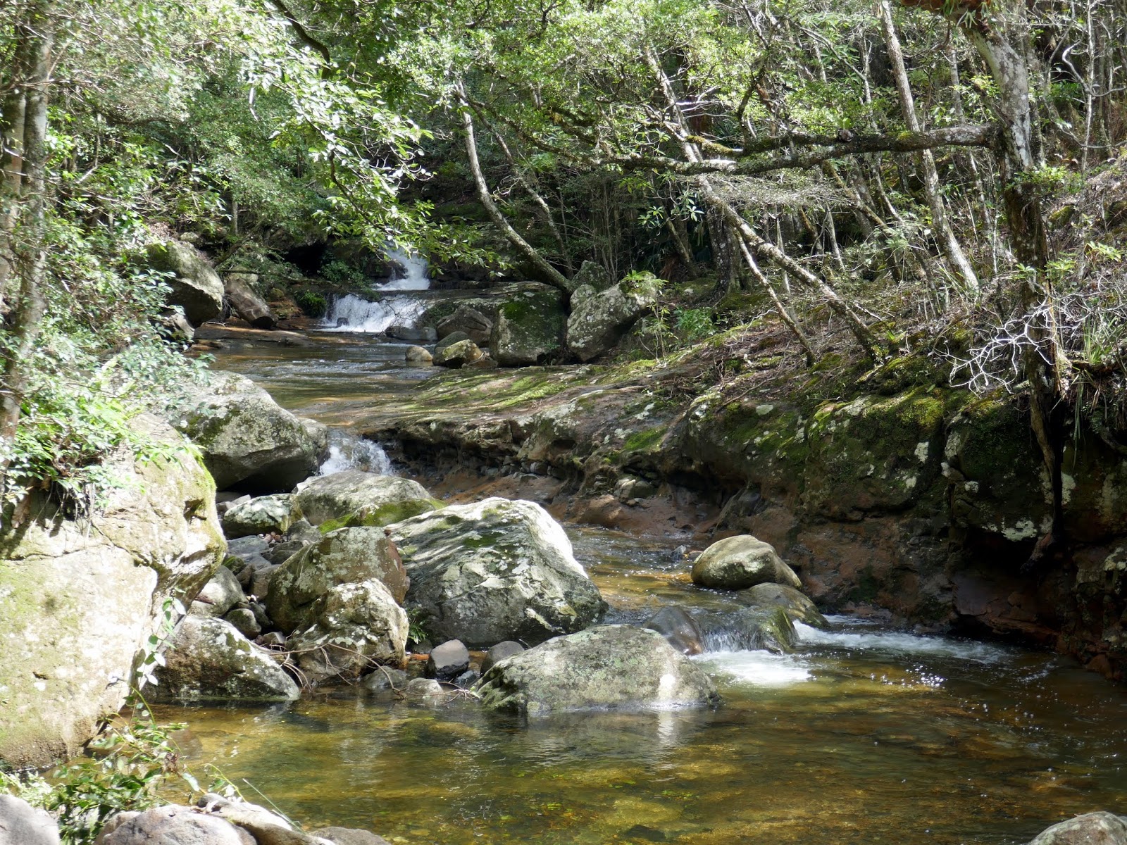 |
| Minnamurra River |
 |
| A section of the mossy, paved path |
 |
| One of the information signs on the Loop Walk |
 |
| The more modern metal walkways |
 |
| Minnamurra River |
 |
| Looking up Minnamurra River |
 |
| The final bridge on the Loop Walk (clockwise) |
 |
| Climbing alongside one of the more dramatic parts of Minnmurra River |
 |
| An opening in the trees |
 |
| Climbing the steep Falls Walk track |
 |
| A termite mound hidden among the trees |
 |
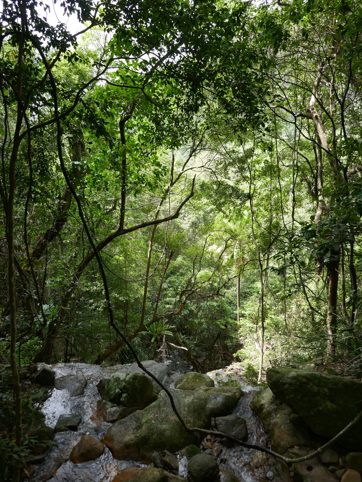
| Minnamurra rainforest |
 |
| The top of Lyrebird Falls |
 |
| The creek feeding Lyrebird Falls |
 |
| The elaborate elevated walkway |
 |
| Lower Minnamurra Falls |
 |
| Upper Minnamurra Falls |
 |
| Minnamurra River |
 |
| Upper Minnamurra Falls |
 |
| The rainforest boardwalk |
 |
| The rainforest boardwalk |
 |
| We passed several small creeks on the way back |
 |
| Minnamurra River |
 |
| Lyrebird Cafe |
 |
| View from Jamberoo Lookout |
 |
| Carrington Falls Loop Track |
 |
| Carrington Falls |
 |
| The top of Carrington Falls |
 |
| Some people for scale |
 |
| Falls Loop Track |
 |
| Carrington Falls from Valley View |
 |
| Kangaroo River valley |
 |
| Carrington Falls |
 |
| Kangaroo River |
 |
| Kangaroo River |
No comments :
Post a Comment