Tuesday, 6 September 2016

All The Gear USA Special: Taft Point & Sentinel Dome

Taft Point & Sentinel Dome 05-09-2016

This map was created using GPS Visualizer's do-it-yourself geographic utilities.

Please wait while the map data loads...


Route: Sentinel Dome Trailhead, Taft Point, Pohono Trail, Sentinel Creek, Sentinel Dome, Sentinel Dome Trailhead

Date: 05/09/2016
From: Sentinel Dome Trailhead


Parking: Glacier Point Road
Start Point: Sentinel Dome Trailhead
Region: Yosemite National Park

Route length: 5.4 miles (8.7 km)
Time taken: 03:41
Average speed: 1.5 mph
Ascent: 341m
Descent: 357m

Summits: Sentinel Dome (2,476m)

Other points of interest: The Fissures, Taft Point

It's been a bit chaotic over the last few weeks as we moved All The Gear HQ from the Wakefield badlands to the leafy suburbs of Leeds. This culminated in an extended break on the other side of 'the pond' which means that most of August and early September have been walking write-offs. I do, however, have a special entry from our trip to the States which I thought would be worthy of a place in the archives of All The Gear But No Idea.
Jetting off to warmer climes
Yosemite National Park needs little introduction and we spent a few nights in a development just inside the National Park boundary. While extended day walks were out of the question on this occasion, we did manage to string together two of the popular tourist trails to create a 5-mile circuit of the southern rim of the dramatic Yosemite Valley.
Entering Yosemite National Park
I said Yosemite needs little introduction as the monolithic granite mountains and spectacular panoramas are famous worldwide. El Capitan is one of the premier rock climbing walls to be found anywhere in the world while the eye-catching drama of Half Dome is instantly recognisable, especially for anyone owning a recent Apple laptop or computer. Our walk would start from the popular Taft Point / Sentinel Dome trailhead, located along the Glacier Point road - more about that a little later.

The National Parks of the US are managed slightly differently from those in the UK with permitting and preparation required to scale many of the mountains and an entrance fee necessary to access the park itself. Fortunately, there are trails (paths) aplenty and two of the more accessible ones both radiate from the Taft Point trailhead, one leading to Taft Point itself and one leading to Sentinel Dome. They can be joined using part of the Pohono Trail, which is exactly what we did.
Yosemite National Park is administered by the US National Park Service
The Taft Point / Sentinel Dome trailhead stands at a stately 2,345m (7,700ft) which, for sea-level dwellers like us, is instantly noticeable anytime you begin to exert any sort of effort unless you have done some acclimatising beforehand. Luckily, most of the trek to Taft Point descends slowly downhill.
Entering the woods
The trail passes through the fragrant woods
Heading for Taft Point
Though it was hot and sunny in Yosemite Valley, the elevation meant that the temperature wasn't uncomfortable and the abundance of trees over the first mile added ample shade, giving you a flavour of walking in the tree-covered high country of the Sierra Nevada.

The Taft Point Trail reaches a junction with the Pohono Trail which is marked by metal marker boards. Taft Point stands a short half-mile further, still descending until the trees stop and the barren plateau opens up. Here you can find The Fissures, a series of cracks in the granite wall that offer a dizzying view down to Yosemite Valley, some 900m below. Up ahead is the overlook, Taft Point itself (also known as Profile Cliff).
The junction marker
The trees begin the thin out
One of the Taft Point fissures
The point is named after 27th President of the United States William Howard Taft, who, according to newspaper accounts, came across the point when he visited Yosemite for three days hosted by John Muir in October 1909. The two hiked from nearby Glacier Point down to the valley floor. President Taft planned the trip by horseback, but the horses brought for his use were all too small for his 21 stone weight.
The overlook at Taft Point
Approaching the overlook
A look back along the rim
The overlook is the only place in the Taft Point area that bears a safety railing, guarding visitors against a fatal vertical fall into the valley below. It is a location to really test your fear of heights - it's nearly a kilometre straight down. The view from the overlook is simply mind-blowing and on a scale that we are not used to in the UK. Below (yes, below) and across the valley is El Capitan, the famous 900m granite cliff face that takes a well-seasoned climber 4 or 5 days to climb. The Nose and the North America Wall (both popular climbing routes) are clearly visible.
The view from the Taft Point overlook
El Capitan and the Merced River
Neighbouring El Capitan are the Three Brothers, a trio of peaks (Eagle Peak, Middle Brother and Lower Brother) though the end-on view from the overlook does lose some of their visual impacts. These are probably best seen from the valley floor. It is said that the Three Brothers were named for the three sons of Chief Tenaya, chief of the Ahwahneechee tribe. His young sons were Indian scouts who were taken prisoner when the Mariposa Battalion went into the valley in 1851 in search of Native Americans to relocate to reservations. As per the legend, the three sons were captured near the base of this rock formation.
El Capitan and the Three Brothers
Close by is Yosemite Falls, the highest waterfall in America though, in early September, the fall is dry which left us simply looking at the 'Yosemite Wall'. Venturing further along the rim leads you to another overlook, which harbours its own staggering views. El Capitan is still present but Cathedral Rocks now make an appearance.
The dry patch where Yosemite Falls usually is
Cathedral Rocks and El Capitan
Cathedral Rocks
Sara at Taft Point
The pine forest beckons
We escaped the heat and the wasps of the baked granite plateau by returned along the shady trail (climbing uphill this time) back to the junction for the Pohono Trail, which is signposted for Sentinel Dome. We were back among the trees as the trail makes a slow and steady descent, heading north to Sentinel Creek.
Sentinel Dome peeks through the trees
A reminder that you are in the high country
As with many of the creeks and falls in Yosemite, Sentinel Creek is dry during the summer, a result of California's ongoing drought and the seasonality of the flow. The waterfalls of Yosemite are at their majestic best in the spring as the winter snow begins to melt.

A steady climb begins from the creek crossing which switchbacks its way up the lower slopes of Sentinel Dome, one of Yosemite's many rounded granite mountains. Ordinarily, this would be a straightforward climb up a relatively shallow gradient but the effects of the elevation made it a little tougher than it first appeared.
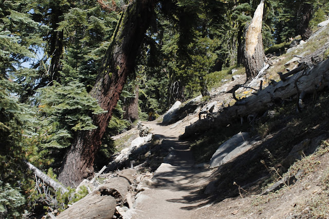
The trail climbs up around Sentinel Dome
A metal sign marks the final climb
Climbing Sentinel Dome
After reaching the foot of Sentinel Dome, the trees are once again replaced by the bright granite that it typical of the National Park. No one route is marked out to the top of the dome but there are no difficulties on the grippy, sloping rock. Reaching the top reveals one of the most amazing views in the whole of Yosemite, a full 360 panorama of the Sierra Nevada, the highlight being Half Dome.
Half Dome and the Sierra Nevada
Half Dome is the icon of Yosemite, a truly amazing piece of rock. Half Dome rises some 1,500m from the valley floor, reaching an elevation of over 2,680m. Despite an 1865 report declaring that it was "perfectly inaccessible, being probably the only one of the prominent points about the Yosemite which never has been, and never will be, trodden by human foot," George Anderson reached the summit in 1875, in the process laying the predecessor to today's cable route. The most famous--or infamous--part of the hike is the ascent up the cables. The two metal cables allow hikers to climb the last 100m to the summit without rock climbing equipment.
Half Dome with Clouds Rest behind
Cathedral Rocks and El Capitan
Mount Starr King with Clark Range beyond
Sara enjoying the grandeur of Half Dome
View towards the Clark Range along the Illouette valley
We sat atop Sentinel Dome for a while enjoying the view before starting our descent. The trail runs downhill for just over a mile to reach the trailhead where we had left the car. Though a relatively short and easy walk, this route scores highly on the views for effort ratio. Yosemite is an incredible place that really has to be seen to believed. It's a shame we didn't really have the time or foresight to plan a climb of Half Dome but maybe that's something for another time.
Sentinel Dome
Descending back through the pine trees
One last view of Sentinel Dome
While tempting to leave it here, it would be rude not to post some additional photos from some of the more famous viewpoints, just to show off the true beauty of Yosemite so, here we go.
Valley View - El Capitan and Cathedral Rocks over the Merced River
Tenaya Lake
The famous Tunnel View
Half Dome and Clouds Rest
The awe-inspiring Glacier Point

No comments :

Post a Comment