This map was created using GPS Visualizer's do-it-yourself geographic utilities.
Please wait while the map data loads...
Date: 27/09/2015
From: Rannerdale
Parking: Rannerdale Car Park
Start Point: Rannerdale Knotts
Region: North Western Fells
Route length: 10.4 miles (16.7 km)
Time taken: 04:58
Average speed: 2.1 mph
Ascent: 1,245m
Descent: 1,250m
Wainwrights on this walk:
Rannerdale Knotts (355m), Whiteless Pike (660m), Wandope (772m), Grasmoor (852m), Hopegill Head (770m), Whiteside (707m)
Other Summits: Thirdgill Head Man (734m), Sand Hill (756m), Gasgale Crags (702m), Whiteside East Top (719m)
Other points of interest: Whiteless Edge, Coledale Hause, Crummock Water
If pressed to do so, I think I'd have to say the North Western fells are my favourites. Two of the best day walks in the Lake can be found in this area; Newlands and Coledale and I enjoyed both of those immensely. I've even had some punishing days on the so-called 'lower' fells which, in hindsight, were certainly memorable. With a free day and some fine weather, I set off to Buttermere to complete a walk I've had in mind for a while now, a circuit of Grasmoor and its satellites and the chance to visit Whiteless Pike and Whiteside which, for me, would complete another area of Wainwrights.
 |
| A splendid morning warranted a quick stop off at Friar's Crag |
 |
| The bench at Friar's Crag |
 |
| The Jaws of Borrowdale |
 |
| Mellbreak on the shores of Crummock Water |
 |
| Grasmoor catches the sun. The car park I used can be seen part way along the road |
 |
| Mellbreak once more |
 |
| Looking to the mighty fells of Buttermere |
 |
| Low Fell |
 |
| Looking down Rannerdale Knotts towards Gale Fell |
 |
| Rannerdale Knotts summit cairn |
 |
| Whiteless Pike |
 |
| Looking down Buttermere |
 |
| Looking along Low Bank to Whiteless Breast |
 |
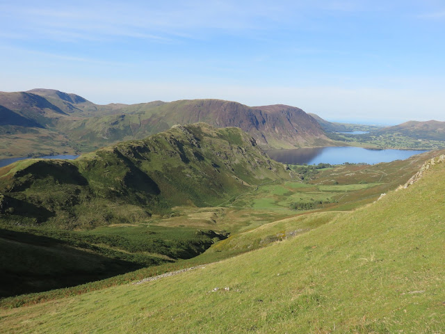
| Rannerdale and Rannerdale Knotts |
 |
| Whiteless Pike looms ahead |
 |
| An unusual view along Sail Beck |
 |
| Whiteless Pike's summit |
 |
| Grasmoor |
 |
| Whiteless Edge leads up to Thirdgill Head Man |
 |
| Crummock Water from Whiteless Pike |
 |
| Looking back along Whiteless Edge |
 |
| Wandope and its expansive view |
 |
| Scar Crag on Crag Hill |
 |
| Crag Hill from the climb up Grasmoor |
 |
| Grisedale Pike in the distance |
 |
| Grasmoor's summit |
 |
| Summit shelter |
 |
| Grasmoor's summit once again |
 |
| Buttermere |
 |
| Low Fell and Fellbarrow |
 |
| The route ahead leads down to Coledale Hause |
 |
| Dove Crags |
 |
| Whiteside |
 |
| Grisedale Pike over Coledale Hause |
 |
| Coledale |
 |
| Sand Hill up ahead |
 |
| Grisedale Pike |
 |
| Eel Crag |
 |
| Hobcarton Crag |
 |
| Hopegill Head |
 |
| Hopegill Head |
 |
| The summit of Hopegill Head |
 |
| Ladyside Pike |
 |
| Hope Gill and Whiteside from the summit |
 |
| Whiteside's superb ridge |
 |
| The hills of Scotland |
 |
| Looking back to Hopegill Head |
 |
| Hopegill Head |
 |
| Dove Crags on Grasmoor |
 |
| Whiteside |
 |
| The Wainwright summit on Whiteside |
 |
| Panorama of Liza Beck with Whiteside, Hopegill Head, Eel Crag and Grasmoor visible |
 |
| Mellbreak |
 |
| The Vale of Lorton |
 |
| Liza Beck as it emerges from the shadows of Grasmoor |
 |
| High Wood on the banks of Crummock Water |
 |
| Rannerdale Knotts and Red Pike |
 |
| Rannerdale Knotts |
 |
| A famous Lakeland sign |
 |
| Whiteless Pike |

No comments :
Post a Comment