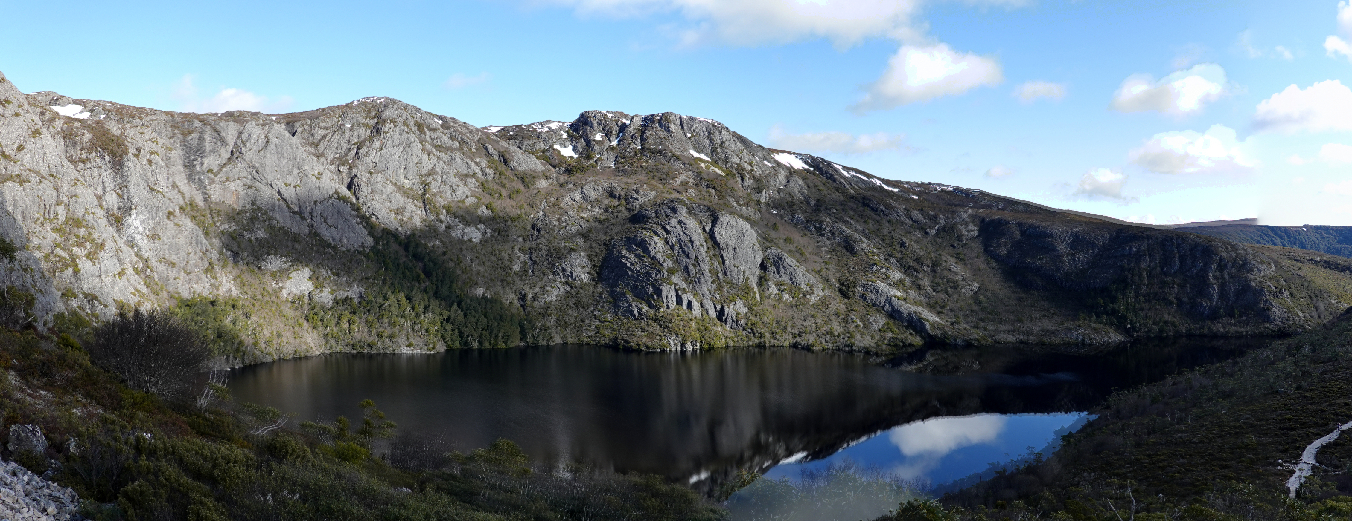
Crater Lake, Marion's Lookout & Dove Lake 09-08-2022
This map was created using GPS Visualizer's do-it-yourself geographic utilities.
Please wait while the map data loads...
Route: Dove Lake Circuit, Cradle Valley Boardwalk, Lake Lilla, Wombat Pool Track, Wombat Pool, Overland Track, Crater Lake, Marions Lookout, Chain Track, Dove Lake Circuit, Glacier Rock
Date: 09/08/2022
From: Dove Lake
Parking: Cradle Mountain Visitor Centre
Start Point: Dove Lake
Finish Point: Dove Lake
Region: Cradle Mountain-Lake St Clair National Park
Route length: 9.4 km
Time taken: 04:02
Average speed: 3.8 km/h
Ascent: 501m
Descent: 498m
Points of Interest: Dove Lake, Lake Lilla, Wombat Pool, Crater Lake, Marions Lookout
We recently spent the week on the beautiful island of Tasmania, Australia's smallest and least populated state. One of Tasmania's attractions is the vast western wilderness which covers almost the entirety of the west side of the island, some 1 million ha, and is home to one of the largest expanses of temperate rainforest in the world. The wild area is divided into several national parks, including Cradle Mountain-Lake St Clair National Park which is the jewel in Tasmania's glittering crown.
While the combined national park is vast in itself, the highlight of the park is centred on Cradle Mountain and its immediate surroundings. We were lucky enough to time our visit on a spectacular winter's day.
Due to its growing popularity, Cradle Mountain is somewhat protected from overuse by using a park-and-ride system, based at the newly constructed visitor centre. During daytime hours, the only way to access Dove Lake and the mountain is to hike 7 km from the visitor centre or get the shuttle bus. The shuttle bus operates seven days a week and runs every 10–15 minutes.
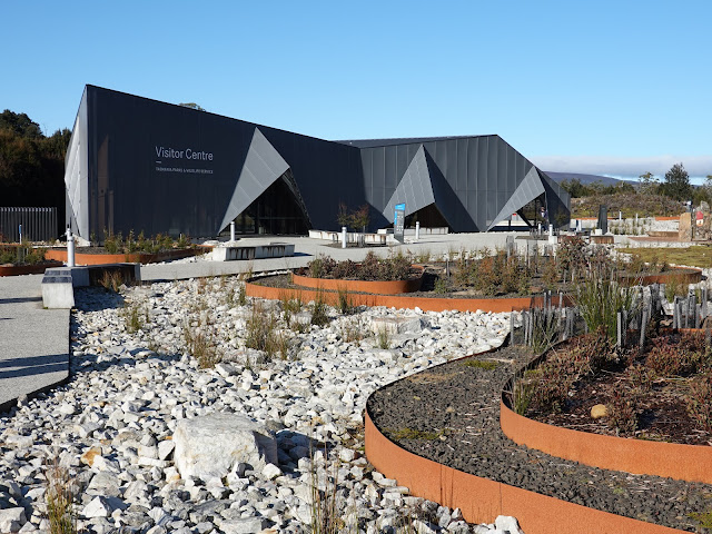 |
| The new visitor centre at Cradle Mountain opened in 2019 |
The most popular hike in the national park is a circuit of Dove Lake, which was our plan for the day. We also opted to include an extension that passes Lake Lilla and Crater Lake before topping out at the spectacular Marion's Lookout. After hopping off the shuttle bus, we were immediately rewarded with the iconic view of Cradle Mountain standing over Dove Lake. This view alone is often what brings visitors to the national park.
 |
| The magnificent Cradle Mountain |
 |
| Cradle Mountain |
 |
| Cradle Mountain and the high peaks around Crater Lake |
 |
| Dove Lake and Cradle Mountain |
After disembarking the bus, we followed the shoreline of Dove Lake west for a short distance to the Lake Lilla Track, beginning the first modest climb of the day. Despite appearances, it was cold and we had to negotiate several icy patches along the path.
 |
| Lake Lilla |
 |
| Lake Lilla |
After reaching the lake, the path descends towards the northern shore and crosses the small creek that flows out from it. The turn-off onto the Wombat Pool Track is only a short distance further.
Using a series of steps and boardwalks, the Wombat Pool Track climbs just under 100m to Wombat Pool, a small lake nestled in a depression in the hillside. Tasmania is famed for its abundant population of wombats, and you are more likely to see them out and about during the daytime here than anywhere else in Australia. Ronny Creek (at the beginning of the Overland Track, not far from Wombat Pool) is a prime spot to see them grazing during the day.
 |
| Lake Lilla and Hansons Peak from the path to Wombat Pool |
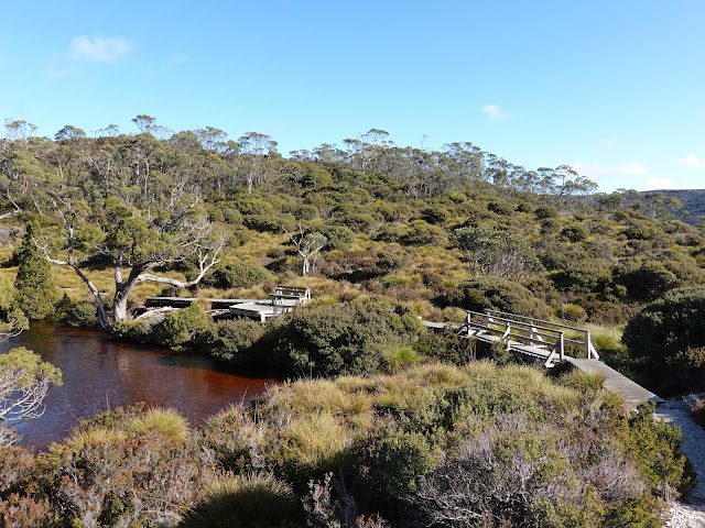 |
| Wombat Pool |
 |
| Wombat Pool — and yes, that is ice in Australia |
The path continues from the pool, climbing across the slopes of Wombat Peak and onto a thin ridge overlooking the spectacular Crater Lake, where it meets the Overland Track as it arrives from its starting point at Waldheim. Despite its name, Crater Lake is a classic cirque lake formed by glacial ice and snow, rather than anything volcanic (or meteoric?).
 |
| Above Wombat Pool |
 |
| This scene shows Wombat Pool in context |
 |
| Marions Lookout is the high point of this range |
 |
| Climbing towards Crater Lake |
 |
| Crater Lake |
 |
| A view towards Marions Lookout |
 |
| Crater Lake below Crater Peak |
After enjoying the views of the lake, we set our sights on the most serious climb of the day to Marions Lookout, following the Overland Track. It is steep as it winds through the rocks towards the lookout and is assisted by a metal chain in places, more for reassurance than anything else, but I would rank small sections of it as very easy scrambling. The view back to Crater Lake is sensational.
On a side note, the Overland Track is one of Australia's best multi-day hikes, straight through the alpine wilderness of Cradle Mountain-Lake St Clair National Park. It's well worth checking out if multi-day hikes are your thing.  |
| Crater Peak |
 |
| Lake Lilla |
Once the steeper section of the path is conquered, it is only a short distance to the lookout, an open, flat area with a sublime view of Dove Lake and Cradle Mountain - the perfect spot for lunch (and, in our case, some celebratory birthday bubbles). |
| Dove Lake and Cradle Mountain from Marions Lookout |
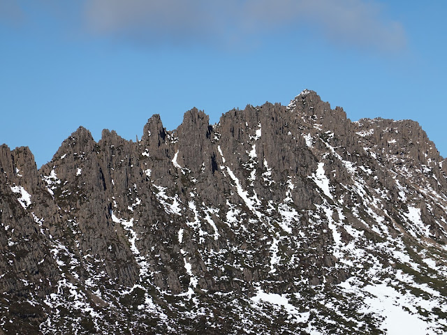 |
| The serrated peak of Cradle Mountain |
 |
| The view from Marions Lookout |
 |
| Hansons Peak |
 |
| Weindorfers Tower — a separate peak on Cradle Mountain |
Backtracking from the lookout towards Crater Lake, you will find a link track to Dove Lake. The Chain Track (or Marions Lookout Link Track) is steep and uses a series of metal chain handrails for assistance, but is by no means difficult. The rocky trail provides a quick route down from the lookout to the shores of Dove Lake and the Dove Lake circuit.
 |
| Lake Lilla and the Dove Lake visitor complex |
 |
| Dove Lake |
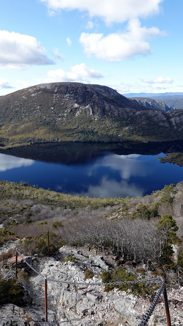 |
| The beginning of the Chain Track |
 |
| The Chain Track as it makes its steep descent |
Walking the Dove Lake circuit is probably the most popular hike in the state and one of Australia's best short hikes - for good reason. The path and wooden boardwalk encircle the lake and, aside from a single climb across a spur, is generally flat with tremendous views.
 |
| On the Dove Lake circuit |
 |
| A view across the lake to Glacier Rock |
 |
| Dove Lake |
 |
| Below Cradle Mountain |
As you close in on Dove Mountain, the path heads into the 'Ballroom Forest', a low-light rainforest made up of ancient myrtles and deciduous beech. The dark woods are quite a contrast to the typical alpine scenery on offer around Cradle Mountain and look like something lifted straight out of the Lord of the Rings.
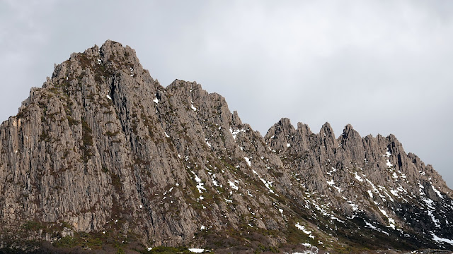 |
| Smithies Peak is the most prominent peak on Cradle Mountain |
 |
| Dove Lake |
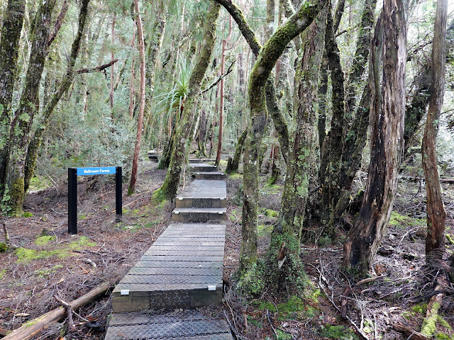 |
| Entering the Ballroom Forest |
 |
| Ballroom Forest |
 |
| Ballroom Forest |
 |
| Leaving the Ballroom Forest |
The views of Cradle Mountain disappear for a short while as you pass directly beneath its steep slopes, at the southern end of the lake. We were now on the home stretch back towards the shuttle bus parking area. The path dips in an out of various stands of trees as it heads north towards the shuttle bus area, interspersed with views of Dove Lake and Cradle Mountain.
The final flourish is Glacier Rock, a prominent outcrop of smooth rock that has a picture-perfect view of the lake. By now, the only downside was we'd lost the brilliant sunshine we had been treated to during the morning as it became shrouded behind a bank of clouds.
 |
| The wooden path hugs the cliffs as it exits the Ballroom Forest |
 |
| On the boardwalk at the southern end of Dove Lake |
 |
| The Dove Lake Circuit Track |
 |
| Cradle Mountain |
 |
| The view from Glacier Rock |
 |
| Cradle Mountain |
From the lookout at Glacier Rock, it's only a short hike to the shuttle bus stop. For some visitors to Dove Lake, the short walk from the bus stop to Glacier Rock provides adequate entertainment for the day. The shuttle bus ride back to the car park takes about 20 minutes, during which we spotted a few wombats hanging out in the fields on either side of the road.
It goes without saying that I thoroughly enjoyed this hike into the Tasmanian alpine area, and I have plans afoot to revisit this area and climb a few of the mountains outright, Cradle Mountain included.