Blencathra via Sharp Edge 22-10-2016
This map was created using GPS Visualizer's do-it-yourself geographic utilities.
Please wait while the map data loads...
Route: Thelkeld, Gategill, Doddick Farm, Scaley Beck, Scales Farm, Mousthwaite Comb, Scales Beck, Scales Tarn, Sharp Edge, Foule Crag, Atkinson Pike, Blencathra, Hall's Fell Ridge, Gategill, Threlkeld
Date: 22/10/2016
From: Threlkeld
Parking: Threlkeld
Start Point: Threlkeld
Region: Northern Fells
Route length: 5.8 miles (9.3 km)
Time taken: 02:43
Average speed: 2.1 mph
Ascent: 819m
Descent: 826m
Wainwrights on this walk:
Blencathra (868m)
Additional summits: Atkinson Pike (Foule Crag) (845m)
Sharp Edge is one of the quintessential Lakeland outings, often held in the same regard as Striding Edge and (to some extent) Crib Goch - though it is much shorter than its illustrious Welsh counterpart. Having decided a number of years ago to save Blencathra for last during my Wainwright quest, meant that Sharp Edge has since remained unclimbed. However, with the Wainwrights now done and dusted, it's time to start really exploring the Lake District, starting with this classic scramble.
This walk, though short, packs a lot into a short space. First, there's Sharp Edge, the narrow arête that either invokes a sense of delight or, possibly, terror depending on your outlook. Following immediately is a modest scramble up Foule Crag to reach Atkinson Pike. Then there's Blencathra and its tremendous views before a descent of Hall's Fell Ridge, a superb ridge that takes you right back to the valley below. All in all, a grand day (or afternoon) out.
 |
| Cloudy skies over Clough Head |
Exploiting the last weekend before the clocks change and we lose an hour of daylight, I didn't arrive in Threlkeld until the early afternoon after a leisurely jaunt up from Leeds. Starting in Threlkeld, I proceeded to head northeast along the edge of the Access Land below Blencathra until I reached Scales Farm at the foot of Scales Fell, having successfully negotiated a tricky rock outcrop at Doddick Gill.
 |
| Spectacular autumn colours on show |
 |
| Gateway to the fells |
 |
| Doddick Gill |
 |
| Scaley Beck |
Here, the path climbs across the contours before turning to face the slope head one, climbing steeply up the side of Mousthwaite Comb, a curious barrier to the River Glenderamackin, sending it on its circuitous course around Souther Fell. The route follows the well-established path up the Glenderamackin valley to reach Scales Beck below Brunt Knott where it climbs once again up to Scales Tarn. From here, things start to get a little more exciting.
 |
| Mousthwaite Comb |
 |
| Comb Beck flows out of Mousthwaite Comb |
 |
| The River Glenderamackin - Sharp Edge looms on the horizon |
 |
| The Glenderamackin at White Horse Bent |
 |
| Sharp Edge |
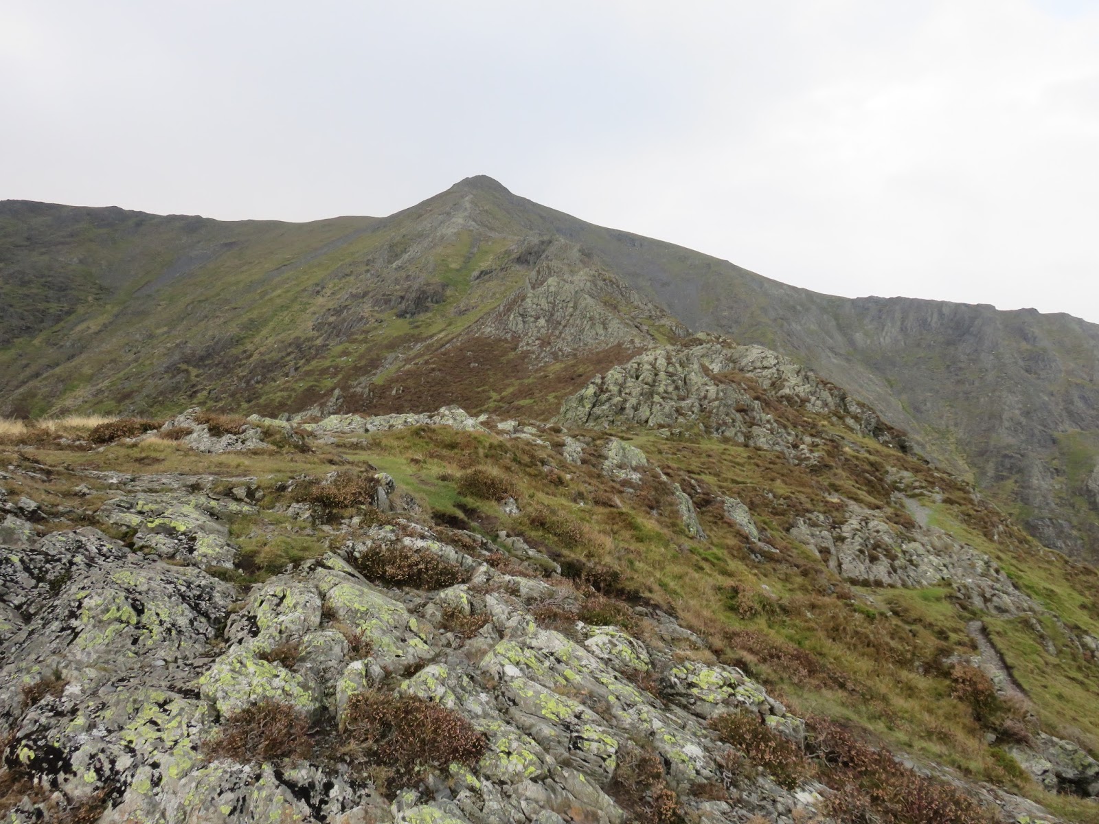
For a while, Sharp Edge has been looming up ahead, the very obvious light grey ridge is seen in profile, often with a number of walkers, silhouetted against the skyline. It can be accessed by the very obvious path that branches right up the hillside but it is worth stopping for a moment at Scales Tarn to savour the impressive mountain scenery.
 |
| Bannerdale Crags |
 |
| Sharp Edge |
 |
| Scales Tarn and Tarn Crags |
The initial climb along the path is easy enough until it reaches the first series of rock outcrops where the scrambling begins. Here, it is straightforward with many lines and no cause for difficulty. This short section will take you to the start of Sharp Edge, the vertiginous ridge ahead and it is here you can decide whether to take on the challenge or return to Scales Tarn to find another route. If you decide to carry on, here's what you can expect to find.
 |
| The path up to Sharp Edge |
 |
| Sharp Edge |
 |
| Foule Crag and Sharp Edge |
 |
| Scales Tarn |
 |
| The first scramble on Sharp Edge |
 |
| Climbing up to the crest |
Sharp Edge sweeps up ahead of you, an extremely narrow ridge with steep drops on either side. If you can stomach the exposure, clambering along its crest is not too difficult and most sections can be done without using your hands.
 |
| Sharp Edge |
 |
| Making my way along the ridge |
 |
| Looking back along Shar pEdge |
 |
| Approaching the Bad Step |
Around halfway, you will reach a small notch on the ridge with a short, jutting rock poking out at the top. This is widely known as the Bad Step, as the rock has been expertly polished by thousands of backsides. In the dry, you may not even notice it and continue on regardless, but when it is wet, the underlying slate can become lethally slippery with a number of casualties ending up the 'usual gully' as the Mountain Rescue put it.
 |
| Sharp Edge |
 |
| The Bad Step |
With the Bad Step negotiated, Sharp Edge starts to climb before ending at the base of Foule Crag. Short but sweet, it's a great introduction to exposed ridges and a real shame that it doesn't last longer. Scrambling up Foule Crag is entertaining in itself, the noticeable gully to the right being the most obvious route of ascent. Views back along Sharp Edge are understandably excellent.
 |
| The scramble up Foule Crag |
 |
| Sharp Edge |
 |
| Looking down Sharp Edge |
Eventually, you will reach the top of Foule Crag where a path will lead you up the final climb to Blencathra's summit. I briefly detoured to Atkinson Pike (the true summit of Foule Crag) and went off in search of the White Cross.
Located in the depression between Atkinson Pike and Blencathra, the White Cross is a large crucifix made entirely from pale rocks and boulders. Its origin is uncertain, but an extension to its current size is attributed to a Harold Robinson of Threlkeld who frequently visited the fell after World War 2.
 |
| The white cross |
Blencathra's summit is easily reached using the wide path that skirts the edge of Tarn Crags. Instead of a traditional trig pillar, there is instead, a small circular ring to denote the summit.
 |
| The path up to the summit |
 |
| Nice light over St. John's in the Vale |
 |
| Knowe Crags |
The descent begins immediately down the sweeping Hall's Fell Ridge, a superb way up or down Blencathra with more sustained hands on rock action than Sharp Edge. Some aspects of Hall's Fell Ridge can be compared to Striding Edge on Helvellyn, though any tricky bits can easily be avoided. It's no wonder that Wainwright suggested it was one of the best ways up any of the Lakeland fells.
 |
| Looking down Hall's Fell Ridge |
 |
| Hall's Fell Ridge |
 |
| Crags of Doddick Fell |
I was treated to some spectacular light as I made my descent, with shafts of sun lighting up the north western fells - a pretty typical autumnal moment. Autumn is a great time to be in the Lake District as the green leaves give way to vibrant orange and brown hues. There's also a good chance you'll not experience the summer crowds during this time of the year, always a bonus.
 |
| The full spectacle of Hall's Fell Ridge |
 |
| Light rays over Keswick and Derwentwater |
In all, a great afternoon out on a superb fell. Sharp Edge is an excellent scramble the absolutely has to be done. It's just a shame the excitement is short-lived. That said, descending Hall's Fell Ridge keeps excitement levels high throughout. This walk is a short, sharp blast of entertainment - pun intended.