This urban circuit around Rozelle and Blackwattle Bays offers a fantastic mix of sweeping harbour views, modern architectural landmarks, and expansive new green spaces. Kicking off at Federal Park, the route follows the foreshore past Wentworth Park to the impressive new Sydney Fish Market. From there, the trail heads up and over the Anzac Bridge before descending into the recently completed Rozelle Parklands, providing a peaceful, leafy finish to a genuinely varied inner-city loop.
Blackwattle Bay, Anzac Bridge & Rozelle Parklands
📍 SYDNEY AND SURROUNDS
Distance7.2 km
Duration01:49 hrs
Elev Gain+75 m
Elev Lost-71 m
Date
11 July 2026
Starting Point
Federal Park
Difficulty
Easy
Pace / Gear
4.4 km/h — Water
Highlights
Sydney Fish Market, Anzac Bridge, Rozelle Parklands
🗺️ Interactive Route MapPinch or use wheel to zoom
Tucked away in the inner harbour, Rozelle Bay and Blackwattle Bay offer a quieter, yet equally scenic, alternative to the bustling Iron Cove Bay Run. Walking the circuit between the two takes you directly across the Anzac Bridge. Though it often plays second fiddle to the Harbour Bridge, walking beneath the towering cables of this concrete giant is spectacular in its own right. Better yet, the route stitches together a brilliant mix of old and new Sydney, serving as the perfect gateway to explore the city's latest harbour-side developments: the newly built Sydney Fish Market and the sprawling green space of Rozelle Parklands.
Federal Park
We started our walk from Federal Park, situated along the Glebe foreshore. It forms part of a superb continuous green corridor—linking seamlessly with Jubilee, Bicentennial, and Blackwattle Bay Parks—to create 17 hectares of open parkland and sports facilities right in the heart of Sydney. The area is looking especially good lately with the finished wetland rehabilitation project at Johnstons Creek settling into the landscape. Almost immediately after leaving the car, the foreshore serves up a fantastic vantage point, offering uninterrupted views across the water to the Anzac Bridge and the CBD skyline.
After passing through Federal Park, we crossed Johnstons Creek via the timber footbridge. The creek has recently undergone a semi-naturalisation project to reintroduce vital ecosystems to the waterway. While sections of the original concrete channel remain, the naturalised banks have successfully restored the surrounding saltmarshes and added six hectares of rejuvenated parkland along the shore.
Johnstons Creek
Jubilee Park
Crossing the Allan Truss Bridge, we moved into Jubilee Park, which merges seamlessly into neighbouring Bicentennial Park. The two areas essentially function as one massive green space, with the foreshore path tracing the water’s edge through the latter. Bicentennial Park was established in 1988 to mark the bicentenary of European settlement in Australia, following a dedicated fifteen-year campaign by the Glebe Society. Interestingly, a public wharf and ferry service operated from Glebe Point here in the early twentieth century—and prior to the park's creation in 1988, that small historical reserve was the only point of public waterfront access on Rozelle Bay.
Johnstons Creek
Anzac Bridge from Glebe point
Glebe Foreshore
At the northern end of the park stand two majestic Moreton Bay fig trees, which are illuminated at twilight as part of a 2008 City of Sydney public art commission. These iconic trees are famous for their sweeping buttress roots and towering, cathedral-like canopies. From here, the path continues to Glebe Point, marking the official boundary between Rozelle Bay to the west and Blackwattle Bay to the east, and offering a spectacular vantage point directly beneath the Anzac Bridge.
Rounding the point, a short flight of steps leads down to a stone-flagged waterfront terrace backed by an old stone retaining wall. This historical section forms the earliest part of Blackwattle Bay Park and serves up magnificent views of the city skyline. Across the water, Pyrmont Point peeks out from behind the Anzac Bridge pylons—an area once dominated by the Colonial Sugar Refinery (CSR) distillery, now transformed into modern high-rise apartments.
Scanning the Sydney skyline from left to right, you can easily pick out several major landmarks: the iconic spire of Sydney Tower on Market Street, the prominent World Square Tower at Liverpool Street, the high-rises towering over Paddy’s Market, and the unmistakable brutalist block of the UTS (University of Technology Sydney) Tower on Broadway.
Blackwattle Bay
Following the foreshore path, the route passes the site of the old municipal incinerator—now cleverly converted into waterfront apartments—before reaching Bridge Road. Just across the street lies Wentworth Park. Reclaimed from the muddy reaches of Blackwattle Swamp between 1880 and 1882, and named in honour of William Charles Wentworth, this expansive green space actually predates Centennial Park. While it was once an elaborately landscaped Victorian pleasure garden, today the park is primarily a hub for local social sports and weekend recreation.
The old Walter Burley Griffin incinerator
Sydney Fish Market
The impressive new Sydney Fish Market now anchors the waterfront on this side of Blackwattle Bay. Designed by architectural firm 3XN, the facility features a striking wave-like timber canopy floating above expansive public boardwalks and terraced wooden seating that steps right down to the water. After navigating past the lively outdoor dining plazas and the open wholesale market floor, we left the bay behind and continued through the cavernous concrete underbelly of the A4 Western Distributor. From there, we picked up the curving, elevated shared path at Saunders Street, which leads directly onto the Anzac Bridge.
Sydney
Sydney Fish Market
Sydney Fish Market
Anzac Bridge
The old Sydney Fish Market is tiny in comparison
Saunders Street bike path
Anzac Bridge
Anzac Bridge
A combined pedestrian and cycle path runs along the northern side of the bridge, though admittedly, the immediate scenery here leaves a little to be desired. Looking out over Johnstons Bay reveals a somewhat stark landscape of industrial concrete docks and working port facilities. However, the Anzac Bridge itself is an impressive piece of modern engineering, originally opening to traffic on 3 December 1995 as the new Glebe Island Bridge.
Anzac Bridge
A peak at Sydney Harbour Bridge through the railings
Anzac Bridge
The bridge received its current name on Remembrance Day in 1998, rededicated to honour the soldiers of the Australian and New Zealand Army Corps (ANZAC) who served in World War I. Reflecting this shared heritage, an Australian flag flies atop the eastern pylon, mirrored by a New Zealand flag on the western tower. At the western end of the walkway stands a striking bronze memorial statue, unveiled on Anzac Day in 2000, depicting an Australian Digger resting on his Lee–Enfield rifle in the solemn "rest on arms reverse" position.
The Anzac solider statue
Rozelle Parklands
Leaving the Anzac Bridge behind, the final leg of the circuit delivers you directly into the newly transformed Rozelle Parklands. Built over the old Rozelle Railyards and sitting atop a massive underground motorway interchange, this 10-hectare green space has completely revitalized the western approach to the bridge. Where there was once a drab, industrial wasteland of disused rail lines and concrete, a broad network of shared paths now meanders past constructed wetlands, a newly planted urban forest, and raised timber boardwalks.
Rozelle Parklands - the three towers are ventilation stacks for the motorway tunnel buried beneath
Rozelle Wetlands
Rozelle Wetlands
Rozelle Parklands
Following the winding trails through the parklands provides a much-needed green buffer from the surrounding arterial roads. Crossing back towards Lilyfield Road and the head of Rozelle Bay, the track links smoothly into the greenways and waterfront reserves to bring you right back to the start at Federal Park. It makes for a far more rewarding finish than the old industrial slog, turning what was once a slightly disjointed urban loop into a genuinely varied harbour circuit.
Discover the hidden natural haven of Hunts Creek Reserve on this easy 2.9km dog-friendly suburban loop. Tucked away behind North Rocks and Carlingford, this secluded patch of native bushland offers a perfect short escape for humans and four-legged explorers alike. The absolute highlight of the trail is Balaka Falls—arguably the most photogenic waterfall in the Parramatta region—where a series of sandstone steps leads you straight to the base of a beautiful cascading tier that truly comes alive after fresh rainfall.
Balaka Falls Loop
📍 SYDNEY AND SURROUNDS
Distance2.9 km
Duration01:02 hrs
Elev Gain+60 m
Elev Lost-53 m
Date
19 October 2024
Starting Point
Parkland Road
Difficulty
Easy
Pace / Gear
3.5 km/h — Water
Highlights
Balaka Falls
🗺️ Interactive Route MapPinch or use wheel to zoom
I’ve been a bit quiet in the hiking space lately, tending to the newest member of the All the Gear crew: our border collie puppy, Indie. Now that she's reached six months old and is eager to explore, I've been introducing her to outdoor adventures—specifically short, dog-friendly hikes around the Sydney region.
Regular readers might not be aware that dogs are strictly prohibited in Australian national parks, which instantly rules out classic hikes across the Blue Mountains, Royal, and Sydney Harbour. However, if you look a little closer, you can find fantastic pockets of native bushland that fall outside the national park system. One of the best is Hunts Creek Reserve, home to Balaka Falls.
Hunts Creek Reserve is a secluded natural haven tucked away right behind the houses and roads of suburban North Rocks and Carlingford. Serving as a vital sanctuary for local wildlife, this resilient patch of native bushland was proudly preserved during the sweeping residential redevelopments of the 1960s.
There are multiple entry points to the reserve from the surrounding streets, meaning parking is never an issue. To get the maximum distance out of the loop, I chose to start from the Parkland Road entrance on the eastern edge.
Parkland Road entry
A well-worn track traces either side of the creek, allowing you to tackle the loop in either direction. Reaching the main circuit requires a short walk through the native canopy following the upper reaches of Hunts Creek—a watercourse early European settlers once described as the cleanest in the region, famously using it to brew illegal peach cider. You'll quickly reach the main trail junction at a sturdy timber footbridge, one of several crossings recently upgraded by the local council to withstand the fast-moving floodwaters that rush down the valley after a storm.
The path squeezes behind some houses initially
Balaka Falls Loop
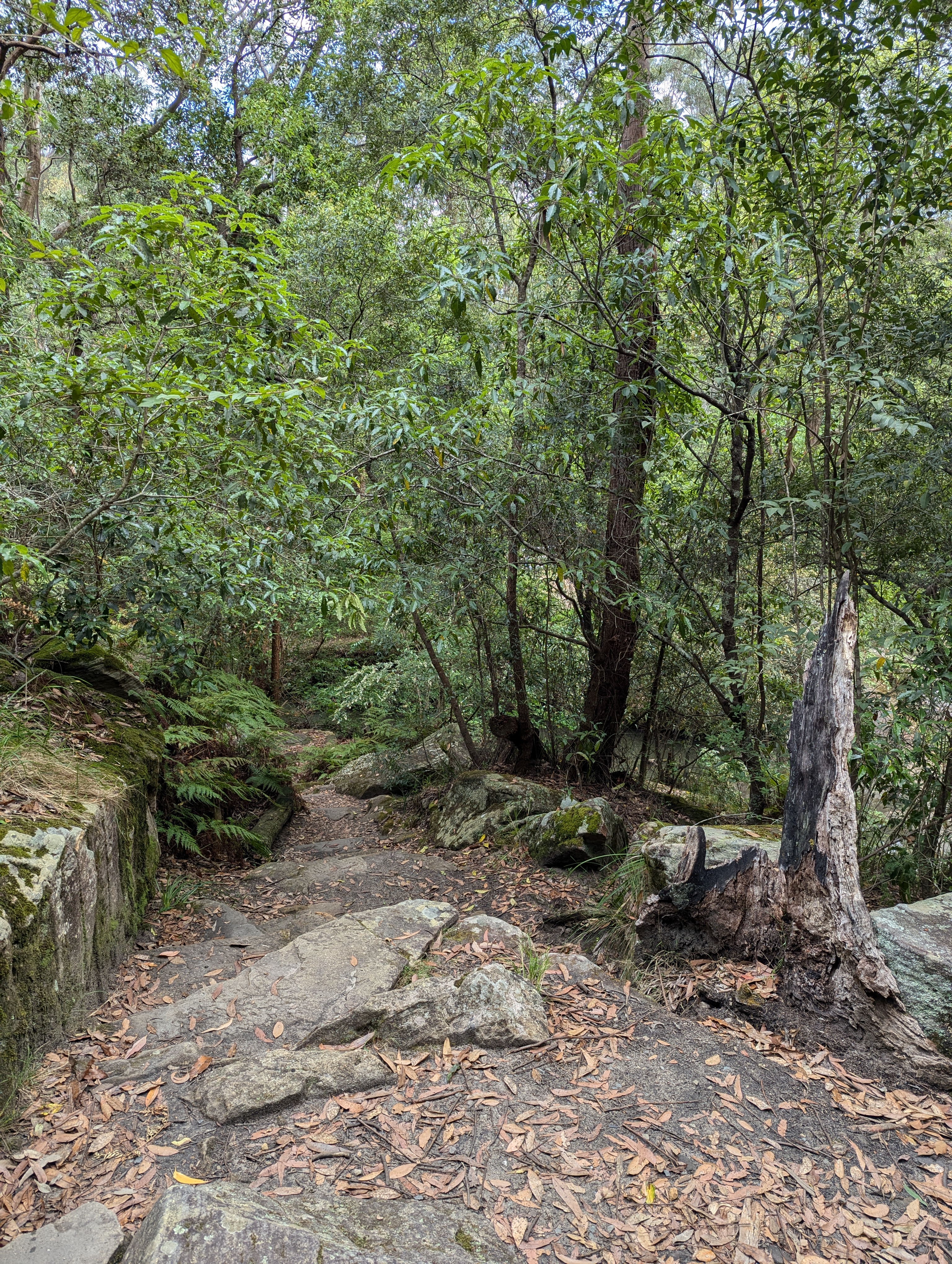
I followed the trail along the northern bank, heading west toward the falls. Clear local signage keeps you on track while marking the various neighbourhood access paths that branch off into the reserve. Just a short distance before the falls, the trail winds past a series of striking, weathered Hawkesbury Sandstone overhangs—ancient rock formations carved out over millennia by the creek's changing path.
Balaka Falls Loop
Balaka Falls Loop
Dogs are allowed in the reserve
Hunts Creek Reserve
The trail brings you out high above Balaka Falls, where the sound of rushing water echoes through the valley long before the cascade comes into view. The path drops down to the top of the falls, requiring a quick creek crossing that can get incredibly slick and challenging after heavy rain (unless you don't mind getting your boots wet). Framed by a lush microclimate of native ferns and towering Sydney Red Gums, a flight of rugged sandstone steps leads you right down into the amphitheatre at the base of the falls.
Descending to the waterfall
While natural waterfalls are an absolute rarity in the heavily urbanised Parramatta region—with historic cascades like the original Parramatta Falls long since lost to 20th-century development—Balaka stands out as a pristine, photogenic exception. It’s particularly spectacular immediately after a heavy downpour, like the storm that passed just before Indie and I arrived. The multi-tiered cascade drops beautifully into a shallow, sandy pool, offering fantastic vantage points from both the upper ledge and the rocky valley floor below.
Balaka Falls on a relatively dry day
Balaka Falls after a storm
Balaka Falls
Balaka Falls
Balaka Falls — yes, I was standing in the creek
Retracing your steps back to the top of the sandstone ledge puts you right back on the main loop—a wide, graded trail that cuts directly along a cleared power line easement. This stretch offers a fast, straightforward route toward the Karingal Avenue trailhead, where you'll pass a handsome timber entry sign that wouldn't look out of place at the entrance of a major national park. It's a striking reminder of the reserve's protected status, sheltering the very waters that flow downstream to fill the historic, heritage-listed Lake Parramatta.
The power line fire trail
The trail eventually guides you down to a sturdy timber footbridge – installed in 2022 to fully reconnect the eastern and western halves of the reserve after past floodwaters washed away the old crossing. Stepping over the running water completes the main circuit, leaving just a short, easy stroll back to the Parkland Road trailhead on the eastern edge.
Hunts Creek
Hunts Creek Reserve is absolute proof that you don't have to drive all the way to the national parks to find a genuine escape into native bushland. For Sydney dog owners looking for a scenic alternative to standard suburban footpaths, this 2.9km loop hits the absolute sweet spot. It delivers an easy, low-stress stroll that perfectly balances wide fire trails with rugged bush tracking, all while serving up the spectacular reward of Balaka Falls. Keep your eyes peeled and you might even spot some of the reserve's more elusive residents, like sugar gliders or powerful owls. Whether you're training a new puppy or just looking for a quick nature fix close to home, it’s a brilliant, peaceful pocket of green tucked away right under our noses.