Looking for one of the most spectacular coastal walks in New South Wales? Swapping Sydney’s familiar sandstone for dramatic volcanic cliffs, this 10.3 km northern stretch of the famous Kiama Coast Walk is a masterclass in coastal scenery. Winding from the pristine estuary of the Minnamurra River down to the iconic seaside town of Kiama, this moderate, highly rewarding route is packed with geological wonders. Trace the golden sands of Jones and Bombo beaches, marvel at the jagged basalt sea stacks of Cathedral Rocks, and step into the otherworldly, hexagonal columns of the heritage-listed Bombo Quarry. Capped off with a visit to the historic Kiama Lighthouse and the famous Kiama Blowhole, this trail delivers non-stop ocean panoramas and unspoilt headlands at every turn.
The Kiama Coast Walk is one of Australia's most scenic walks with ocean views, spectacular rock formations, and unspoilt beaches. It has three sections, comprising a series of shorter walks from the mouth of the Minnamurra River south through Kiama to Gerringong’s Werri Beach. The hills are gentle enough for most fitness levels, offering a mix of sealed paths, grassed tracks and beach walking.
We started from Minnamurra village, parking close to the small platform that makes up the train station. 'Minnamurra' means 'plenty of fish' in the local Aboriginal dialect of the Dharawal people, and, once we reached the beach, we could see why. The river estuary is beautiful and looks ideal for a mid-summer swim. However, today, after days of soaking rains, the brown waters of the estuary left little to be desired.
 |
| Minnamurra River |
 |
| Stack Island |
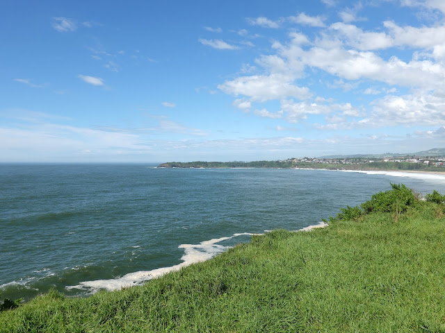
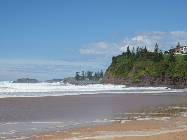
The Coast Walk path climbs a headland to Minnamurra Point, which has a sweeping view of the estuary, looking across Boyds Beach and the dramatic volcanic sea stack known as Stack Island. This is a very different territory from the sandstone-dominated geology of Sydney and the Blue Mountains. The path continues south to a whale-watching platform (winter is the peak season for spotting migrating humpback whales) and then threads through a section of suburbia to find Jones Beach.
 |
| Minnamurra River |
 |
| The river estuary |
 |
| Minnamurra River |
 |
| The Kiama coast |
 |
| Jones Beach |
 |
| Jones Beach |
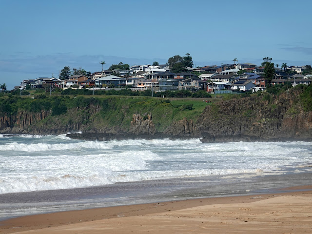
The long stretch of sand is popular with surfers, particularly at Kiama Downs, where the local lifesaving club is located. We followed the length of the beach to its southern end, where you will find Cathedral Rocks, which is a must-see along the route.
 |
| Jones Beach and Cathedral Rocks |
Accessed along a rock shelf, Cathedral Rocks are a series of basalt sea stacks arranged below the cliffs. One, in particular, resembles a large building, hence the name. Professional photographers flock to the area for obvious reasons. There is also a small sea cave to investigate, hidden just around the corner of the first cliff. Sadly, today, the waves were too strong for us to get to Cathedral Rocks.
 |
| Cathedral Rocks |
 |
| Cathedral Rocks |
We followed North Kiama Drive south as it rises over a low hill to Cliff Drive before Cliff Drive descends to The Boneyard. If you can't get to Cathedral Rocks from the beach, you'll be able to look back at them from the road.
 |
| Cathedral Rocks |
The sheltered pebble beach gets its name from a heavy reef break called Boneyards, located just off the shore, rather than anything more sinister. The path follows the beach and the shoreline briefly before venturing into the bush on the Bombo Headland, home to some unique geological formations.
 |
| Boneyard Beach |
 |
| Boneyard Beach |
 |
| Cathedral Rocks |
 |
| Boneyard Beach |
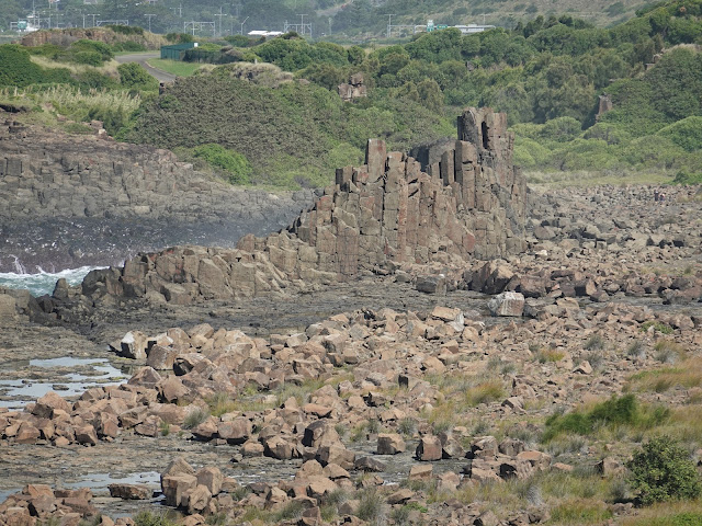
As I mentioned earlier, the coastline here is volcanic basalt, which forms vertical columns much like those found at the Giants Causeway in Northern Ireland. The Bombo Headland, however, used to be a working quarry and, while largely artificial, has left hundreds of tall, vertical basalt columns remaining. It is now a heritage-listed geological site.
 |
| Bombo Quarry |
The headland provides a good view over the quarry, and following the path further allows you to detour into the quarry if you desire. Here you can get up close to the hexagonal columns, and it provides endless opportunities for those sporting a camera.
 |
| Bombo Headland |
 |
| Waves pound the shoreline |
 |
| The vertical quarry walls |
 |
| Bombo Quarry |
 |
| One of the local residents |
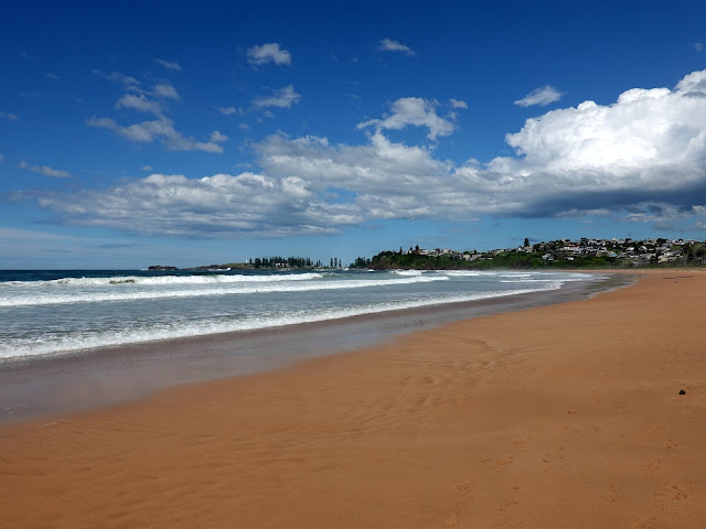
We left the quarry and made our way south to Bombo Beach, another long strip of golden sand served by its very own train station. We followed the beach to the southern end, where we crossed Spring Creek, heading beneath the railway to Hothersall Street. This led us to Gripps Street, which ultimately makes its way into Kiama.
 |
| Bombo Beach |
 |
| Bombo Beach |
 |
| Bombo Beach |
 |
| Pheasant Point |
Kiama is a beautiful seaside town, best known for its lighthouse and blowholes. Located on Blowhole Point, the Kiama Lighthouse is hard to miss. It was established in 1887, 10 years after the creation of the man-made Kiama Harbour.
 |
| Black Beach in Kiama |
 |
| Kiama Harbour |
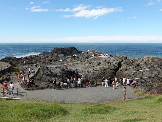
Sitting just beneath the lighthouse is the Kiama Blowhole, a natural cavity in the rugged cliffs that blasts seawater 20 metres or more into the air. Today, it was a little benign due to the small waves, but we did see one or two spurts while we were hanging around waiting for the time to head to the train station.
 |
| Kiama Blowhole |
 |
| Blowhole Point |
 |
| Kiama Lighthouse |
It wasn't long before we were back in Minnmurra retrieving the car from our starting point in the village. I thoroughly enjoyed this walk, and, considering it's the first third of a much longer hike, I'm keen to revisit it again in the future.


No comments :
Post a Comment