Narrabeen Lagoon, Warriewood Wetlands & Turimetta Head
Looking for a scenic walk on Sydney’s Northern Beaches that easily stretches into a proper coastal adventure? The Narrabeen Lagoon Loop is a local favourite for a reason, offering effortless water views, quiet paperbark forests, and rich biodiversity. But combining the trail with the boardwalks of Warriewood Wetlands and the rugged cliffs of Turimetta Headland turns a simple lake circuit into an outstanding day out—delivering lush freshwater swamps, sweeping ocean vistas, and golden surf beaches all in one trip.
Narrabeen Lagoon, Warriewood Wetland & Turimetta Head
📍 SYDNEY AND SURROUNDS
Distance18.7 km
Duration03:58 hrs
Elev Gain+281 m
Elev Lost-273 m
Date
21 October 2023
Starting Point
Berry Reserve
Difficulty
Moderate
Pace / Gear
5.1 km/h — Light day pack
Highlights
Narrabeen Lagoon, Warriewood Wetlands, Turimetta Head
🗺️ Interactive Route MapPinch or use wheel to zoom
Narrabeen Lagoon sits on Sydney’s Northern Beaches, just north of the CBD. The region’s name leaves little to the imagination: a spectacular ribbon of golden sand stretches along the coast from Manly all the way to Palm Beach, with Narrabeen Beach ranking as one of the longest.
Tucked directly behind the sand dunes lies the Narrabeen Lagoon Loop—a scenic 8.4-kilometre walking and cycling trail that skirts the entire perimeter of the lake. Wide, mostly flat, and easy to navigate, it's suitable for all fitness levels. If you're looking for a relaxing, accessible walk surrounded by nature and water views, the Narrabeen Lagoon Trail is hard to beat.
While several car parks are scattered around the lagoon, parking fees can be surprisingly steep. Public transport is a smart alternative; the frequent B1 B-Line bus service from Sydney CBD drops you right at Berry Reserve, making it an ideal starting point for the circuit.
From Berry Reserve, the trail follows a paved pathway through narrow parkland toward The Esplanade before continuing onto Jamieson Park. While this early section is fairly straightforward—and popular with local runners, families, and cyclists—the views across the water are lovely, with plenty of quiet clearings between the trees to pause and take in the scenery.
Narrabeen Lagoon at Berry Reserve
Narrabeen Lagoon
The shared path in Berry Reserve
Past Jamieson Park, the Lagoon Trail winds into the lush surrounds of South Creek and Middle Creek. This section of the loop passes through dense rainforest, home to threatened ecological communities like Cabbage Tree Palm woodland. Tucked away from the Wakehurst Parkway, this quiet reserve feels a world away from the bustle of the Northern Beaches. Further along, Pipeclay Point juts into the lagoon, serving up sweeping vistas across the water and an unbeatable spot to catch the sunset.
Pipeclay Point juts out into the lagoon
James Wheel Place Reserve
Pipeclay point
A substantial bridge crosses South Creek, where the path hugs the shoreline before traversing Middle Creek via the Jim Somerville Bridge. Opened in 2015 alongside new boardwalks near the Sydney Academy of Sport, this crucial link finally completed the full Narrabeen Lagoon circuit. The loop was originally the brainchild of local resident Graham Jones, who was inspired after walking around Canberra’s Lake Burley Griffin. Getting access through the Academy's land proved a major hurdle, but local campaigner Jim Somerville spent years lobbying state and local politicians until a breakthrough agreement was reached.
The crossing of Middle Creek
Middle Creek
Narrabeen Lagoon
Middle Creek
After crossing Middle Creek, the path hugs the lagoon, sandwiched between the water and the Wakehurst Parkway. A small viewing platform near the remnants of the old shell-grit cement works offers great views across the water. Built in the 1920s to dredge lime from the lagoon bed, the operation was short-lived and never reached its full potential, ultimately abandoned as the construction of the Parkway reshaped the shoreline.
The viewing platform close to the old cement works
Little Pied Cormorants
Narrabeen Lagoon
Just around the bend is the impressive aquatic boardwalk, which curves directly over the water. Built to replace a tight, exposed stretch of track alongside the Wakehurst Parkway, it makes the loop vastly safer for walkers and cyclists while shielding the fragile marine ecosystem and saltmarsh along the lagoon's northern foreshore. Floating right above the surface, the boardwalk delivers brilliant open water views as it leads directly into Bilarong Reserve.
Deep Creek
The lagoon trail boardwalk
A view of the lagoon from the boardwalk
The boat ramp at Bilarong Reserve
White-faced Heron
This largely completes the circuit of the lagoon, but I had my sights set on the Warriewood Wetlands just to the north—the largest remaining freshwater wetland in coastal Sydney. You can reach it easily by following Pittwater Road and Garden Street, or by taking the scenic detour up through the bush to Alleyne Avenue Lookout for an elevated view over the canopy and lagoon before dropping down into the reserve.
The view from Alleyne Avenue Lookout
The wetland is impressive, to say the least, standing as the largest remaining sand plain wetland in northern Sydney. Fed by Narrabeen, Fern, and Mullet Creeks before draining downstream into Narrabeen Lagoon, this crucial habitat supports a rich variety of birdlife, including migratory species. A network of quiet paths and elevated boardwalks winds directly into the heart of the paperbark swamp, allowing you to explore the lush canopy and tranquil waters without getting your boots muddy.
Mullet Creek flows from Warriewood Wetlands
A weedy Mullet Creek
Warriewood Wetlands boardwalk
Warriewood Wetlands
Warriewood Wetlands
Warriewood Wetlands
Emerging on the northern side of the wetlands near Fern Creek, I navigated a few quiet suburban streets toward Warriewood Beach—one of the many golden stretches of sand along Sydney's Northern Beaches. Guarding the southern end of the beach is Turimetta Headland, a rugged bluff offering sweeping views up and down the coast. The cliffside trail makes an energetic climb up and over the headland, rewarding the extra legwork with a front-row seat to the crashing surf below.
Warriewood Beach, seen from Narrabeen Park Parade
Turimetta Headland
Warriewood Beach
Warriewood Beach
The headlands to the north of Turimetta
Turimetta Headland
Turimetta Beach
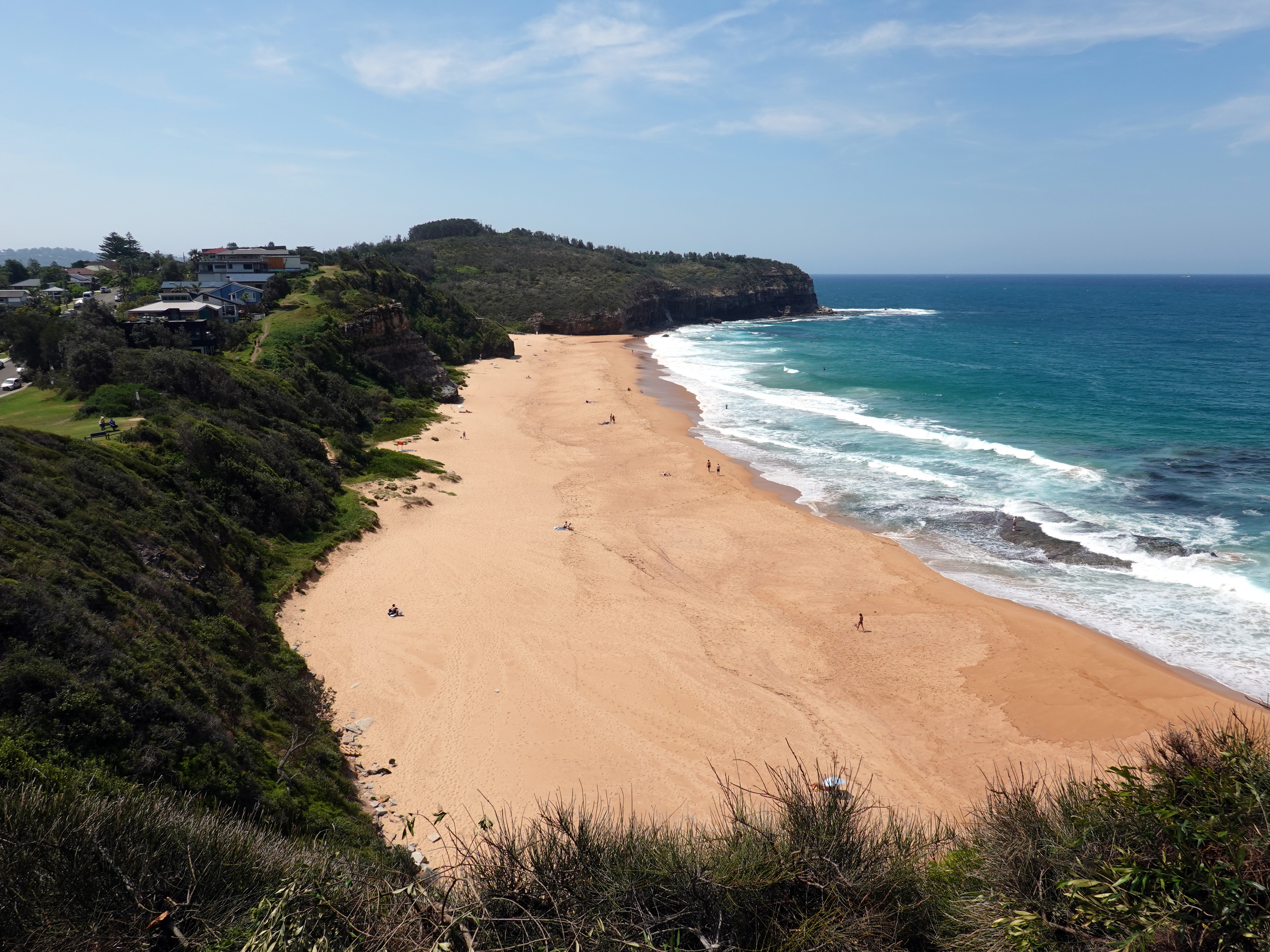
Dropping down the southern side of the headland brings you to Turimetta Beach, a quiet, secluded pocket of sand framed by dramatic shale cliffs and a popular rock platform. From here, the cliffside path leads up toward North Narrabeen Headland Reserve, offering a couple of cracking lookouts before terminating above the mouth of Narrabeen Lagoon. The view south from the headland is the real standout, taking in the sweeping golden arc of Narrabeen and Collaroy beaches stretching all the way to Long Reef Point. From the headland, it's a short walk down to Ocean Street and across the bridge over the lagoon outlet, bringing you right back into the heart of Narrabeen.
Turimetta Beach
Turimetta Beach - the Coast Walk can be seen running along the top of the cliffs
North Narrabeen Beach
Narrabeen and Collaroy Beaches
Narrabeen Lagoon
Narrabeen Lagoon
What makes this walk special is how seamlessly it transitions from tranquil lake path to wild coastal trek. Tying together Narrabeen Lagoon, the paperbark canopy of Warriewood Wetlands, and the dramatic headlands above Turimetta Beach gives you the absolute best of the Northern Beaches in a single day. Whether you stick strictly to the flat perimeter of the lagoon or push up over the cliffs to catch the surf below, it's a remarkably versatile route that proves you don't need to head deep into the national parks to find a great bushwalk.




No comments :
Post a Comment