Vaucluse Loop 26-03-2022
This map was created using GPS Visualizer's do-it-yourself geographic utilities.
Please wait while the map data loads...
Route: Towns Road, Oceanview Avenue, Ray Street, Diamond Bay Cliffwalk, Rosa Gully, Chris Bang Crescent, Clarke Reserve, Christison Park, Macquarie Lighthouse, Signal Hill, Old South Head Road, Gap Park, The Gap, Gap Bluff, Cliff Street, South Head Heritage Trail, Hornby Lighthouse, Camp Cove, Green Point, Pacific Street, Marine Parade, Watsons Bay, Gibsons Beach, Hopetoun Avenue, The Crescent, Parsley Bay, Vaucluse House, Coolong Road, Shark Beach, Nielson Park, Hermitage Foreshore, Milk Beach, Hermit Beach, Queens Beach, Bayview Hill Road
Date: 26/03/2022
From: Vaucluse
Parking: Vaucluse
Start Point: Diamond Bay
Finish Point: Queens Beach
Region: Sydney
Route length: 13.7 km
Time taken: 03:02
Average speed: 4.8 km/h
Ascent: 362m
Descent: 369m
Points of Interest: Diamond Bay, The Gap, South Head, Hermitage Foreshore
I was back hiking in Sydney this weekend, mostly because the weather had been pretty poor lately, and I lacked the motivation to drive further afield. I decided to head to one of Sydney’s best hiking areas—South Head—to revisit parts of the Bondi to Manly track, the 80 km route linking two of Sydney’s most famous beaches. Specifically, I planned to tackle one of the early sections between Diamond Bay and the Hermitage Foreshore, including South Head.
I parked at the bottom of Towns Road, a steep street climbing into the heart of Vaucluse, providing a stiff warm-up for the day. After a few pedestrian crossings and suburban streets, I arrived at the entrance to Diamond Bay on the eastern side of the Vaucluse peninsula.
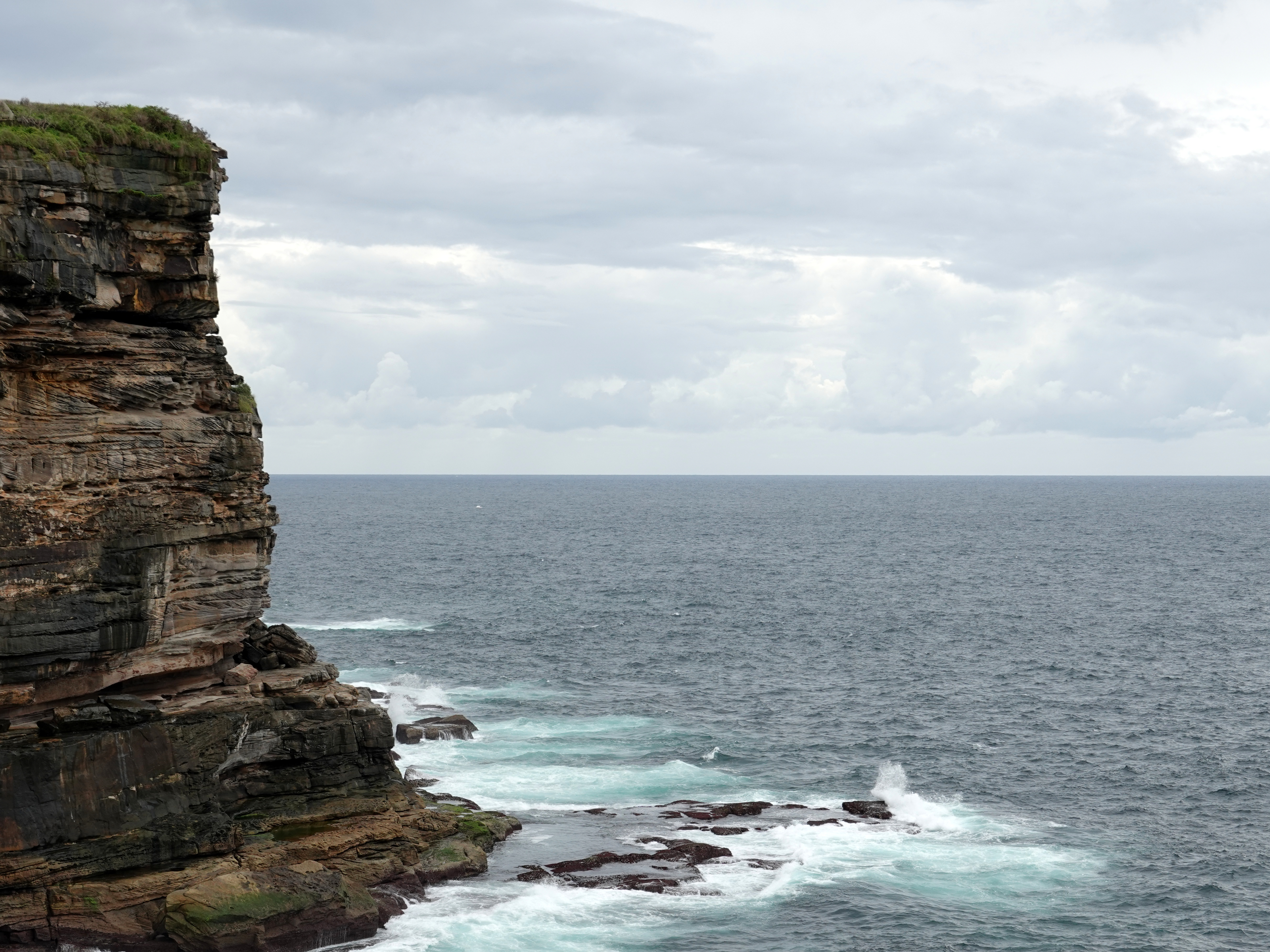
The craggy bay is surrounded by a reserve of the same name, which includes Rosa Gully—a small remnant of bushland tucked within the area. |
| The rugged Diamond Bay |
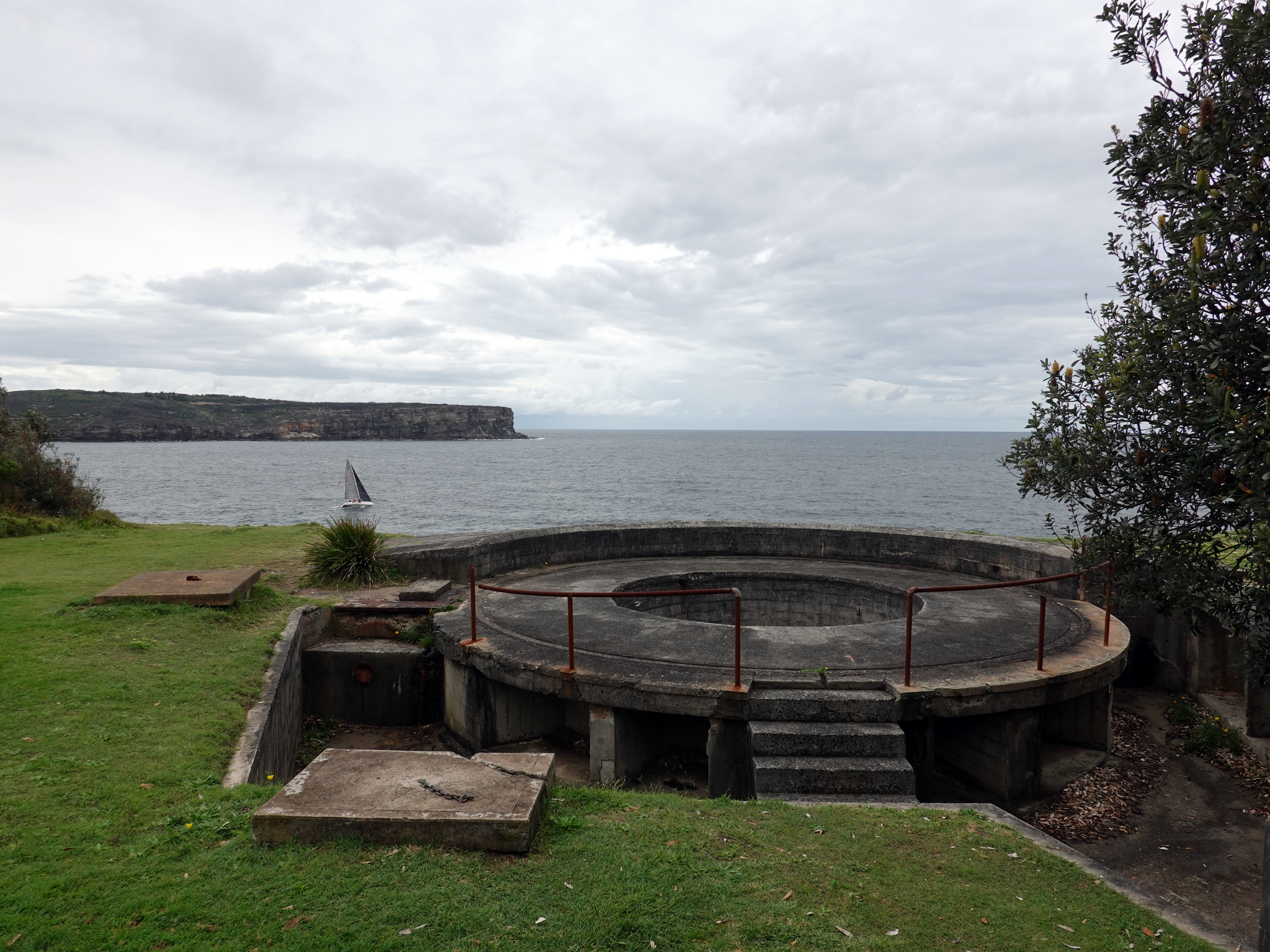
The path skirts the top of Rosa Gully and then heads along a road back towards the cliff edge. I followed the streets until I reached Clarke Reserve and Christison Park, home to the Macquarie Lighthouse, the first in Australia, and the longest-serving. North of the lighthouse is the remaining foundations of the Signal Hill Battery - a gun emplacement intended to defend Sydney from bombardment by an enemy vessel standing off the coast.
 |
| Diamond Bay |
 |
| The entrance to Rosa Gully |
 |
| Diamond Bay |
 |
| Sydney viewed from the football stand in Christison Park |
 |
| Macquarie Lighthouse |
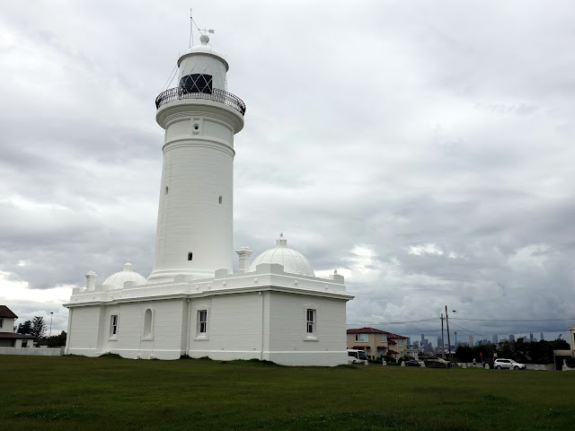 |
| Macquarie Lighthouse |
 |
| Signal Hill Battery |
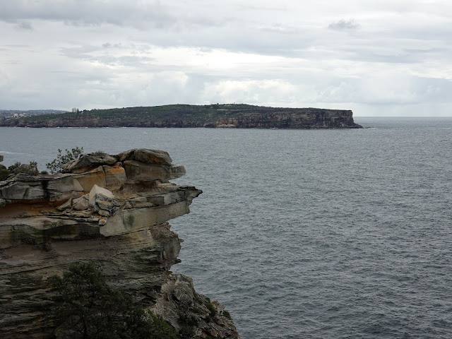
From the battery site, Old South Head Road squeezes the path onto the pavement for a short distance until you reach the entrance to Gap Park, an area of recreation ground that extends from The Gap to the tip of South Head. The park was dedicated as a public recreation reserve in 1887. Now, thanks to the nearby car park and superb views, the small lookout at The Gap attracts a multitude of phone-wielding tourists.
 |
| North Head viewed across the harbour entrance |
 |
| Overlooking Sydney Harbour |
 |
| The Gap |
Aside from the view, the lookout is home to a memorial for the Dunbar, a ship wrecked on the cliffs in 1857, with only one of its 122 passengers and crew surviving. The tragedy highlighted the need for a clearer definition of the harbour entrance, exposing deficiencies at Macquarie Lighthouse, as it seemed The Gap may have been mistaken for the harbour entry. As a result, the Hornby Light was constructed at the extreme northern tip of South Head, which would be my next destination. |
| The recovered anchor from the Dunbar |
 |
| The Gap |
 |
| Gap Bluff Walking Track |
From The Gap, the route follows a slightly circuitous path along the Gap Bluff Walking Track, winding around the existing naval base at HMAS Watson before descending to Camp Cove, one of Sydney’s most idyllic harbour bays. The South Head Heritage Trail begins at the northern end of the beach, forming a short 2 km loop around the headland that takes in Hornby Lighthouse before returning to the beach. |
| Camp Cove |
 |
| A replica cannon sits on the South Head walking track |
 |
| South Head Battery |
 |
| Hornby Lighthouse at South Head |
 |
| Looking across the harbour entrance to North Head |
 |
| Yachts in Middle Harbour |
 |
| Sydney Harbour |
 |
| Green Point at the south end of Camp Cove |
 |
| Camp Cove |
At the southern end of Camp Cove lies Green Point Reserve, a small open area covering a peninsula that juts into the harbour. The Bondi–Manly route follows the exposed rocks along the shore, passing a stone obelisk and a concrete pad marking the remains of a winch house. The building once served a World War II anti-torpedo net that stretched 1.5 km across the harbour, while the obelisk—constructed some 90 years earlier—served as a navigational aid. |
| Camp Cove |
 |
| Green Point |
Once around Green Point, the route heads east to Watson's Bay, before turning south through the fringe of Robertson Park until it reaches the Vaucluse Yacht Club in the suburb of Vaucluse, one of the most affluent areas in Sydney, along with Point Piper. The properties in these neighbourhoods exchange hands for millions of dollars.
 |
| Marine Parade at Watsons Bay |
 |
| Watsons Bay |
 |
| Watsons Bay Beach |
The path follows the shore to Gibson Beach where it is forced onto one of the leafy residential streets, Hopetoun Avenue and The Crescent. While not unpleasant, suburban streets don't make for particularly impressive photos. After following The Crescent for some 700m, I reached the footbridge over Parsley Bay.
The 1910 suspension bridge is the focal point of the wider Parsley Bay reserve, a tiny but beautiful bay that has long been one of Sydney’s favourite harbour-side places, and since 1906 has been officially reserved for the enjoyment of the public.
 |
| The bridge over Parsley Bay |
 |
| Parsley Bay |
From Parsley Bay, I made my way through more suburbs, towards the promontory of Steele Point which is comprised of Shark Bay and Vaucluse Bay. The route took me past Vaucluse House, one of Sydney's C19th mansions now home to the Living Museum. It is one of the few C19th houses on Sydney Harbour retaining a significant part of its original estate setting.  |
| Vaucluse House |
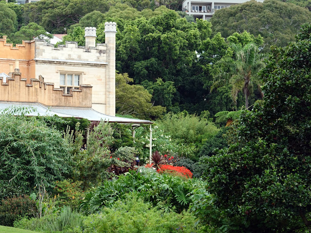 |
| Vaucluse House |
Like many coastal areas around Sydney, Steele Point is home to a former gun battery tasked with defending the entrance to the harbour. Perhaps more interestingly, Steele Point was home to a naval degaussing station, which helped to protect ships from magnetic sea mines.
 |
| Nielson Park |
Just off Steele Point Road is the first access to the Hermitage Foreshore, one of Sydney's most popular tracks. The area was established as a reserve in 1912 as part of the Foreshore Resumption Scheme though the land wasn't declared public until the 1960s.
 |
| The beginning of the Hermitage Foreshore Track at Shark Point |
 |
| Rose Bay |
The area was largely left in its natural state so that the 3km of rock and beach along the foreshore is mostly untouched by urban development and is fully accessible to the public. The tracks and facilities were upgraded in the 1990s and are now one of the best short walks in the city.
 |
| Milk Beach |
 |
| The two icons of Sydney |
Just after Milk Beach, the foreshore track skirts the grounds of Strickland House, a largely intact 1850s villa. Its location on a rise overlooking the harbour represents the picturesque aspirations of wealthy mid-nineteenth-century society. The grounds now form one of the best harbourside parks in Sydney.
 |
| Milk Beach |
 |
| Strickland House |
As it winds south along the shore, the path is squeezed between the waters of Sydney Harbour and the high retaining walls of the mansions lining Carrara Road above—one of the city’s most expensive areas. One property even offered short-term leases to A-listers such as Elton John and Brad Pitt before being sold. |
| Below the mansions of Vaucluse |
 |
| Hermit Beach |
 |
| Hermit Beach |
 |
| The foreshore walking track |
The Hermitage Foreshore track leads to the small Hermit Bay with its beach and boat ramp before continuing along the shore to Queens Beach and finishing at Bayview Hill Road. For me, this marked the end of the circuit as Bayview Hill Road ultimately leads back to Towns Road where I had parked the car.
 |
| The commanding Kincoppal-Rose Bay School |
 |
| Sydney Harbour |


No comments :
Post a Comment