Perfect for a rainy day or a lower-level adventure, this stunning trail kicks off from the free viewpoint car park at Tynllwyn and winds down through the trees along the roaring Afon Llugwy. You will experience the sheer force of Swallow Falls from its best vantage point on the quiet northern bank, follow the historic Snowdonia Slate Trail, and cross the dramatic gorge at Miners Bridge. Climbing past the cafes of Betws-y-Coed, the route plunges into the deep canopies of the Gwydyr Forest, revealing hidden zinc mines, the peaceful shores of Llyn Sarnau, and striking valley vistas.
Swallow Falls. Betws-y-Coed & Llyn Sarnau
📍 ERYRI NATIONAL PARK (SNOWDONIA)
Distance
11.7 km
Duration
04:00 hrs
Elev Gain
+648 m
Elev Lost
-655 m
| Date |
17 February 2019 |
| Starting Point |
Twnllwyn Viewpoint |
| Difficulty |
Moderate |
| Pace / Gear |
3.8 km/h — Full day pack |
| Highlights |
Swallow Falls, Miners Bridge, Betws-y-Coed, Llyn Sarnau |
🗺️ Interactive Route Map
Pinch or use wheel to zoom
With strong winds and rain forecast for the day, we decided against any serious mountain climbing, instead seeking out a lower-level route somewhere in northern Snowdonia. I happened across a circuit on the excellent Mud and Routes which takes in the sights along the Afon Llugwy as well as venturing into some relatively uncharted territory in the woods above Betws-y-Coed.
We started from a free car park at the viewpoint of Tynllwyn, accessed via a narrow road from the Ugly House (Ty Hyll) on the A5. You could start this walk higher up at Llyn Sarnau or even in Betws-y-Coed itself. From the car park, a path winds down through the woods to Swallow Falls, waymarked the entire way.
 |
| Bright sun over Betws-y-Coed and the Llugwy Valley |
 |
| Waymarking leads to the Swallow Falls |
 |
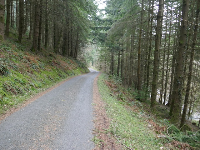
| The path leading through the woods at Coed Cae Huddygl |
Swallow Falls (or, more correctly, Rhaeadr Ewynnol - Foaming Waterfall) is a large, cascading waterfall on the River Llugwy where the river flows down through a rocky chasm. While its principal and more popular viewpoints are situated on the south bank of the river (with the convenience of ample parking within the hotel car park), it is observed far more dramatically if approached on foot along the northern bank – as we were about to do.
 |
| The upper cascades of Swallow Falls |
We passed the first viewpoint which hangs over the upper falls - it's a little underwhelming, to be honest. It's not until you reach the next viewpoint further along the path where you get a sense of the full cascade of the falls. A narrow path is sandwiched between a tall rock wall and the river below, leading along the Afon Llugwy towards Betws-y-Coed. The path forms part of the new Snowdonia Slate Trail.
 |
| Swallow Falls |
 |
| Swallow Falls |
The Slate Trail is an 83-mile circular trail that enables walkers to explore the industrial heritage of the slate villages throughout Snowdonia. Starting at Porth Penrhyn near Bangor, the route visits villages such as Bethesda, Dinorwig, Llanberis, Rhyd Ddu, Beddgelert and Ffestiniog, providing opportunities for people to gain a better understanding and appreciation of the slate heritage of the area.
 |
| The old quarry path above Afon Llugwy |
 |
| Following the signs for the Slate Trail |
 |
| One of the small streams in the Gwydyr Forest |
 |
| Gwydyr Forest |
 |
| One of the many forest tracks in Gwydyr Forest |
The trail leads to the Miners Bridge, a precariously placed crossing of a narrow gorge of the Afon Llugwy. The bridge was used by workers accessing the mines and quarries hidden high in the Gwydyr Forest. We crossed the bridge and erroneously followed the road into Betws-y-Coed, not realising there was a much more pleasant path along the other side of the river – one for next time.
 |
| Afon Llugwy |
 |
| The Miners Bridge |
 |
| The Miners Bridge |
 |
| Afon Llugwy |
We reached the village just as a heavy shower rolled in, taking refuge in one of the many tea rooms that lined the main road. It's safe to say we took the opportunity for some refreshments before continuing on our way. Once across the Pont-y-Pair (Betws' iconic bridge), we deviated from the route I had in my mind to a well-waymarked path provided by the local forestry commission. After winding up the roads above the bridge, a steep path climbs up into the Gwydyr Forest.
 |
| Afon Llugwy |
 |
| Betws-y-Coed |
Between 1850 and 1919, lead and zinc mining dominated the area. The legacy of old engine houses, waste tips and reservoirs are characteristic features of the forest landscape today. Nearly all of the lakes in the forest were created to serve the mines. Several of the most important mines have been partially restored and made safe for visitors.
 |
| Climbing into the Gwydyr Forest |
 |
| Climbing through the trees of the Gwydyr Forest |
 |
| Looking south towards the Lledr valley |
After weaving among the roots and trees of the forest, the path emerges high above the Conwy Valley, though much of the view was obscured. We followed the forest tracks and paths past the cottage at Pen-yr-allt-isaf to the isolated cottage at Coedmawr, which sits below the remains of a long-abandoned reservoir (likely to be related to the area's mining heritage). Views into northern Snowdonia from this elevated location were surprisingly good.
 |
| A peek through the trees over the Conwy Valley |
 |
| Gwydyr Forest |
 |
| The forest road at Coedmawr |
 |
| Sun over the Lledr valley |
 |
| Moel Siabod hides in the cloud |
We continued along the tracks until we reached Llyn Sarnau, one of the larger lakes among the trees of the Gwydyr Forest. Llyn Sarnau means “lake of the old tracks” in Welsh. The lake is fairly shallow, and so it often dries out in summer. Even though it may not be much to look at during warmer months, it's a valuable home for wetland-loving wildlife.
 |
| The hills of the Ogwen valley |
 |
| Llyn Sarnau |
 |
| Llyn Sarnau |
 |
| Llyn Sarnau |
A short distance beyond the shore of Llyn Sarnau are the remains of the Cyffty mine. The surface remains include wheel pits and ruined buildings; an engine house dating from 1878 was demolished in 1966. There are two shafts, a wooden headframe and pulleys and an entrance for mine trams. Above the mine is also the reservoir, which was once used to power much of the machinery.
 |
| Remains of the Cyffty mine |
 |
| The Llugwy valley once again |
We passed the mine, covering the final few hundred metres along the narrow road to the viewpoint and the car at Tynllyn. Having been empty in the morning, there were now a few cars occupying the spaces in the parking area. This was a surprisingly interesting walk, perhaps much better than it appears on the map – the highlight being the walk along the Afon Llugwy. Highly recommended.


Yup, I'd second that recommendation.
ReplyDelete