This map was created using GPS Visualizer's do-it-yourself geographic utilities.
Please wait while the map data loads...
Route: Crowden, Pennine Way, Span Gutter, Oakenclough Brook, Laddow Rocks, Grains Moss, Dun Hill, Black Hill, Tooleyshaw Moss, Tooleyshaw Moor, White Low, Westend Moss, Hey Edge, Loftend Quarry, Crowden
From: Crowden
Parking: Free parking in Crowden
Start Point: Crowden
Region: Peak District Dark Peak
Route length: 9.2 miles (14.8 km)
Time taken: 04:19
Average speed: 2.1 mph
Ascent: 583m
Descent: 595m
Summits: Black Hill (582m)
Other points of interest: Laddow Rocks
The Dark Peak area of the Peak District is a fairly unique environment in the UK and is dominated by the famous Kinder Scout and Bleaklow gritstone moors. Less popular, though no less impressive, is Black Hill, the most northerly of the major gritstone peaks. Though it may lack some of the dramatic gritstone edges that are famed in the Dark Peak, it has bogs that are a match for those found on either of its larger neighbours to the south.
We were treated to a superb Autumn day with plenty of sun and blue skies showing off the moorland at their most colourful. There is a free car park in Crowden that forms the starting point for this walk, a wild circular up the Pennine Way and down Tooleyshaw Moss, visiting the summit of Black Hill almost exactly halfway around.
We set off from Crowden car park and met the Pennine Way almost immediately as it descends from Bleaklow. The route turns into Crowden Great Brook, following the stream for a short while before it begins a slow climb up the valley side.
 |
| The familiar Pennine Way marker posts |
 |
| Spoil heaps from Loftend Quarry |
 |
| A spectacular day in the Peak District |
 |
| Oakenshaw Great Brook |
 |
| Black Hill |
 |
| Bareholme Moss |
 |
| Oakenclough Brook |
 |
| Laddow Rocks |
 |
| Bleaklow |
 |
| Laddow Rocks |
 |
| Laddow Rocks |
 |
| Looking down the valley from Laddow Rocks |
 |
| Crowden Great Brook |
 |
| Crowden Great Brook |
 |
| Crowden Great Brook |
 |
| Crowden Great Brook |
 |
| The Pennine Way |
 |
| Big skies over Middle Edge Moss |
 |
| The view from Dun Hill |
 |
| The Pennine Way approaching the summit |
 |
| Black Hill's proud pillar |
The official name of the summit is "Soldier's Lump" which is a reference to the eighteenth-century visits of the Royal Engineer surveyors who first used it as a triangulation point. An examination of the mound in 1841 revealed the timber framework for the theodolite which was used for the survey which began in 1784. The original instrument is now in the Science Museum.
The trickiest part of the walk is picking up the path back towards Tooleyshaw Moss. Don't be tempted to follow the Pennine Way any further or the noticeable path towards the Holme Moss transmitter mast as these will lead you astray. Instead, a southeasterly bearing from the summit is required and a brief stride out across the bogs until a very faint path is revealed heading across the featureless plateau. I imagine this part is particularly challenging when the weather is down.
 |
| Featurelessness awaits |
 |
| Tooleyshaw Moss |
 |
| The Holme Moss transmitter |
 |
| Bareholme Moss |
 |
| Black Hill |
 |
| Westend Moss |
 |
| The trig pillar at Hey Edge |
 |
| The Woodhead valley |
 |
| Laddow Rocks from Hey Edge |
 |
| Crowden Little Brook |
 |
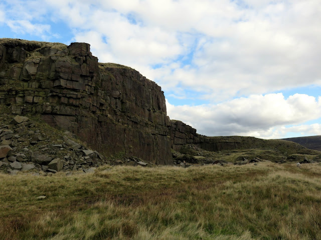
| Loftend Quarry |
 |
| Loftend Quarry |
 |
| Loftend Quarry |
 |
| Crowden |
 |
| Spoil heaps from Loftend Quarry |
 |
| Spoil heaps |


No comments :
Post a Comment