This map was created using GPS Visualizer's do-it-yourself geographic utilities.
Please wait while the map data loads...
Date: 23/08/2015
From: Ilkley
Parking: Westwood Drive
Start Point: Westwood Drive
Region: Yorkshire
Route length: 8.5 miles (13.7 km)
Time taken: 03:37
Average speed: 2.3 mph
Ascent: 362m
Descent: 369m
Summits: Ilkley Moor (402m)
Other points of interest: Swastika Stone, Long Ridge End, Buck Stones, Cowper's Cross, Thimble Stones, Lanshaw Lad, Twelve Apostles, Ilkley Crags, Cow and Calf, Rocky Valley, White Wells
The response I normally receive to the statement 'I've never been up Ilkley Moor' is often one of surprise and disbelief. It seems everyone I know has been up Ilkley Moor and that fact I haven't comes unexpectedly to most. That, however, is all to change as Sara and I made the most of a superb summer day to finally scratch the Ilkley Moor itch.
Ilkley Moor stands just outside of the Yorkshire Dales boundary but don't let that fact suggest that it is dull or lacking in character because it isn't. A bewildering array of things to see make it a fairly unique place among the lower Pennines, largely thanks to its location close to the ancient settlements of Ilkley and Skipton. The area around Ilkley has been continuously settled since at least the early Bronze Age.
There's plenty of space to leave a car along the road close to the Millennium Way, a 45-mile circuit of the countryside north of Bradford and our route along the northern face of the moor. At first, it passes behind the last few houses in the southwestern corner of the town and the small reservoir above Panorama Rocks where the views open up and it makes its way out onto the open moor. It crosses the small Black Beck, descending a short distance as it does so before climbing back up to the Swastika Stone, one of Ilkley Moor's most famous landmarks.
 |
| The slopes of Ilkley Moor on a fine summer day |
 |
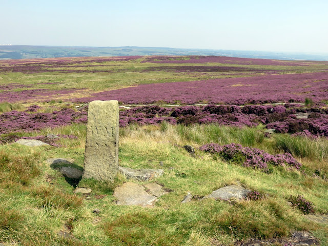
| The Millennium Way winds its way among the heather |
 |
| Approaching the Swastika Stone |
 |
| The Swastika Stone |
 |
| The feint swastika carving |
 |
| The recreated carving |
 |
| View through the gate close to Piper's Crag |
 |
| Looking north towards Beamsley Beacon |
 |
| Reaching the moor above Hardwick Holes |
 |
| Heading off-path through the heather |
 |
| Trig pillar at Long Ridge End |
 |
| View west from the trig pillar across Addingham High Moor |
 |
| Heather out in full force across Rombalds Moor |
 |
| Some stone flags help cross some of the boggier bits |
 |
| Plantation at High Moor |
 |
| East Buck Stones |
 |
| East Buck Stones |
 |
| East Buck Stones |
 |
| East Buck Stones |
 |
| Bogs |
 |
| More bogs |
 |
| Cowper's Cross |
 |
| Cowper's Cross |
 |
| The police radio mast atop the moor |
 |
| The Thimble Stones |
 |
| A familiar scene along many a moor |
 |
| The summit of Ilkley Moor |
 |
| A long stroll along the summit |
 |
| Contrasting colours were out in force today |
 |
| RAF Menwith Hill |
 |
| Lanshaw Lad |
 |
| The Twelve Apostles |
 |
| Panorama of the stone circle |
 |
| Looking back to Lanshaw Lad |
 |
| The view from Ilkley Crags |
 |
| A quarry that is part of the Cow and Calf |
 |
| Cow and Calf quarry |
 |
| Cow and Calf Rocks |
 |
| The Calf and Ben Rhydding below |
 |
| Ilkley |
 |
| Cow and Calf Rocks |
 |
| Hangingstone Quarry |
 |
| Entering Rocky Valley |
 |
| West Rock |
 |
| West Rock |
 |
| White Wells |

No comments :
Post a Comment