Sunday, 28 July 2013

Dodd Fell Hill & Drumaldrace

Dodd Fell Hill & Drumaldrace 27-07-2013

This map was created using GPS Visualizer's do-it-yourself geographic utilities.

Please wait while the map data loads...


Route: Hawes, Gayle, Gaudy Lane, Rottenstone Hill, Ten End, West Cam Road, Dodd Fell Hill, Cam High Road, Drumaldrace, Wether Fell, Burtersett High Pasture, Burtersett, Hawes

Date: 27/07/2013
From: Hawes


Parking: On street parking in Hawes
Start Point: Hawes town centre
Region: Yorkshire Dales

Route length: 11.7 miles (18.8km)
Time taken: 04:07
Average speed: 2.8mph
Ascent: 682m
Descent: 689m

2000s on this walk: Dodd Fell Hill (668m), Drumaldrace (614m)

Additional summits: Ten End (586m)

Other points of interest: Pennine Way, Cam High Road, Yorburgh, Burtersett

After spending a fair bit of time concentrating on Wainwrights in the Lake District, it was time to focus my attention back to the Yorkshire 2000s and climb two more hills to take me past a third of the way to completing the 40. The two hills in question were Dodd Fell Hill and Drumaldrace, two hills that overlook Hawes and guard the valley of Sleddale.

Another fine summer day greeted me as I arrived in Hawes and parked up on the main road. As I made my way into the town centre to begin the walk proper, I found it surprisingly quiet for a Saturday morning in the summer holidays.
A classy signpost directing you to Hawes from Gayle
Threading my way through Hawes and the small village of Gayle, I joined the Pennine Way as it follows Gaudy Lane and began the long climb up the western shoulder of Dodd Fell towards Ten End. Being the Pennine Way, the path is well established and it's a case of getting your head down and covering the miles as you climb the hill. The climb is not as steep as it appears from below and I was able to keep a steady pace most of the way up.
Looking down the hill into the expanse of Wensleydale
Rottenstone Hill and Ten End from the Pennine Way
The unpleasantly named Rottenstone Hill stands in front of Ten End and must be crossed before the final plod to the summit. I've not been able to find a reasoning behind its name though. I'm pretty sure stones don't rot. Erode, yes; rot, I don't think so.

Continuing on, I made the mistake of leaving the Pennine Way to make the final steep climb to the summit of Ten End only to find a stone wall blocking the way. Returning back to the path and rounding the wall, I made the climb to the summit once again. That'll teach me not to look at the map.
Approaching the final climb to the summit of Ten End
The summit of Ten End covers a long, thin area of boggy, peaty high ground. There are a couple of small lakes or ponds on the summit that must have some permanence to be shown on the OS maps. The actual summit is marked by a very small cairn and has a great view across the valley of Sleddale to Drumaldrace and Wether Fell to the south-east and Great Knoutberry Hill in the other direction.
Great Knoutberry Hill from Ten End
The very small cairn on the summit of Ten End
Travelling along the summit, parallel to the Pennine Way, Dodd Fell can clearly be seen as the next objective. After negotiating a few damp, boggy patches, I met the Pennine Way on the West Cam Road. West Cam Road is a track that crosses between Grove Head and Hawes and is popular with 4x4 enthusiasts. Luckily I didn't bump into any today.
West Cam Road with Dodd Fell Hill in the distance
At the point where the last drystone wall ends, it was time to leave the Pennine Way and strike out up the limb of high ground to the summit of Dodd Fell Hill. Despite there being no path on the map, I could make out a vague path that certainly made straight for the summit. Whether being an actual path or a sheep trod, I wouldn't know but it certainly took me in the right direction. The summit is a mile or so from the Pennine Way and, upon reaching the lonely looking trig pillar, I was amazed to see the panorama in front of me.

Through a 180 degree sweep were the proud three peaks of Yorkshire; Pen-y-Ghent, Ingleborough and Whernside. The view would have been even better were it not for the lack of prominence of the summit of Dodd Fell Hill. Dodd Fell Hill is the high point of Dodd Fell, the source of Duerley Beck and Little Ings Beck that feed Gayle Beck and the River Ure.
A faint trail can be followed to the summit
The OS trig pillar on the summit of Dodd Fell Hill
Simon Fell and Ingleborough can be seen in the distance
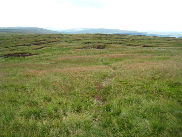
After lunch, I headed east across the summit, making directly for Cam High Road, a track of Roman origin that crosses Wether Fell. A number of peat hags had to be negotiated and luckily, thanks mainly to the dry weather the weeks preceding, the ground was fairly dry and solid underfoot. Upon reaching a drystone wall that runs parallel to Cam High Road, I followed it north until the wall crossed the track allowing me to continue northeast along Cam High Road. As with most Roman roads, Cam High Road is very direct and links the Roman fort at Bainbridge to the village of Ingleton.
A view down Bank Gill with Wether Fell and Drumaldrace in the background
The peat ground between me and Cam High Road
Cam High Road as it sweeps up Wether Fell
After a brief yomp along a section making up the lane between Hawes and Langstrothdale, I returned to the track and started the climb up Wether fell towards Drumaldrace. The very summit is easily reached by leaving the track after passing through a gate and following a vague path that leads to higher ground. The summit, despite being a relatively modest height, is home to a reasonably sized cairn. Time for another quick break and to soak in the spectacular views.
Returning to the Cam High Road, a short walk took me to a bridleway that would lead down the northern slopes of Wether Fell to Burtersett. From here, the scenery of the high Yorkshire fells really opened up and I was able to see Great Shunner Fell, Lovely Seat, Wild Boar Fell, Swarth Fell, Sails and, of course, Dodd Fell.
Panorama of Wensleydale including the fells mentioned above
Dropping off Wether Fell, I rounded Yorburgh, a prominent hump on the side of Burtersett High Pasture. I had intended to visit the summit but it appeared from where I was that it was entirely surrounded by drystone walls. Continuing the descent, I quickly reached Burtersett, a small village to the east of Hawes.
A Roman road doing what Roman roads do best
Yorburgh
The path as it leads towards Burtersett
From Burtersett, there was a 1-mile paved section of path across the fields back to Hawes. Ominous clouds in the distance spelt some approaching rain but I was well on my way back home in the car by the time it eventually started falling.

A fantastic walk that I really enjoyed, some of the Yorkshire Dales at its very best without the crowds of the more popular areas of the National Park. The views of the higher fells encircling Hawes have made the thought of climbing them all the more appealing and I think I'll be paying a bit closer attention to them in the near future.

No comments :

Post a Comment