Mount Portal, Red Hands Cave & Glenbrook Gorge 23-01-2021
This map was created using GPS Visualizer's do-it-yourself geographic utilities.
Please wait while the map data loads...
Route: Lapstone Station, Tunnel Gully, Nepean River, Glenbrook Creek, Mount Portal Lookout, Mount Portal Trail, Tunnel View Lookout, Euroka Road, Oaks Trails, Campfire Creek, Link Track, Red Hands Firetrail, Red Hands Cave, Campfire Creek Track, Glenbrook Causeway, Glenbrook Creek, Jellybean Pool, Glenbrook Creek, Glenbrook Gorge, Nepean River, Lapstone Station
Date: 23/01/2021
From: Lapstone
Parking: N/A
Start Point: Lapstone Station
Finish Point: Lapstone Station
Region: Blue Mountains
Route length: 11.0 miles (17.7km)
Time taken: 06:36
Average speed: 1.6mph
Ascent: 527m
Descent: 550m
Points of Interest: Mount Portal, Tunnel View Lookout, Red Hands Cave, Glenbrook Gorge
After a false start over Christmas, things are now really beginning to heat up in Sydney with several 30+ days coming one after another. Though it has been a summer dominated by La Niña (meaning cooler, wetter days) we still get a few real scorchers thrown in now and again, and today was one of them. So hot, in fact, that the most important piece of kit accompanying me would be a water filter.
I conjured up this hike to join up a few interesting places - the three named in the title. Mount Portal promised fine views over the Nepean River, Red Hands Cave offers some Indigenous history while Glenbrook Gorge provides an exciting end to the day. To top it off, all can be completed without having to use the car by getting the train to Lapstone or Glenbrook stations. Lapstone is more useful if you plan to hike the length of the gorge and that's where this hike begins.
A path leaves immediately from the east side of the station, leading to a fire trail that snakes downhill, through the trees. It leads towards the village/suburb of Leonay, but a narrow side path takes you away from the fire trail and down to the banks of the Nepean River.
 |
| The access track between Lapstone Station and the Nepean River |
The path here, though easy to follow, is quite overgrown and was slow going, negotiating a couple of steep, slippery gullies as it makes its way along the river, frequently emerging right on the river bank itself. It seems this stretch of the river is used primarily to play a game of 'how loud is your boat engine' (or, conversely, how small is your penis?) with many day-trippers zooming up and down, blaring music, which does disturb the peace somewhat.
 |
| The Nepean River through the trees |
 |
| Nepean River |
 |
| Approaching the rocky section |
The track eventually comes a rocky section where an island-like stretch of sand has formed in the river, likely sediment washed out of Glenbrook Creek. The track winds, climbs or walks above these rock formations, and comes to be above the junction of Glenbrook Creek and the Nepean River, with a superb view of the gorge. My aim was to cross Glenbrook Creek and climb Mount Portal from this location.
 |
| The route follows these rock platforms for a short distance |
 |
| The sandy deposits from Glenbrook Creek |
 |
| Glenbrook Creek and Nepean River |
 |
| The bottom of Glenbrook Gorge - Mount Portal is hidden in the trees |
 |
| Glenbrook Creek |
 |
| Glenbrook Creek emerging from Glenbrook Gorge - this is where I'll emerge later on in the day |
The first challenging task is to locate the vague path which climbs Mount Portal (really just the end of a broad ridge, rather than a mountain). It is supposedly marked by a cairn near the creek but it's plenty overgrown and I couldn't find one. Instead, armed with a GPS, I weaved across the hillside in the vicinity of the path until I eventually spotted it, climbing up through the trees.
 |
| Beginning the hike up Mount Portal |
 |
| Climbing Mount Portal |
 |
| Approaching the Mount Portal cliffs |
It's a steep climb and I took it slow in the 35+ degree heat, with several short pauses. The path leads to the base of some imposing cliffs where the second challenge awaits. A tall fallen log and a length of rope have been placed strategically to assist you in climbing a 5m or so rock face. The art is to balance on the log then grab the rope and use it to haul yourself up the rocks. Once over this obstacle, you'll be in a rock amphitheatre of sorts. Away to the right (slightly hidden) is a metal ladder that will get you up the final steeper face though with an awkward finish due to a jutting rock. Most of this will probably be complete under the watchful gaze of climbers and abseilers.
 |
| The log (left) and rope assist in climbing the short sandstone wall |
 |
| Looking down from the top of the rope |
The ladder takes you to the top of Mount Portal where there is a trig pillar sat on a platform of rock, formed thanks to the geological faults which run through the area. It has a sensational panorama of the Nepean River and the 2700km2 Cumberland Plain which encompasses most of Western Sydney.
 |
| Atop Mount Portal |
 |
| The Mount Portal trig pillar |
 |
| Mount Portal lookout |
 |
| Nepean River and Cumberland Plain |
 |
| Mount Portal |
There is a small, dusty parking area at the lookout on Mount Portal, accessed by an unsealed road in relatively good condition. I saw a couple of 2WD drive cars making the trip as I made my way along the road towards the lookout at Tunnel View, doing my best to seek the shady patches along the verges of the road.
 |
| Mount Portal Trail |
 |
| The access track to Tunnel View Lookout |
The Tunnel View Lookout is accessed via a trail that leaves the main unsealed road, heading back into the bush. The lookout features some exposed outcrops of rock and sits on a bend above Glenbrook Gorge. The lookout is named after the railway tunnel on the opposite side of the gorge, built between 1910 and 1913 though you can't actually see it as it is directly opposite.
 |
| Tunnel View Lookout |
 |
| Glenbrook Gorge - eastern view |
 |
| Glenbrook Gorge and the greater Blue Mountains area to the west |
 |
| Looking down into Glenbrook Gorge - I'd be down there later in the day |
The next section of the hike links the lookout to Campfire Creek and Red Hands Cave. It requires a more lengthy stroll downhill along the Mount Portal fire trail until it reaches the junction of Euroka Road, avoiding any turnoffs for other hiking trails. Euroka Road then leads to The Oaks Trail and the parallel Oaks Single Track bike trail (which is accessible for hikers though I was wary of any speeding mountain bikes). After making my way south a short distance a narrow path branches off to the right, descending a broad ridge into the valley of Campfire Creek.
 |
| Mount Portal Trail |
 |
| Mount Portal Trail |
 |
| The Oaks Trail |
 |
| Descending to Campfire Creek |
 |
| Campfire Creek |
At the creek, you're immediately met with a small information board, noting the various Aboriginal axe-grinding grooves in the sandstone bed of the creek. These well-defined grooves were formed by Aboriginal people when sharpening axes (or forming axe blanks). Rubbing the axe blanks would sharpen the stone into a more useful tool, and the process would also wear the sandstone, leaving these markings. These sites are typically found near water, as the water was added to make the stone more abrasive.
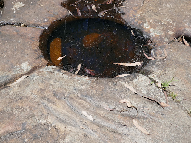 |
| The grinding grooves and water bowl in Campfire Creek |
 |
| Campfire Creek |
I followed the creek upstream a short while on a well-trodden path, crossing the creek a distance later while using the opportunity for my first water refill. If you are interested, I use a Sawyer Squeeze as it weighs practically nothing and is idiot-proof. The Link Track makes its way through the bush to the car park at the end of Red Hands Firetrail.
 |
| Following the Link Track from Campfire Creek to Red Hands Cave car park |
 |
| The Link Track |
 |
| NSW signage in the car park |
The car park serves as a place to stop if you're simply visiting Red Hands Cave and is furnished by a few picnic benches and bush toilets (essentially long drops). The Red Hands Cave Walking Track leads from the car park to the cave itself in the depths of Red Hands Gully. It's a short trek downhill and the cave is truly remarkable.
 |
| Red Hands Cave Track |
 |
| Red Hands Cave |
 |
| The remarkable interior of Red Hands Cave, taken through the gap in the metal fence |
Amongst several techniques, the artists of the Oryang people would chew a mixture of ochre and water, and then blow it over a hand resting on the wall, forming a stencil. The site is a ceremonial cave that was used for the initiation of young warriors. There is documented evidence that there was a Bora Ring on the top of the cave and according to Aboriginal stories the cave was the abode of Aboriginal ghosts that represented the children left there by the Great Spirit.
 |
| Not all the hands are stencils, some are printed |
 |
| Red Hands Cave |
 |
| Red Hands Cave |
It was a shame to leave the cave but I was aware there was still plenty of hiking to do, including a slow trek through Glenbrook Gorge so I bade farewell to the cave and continued along the walking track. It follows Red Hands Gully to Campfire Creek (close to the axe grooves) and follows the creek all the way to Glenbrook Causeway crossing the larger Glenbrook Creek (more river than stream). If the river is flooded then Red Hands Cave and Mount Portal are inaccessible.
 |
| The track along Campfire Creek |
 |
| A rather dry looking Campfire Creek |
 |
| Campfire Creek |
 |
| Campfire Creek |
 |
| Campfire Creek |
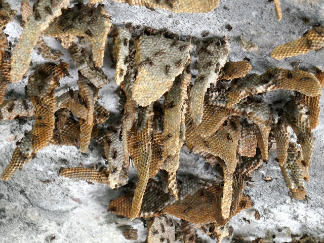 |
| Wild honey |
 |
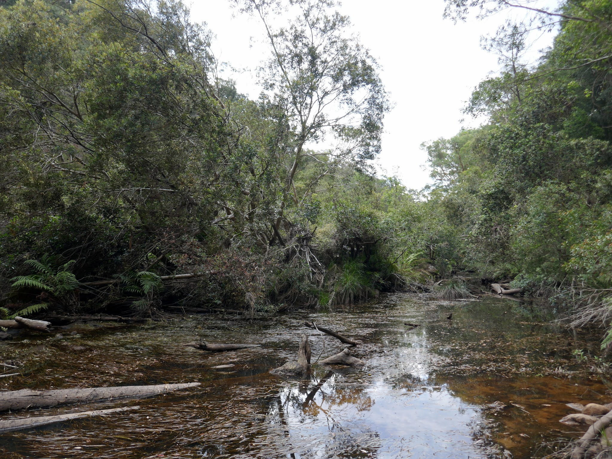
| Glenbrook Creek |
Though it is marked on the map, the 'path' from the causeway to Jellybean Pool is vague at best but the route finding isn't challenging. I'd be following Glenbrook Creek all the way back to the Nepean River from here. Being so close to Sydney makes Jellybean Pool as busy as a city water park in summer, but a large sandbank means there’s usually a place to lay down a towel. It certainly looked appealing on this hot day.
 |
| The popular Jellybean Pool |
Beyond the pool is a pathless section along the creek that is generally straightforward but with one or two tricky boulders to negotiate (and by boulders I mean ones that are the size of small houses). The clear waters of the creek also provided another opportunity to refill my water for the remainder of the day. Eventually, I reached a small path that descends from the Glenbrook national park car park taking people into Glenbrook Gorge.
 |
| Glenbrook Creek |
 |
| Making the pathless trek toward Glenbrook Gorge |
 |
| Glenbrook Creek |
Glenbrook Gorge is a deep cut in the sandstone formed by Glenbrook Creek, just before it flows into the Nepean River. From the bottom of the steps, you are left to your own devices to navigate your way through the twisting gorge. Luckily for me, it had turned cloudy as I proceeded along the gorge, I have no doubt that it acts as a massive suntrap otherwise. There is no route per se, however, finding a dry route through the canyon is not too much of a challenge though it will require you to cross Glenbrook Creek a number of times.
 |
| Entering Glenbrook Gorge - note the change in the weather |
 |
| Glenbrook Gorge below Tunnel View Lookout |
 |
| Glenbrook Gorge |
 |
| The towering cliffs of Glenbrook Gorge |
Travelling through the canyon is not quick and you could spend a whole day in there hiking and swimming in the various pools along the way. I was hurried along slightly by the rumble of an approaching thunderstorm but it decided to skirt by to the north, leaving me and the canyon in peace.
 |
| Glenbrook Gorge |
 |
| Looking back along the gorge - Tunnel View is atop the cliff on the bend |
 |
| Glenbrook Gorge |
 |
| Glenbrook Gorge |
 |
| Glenbrook Gorge |
 |
| A tricky section of boulders needs to be negotiated |
 |
| Glenbrook Gorge |
Eventually, I reached familiar territory - the area where Glenbrook Gorge meets the Nepean River. Having come from that way earlier in the day, it was easy to find where the path branches off towards Lapstone - it's high on a shelf of rock to the left of Glenbrook Creek. It's not obvious unless you've passed this way before. As I made my way back along the river I could see the dark clouds of the thunderstorm passing away to the north which was fortunate as I was not carrying a jacket of any description.
 |
| Glenbrook Creek at the Nepean River |
 |
| Dark clouds gather over the Cumberland Plain |
 |
| A passing storm |
It had become dark and cloudy by the time I'd followed the path back along the Nepean River to the maintenance trail. One final, tiring climb was all the separated me from the station at Lapstone and a swift journey back to Sydney.


No comments :
Post a Comment