Sunday 1 April 2018

Moel Hebog, Moel yr Ogof & Moel Lefn

Moel Hebog, Moel yr Ogof & Moel Lefn 01-04-2018

This map was created using GPS Visualizer's do-it-yourself geographic utilities.

Please wait while the map data loads...


Route: Beddgelert, Cwm Cloch, Y Grusiau, Moel Hebog, Bwlch Meillionen, Moel yr Ogof, Moel Lefn, Craig Cwm-trwsgl, Bwlch Cwm-trwsgl, Beddgelert Forest, Meillionen, Parc Ty'n-y-coed, Cwm Cloch, Beddgelert

Date: 01/04/2018
From: Beddgelert


Parking: Beddgelert
Start Point: Beddgelert
Region: Snowdonia - Moel Hebog & the Nantlle Ridge

Route length: 8.2 miles (13.2 km)
Time taken: 04:41
Average speed: 1.8 mph
Ascent: 1,080m
Descent: 1,088m

Summits: Moel Hebog (783m), Moel yr Ogof (655m), Moel Lefn (638m)

Other points of interest: Beddgelert Forest

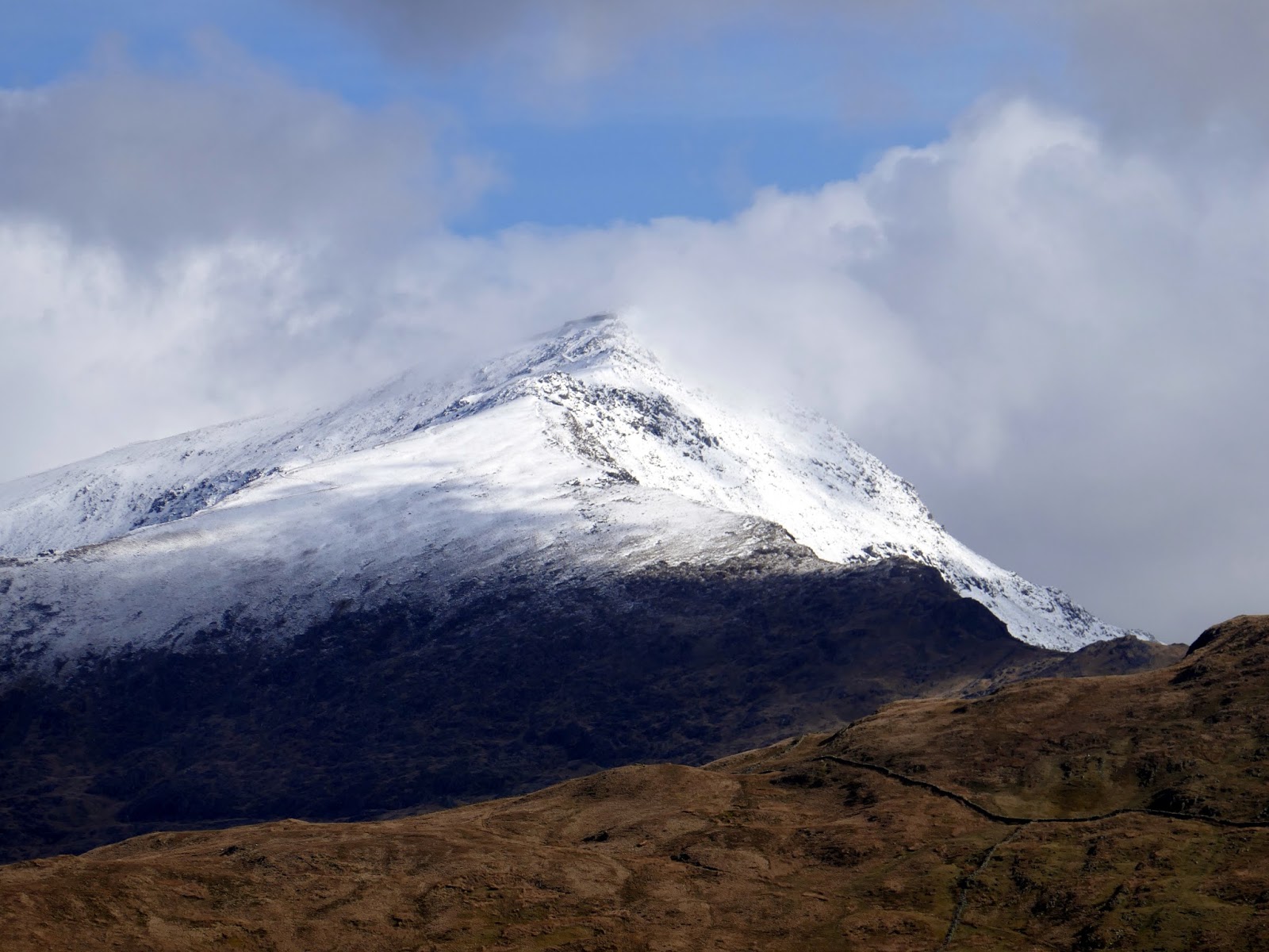
Moel Hebog is a striking mountain, certainly when seen from Beddgelert; a pyramid of rock that towers over the village. It lends its name to the full range of hills in the area including those of the Nantlle Ridge and the outlying Mynydd Mawr. This route from Beddgelert is the best approach to the mountain and includes the additional peaks of Moel yr Ogof and Moel Lefn.

Having driven along the A55 beside the snow-capped Carneddau and then below the slopes of Snowdon along the A4086 - I was tempted to alter my plans given the covering of snow and the pleasant weather. However, seeing the ill-equipped crowds leaving the Snowdon Ranger and Rhyd-Ddu car parks I thought better of it. If there's ever a day to avoid Snowdon, it's a bank holiday.

From one of the village car parks in Beddgelert, I proceeded west, crossing the Welsh Highland railway via a footbridge and climbing alongside the woodland of Parc Cae-Morys. An alternate route would be to use a path to Cwm Cloch Isaf but the ultimate destination is the same - a collection of farm buildings at Nant Cwmcloch, a small stream emanating from the slopes of Moel Hebog.
Moel Hebog seen as you exit Beddgelert
The dark cliffs of Y Diffwys
The farm at Nant Cwmcloch backed by the Nantlle ridge
The walk from this point is easy enough though the route up Moel Hebog is fairly direct and unrelentingly steep. A broad ridge bisects Cwm Bleiddiaid and Cwm Llwy, rising below the sharp peak of Y Grisiau, a false summit that may be mistaken for Moel Hebog itself.
Nanygwynant looking towards Moel Siabod
Moel Hebog
A snow-capped Snowdon
The Moelwyns - Cnicht and Moelwyn Mawr
The Cwm Llwy ridge with Y Diffwys rising beyond
Nantgwynant
Y Diffwys
The hills of Moel Eilio
The path climbs up an interesting, narrow gully in a band of rock before a momentary respite from the climb, though this is short-lived. Becoming even steeper, a rocky, scree-laden route winds up through the rocks of Y Grisiau, first traversing away from the summit before turning back in the correct direction.
Climbing the gully
Y Diffwys
Looking back down to Beddgelert
It was here that I met a young French woman who was looking slightly perturbed by the route ahead, unsure of which way to go. After exchanging pleasantries, we decided to band together as our chosen routes for the day were fairly similar. The party of one had temporarily become two.
The final scramble towards the summit
Beddgelert and Nantgwynant
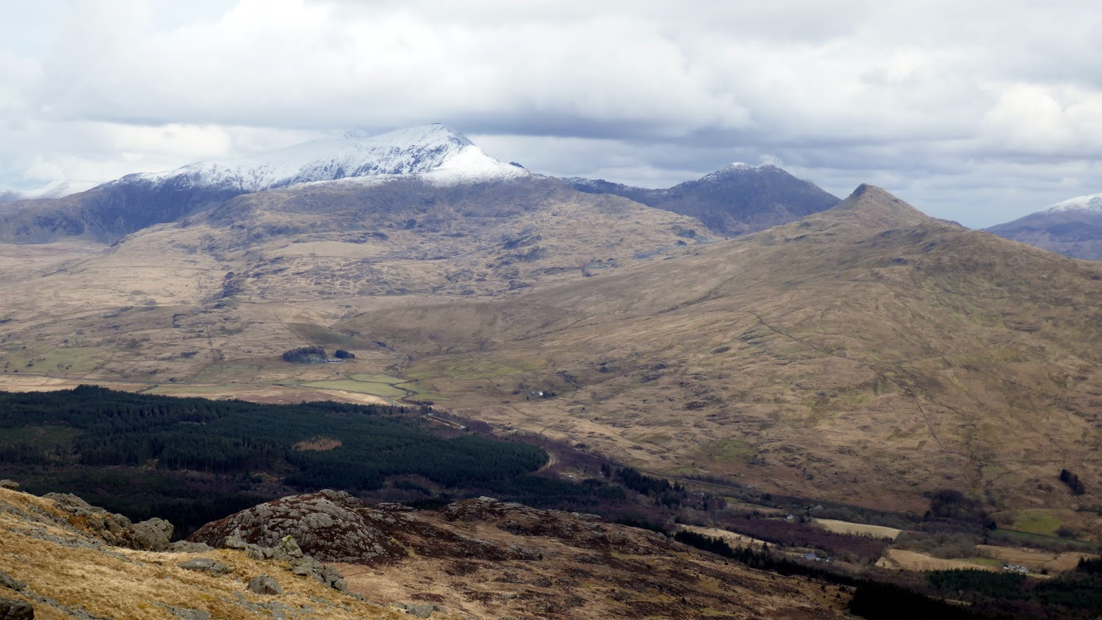
Beddgelert Forest and the Nantlle Ridge
Emerging at the top of Y Grisiau, the final summit push stands ahead until you reach a flattish, grassy area with a trig pillar at the far end, the summit of Moel Hebog. Thanks to its isolated position, views from the top are superb.
Moel Hebog's summit ridge
Moel Hebog's summit
A trig pillar marks the top
A very steep grassy slope separates Moel Hebog from its two outliers though it posed little problem today. In the wet, it can be a tricky proposition. To say it posed little problem, however, would be glossing over the story of the day. Halfway down, a personal disaster struck.
Mynydd Graig Goch and Garnedd-goch
Moel yr Ogof
I occasionally suffer from migraines which are brought on by physical exertion - the result of dehydration I think. The symptoms are always the same, starting with ever-increasing, blurry shapes in my vision - the telltale sign that a migraine is incoming. The timeline is predictable - blurred vision followed by an increasing headache and a few hours of nauseousness. It's not a feeling I would wish upon anyone.
Moel Hebog
Luckily, my French companion's route started to take her down into Beddgelert Forest from Bwlch Meillionen, leaving me sat below Moel yr Ogof wondering what course of action to take. One option would be to abandon the walk and return to Beddgelert, however, I wasn't keen on arriving back at the car and attempting to drive in the condition I expected to be in later in the day. I decided to follow the second option which was the carry on as planned in the hope that the fresh air and the remainder of the walk would allow my migraine to subside in time for the long drive back to Leeds.
The path continues up through the crags
The crags seen from Bwlch Meillionen
A rampart of rocks surround the base of Moel yr Ogof but a huge chasm between them allows the path to penetrate to the upper slopes. From here, the route to the summit with some easy scrambling up the final rocks.
Climbing through the crags
Moel Hebog
Moel yr Ogof's summit
Moel Hebog
The summit of Moel Hebog
Moel yr Ogof is home to a cave, famed as being the hiding place of Owain Glyndŵr. In fact, Moel yr Ogof is named after the cave - Ogof being Welsh for cave. The story is that Owain Glyndŵr climbed the cliff and hid in the cave for a number of weeks when he was in hiding from the English after his revolt petered out. Had I not been in the throes of a migraine, I would probably have gone to have a look for it, though it is difficult to find.
Cwm Pennant and the Nantlee Ridge
Y Diffwys
Snowdon
From Moel yr Ogof, an easy crossing of a shallow depression leads to Moel Lefn, the final summit of the day. Though not particularly distinguished, the summit does have a nice view of the neighbouring Nantlle Ridge. From Moel Lefn, a sharp descent to Bwlch Cwm-trwsgl is required.
Moel Lefn
Moel Lefn's summit
Moel Hebog and Moel yr Ogof
The summit rocks of Moel Lefn
Moel Lefn's summit
Snowdon and Yr Aran
Moel Hebog
Craig Cwm Silyn
Garnedd-goch
The Nantlle ridge as you descent into Beddgelert Forest
The sun catches Allt Maenderyn
Y Gryn
Beddgelert Forest - what's left of it
Now, this may have been the migraine influencing my opinion but the initial route through Beddgelert Forest is tedious and extremely boggy and not particularly enjoyable. In hindsight, it's probably preferable to avoid this section by descending along the small peak of Castell and entering the woodland at Hafod Ruffydd Ganol. Once through bogs, a made track that links Beddgelert and Rhyd-Ddu offers a quick and easy route back to the car park. If you're lucky you may also have a close encounter with the Welsh Highland Railway as you cross it no less than three times.
Llyn Llywelyn
Beddgelert Forest
Moel Hebog
The track between Rhyd-Ddu and Beddgelert
Crossing the Welsh Highland Railway
Afon Colwyn
Luckily, by the time I reached Beddgelert, the worst of the migraine had passed and I was thankful for the solitude of the forest. I think my decision at Bwlch Meillionen paid off as I now had three new Nuttalls in the bag and a clearer head for the drive home. It's always amusing to count how many cars parked along the A498 at Snowdon have parking tickets - it's a small moment of enjoyment after what had been a fairly taxing day.
Nantgwynant
Snowdon

No comments :

Post a Comment