Sunday 8 January 2017

Dove Stone Edge

Dove Stone Edge 08-01-2017

This map was created using GPS Visualizer's do-it-yourself geographic utilities.

Please wait while the map data loads...


Route: Dove Stone Reservoir, Bill O'Jack's Plantation, Greenfield Reservoir, Greenfield Brook, Birchen Clough, Raven Stones, Little Flat, Memorial Cross, Ashway Gap, Dean Rocks, Great Dove Stone Rocks, Bramley's Cot, Dove Stone Moss, Dish Stone Brow, Chew Road, Dove Stone Reservoir

Date: 08/01/2017
From: Dove Stone Reservoir


Parking: Dove Stone Reservoir
Start Point: Dove Stone Reservoir
Region: Peak District Dark Peak

Route length: 8.0 miles (12.9 km)
Time taken: 03:10
Average speed: 2.5 mph
Ascent: 375m
Descent: 364m

Other points of interest: Memorial Cross, Bramley's Cott

It was damp and dreary on the west side of the Pennines, almost enough to persuade me to not bother with a walk. Still, as the car park at Dove Stone Reservoir began to fill up, I decided that being out in the mist and fog was still infinitely better than being at work so I got my boots on and set off.
A busy car park under leaden skies
Dovestone Reservoir occupies one of the most north-westerly areas of the Peak District, located close to the outskirts of Oldham. The reservoir scheme in the valley was completed in the 1960s and consists of Dovestone, Yeoman Hey and Greenfield Reservoirs. My route would take me past all three before clambering up onto the moorland above via Birchin Clough.

The first few miles follow a gravelled track that encircles all three of the reservoirs. It's an easy stroll that gets quieter as you press further on towards the moorland. Once past Greenfield Reservoir, the track becomes much more rugged until it reaches Birchin Clough which joins from the southeast.
The Dove Stone Reservoir dam
Dove Stone Reservoir
The unusual spillway in Dove Stone Reservoir
Valve house in Yeoman Hey Reservoir
The track around the three reservoirs
Yeoman Hey Reservoir
Greenfield Brook
Birchin Clough is the most obvious route up onto the moorland above the reservoirs and, for the most part, the way up is straightforward enough. There are two minor challenges, however, the first being a short rock step that can be easily climbed. The second is crossing the stream once past the rock step, which can be difficult if the stream is in spate.
Birchen Clough
Birchen Clough
Birchen Clough
Birchen Clough
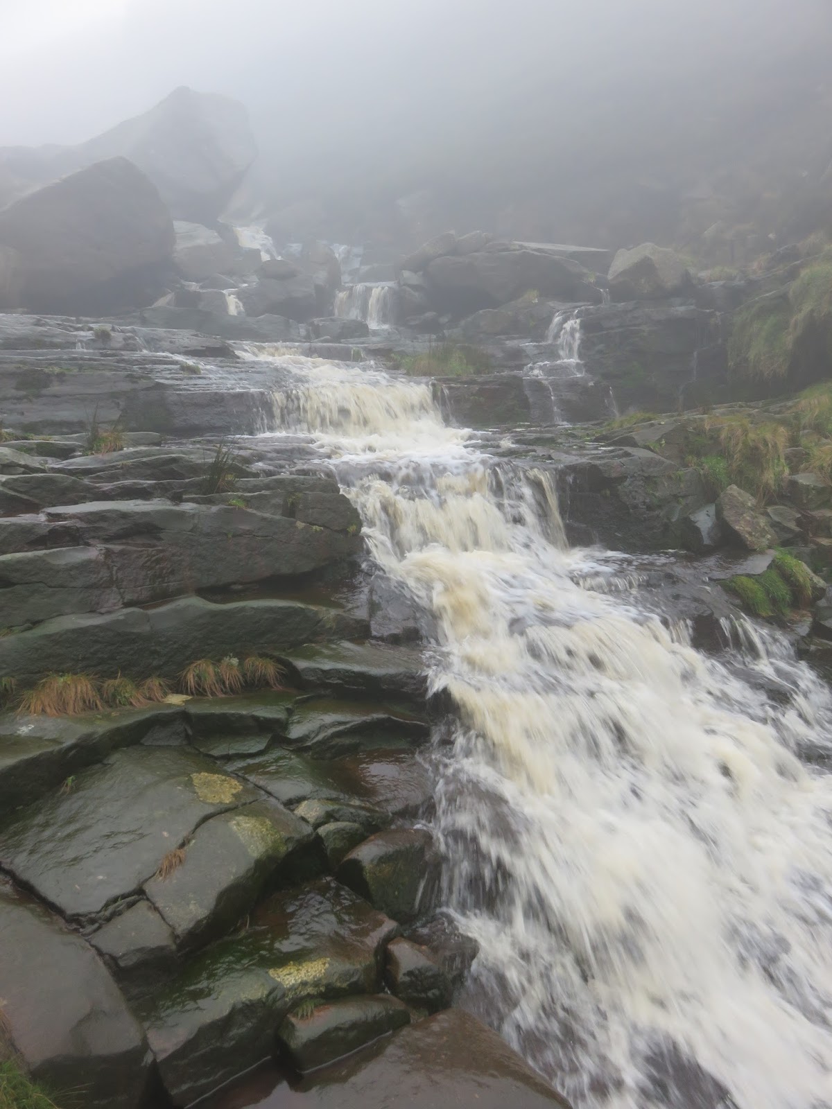
Cascades in Birchen Clough
Once I had negotiated these, I took a direct route up the hillside to reach Raven Stones Brow and the beginning of the edge that would lead back to Dovestone. I'd love to say that the views and scenery were magnificent (which I'm sure they are) but I was well in the midst of the clouds now and couldn't see further than a few metres, which is a shame.
Raven Stones
Raven Stones
The path passes the impressive Trinnacle - a triple column of gritstone before it cuts off a corner at the boggy Little Flat and begins heading south. I noticed at this point that the path I was following was beginning the head towards the valley so, after a quick map check, I followed a faint path back up the hill to find the memorial cross that stands proudly on the edge of the moor.
The Trinnacle
The memorial cross appears in the mist
The cross (called the Ashway Cross or Platt Memorial), located above Ashway Gap, is a memorial to James Platt, MP for Oldham, who, according to the inscription, "was killed here by an accidental discharge of his own gun" in 1857. It is clear that the memorial fell into ruin at some point and is currently held aloft by some suspect looking ironwork.
Ashway Cross
Inscription on the cross
The path takes a long route around Ashway Gap to reach the interesting looking Dean Rocks and Great Dove Stone Rocks, which lend their name to the reservoir. This is the highest point on the edge marked by a cairn on top of Fox Stone. A memorial plaque to two climbers is also mounted on the stone.
The path at Ashway Stones
This came in handy today
The stream at Ashway Gap
Dean Rocks
Dean Rocks
Fox Stone - the high point of the edge 
Not far from the Fox Stone is another outcrop of rock, this one hiding the remains of a small cottage, Bramley's Cot, that was partly built into the rock wall of the outcrop. It is likely that it was a shooting hut belonging to the Ashley Gap House country estate though some sources suggest it was a shepherd's hut.
Bramley's Cot
Slots for the roof and beams remain in the rock
Bramley's Cot
Ahead is a fairly featureless mile or so - at least when the weather is down where I passed a few groups of mountain bikers making their way in the opposite direction. The path leads to Chew Reservoir, once the highest in the country though I cut a small corner and headed down onto the Chew Road, the location of an as yet unsolved mystery.
This rock provided a moment of interest
In December 2015, a man who travelled from London to Manchester died on Chew Road. The location led investigators to name him Neil Dovestone as his identity was unknown. The man died from a lethal dose of strychnine and is believed by police to have committed suicide. A few weeks after I wrote this, he was identified as David Lytton.
Chew Road
Chew Road and Chew Brook
Chew Road and Dove Stone Reservoir
Chew Brook 
Other than the mist, the track posed me no such problems and it wasn't long before I was drying off back in the car. It was nice to out but a massive disappointment to be in the clouds all day, though it didn't come as a surprise. Typically, the weather did begin to clear a bit by the time I was crossing back into Yorkshire. Still, the small fraction I did see is reason enough to return to these parts.

No comments :

Post a Comment