Saturday 17 January 2015

Lingmoor Fell & Blea Tarn

Lingmoor Fell 17-01-2015

This map was created using GPS Visualizer's do-it-yourself geographic utilities.

Please wait while the map data loads...


Route: Langdale NT Campsite, Red Acre Gill, Side Pike, Lingmoor Tarn, Lingmoor Fell, Bleatarn House, Blea Tarn, Langdale NT Campsite

Date: 17/01/2015
From: Langdale NT Campsite


Parking: Langdale NT Campsite / Blea Tarn
Start Point: Langdale NT Campsite
Region: Southern Fells

Route length: 4.8 miles (7.7 km)
Time taken: 02:22
Average speed: 2.01 mph
Ascent: 630m
Descent: 629m

Wainwrights on this walkLingmoor Fell (469m)

Additional summits: Side Pike (362m)

Other points of interest: Lingmoor Tarn, Blea Tarn

In short, this is a fantastic walk with great rewards for minimal effort. I have missed out climbing Lingmoor Fell a number of times but, today would be the day I'd finally get up it. It's not a big fell by any means but it has a huge amount of character and some stunning views to match. In addition to this, we could start the walk right from the campsite in Langdale.

I'd chosen Lingmoor Fell for a couple of reasons - firstly, it's on 'the list' and secondly, the winter snows had arrived and I was wanting to see Langdale in all its snow-crowned glory. The downside of climbing the high mountains is you tend not to see the mountain in question whereas the smaller fells provide the perfect lookout post for some of Lakeland's greats.

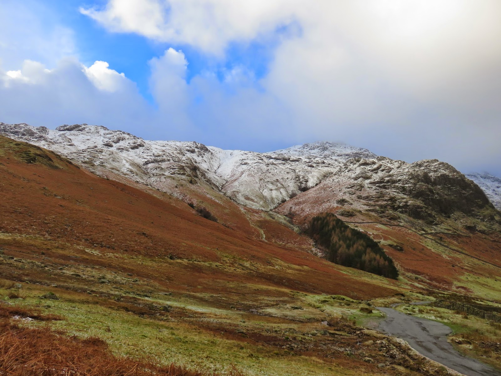
We left the campsite along the road that leads to Blea Tarn and Little Langdale and were already in awe of our snow-capped surroundings. A short climb along the road reaches the small hause between Wrynose Fell and Side Pike, Lingmoor's dramatic subsidiary summit. Pike O'Blisco was looking grand with its winter coating and a subtle light shining on the lower slopes - it was fortunate I had my SLR with me today to really capture the mood.
Leaving the campsite on the road to Blea Tarn
A subdued but snowy Langdale Pikes
The Band and Crinkle Crags
We met the now line fairly quickly after leaving the road and beginning our climb up Side Pike, it was lying at around 250m which meant we'd be wading around in it for most of the day (though it wasn't particularly deep and the paths were still distinct). It's a very short climb up to the top of Side Pike and one that's well worth the modest efforts required - the views of the Langdale Pikes are stunning.
A beam from the heavens
Pike O'Blisco
Snow shower in Mickleden
The route is well marked
Pike O'Blisco
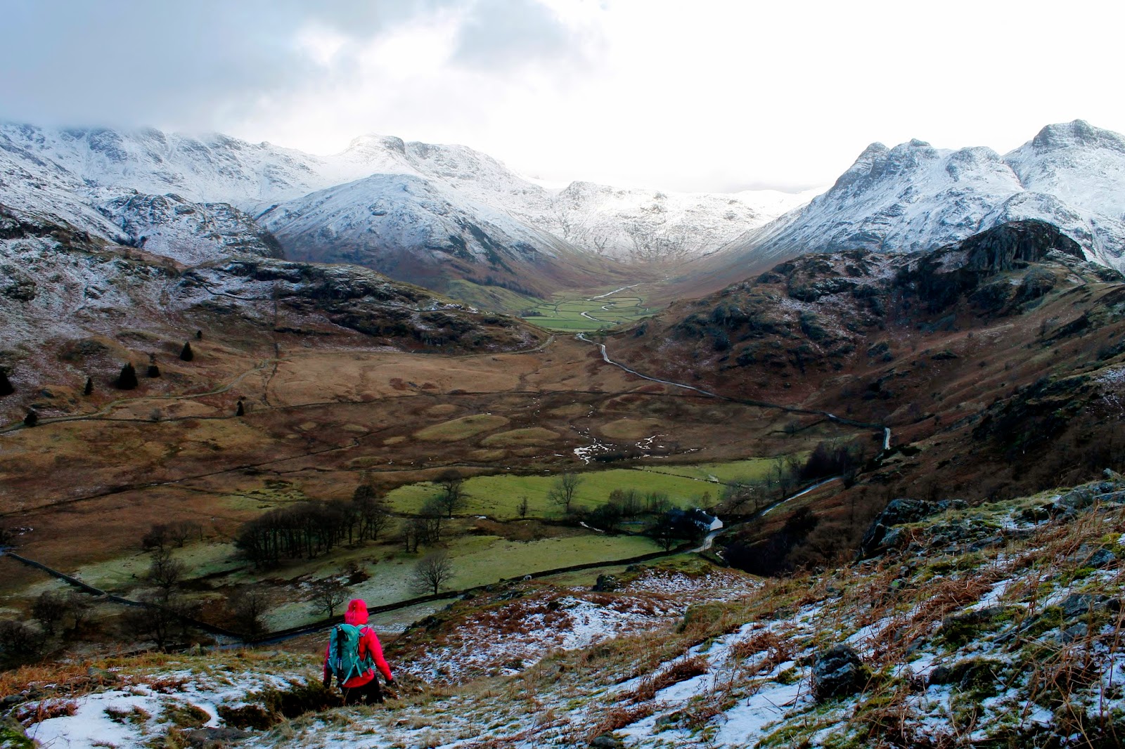
Sara making the climb to Side Pike
Raven Crag, Harrison Stickle and Pavey Ark
Rossett Pike
Side Pike itself is no boring lump and has a character all of its own. It's only accessible from the south and the west, as we found out trying to descend it, as it's guarded around the north and east by vertical crags that are impassable to regular walkers. It's quite a detour to reach the base of the crags in order to get around them but it does lead you to one of Side Pike's most appealing features.
Great Langdale from Side Pike
Harrison Stickle and Pavey Ark
Side Pike summit
Blea Tarn with Wetherlam behind
The path passes through a narrow gap between a detached flake of rock and its parent crag. I'm not sure if it has a proper name, I've seen it referred to as 'The Squeeze', 'The Squeeze Rock', 'Fat Man's Dilemma' and 'Fat Man's Agony' (not to be confused with Fat Mans Agony on Broad Stand. Either way, Sara and I managed to shuffle through without obstruction.
Heading through the squeeze
The path as it passes behind the rock
Great Langdale and Side Pike
The general terrain of Lingmoor Fell
Views of the Langdale Pikes are now replaced with views of Pike O'Blisco and Wetherlam as the path drops down the southern side of Lingmoor Fell and begins a steady climb up the fellside. It's a short distance directly to the summit following a wall and/or fence but we decided to detour slightly to visit Lingmoor Tarn, a lovely little tarn cradled among the undulations atop its parent fell.
Lingmoor Tarn
Beautiful reflections on the water
Sara heading for the summit
We aimed straight up one of the spurs that leads to the main path from Lingmoor Tarn before following the fence to the blustery summit. Once again, the views are excellent and include the Langdale Pikes once again, Wetherlam and across to a distant Windermere, all looking wonderful with a dusting of snow. The fell's name originates from the Old Norse word lyng meaning “heather-covered”.
A nice covering of snow near the summit
The summit in the distance
View of Great Langdale from the summit
A cairn marks the highest point
Sergeant Man
Windermere is visible in the distance
We began our descent following the drystone wall that drops away from the summit to the head of a small stream that ultimately feeds Little Langdale Tarn. We were heading for Blea Tarn, a popular spot for professional photographers wanting to capture the reflections of Side Pike and the Langdale Pikes on the surface of the still water. We made our way to the southern side of the lake where to find the classic view of the Langdale Pikes between the hause of Side Pike and Wrynose Fell.
Sunlight over the Southern fells
Mickleden through the gap
Pike O'Blisco looking fairly mighty
Blea Tarn and Great Langdale
Bowfell finally makes an appearance
Descending to Blea Tarn
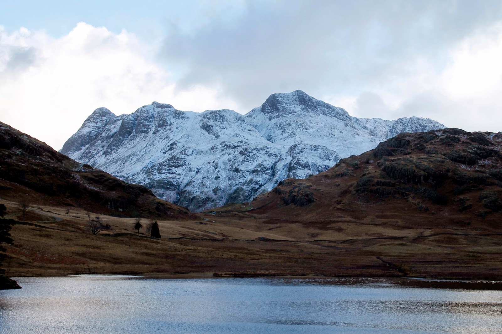
The Langdale Pikes and Side Pike over Blea Tarn
The Langdale Pikes
Satisfied with the knowledge that I am not a professional photographer, we finished off the walk in time to capture a sunny Oxendale and Mickleden look resplendent in the early afternoon. The clouds had even lifted off Crinkle Crags and Bowfell giving us a stunning view. It's a good job we live in the digital age; it would have cost an arm and a leg in 35mm film otherwise. We returned down the harsh zigzag track that leads into the campsite, an example of some of the more extreme examples of footpath repair.
Pike O'Stickle and Loft Crag
The Langdale Pikes looking monumental
Harrison Stickle
Mickleden
Rossett Pike
Great Langdale
Lingmoor is a great little fell that has some excellent viewpoints and is well worth climbing again and again. There is much more to explore than we did today and a number of routes that can be taken to reach the summit. I'm glad we climbed it on a winters day to savour the snow-capped peaks that surround it on all sides, as I mentioned at the start, often the best views of the Lake District's best mountains are from the smaller satellites that surround them.

1 comment :

  1. Beautiful images, thank you for describing your route. I will try this.

    ReplyDelete