Saturday 15 November 2014

Parson's Pulpit, The High Marks & Dowkabottom

Hawkswick Clowder 16-11-2014

This map was created using GPS Visualizer's do-it-yourself geographic utilities.

Please wait while the map data loads...


Route: Sleets Gill Bridge, Scar Gill Barn, Hawkswick Bridge, Castleberg Barns, Arncliffe, Monk's Road, Falcon Cave, Dew Bottoms, Parson's Pulpit, Flock Rake, Lee Gate High Mark, High Lineseed Head, High Mark, Proctor High Mark, High Kilnsey Moor, Dowkabottom, Sleets Gill Cave

Date: 16/11/2014
From: Sleets Gill Bridge


Parking: Small layby on Sleets Gill Beck crossing
Start Point: Sleets Gill Bridge or Arncliffe
Region: Southern Yorkshire Dales

Route length: 10.0 miles (16 km)
Time taken: 04:20
Average speed: 2.3 mph
Ascent: 582m
Descent: 599m

Summits: Parson's Pulpit (538m), Proctor High Mark (531m)

Other points of interest: Yew Cogar Scar, Dowkabottom, Dowkabottom Cave, Sleets Gill Cave

We were back in the Yorkshire Dales this weekend, scratching an itch that's long been nagging at my attention. Malham Cove is an obvious and impressive, much-visited landmark and rightly so. It marks the beginning of a large upland limestone plateau that, despite its size, has little in the way of paths or traditional access for a walker. The area in question is Hawkswick Clowder (into which I have included an area called Clowder and the imaginatively titled, Height).

Planning a walk around this area can be a bit of a challenge given the number of walls and disused shafts that are marked on the map, combined with the lack of paths or even obvious rights of way. However, after a read through some other posts where people had undertaken similar outings, the walk seemed a lot more straightforward than it may have been.

After much debate (and to Sara's concern), we left the car in a small layby at a crossing of Sleets Gill Beck, deciding that we'd rather complete the long stroll to Arncliffe first and finish off coming down the hillside to the car. There's probably just enough room for two cars, almost entirely off the road.
Heading into the heart of Littondale
As you may imagine, the walk alongside the River Skirfare is a delight, especially along the quiet valley of Littondale. Split from the main valley of Wharfedale by the great wedge of Old Cote Moor, Littondale is rarely frequented by tourists but it is wonderful. A beautiful dale in itself, it is lined by the high, limestone faced moors of Hawkswick, Darnbrook Fell and Old Cote Moor with a number of steep-sided valleys piercing through these steep ramparts. One of these is Yew Cogar Scar, our route into the heart of upland limestone country. One of the other valleys is Pen-Y-Ghent Gill, which Sara and I had a look at earlier this year.
The remains of Scar Gill Barn
Hawkswick Bridge
The exposed limestone of Blue Scar
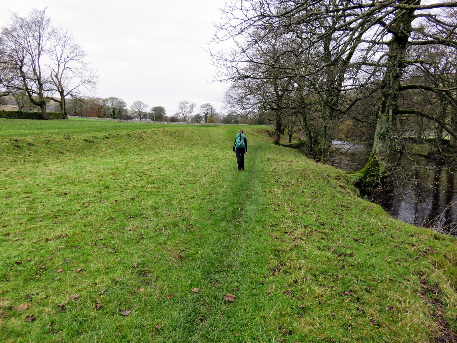
Erosion on the banks of the River Skirfare
River Skirfare at Holme Barn
Approaching Arncliffe
At this juncture, I have some parts interesting and partly useless information for you. First, the interesting. Littondale was originally called Amerdale though it seems the reason and time that its name changed has been lost. Secondly, and of less interest, the pilot episodes of the TV series Emmerdale were filmed in the valley with Emmerdale being a derivative of Amerdale.

The riverside path sticks diligently to the riverbank, only leaving it once you reach Arncliffe. After passing around the side of The Falcon Inn, we joined the walled lane that leads to the Monk's Road, a path that links Arncliffe to Malham and eventually Airedale. The path was supposedly used by the monks to access large areas of land they owned in the Dales, stretching as far as the Lake District.
St. Oswald's Church in Arncliffe
The entrance to Yew Cogar Scar
The Monk's Road - Sara correctly identifying the correct route
The route heads off up the hillside
Littondale backed by Out Moor
We wouldn't be travelling that far, despite the path having a fine, high-level vantage point over Littondale and Yew Cogar Scar. At Dew Bottoms, we left the path to begin our off-piste tour of Hawkswick Clowder. Having now done this walk, my recommendation would be to stay with the drystone wall on your left, rather than follow it to your right as we did (we had to cross the wall in the end).
Yew Cogar Scar with Cowside Beck
The Monk's Road heads up over the moor
A look back down the wall we were following
We were aiming for Parson's Pulpit, the highest point in the area which sits on a limestone plateau to the right of the wall (rather than at the 525m spot height on the map to the left). It's easily identifiable as a ring of stones with an OS bolt fixed to a batch patch of rock. It has an extensive panorama, being the high point, taking in the distant Aire valley.
Some of the limestone starts to poke through as we climb higher
Great Whernside in the distance
Pendle Hill
Sara makes her way up Parson's Pulpit
The survey bolt on Parson's Pulpit
A close up of the bolt
We dropped off this high point, back to the wall we'd followed from Dew Bottoms. Approaching a complex area of gates and walls, we used the nearby footpath and its handy gates at Lee Gate High Mark to circumnavigate the enclosures and strike out across the moorland once again.
An interesting feature, an old river channel perhaps?
More limestone pavement at High Lineseed Head
We followed the wall east from Lee Gate High Mark, this time staying to the left of it, a decision made for us by the large herd of cows that were occupying the fields between us and our intermediate destination. We had to cross the most awkward wall of the day at the head of High Lineseed Head but, as wall crossings go, it still remained fairly straightforward with a bit of thought.
We had to cross the point where the two walls meet
A view into Low Lineseed Head
Limestone pavement at High Mark
High Lineseed Head
The sprawling Great Whernside
We made our way up the hillside, eventually reaching a gate in the wall. I couldn't resist the urge to cross over and visit Proctor High Mark, one of a number of high points in the area. A small cairn sits atop Proctor High Mark, something similar to the one you may find in the Lake District or on top of a prominent peak. A short distance away, however, stands something much more remarkable.
The cairn atop Proctor High Mark
The view south-west
A large (and I mean very large) cairn sits amongst a pile of limestone boulders, arranged in an odd circular fashion. It marks the beginning of a great line of mining shafts so I can only assume it is the remnants of an industrial past. Failing that, it does resemble a similar structure on Beamsley Beacon that's of a much more ancient origin but I can't find any information to support this theory.
The large cairn close to the summit
A close up of the structure
The view south-east
Buckden Pike
Returning to the path, we began our descent down towards the charmingly named Dowkabottom, something I was particularly looking forward to. We followed yet another drystone wall, down the flanks of High Kilnsey Moor and into some wonderful limestone scenery. There's a spot height actually marked as Dowkabottom but, generally, it refers to a large, hidden gem above Littondale.
The nose of Great Whernside
A long stroll following the wall
Sara heads to Dowkabottom
From the peak of Dowkabottom, a large bowl stretches out ahead of you, guarded on both sides by a steep limestone escarpment. The limestone hillside holds the remains of several walled enclosures and hut circles, an extensive prehistoric settlement complex. A few of these are quite obvious, especially the remains of a circle hut down in the bottom of the bowl. There's a clue to the name Dowkabottom held on the 50k maps where the nearby cave is actually called Douky Bottom. It is suspected that douky, meaning ‘damp, wet or misty’, is a north dialect word.
Dowkabottom
One of the enclosure remains
The same structure from the other angle
The huge bowl of Dowkabottom
Remains of the circle hut and the cave entrance
If an ancient settlement and a cave weren't enough, there's something else a little more strange to visit at Dowkabottom; the odd arrangement of cairns that silently stand guard to the north. There are a fair number of them, ranging in size from waist high to over 6 feet high. I've seen them referred to as curricks, an old northern word used to describe a shepherd's lookout post. This seems an apt description as they command a fine view of both the entire settlement and Littondale below.
The cairns of Dowkabottom
They sit on a limestone platform
The platform forms a natural shelter
The largest of the cairns
Monochrome panorama
Old Cote Moor and Littondale
Me among the cairns!
Away from the look outposts, Sara and I headed over to the cave for a quick look inside. It's an easy scramble down into the first, large cavern which we illuminated with our head torches. The cave was used as a home and place of storage by humans the ancient settlers, a fact discovered in the 19th century when a tiny child's skeleton was found, hidden in a small grave chipped out of the stalagmite floor and covered in stone slabs. There is also a number of etchings on the walls, left by numerous visitors to the cave.
Sara peers into Dowkabottom cave
Access is down an easy ramp
Flowstone in the ceiling of the chamber
Sara in the cave
The etchings on the wall
A look down the corridor
After nosing around as far as we dared, including the old 'lights off in a cave to see how dark it really is' (turns out very), we returned to the surface to make our way down the hillside to the car. I'd used a very informative post someone wrote about the caves to work out how to reach the roadside again (in addition to recreating some of the facts; you can see the whole piece here). The key to the operation is to aim for Sleets Gill Cave and then follow the stream down to the road, which we duly did after an awkward fence crossing.
Classic limestone formations
The sun was on its way down by the time we resurfaced
Sleets Gill Cave
Sleets Gill Cave
Sleets Gill
With the light fading, we picked our way past the cave entrance (not one to be entered by the inexperienced) and down alongside the dry streambed to the car, content that we'd completed a hearty day of walking. True to my expectations, we saw next to no one all day (except for bumping into one of Sara's work colleagues). I'll admit that I thought that the High Marks would be a bit more impressive but they were bookmarked by the impressive Yew Cogar Scar and the extensive Dowkabottom. Dowkabottom alone is worth a trip in itself, a real hidden beauty off the beaten track. I'd highly recommend it.

1 comment :

  1. Such beautiful and unusual landscapes that pop out of nowhere. I liked your picture amongst the cairns, giving an idea of size/scale. It is a real hidden gem, thanks for sharing.

    ReplyDelete