Sunday 29 October 2017

Hart Side, The Dodds & Clough Head

Hart Side, The Dodds & Clough Head 29-10-2017

This map was created using GPS Visualizer's do-it-yourself geographic utilities.

Please wait while the map data loads...


Route: Dockray, Bracken How, Round How, Common Fell, Watermillock Common, Swineside Knott, Brown Hills, Birkett Fell, Hart Side, Stybarrow Dodd, Watson's Dodd, Great Dodd, Little Dodd, Clough Head, Mart Crag, Mariel Bridge, Old Coach Road, Barbary Rigg, Groovebeck Fold, High Row, Gill Edge, Dockray

Date: 29/10/2017
From: Dockray


Parking: Dockray
Start Point: Dockray
Region: Eastern Fells

Route length: 12.8 miles (20.6 km)
Time taken: 05:21
Average speed: 2.3 mph
Ascent: 954m
Descent: 958m

Wainwrights on this walk:
Hart Side (756m), Stybarrow Dodd (843m), Watson's Dodd (789m), Great Dodd (857m), Clough Head (726m)

Other Summits: Bracken How (360m), Round How (387m), Common Fell (552m), Watermillock Common (542m), Swineside Knott (553m), Brown Hill (551m), Birkett Fell (725m), Little Dodd (785m)

Other points of interest: Broad Slack

There has long been a large, un-walked area in my Lake District map, encompassing the quiet hills of Watermillock Common and Matterdale Common, hidden behind the rolling Dodd fells. This is not popular walking territory but provides a quiet and relatively easy approach to the northern third of the Helvellyn ridge and, more specifically, the high fells that make up the Dodds.

I've been quite lucky with the weather this year and today was no different, it was forecast to be dry and bright for the whole day. Perfect fell walking conditions. I started in Dockray, managing to arrive early enough to bag a car parking space in a small layby next to the stone bridge over Aira Beck. If this is full, there's an old quarry that could be used a short distance down the road towards Ullswater. It was 8.30am once I had my boots and bag ready to walk.
Common Fell above Dockray
Named fells come thick and fast on this walk and were the main reason for me doing it. The Watermillock Common area alone is home to six Birketts before it climbs up towards Hart Side, the first of these is Bracken How, just 60m above Dockray.
Dockray from Bracken How
Common Fell
Bracken How
From Bracken How, Round How follows closely before the route joins a path that follows a drystone wall to climb towards the higher fells. This path forms part of a miners route which ultimately ends on the Glencoyne Balcony Path as it leads to the Greenside Mines of Glenridding. I wouldn't be going that far today, however.
Round How and Common Fell
Looking towards the Kirkstone Pass
Bracken How
Gowbarrow Fell
Ullswater
Common Fell
A lone tree
Ullswater
Common Fell
As the path begins to level off, I carried on climbing to reach the summit of Common Fell, the first significant high point of the day at over 540m. Common Fell lies at the end of a broad, boggy ridge, which rises up to Hart Side and, ultimately, Stybarrow Dodd. Along the ridge are a number of minor tops, Swineside Knott being the highlight for its view across Ullswater and Patterdale.
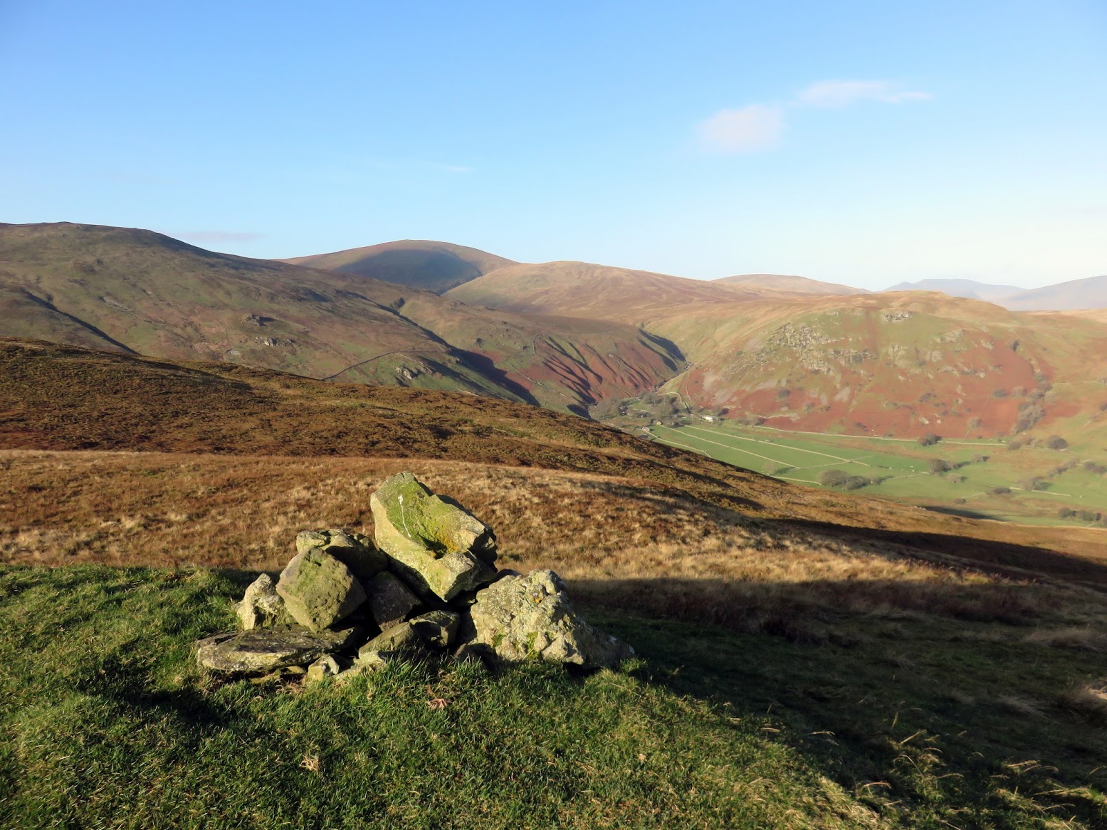
Common Fell's summit
Dowthwaitehead below Great Dodd
Watermillcok Common
Hart Side
Looking across Brown Hills towards Helvellyn
Swineside Knott
Swineside Knott's summit
Watermillock Common and Great Mell Fell
From Swineside Knott, the ridge rises further up Brown Hills to meet a drystone wall. Following this wall higher still leads up to the summit of Birkett Fell, a minor top that forms part of Hart Side. A smart cairn marks Birkett Fell, built by members of the nearby Outward Bound School. The fell is named in honour of Lord Birkett of Ulverston and in recognition of the part played by him in preventing Ullswater from being made into a reservoir.
Brown Hills
Glencoyne Head
Catstye Cam and Helvellyn
Looking back down the walkk up Birkett Fell
Interesting clouds formed over the Far Eastern Fells
Birkett Fell
Birkett Fell
Hart Side, a much overlooked fell, stands a short distance to the west and, by all accounts, is fairly unremarkable. The grassy top has a scattering of boulders but no extensive views. There is an interesting trench located close to the summit, likely the result of prospecting from the nearby Greenside Mines.
Hart Side from Birkett Fell
Hart Side's summit
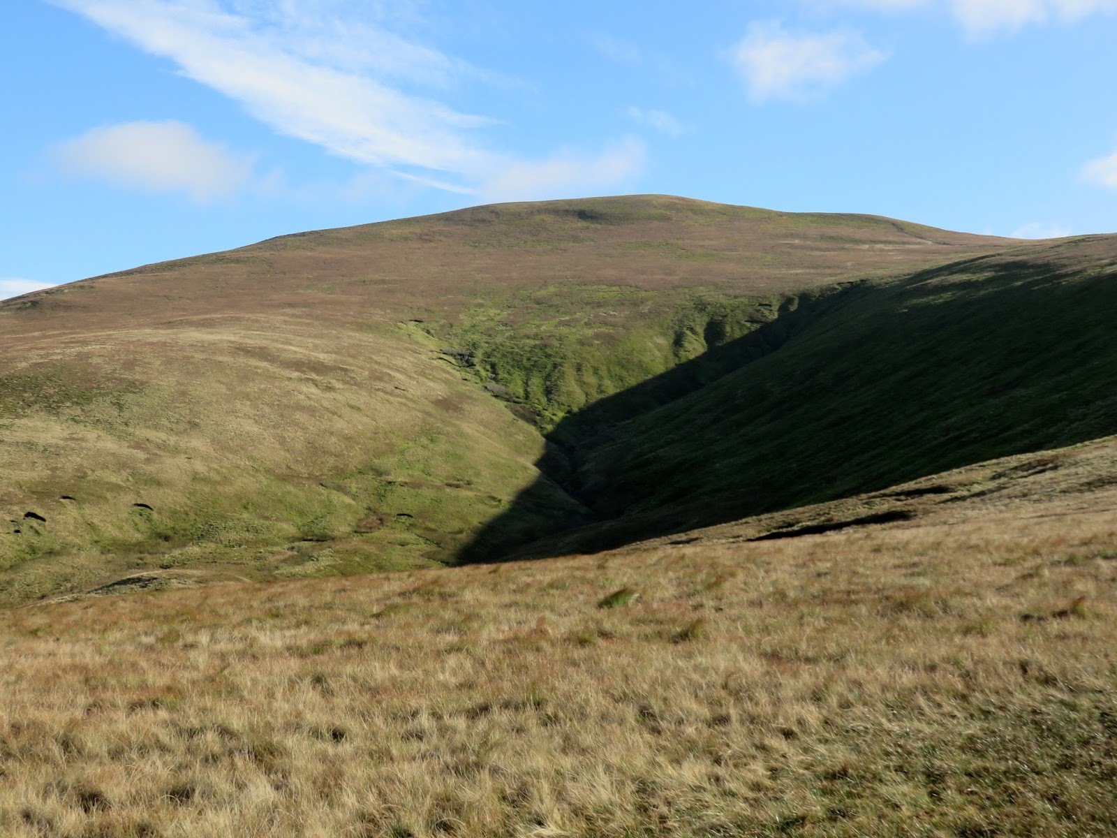
Hart Side's interesting trench
The path continues on, hugging the rim of the Deepdale valley as it makes its way towards Stybarrow Dodd before an easy climb to the summit. Though it was bright and sunny, the wind was bitterly cold - the first outing for gloves this season. I made a quick detour to the southern top before returning to the main summit and continuing on.
The route to Stybarrow Dodd
Stybarrow Dodd
Lovely layers of fells
Catstye Cam and the slopes of Raise
Stybarrow Dodd's summit
From the ridge path, views across the central, southern and western Lake District are truly sensational and contain a vast array of fells. The scene is an accompaniment for much of the ridge. The very best of the view can be found at Watson's Dodd where the location of the summit, above the western slopes, provides an uninterrupted view.
Looking across St, John's in the Vale
Watson's Dodd
Watson's Dodd's summit
High Rigg, Keswick and the Skiddaw range
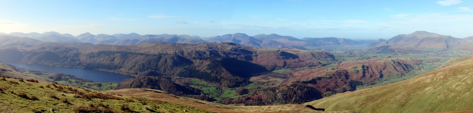
Panorama from Watson's Dodd
Watson's Dodd is really just a small rise on the ridge adjoining Great Dodd, the next major fell on this walk. The climb up the grassy southern slopes is easy enough but the path was particularly wet, much like the majority of the walk. So much so that I now had wet feet, a sure sign that the Goretex layer in my boots has all but given up.
Raven Crag and High Tove
The climb up Great Dodd
Watson's Dodd
Great Dodd's summit shelter
The Mell Fells and Gowbarrow
Great Mell Fell
The main summit plateau
Great Dodd's summit
A huge, curved ridge sweeps down from Great Dodd to join it to Clough Head, only interrupted by the protrusion of Calfhow Pike. The climb up Clough Head is almost an exact repeat of the climb up Great Dodd, such is the nature of these large, grassy fells.
Looking across the Clough Head ridge towards Keswick
Clough Head
Calfhow Pike
Great Dodd
Clough Head, like the fells preceding it, has an excellent view, though also includes a perfect panorama of Blencathra across the valley, its ridges picked out by the afternoon sun. The last time I visited Clough Head, we had climbed the exhausting Fisher's Wife's Rake so it was nice to reach it with some stamina intact.
Clough Head
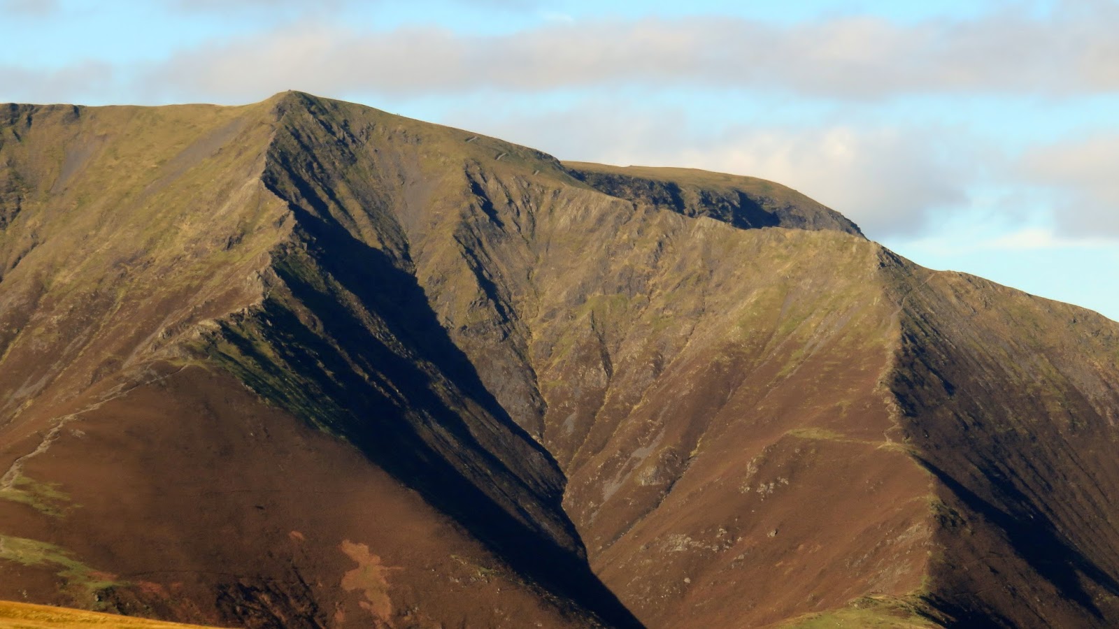
Hall's Fell Ridge on Blencathra
Clough Head marks the northern end of the main Helvellyn ridge which, for 11km, never dips below 600m, making it one of the highest continuous ridges in the country. Such is its height that Clough Head, at 726m, is the lowest main fell until the depression of Grisedale Tarn.
Blencathra
The stunning Vale of Keswick
After following numerous tracks and paths to this point, it was time to go off-piste for a short distance to descend east down easy grassy slopes. My target was Mariel Bridge on the Old Coach Road which would provide a crossing point for Mosedale Beck.
Off into the wilderness - the route to the Old Coach Road
Clough Head
Mariel Bridge
The Old Coach Road crosses from Wanthwaite to Dockray. Official signs present on the gates at both ends of the road clearly show that access by motorised vehicles is permitted and a number of 4WDs drove past as I made my way towards Groovebeck Fold. Most were paragliders who were using the superb weather for a spot of flying.
Blencathra
The Old Coach Road
The Old Coach Road
Blencathra's many ridges
After what seemed like a long time, I reached the end of the old route at the High Row car park, around a mile from Dockray. If parking wasn't available in the village, this is a viable alternative for this walk. The sun was still shining brightly and the autumnal colours were out in force as I finished off the walk along the backroads to the village.
Loadpot Hill
Lucy's Wood
Bracken How and Round How
Gowbarrow Fell
Gill Edge

No comments :

Post a Comment